
Weak low in NE Gulf of Mexico: (Is Invest 95L)
Moderator: S2k Moderators
Forum rules

The posts in this forum are NOT official forecasts and should not be used as such. They are just the opinion of the poster and may or may not be backed by sound meteorological data. They are NOT endorsed by any professional institution or STORM2K. For official information, please refer to products from the National Hurricane Center and National Weather Service.
-
tropicwatch

- Category 5

- Posts: 3427
- Age: 62
- Joined: Sat Jun 02, 2007 10:01 am
- Location: The Villages, Florida
- Contact:
Looks like it might be trying to get its act together just north of the trough line.
http://weather.msfc.nasa.gov/cgi-bin/ge ... mframes=15
http://weather.msfc.nasa.gov/cgi-bin/ge ... mframes=15
0 likes
Tropicwatch
Agnes 72', Eloise 75, Elena 85', Kate 85', Charley 86', Florence 88', Beryl 94', Dean 95', Erin 95', Opal 95', Earl 98', Georges 98', Ivan 2004', Arlene 2005', Dennis 2005', Ida 2009' Debby 2012' Irma 2017' Michael 2018'
Agnes 72', Eloise 75, Elena 85', Kate 85', Charley 86', Florence 88', Beryl 94', Dean 95', Erin 95', Opal 95', Earl 98', Georges 98', Ivan 2004', Arlene 2005', Dennis 2005', Ida 2009' Debby 2012' Irma 2017' Michael 2018'
-
gatorcane

- S2K Supporter

- Posts: 23708
- Age: 48
- Joined: Sun Mar 13, 2005 3:54 pm
- Location: Boca Raton, FL
Re:
panamatropicwatch wrote:Looks like it might be trying to get its act together just north of the trough line.
http://weather.msfc.nasa.gov/cgi-bin/ge ... mframes=15
Is that a possible LLC trying to form a about 150 miles WNW of Tampa? It looks like that swirl is dropping slowly SSW. That link you provided is a good close-up shot of the Eastern Gulf.
0 likes
-
gatorcane
- S2K Supporter
- Posts: 23708
- Age: 48
- Joined: Sun Mar 13, 2005 3:54 pm
- Location: Boca Raton, FL
0 likes

-
northjaxpro

- S2K Supporter
- Posts: 8900
- Joined: Mon Sep 27, 2010 11:21 am
- Location: Jacksonville, FL
Yeap! Shear has been gradually dropping since yesterday in the region. I am liking the chances better as time progresses with some possible Low pressure development in the NE GOM , especially the Monday- Wednesday timeframe. The strongest vorticity I believe will be in this region
0 likes
NEVER, EVER SAY NEVER in the tropics and weather in general, and most importantly, with life itself!!
________________________________________________________________________________________
Fay 2008 Beryl 2012 Debby 2012 Colin 2016 Hermine 2016 Julia 2016 Matthew 2016 Irma 2017 Dorian 2019
________________________________________________________________________________________
Fay 2008 Beryl 2012 Debby 2012 Colin 2016 Hermine 2016 Julia 2016 Matthew 2016 Irma 2017 Dorian 2019


-
tropicwatch
- Category 5
- Posts: 3427
- Age: 62
- Joined: Sat Jun 02, 2007 10:01 am
- Location: The Villages, Florida
- Contact:
Re:
gatorcane wrote:12Z UKMET develops a low just west of Tampa and then it eventually becomes a strong tropical storm that rides the Northern Gulf coast........this ought to open some eyes:
144 hours - New Orleans:
Now that would be pretty wild.
0 likes
Tropicwatch
Agnes 72', Eloise 75, Elena 85', Kate 85', Charley 86', Florence 88', Beryl 94', Dean 95', Erin 95', Opal 95', Earl 98', Georges 98', Ivan 2004', Arlene 2005', Dennis 2005', Ida 2009' Debby 2012' Irma 2017' Michael 2018'
Agnes 72', Eloise 75, Elena 85', Kate 85', Charley 86', Florence 88', Beryl 94', Dean 95', Erin 95', Opal 95', Earl 98', Georges 98', Ivan 2004', Arlene 2005', Dennis 2005', Ida 2009' Debby 2012' Irma 2017' Michael 2018'
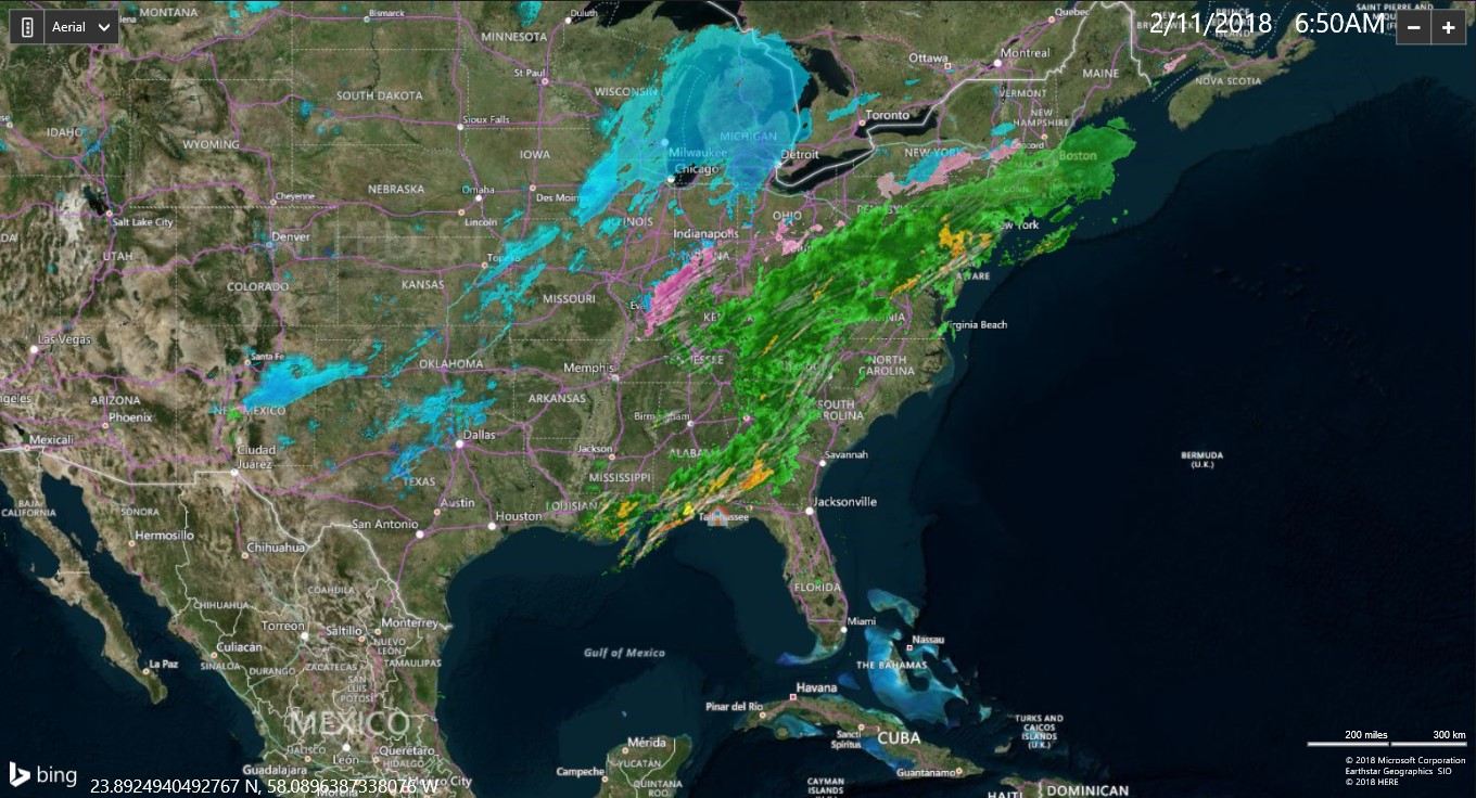
a broad cyclonic turning is evident on the radar...a sharp line of storms running from near Orlando west northwest to the big bend area is moving SW...showers out in the Gulf west of Tampa are moving south...meanwhile over south Florida the showers/storms have an eastward component of motion. this is a change from even this morning when the torrential rain that impacted the Tampa bay are approached from the northwest (yesterday's rains did as well).
0 likes
-
gatorcane
- S2K Supporter
- Posts: 23708
- Age: 48
- Joined: Sun Mar 13, 2005 3:54 pm
- Location: Boca Raton, FL
psyclone, I see what you mean. By the way, here is a really good sat loop where you can see the broad cyclonic turning. The shear is blowing the convection to the South and SW, but if the shear can let up, maybe something might get going off the west coast of Florida.
http://www.nrlmry.navy.mil/nexsat-bin/n ... PE=Instant
Looking at this loop, it seems the beginning of potential genesis the way the area looks on satellite with the broad low just north of the convection, and all the convection on the southern side of the broad low (for now) with convection "fanning out." Question is will new convection fire or not? If so, then we could indeed see something try to get going in the Eastern Gulf as the upper-level winds are supposed to relax over the next couple of days.
0 likes
-
stormlover2013
Re: Weak low in NE Gulf of Mexico
Well I said earlier longer this takes the more west it goes because high pressure builds back up towards se
0 likes
Re: Weak low in NE Gulf of Mexico
Hard to pinpoint where the center is trying to form on that loop.
0 likes
-
gatorcane
- S2K Supporter
- Posts: 23708
- Age: 48
- Joined: Sun Mar 13, 2005 3:54 pm
- Location: Boca Raton, FL
Sanibel look at the radar out of Tampa. Very clear broad cyclonic turning. You are right though. Tough to pick out a center as it is broad.
http://www.srh.noaa.gov/tbw/
http://www.srh.noaa.gov/tbw/
0 likes
Re: Weak low in NE Gulf of Mexico
Sanibel wrote:Hard to pinpoint where the center is trying to form on that loop.
agree. It's a total mess and a long time from becoming anything. having said that, a good sized area has received 5"+ of rain from this non entity so anytime you get PWATs north of 2" and something to lift that air you can't help but pay attention.
0 likes
-
Dean4Storms
- S2K Supporter
- Posts: 6358
- Age: 63
- Joined: Sun Aug 31, 2003 1:01 pm
- Location: Miramar Bch. FL
Re: Weak low in NE Gulf of Mexico
It's breezy tonight which is unusual. Something's trying to kick up.
0 likes

latest GFS running, doesn't seem to develop anything at all now through the entire run.
0 likes
The above post is not official and should not be used as such. It is the opinion of the poster and may or may not be backed by sound meteorological data. It is not endorsed by any professional institution or storm2k.org. For official information, please refer to the NHC and NWS products.
-
NCSTORMMAN
Re:
Hammy wrote:latest GFS running, doesn't seem to develop anything at all now through the entire run.
So, the odds are going down right? It looks like all the convection is dying in the gulf and in the atlantic. At least to me it does but I am no weatherman. Am I the only one who feels that way?
0 likes
Re: Re:
NCSTORMMAN wrote:Hammy wrote:latest GFS running, doesn't seem to develop anything at all now through the entire run.
So, the odds are going down right? It looks like all the convection is dying in the gulf and in the atlantic. At least to me it does but I am no weatherman. Am I the only one who feels that way?
There is still some turning in the Gulf, but much of the convection may have been from heating of the day, though there is a bit of new convection forming. I would say for the time being that it's done.
0 likes
The above post is not official and should not be used as such. It is the opinion of the poster and may or may not be backed by sound meteorological data. It is not endorsed by any professional institution or storm2k.org. For official information, please refer to the NHC and NWS products.
Who is online
Users browsing this forum: No registered users and 170 guests