
I have a feeling that they will wait for a recon flight and post warnings as a named storm.
With about 24 hours advance warning before landfall you know what the storm is and still have time to take effective action.
ATL: INVEST 92L - Discussion
Moderator: S2k Moderators
Re: ATL: INVEST 92L - Discussion
0 likes

Re: Re:
jlauderdal wrote:Dean4Storms wrote:Nimbus wrote:Despite the current presentation with increasing convection over a low level center the pro's probably are also considering the possibility of another collapse event like we saw yesterday morning.
Dry air shearing into the center, then you see an outflow boundary and the system is dead for the next 24 hours.
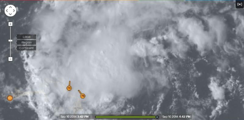
Thanks for the buoy link that will help! The center circulation looks about the size of a tornado ATM.
Never a go fast boat around when you need one..
That will be key, with it running out of ocean soon it needs to sustain convection overnight for it to be much by the time it reaches the FL coast.
if it can maintain and increase convection overnight and then we get euro support on next run we have something to deal with..those two conditions need to be met
IMO, the Euro has not done so well with this system, very inconsistent, some runs it showed a nice vorticity to later on just show a broad circulation on the following run. With Homegrown systems is better to look at actual conditions and its trends, some times global models do not do that well with small systems like 92L.
0 likes
-
jlauderdal
- S2K Supporter

- Posts: 7240
- Joined: Wed May 19, 2004 5:46 am
- Location: NE Fort Lauderdale
- Contact:
Re: Re:
NDG wrote:jlauderdal wrote:Nimbus wrote:Despite the current presentation with increasing convection over a low level center the pro's probably are also considering the possibility of another collapse event like we saw yesterday morning.
Dry air shearing into the center, then you see an outflow boundary and the system is dead for the next 24 hours.
]
if it can maintain and increase convection overnight and then we get euro support on next run we have something to deal with..those two conditions need to be met
IMO, the Euro has not done so well with this system, very inconsistent, some runs it showed a nice vorticity to later on just show a broad circulation on the following run. With Homegrown systems is better to look at actual conditions and its trends, some times global models do not do that well with small systems like 92L.
we certainly cant argue with what is happening outside the window...this system has had a very good afternoon to be sure...lets see if it can maintain and build..kind of like the dolphins, they had a good game, lets see if it continues before declaring them a champ
0 likes
-
USTropics
- Professional-Met

- Posts: 2739
- Joined: Sun Aug 12, 2007 3:45 am
- Location: Florida State University
Re: ATL: INVEST 92L - Discussion
Last 10 images saved to animated .gif (courtesy of NASA GOES-E 1KM):

0 likes

Re: ATL: INVEST 92L - Discussion
USTropics wrote:Last 10 images saved to animated .gif (courtesy of NASA GOES-E 1KM):
[]http://i.imgur.com/L2eK2f8.gif[/img]
Almost looks like multiple vort maxes in that loop.
0 likes
The following post is NOT an official forecast and should not be used as such. It is just the opinion of the poster and may or may not be backed by sound meteorological data. It is NOT endorsed by any professional institution including storm2k.org For Official Information please refer to the NHC and NWS products.
-
Hurricaneman

- Category 5

- Posts: 7404
- Age: 45
- Joined: Tue Aug 31, 2004 3:24 pm
- Location: central florida
I see outflow boundries coming from the center, its the only negative I can see at the moment but new storms are also firing on the south side so its still organizing and trying to mix out some of the stable air
The posts in this forum are NOT official forecast and should not be used as such. They are just the opinion of the poster and may or may not be backed by sound meteorological data. They are NOT endorsed by any professional institution or storm2k.org. For official information, please refer to the NHC and NWS products
The posts in this forum are NOT official forecast and should not be used as such. They are just the opinion of the poster and may or may not be backed by sound meteorological data. They are NOT endorsed by any professional institution or storm2k.org. For official information, please refer to the NHC and NWS products
0 likes
-
northjaxpro

- S2K Supporter
- Posts: 8900
- Joined: Mon Sep 27, 2010 11:21 am
- Location: Jacksonville, FL
If you look extremely close, you can see what was a naked LLC/vort now tucking under the convection just off to its northwest. The LLC is drifting west-west/northwest currently
0 likes
NEVER, EVER SAY NEVER in the tropics and weather in general, and most importantly, with life itself!!
________________________________________________________________________________________
Fay 2008 Beryl 2012 Debby 2012 Colin 2016 Hermine 2016 Julia 2016 Matthew 2016 Irma 2017 Dorian 2019
________________________________________________________________________________________
Fay 2008 Beryl 2012 Debby 2012 Colin 2016 Hermine 2016 Julia 2016 Matthew 2016 Irma 2017 Dorian 2019
-
gatorcane

- S2K Supporter
- Posts: 23708
- Age: 48
- Joined: Sun Mar 13, 2005 3:54 pm
- Location: Boca Raton, FL
Re:
northjaxpro wrote::uarrow:
If you look extremely close, you can see what was a naked LLC/vort now tucking under the convection just off to its northwest. The LLC is drifting west-west/northwest currently
Here is a nice loop to see the overall progression of this invest plus you can see that naked swirl tucking underneath:
http://www.nrlmry.navy.mil/nexsat-bin/n ... x.DAY.jpg&
0 likes
-
jlauderdal
- S2K Supporter
- Posts: 7240
- Joined: Wed May 19, 2004 5:46 am
- Location: NE Fort Lauderdale
- Contact:
Re: ATL: INVEST 92L - Discussion
USTropics wrote:Last 10 images saved to animated .gif (courtesy of NASA GOES-E 1KM):
that looks like a mighty intense outflow boundary heading west, that is not a very good sign for development
0 likes

Re:
northjaxpro wrote::uarrow:
If you look extremely close, you can see what was a naked LLC/vort now tucking under the convection just off to its northwest. The LLC is drifting west-west/northwest currently
Clear circulation center from the rotating low clouds, ECM showed some rather stout 850 mb vorticity. Think just a matter of time before we see a tropical cyclone.
0 likes
-
northjaxpro
- S2K Supporter
- Posts: 8900
- Joined: Mon Sep 27, 2010 11:21 am
- Location: Jacksonville, FL
Re: Re:
gatorcane wrote:northjaxpro wrote::uarrow:
If you look extremely close, you can see what was a naked LLC/vort now tucking under the convection just off to its northwest. The LLC is drifting west-west/northwest currently
Here is a nice loop to see the overall progression of this invest plus you can see that naked swirl tucking underneath:
http://www.nrlmry.navy.mil/nexsat-bin/n ... x.DAY.jpg&
Yeah, excellent loop gatorcane. Thanks for providing the link.
0 likes
NEVER, EVER SAY NEVER in the tropics and weather in general, and most importantly, with life itself!!
________________________________________________________________________________________
Fay 2008 Beryl 2012 Debby 2012 Colin 2016 Hermine 2016 Julia 2016 Matthew 2016 Irma 2017 Dorian 2019
________________________________________________________________________________________
Fay 2008 Beryl 2012 Debby 2012 Colin 2016 Hermine 2016 Julia 2016 Matthew 2016 Irma 2017 Dorian 2019
-
floridasun78
- Category 5
- Posts: 3755
- Joined: Sun May 17, 2009 10:16 pm
- Location: miami fl
-
USTropics
- Professional-Met
- Posts: 2739
- Joined: Sun Aug 12, 2007 3:45 am
- Location: Florida State University
Here is another closer look at how things have progressed over the past 6 hours:
http://gifmaker.cc/PlayGIFAnimation.php?folder=2014091008tdNisniTxSDx2GMlNQKn0I&file=output_3wxAvm.gif
http://gifmaker.cc/PlayGIFAnimation.php?folder=2014091008tdNisniTxSDx2GMlNQKn0I&file=output_3wxAvm.gif
0 likes
Re:
USTropics wrote:Here is another closer look at how things have progressed over the past 6 hours:
http://gifmaker.cc/PlayGIFAnimation.php?folder=2014091008tdNisniTxSDx2GMlNQKn0I&file=output_3wxAvm.gif
Looks elongated to me.
0 likes
The following post is NOT an official forecast and should not be used as such. It is just the opinion of the poster and may or may not be backed by sound meteorological data. It is NOT endorsed by any professional institution including storm2k.org For Official Information please refer to the NHC and NWS products.

Re:
USTropics wrote:It appears to me to have multiple vorticies rotating around the center. The last few visible images show one taking form just north of Eleuthera Island. CIMSS vorticity overlay also indicating this is the strongest area for vorticity. I placed a red arrow indicating what I'm referring to:
http://i.imgur.com/4Ls9TTH.jpg
Yep that is what I am seeing two vorticies around the broad elongated area. This is going to take longer than I first thought.
0 likes
The following post is NOT an official forecast and should not be used as such. It is just the opinion of the poster and may or may not be backed by sound meteorological data. It is NOT endorsed by any professional institution including storm2k.org For Official Information please refer to the NHC and NWS products.
-
Hurricaneman
- Category 5
- Posts: 7404
- Age: 45
- Joined: Tue Aug 31, 2004 3:24 pm
- Location: central florida
Re:
USTropics wrote:It appears to me to have multiple vorticies rotating around the center. The last few visible images show one taking form just north of Eleuthera Island. CIMSS vorticity overlay also indicating this is the strongest area for vorticity. I placed a red arrow indicating what I'm referring to:
http://i.imgur.com/4Ls9TTH.jpg
thats an eddy moving around the main low I believe
0 likes
Who is online
Users browsing this forum: No registered users and 19 guests