Time_Zone wrote:How is the pressure falling? It's over cold water and high shear.
This storm confuses me...
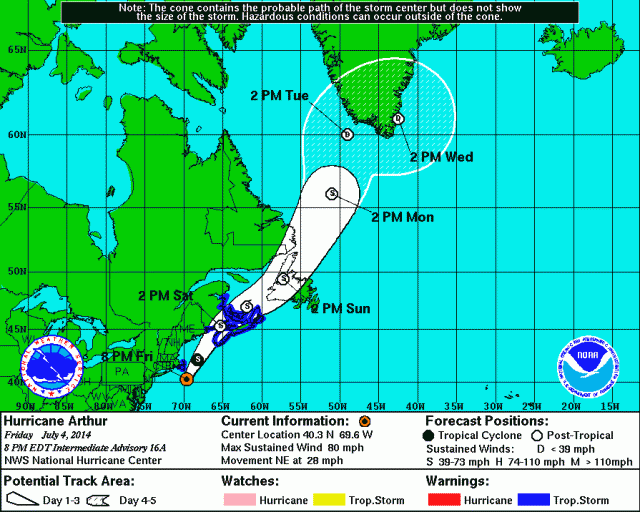
These tropical cyclones transitioning to non-tropical are very confusing until you learn the dynamics. I know them a little better because I live up here where this happens all the time and because my friend Stacy Stewart taught me a lot of this.
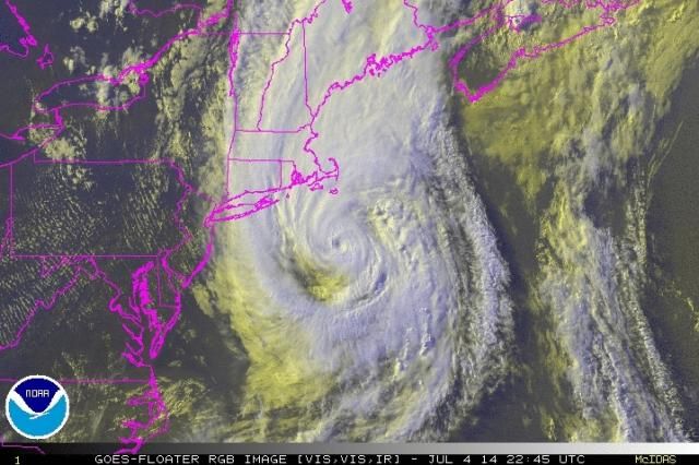
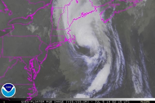
 Because the thunderstorms are maintaining (for the reason I just posted) and the circulation is still very symmetric, the winds are maintaining so the pressure maintains or even drops a little bit. Also, as you go northward towards the poles the Coriolis force gets stronger, so a cyclone with a pressure of 970 mb near Cape Cod is needed to support similar winds as a 980 cyclone would further south. (These are rough numbers just for an example). Recall that Hurricane Sandy (becoming extra-tropical) had a very low pressure around 940 mb at New Jersey but top sustained winds were 70-80 mph. Hurricane Hugo at South Carolina in 1989 had a similar pressure and had sustained winds near 140 mph! There are other reasons that are pretty complex to go into here, especially the dynamic differences between tropical and extra-tropical cyclones, but the important point is that if a hurricane racing northward off the mid-Atlantic has the necessary dynamics to maintain its winds, the pressure will maintain or even drop.
 Because the thunderstorms are maintaining (for the reason I just posted) and the circulation is still very symmetric, the winds are maintaining so the pressure maintains or even drops a little bit. Also, as you go northward towards the poles the Coriolis force gets stronger, so a cyclone with a pressure of 970 mb near Cape Cod is needed to support similar winds as a 980 cyclone would further south. (These are rough numbers just for an example). Recall that Hurricane Sandy (becoming extra-tropical) had a very low pressure around 940 mb at New Jersey but top sustained winds were 70-80 mph. Hurricane Hugo at South Carolina in 1989 had a similar pressure and had sustained winds near 140 mph! There are other reasons that are pretty complex to go into here, especially the dynamic differences between tropical and extra-tropical cyclones, but the important point is that if a hurricane racing northward off the mid-Atlantic has the necessary dynamics to maintain its winds, the pressure will maintain or even drop.This is a simplification just to give you an overall idea.


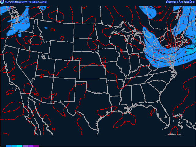
 You're welcome! And yes right now it still is. Now while it's maintained really well so far it is just now about to go from 25C to 18C water in a really short time. Look at one of the satellite floaters and turn on SSTs at the top selection boxes. See that incredibly steep isotherm for SSTs that it's about to cross where the lines are so tightly packed? Wow! That's a really fast drop. Now you would expect the strength to drop off noticeably, but there's one catch. As it ingests that much lower octane fuel, it will now start undergoing extra-tropical transition. Look at a current surface chart and you can see that the cold front just west of it is getting close to the COC of Arthur. So it will now start ingesting the cooler drier air behind the front into its circulation. The cooler air will get pulled into its southern and western half while the warm tropical air on the east will remain on the eastern side and spread across the northern side and it will start becoming like a mid-latitude cyclone which are driven by difference in temp horizontally rather than vertically. Also, cold air at 500 mb (near 20,000 feet roughly) will move in over the cyclone and this will invigorate it by keeping the temperature difference between the low levels and upper levels fairly significant. So this extra-tropical transition from tropical to mid-latitude type will prevent it from weakening as rapidly. The transition is offsetting the SST drop! Pretty neat, huh? In cases where the 500mb cold pool (trough) moving over it is really strong you can actually get strengthening. That's what happened with Sandy.
 You're welcome! And yes right now it still is. Now while it's maintained really well so far it is just now about to go from 25C to 18C water in a really short time. Look at one of the satellite floaters and turn on SSTs at the top selection boxes. See that incredibly steep isotherm for SSTs that it's about to cross where the lines are so tightly packed? Wow! That's a really fast drop. Now you would expect the strength to drop off noticeably, but there's one catch. As it ingests that much lower octane fuel, it will now start undergoing extra-tropical transition. Look at a current surface chart and you can see that the cold front just west of it is getting close to the COC of Arthur. So it will now start ingesting the cooler drier air behind the front into its circulation. The cooler air will get pulled into its southern and western half while the warm tropical air on the east will remain on the eastern side and spread across the northern side and it will start becoming like a mid-latitude cyclone which are driven by difference in temp horizontally rather than vertically. Also, cold air at 500 mb (near 20,000 feet roughly) will move in over the cyclone and this will invigorate it by keeping the temperature difference between the low levels and upper levels fairly significant. So this extra-tropical transition from tropical to mid-latitude type will prevent it from weakening as rapidly. The transition is offsetting the SST drop! Pretty neat, huh? In cases where the 500mb cold pool (trough) moving over it is really strong you can actually get strengthening. That's what happened with Sandy.