
EPAC: AMANDA - Post-Tropical
Moderator: S2k Moderators
-
Kingarabian

- S2K Supporter

- Posts: 16373
- Joined: Sat Aug 08, 2009 3:06 am
- Location: Honolulu, Hawaii
-
Yellow Evan

- Professional-Met

- Posts: 16242
- Age: 27
- Joined: Fri Jul 15, 2011 12:48 pm
- Location: Henderson, Nevada/Honolulu, HI
- Contact:
Re:
stormkite wrote:Seen many of these midget cyclones in my basin will be very surprised if this don't achieve 140 knots after the next eye-wall replacement given the present conditions.
I see no signs of an ERC given how new it's eyewall is. And I'd lean against 140 knots, especially if it it ERC's given that conditions become less favorable in 24 hours or so.
0 likes
-
Yellow Evan
- Professional-Met
- Posts: 16242
- Age: 27
- Joined: Fri Jul 15, 2011 12:48 pm
- Location: Henderson, Nevada/Honolulu, HI
- Contact:
Re:
Kingarabian wrote:Certainly does look like a Cat.4 storm with the way the eye is clearing out now.
It looks around 115-120 knts to me. Raw T numbers got this at 6.9, or around 140 knots.
0 likes
-
Kingarabian
- S2K Supporter
- Posts: 16373
- Joined: Sat Aug 08, 2009 3:06 am
- Location: Honolulu, Hawaii
Re: Re:
Yellow Evan wrote:stormkite wrote:Seen many of these midget cyclones in my basin will be very surprised if this don't achieve 140 knots after the next eye-wall replacement given the present conditions.
I see no signs of an ERC given how new it's eyewall is. And I'd lean against 140 knots, especially if it it ERC's given that conditions become less favorable in 24 hours or so.
True. Just came out of an ERC. But it came out rather quickly.
0 likes
RIP Kobe Bryant
-
djones65
- Category 1

- Posts: 264
- Age: 60
- Joined: Mon Jun 20, 2005 12:05 am
- Location: Ocean Springs, MS
Re: EPAC: AMANDA - Hurricane
Calling a spade a spade... Amanda has no indications of an ERC. At the moment. As Evan stated IF "another" ERC occurs it very likely will be too late to allow category 5. It has less than 24 hrs before unfavorable conditions impact the cyclone. I have no idea what you mean about a pecking order however.
0 likes
-
Yellow Evan
- Professional-Met
- Posts: 16242
- Age: 27
- Joined: Fri Jul 15, 2011 12:48 pm
- Location: Henderson, Nevada/Honolulu, HI
- Contact:

-
Yellow Evan
- Professional-Met
- Posts: 16242
- Age: 27
- Joined: Fri Jul 15, 2011 12:48 pm
- Location: Henderson, Nevada/Honolulu, HI
- Contact:
Re: Re:
Kingarabian wrote:Yellow Evan wrote:stormkite wrote:Seen many of these midget cyclones in my basin will be very surprised if this don't achieve 140 knots after the next eye-wall replacement given the present conditions.
I see no signs of an ERC given how new it's eyewall is. And I'd lean against 140 knots, especially if it it ERC's given that conditions become less favorable in 24 hours or so.
True. Just came out of an ERC. But it came out rather quickly.
When did it ERC? I thought that the unarrested development this morning was due to some mid-level dry air.
0 likes
-
Kingarabian
- S2K Supporter
- Posts: 16373
- Joined: Sat Aug 08, 2009 3:06 am
- Location: Honolulu, Hawaii
Re: Re:
Yellow Evan wrote:
When did it ERC? I thought that the unarrested development this morning was due to some mid-level dry air.
Thank you for correcting me. I think it was not an ERC (because it did not have an eyewall in the first place), but rather a temporary collapse of the eyewall. Microwave showed a partial eyewall earlier today right before it became a hurricane, but then it weakened through mid until a few hours before the 5PM update.
Last edited by Kingarabian on Sat May 24, 2014 11:47 pm, edited 1 time in total.
0 likes
RIP Kobe Bryant
-
supercane4867
- Category 5

- Posts: 4966
- Joined: Wed Nov 14, 2012 10:43 am
Re: EPAC: AMANDA - Hurricane
Appear to be steadily intensifying I don't see an ERC happen any time soon
0 likes
-
Kingarabian
- S2K Supporter
- Posts: 16373
- Joined: Sat Aug 08, 2009 3:06 am
- Location: Honolulu, Hawaii
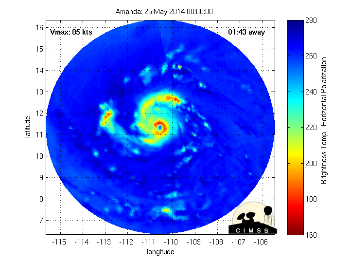
Raw T# are at 7.0! 
UW - CIMSS
ADVANCED DVORAK TECHNIQUE
ADT-Version 8.2.1
Tropical Cyclone Intensity Algorithm
----- Current Analysis -----
Date : 25 MAY 2014 Time : 040000 UTC
Lat : 11:28:31 N Lon : 110:42:02 W
CI# /Pressure/ Vmax
5.5 / 963.3mb/102.0kt
Final T# Adj T# Raw T#
5.5 5.6 7.0
Estimated radius of max. wind based on IR : 16 km
Center Temp : +2.8C Cloud Region Temp : -74.0C
Scene Type : EYE
0 likes
RIP Kobe Bryant
-
xtyphooncyclonex

- Category 5
- Posts: 3892
- Age: 24
- Joined: Sat Dec 08, 2012 9:07 am
- Location: Cebu City
- Contact:
Re: EPAC: AMANDA - Hurricane
supercane4867 wrote:Appear to be steadily intensifying I don't see an ERC happen any time soon
The eyewall is almost 100% closed and is very new. Yep, I agree with you.
0 likes
REMINDER: My opinions that I, or any other NON Pro-Met in this forum, are unofficial. Please do not take my opinions as an official forecast and warning. I am NOT a meteorologist. Following my forecasts blindly may lead to false alarm, danger and risk if official forecasts from agencies are ignored.
-
Kingarabian
- S2K Supporter
- Posts: 16373
- Joined: Sat Aug 08, 2009 3:06 am
- Location: Honolulu, Hawaii
I think we could see a special advisory soon.

Last edited by Kingarabian on Sun May 25, 2014 12:01 am, edited 1 time in total.
0 likes
RIP Kobe Bryant
-
xtyphooncyclonex
- Category 5
- Posts: 3892
- Age: 24
- Joined: Sat Dec 08, 2012 9:07 am
- Location: Cebu City
- Contact:
I wonder what forecasters in the NHC will say about the very Rapid Intensification of Hurricane Amanda. 
0 likes
REMINDER: My opinions that I, or any other NON Pro-Met in this forum, are unofficial. Please do not take my opinions as an official forecast and warning. I am NOT a meteorologist. Following my forecasts blindly may lead to false alarm, danger and risk if official forecasts from agencies are ignored.
-
Yellow Evan
- Professional-Met
- Posts: 16242
- Age: 27
- Joined: Fri Jul 15, 2011 12:48 pm
- Location: Henderson, Nevada/Honolulu, HI
- Contact:
-
xtyphooncyclonex
- Category 5
- Posts: 3892
- Age: 24
- Joined: Sat Dec 08, 2012 9:07 am
- Location: Cebu City
- Contact:
Re:
Yellow Evan wrote:Let's keep it nice on here.
Back to the storm, Amanda remains very impressive. Really starting to get that Cat 4 type of appearance IMO.
Really starting to flare up, and yeah, they should upgrade Amanda into a Category 4 in the next update. It really is getting organized and eyewall is already closed, meaning it intensified really fast.
If this were in the WPAC, this would be barely at cat 2.
0 likes
REMINDER: My opinions that I, or any other NON Pro-Met in this forum, are unofficial. Please do not take my opinions as an official forecast and warning. I am NOT a meteorologist. Following my forecasts blindly may lead to false alarm, danger and risk if official forecasts from agencies are ignored.
-
djones65
- Category 1
- Posts: 264
- Age: 60
- Joined: Mon Jun 20, 2005 12:05 am
- Location: Ocean Springs, MS
I also agree. I believe ths ships rapid intensity forecast has been spot on since formation. At the first advisory TDOne E Had a 48% chance of RI according to SHIPS index. And each subsequent advisory increased. Amanda has all the earmarks of a category 4 hurricane in my opinion 115kt at 0600 UTC ?
0 likes
-
tolakram
- Admin

- Posts: 20186
- Age: 62
- Joined: Sun Aug 27, 2006 8:23 pm
- Location: Florence, KY (name is Mark)
Re: EPAC: AMANDA - Hurricane
Hi all,
please remember to keep all post respectful. Avoid snide comments and personal attacks, and report posts that you think violate storm2k rules but please do not comment on them since it requires more work from the mods to clean everything up.
Thanks.
please remember to keep all post respectful. Avoid snide comments and personal attacks, and report posts that you think violate storm2k rules but please do not comment on them since it requires more work from the mods to clean everything up.
Thanks.
0 likes
M a r k
- - - - -
Join us in chat: Storm2K Chatroom Invite. Android and IOS apps also available.
The posts in this forum are NOT official forecasts and should not be used as such. Posts are NOT endorsed by any professional institution or STORM2K.org. For official information and forecasts, please refer to NHC and NWS products.
-
JonathanBelles
- Professional-Met
- Posts: 11430
- Age: 35
- Joined: Sat Dec 24, 2005 9:00 pm
- Location: School: Florida State University (Tallahassee, FL) Home: St. Petersburg, Florida
- Contact:
Re:
djones65 wrote:I also agree. I believe ths ships rapid intensity forecast has been spot on since formation. At the first advisory TDOne E Had a 48% chance of RI according to SHIPS index. And each subsequent advisory increased. Amanda has all the earmarks of a category 4 hurricane in my opinion 115kt at 0600 UTC ?
With cloud top temperatures of -80 to -70C, a clear eye during RI, and a full eyewall I make the intensity estimate of 120 to 125kt. Could continue to intensify into tomorrow afternoon.
0 likes
-
Yellow Evan
- Professional-Met
- Posts: 16242
- Age: 27
- Joined: Fri Jul 15, 2011 12:48 pm
- Location: Henderson, Nevada/Honolulu, HI
- Contact:
Re:
djones65 wrote:I also agree. I believe ths ships rapid intensity forecast has been spot on since formation. At the first advisory TDOne E Had a 48% chance of RI according to SHIPS index. And each subsequent advisory increased. Amanda has all the earmarks of a category 4 hurricane in my opinion 115kt at 0600 UTC ?
I'm thinking this will be at either 110 or 115 knt at the next ATCF update. FYI, I'm going to bed now, so I won't be able to post for several hours.
0 likes
Who is online
Users browsing this forum: No registered users and 14 guests