Very very loud thunder now..
SEVERE THUNDERSTORM WARNING
TXC215-427-100115-
/O.NEW.KBRO.SV.W.0005.140510T0026Z-140510T0115Z/
BULLETIN - EAS ACTIVATION REQUESTED
SEVERE THUNDERSTORM WARNING
NATIONAL WEATHER SERVICE BROWNSVILLE TX
726 PM CDT FRI MAY 9 2014
THE NATIONAL WEATHER SERVICE IN BROWNSVILLE HAS ISSUED A
* SEVERE THUNDERSTORM WARNING FOR...
WESTERN HIDALGO COUNTY IN DEEP SOUTH TEXAS.
SOUTHERN STARR COUNTY IN DEEP SOUTH TEXAS.
* UNTIL 815 PM CDT
* AT 726 PM CDT...NATIONAL WEATHER SERVICE METEOROLOGISTS DETECTED A
SEVERE THUNDERSTORM...CAPABLE OF PRODUCING DAMAGING 60 MPH WINDS...
OVER LA ROSITA...MOVING EAST AT 40 MPH.
* LOCATIONS IN THE WARNING INCLUDE...
LOS ALVAREZ.
RIO GRANDE CITY.
LAS LOMAS.
LA PUERTA.
GARCIASVILLE.
LA VICTORIA.
PRECAUTIONARY/PREPAREDNESS ACTIONS...
SEVERE THUNDERSTORMS CAN PRODUCE WIND SPEEDS STRONG ENOUGH TO BRING
DOWN TREES AND POWER LINES AND DAMAGE OR DESTROY MOBILE HOMES AND
OUTBUILDINGS. PERSONS OUTDOORS OR IN VEHICLES SHOULD SEEK SAFETY
INSIDE A STURDY BUILDING UNTIL THE STORM PASSES. IF YOU CAN HEAR
THUNDER...YOU ARE CLOSE ENOUGH TO BE STRUCK BY LIGHTNING.
PLEASE REPORT TORNADOES OR FUNNEL CLOUDS...WINDS OF 58 MPH OR
HIGHER...HAIL THE SIZE OF PENNIES OR LARGER...AND ANY WIND DAMAGE TO
YOUR NATIONAL WEATHER SERVICE IN BROWNSVILLE BY CALLING 956-504-1432.
&&
LAT...LON 2623 9854 2623 9858 2625 9859 2623 9867
2626 9869 2627 9873 2629 9873 2630 9876
2631 9875 2632 9878 2636 9880 2635 9890
2638 9893 2636 9895 2639 9896 2639 9900
2653 9897 2642 9843 2622 9846 2620 9848
TIME...MOT...LOC 0026Z 283DEG 35KT 2642 9888
$$
55
Texas Spring-2014
Moderator: S2k Moderators
Forum rules

The posts in this forum are NOT official forecast and should not be used as such. They are just the opinion of the poster and may or may not be backed by sound meteorological data. They are NOT endorsed by any professional institution or STORM2K.
-
Rgv20

- S2K Supporter

- Posts: 2466
- Age: 39
- Joined: Wed Jan 05, 2011 5:42 pm
- Location: Edinburg/McAllen Tx
0 likes
The following post is NOT an official forecast and should not be used as such. It is just the opinion of the poster and may or may not be backed by sound meteorological data. It is NOT endorsed by any professional institution including storm2k.org For Official Information please refer to the NHC and NWS products.
-
Rgv20
- S2K Supporter
- Posts: 2466
- Age: 39
- Joined: Wed Jan 05, 2011 5:42 pm
- Location: Edinburg/McAllen Tx

Tornado Warning
TORNADO WARNING
TXC047-247-100100-
/O.NEW.KBRO.TO.W.0001.140510T0036Z-140510T0100Z/
BULLETIN - EAS ACTIVATION REQUESTED
TORNADO WARNING
NATIONAL WEATHER SERVICE BROWNSVILLE TX
736 PM CDT FRI MAY 9 2014
THE NATIONAL WEATHER SERVICE IN BROWNSVILLE HAS ISSUED A
* TORNADO WARNING FOR...
SOUTHERN BROOKS COUNTY IN DEEP SOUTH TEXAS.
EASTERN JIM HOGG COUNTY IN DEEP SOUTH TEXAS.
* UNTIL 800 PM CDT
* AT 736 PM CDT...NATIONAL WEATHER SERVICE METEOROLOGISTS WERE
TRACKING A TORNADO ON RADAR OVER SOUTHEASTERN JIM HOGG COUNTY...
MOVING EAST AT 30 MPH.
* LOCATIONS IN THE WARNING INCLUDE...
RACHAL.
PRECAUTIONARY/PREPAREDNESS ACTIONS...
TAKE COVER NOW ON THE LOWEST FLOOR OF YOUR HOME OR BUSINESS IN AN
INTERIOR ROOM OR CLOSET. DO NOT WAIT UNTIL YOU CAN SEE OR HEAR THE
TORNADO. PUT AS MANY WALLS BETWEEN YOURSELF AND THIS STORM AS
POSSIBLE. TRAILER HOMES ARE EASILY DESTROYED BY TORNADOES AND SHOULD
BE ABANDONED IMMEDIATELY FOR STRONGER SHELTER.
IF TRAVELING...FIND STURDY SHELTER IMMEDIATELY OR PULL OVER AND GET
BELOW THE DASHBOARD IF DEBRIS IS SIGHTED.
PLEASE REPORT TORNADOES OR FUNNEL CLOUDS...WINDS OF 58 MPH OR
HIGHER...HAIL THE SIZE OF PENNIES OR LARGER...AND ANY WIND DAMAGE TO
YOUR NATIONAL WEATHER SERVICE IN BROWNSVILLE BY CALLING 956-504-1432.
&&
LAT...LON 2696 9806 2678 9812 2678 9824 2689 9859
2706 9854
TIME...MOT...LOC 0036Z 286DEG 27KT 2689 9842
$$
61
0 likes
The following post is NOT an official forecast and should not be used as such. It is just the opinion of the poster and may or may not be backed by sound meteorological data. It is NOT endorsed by any professional institution including storm2k.org For Official Information please refer to the NHC and NWS products.


Cavanaugh (of course) did a great discussion this afternoon on upcoming MCS/Squall line/Derecho potential Monday. Though it is a FWD discussion the MCS will likely effect most in the state east of W Texas. Euro has it as a very slow moving complex. Someone, somewhere will get a heck of a lot of rain out of this. Lets have a raffle on a winner!
****
OUT AHEAD OF THE FRONT...MODELS ARE INDICATING THE PRESENCE OF A
40-50 KT LOW LEVEL JET AT/AROUND THE 850 MB LEVEL. THIS
JET...COMBINED WITH A MODERATELY UNSTABLE AIRMASS WILL SUPPORT
CONDITIONS IDEAL FOR A SQUALL LINE WITH BOWING SEGMENTS THAT POSES
A THREAT OF DAMAGING STRAIGHT LINE WINDS. IF THE FRONT MOVES
ACROSS NORTH TEXAS LATE SUNDAY NIGHT TO EARLY MONDAY MORNING...THE
THREAT OF DAMAGING WINDS WILL BE DAMPENED BY MOVING ACROSS THE
AREA DURING THE COOLEST TIME OF THE DAY. LOW-LEVEL STABILITY WILL
BE SOMEWHAT HIGHER REDUCING THE EFFICIENCY OF DOWNWARD MOMENTUM
TRANSFER OF STRONG WINDS THAT WILL BE LIKELY PART OF A REAR INFLOW
JET ASSOCIATED WITH ANY BOWING SEGMENT IN THE SQUALL LINE. OF
COURSE OF THE ECMWF VERIFIES...THE FRONT WILL MOVE THROUGH MONDAY
AFTERNOON...AND THE THREAT OF DAMAGING WINDS WILL BE MUCH HIGHER
WITH LOW-LEVEL INSTABILITY MUCH HIGHER IN THE AFTERNOON HOURS OF
THE DAY.
0 likes
The above post and any post by Ntxw is NOT an official forecast and should not be used as such. It is just the opinion of the poster and may or may not be backed by sound meteorological data. It is NOT endorsed by any professional institution including Storm2k. For official information, please refer to NWS products.
Help support Storm2K!
-
Rgv20
- S2K Supporter
- Posts: 2466
- Age: 39
- Joined: Wed Jan 05, 2011 5:42 pm
- Location: Edinburg/McAllen Tx
Tornado Warning
TORNADO WARNING
TXC215-489-100200-
/O.NEW.KBRO.TO.W.0003.140510T0128Z-140510T0200Z/
BULLETIN - EAS ACTIVATION REQUESTED
TORNADO WARNING
NATIONAL WEATHER SERVICE BROWNSVILLE TX
828 PM CDT FRI MAY 9 2014
THE NATIONAL WEATHER SERVICE IN BROWNSVILLE HAS ISSUED A
* TORNADO WARNING FOR...
NORTHEASTERN HIDALGO COUNTY IN DEEP SOUTH TEXAS.
WESTERN WILLACY COUNTY IN DEEP SOUTH TEXAS.
* UNTIL 900 PM CDT
* AT 829 PM CDT...NATIONAL WEATHER SERVICE METEOROLOGISTS WERE
TRACKING A TORNADO ON RADAR 7 MILES EAST OF SAN MANUEL...MOVING
SOUTHEAST AT 45 MPH.
* LOCATIONS IN THE WARNING INCLUDE...
SAN MANUEL.
LASARA.
RAYMONDVILLE.
SEBASTIAN.
PRECAUTIONARY/PREPAREDNESS ACTIONS...
TAKE COVER NOW ON THE LOWEST FLOOR OF YOUR HOME OR BUSINESS IN AN
INTERIOR ROOM OR CLOSET. DO NOT WAIT UNTIL YOU CAN SEE OR HEAR THE
TORNADO. PUT AS MANY WALLS BETWEEN YOURSELF AND THIS STORM AS
POSSIBLE. TRAILER HOMES ARE EASILY DESTROYED BY TORNADOES AND SHOULD
BE ABANDONED IMMEDIATELY FOR STRONGER SHELTER.
IF TRAVELING...FIND STURDY SHELTER IMMEDIATELY OR PULL OVER AND GET
BELOW THE DASHBOARD IF DEBRIS IS SIGHTED.
PLEASE REPORT TORNADOES OR FUNNEL CLOUDS...WINDS OF 58 MPH OR
HIGHER...HAIL THE SIZE OF PENNIES OR LARGER...AND ANY WIND DAMAGE TO
YOUR NATIONAL WEATHER SERVICE IN BROWNSVILLE BY CALLING 956-504-1432.
&&
LAT...LON 2632 9770 2635 9786 2627 9787 2662 9820
2675 9806 2668 9798 2661 9798 2660 9789
2638 9764
TIME...MOT...LOC 0129Z 317DEG 39KT 2653 9798
$$
61
TORNADO WARNING
TXC215-489-100200-
/O.NEW.KBRO.TO.W.0003.140510T0128Z-140510T0200Z/
BULLETIN - EAS ACTIVATION REQUESTED
TORNADO WARNING
NATIONAL WEATHER SERVICE BROWNSVILLE TX
828 PM CDT FRI MAY 9 2014
THE NATIONAL WEATHER SERVICE IN BROWNSVILLE HAS ISSUED A
* TORNADO WARNING FOR...
NORTHEASTERN HIDALGO COUNTY IN DEEP SOUTH TEXAS.
WESTERN WILLACY COUNTY IN DEEP SOUTH TEXAS.
* UNTIL 900 PM CDT
* AT 829 PM CDT...NATIONAL WEATHER SERVICE METEOROLOGISTS WERE
TRACKING A TORNADO ON RADAR 7 MILES EAST OF SAN MANUEL...MOVING
SOUTHEAST AT 45 MPH.
* LOCATIONS IN THE WARNING INCLUDE...
SAN MANUEL.
LASARA.
RAYMONDVILLE.
SEBASTIAN.
PRECAUTIONARY/PREPAREDNESS ACTIONS...
TAKE COVER NOW ON THE LOWEST FLOOR OF YOUR HOME OR BUSINESS IN AN
INTERIOR ROOM OR CLOSET. DO NOT WAIT UNTIL YOU CAN SEE OR HEAR THE
TORNADO. PUT AS MANY WALLS BETWEEN YOURSELF AND THIS STORM AS
POSSIBLE. TRAILER HOMES ARE EASILY DESTROYED BY TORNADOES AND SHOULD
BE ABANDONED IMMEDIATELY FOR STRONGER SHELTER.
IF TRAVELING...FIND STURDY SHELTER IMMEDIATELY OR PULL OVER AND GET
BELOW THE DASHBOARD IF DEBRIS IS SIGHTED.
PLEASE REPORT TORNADOES OR FUNNEL CLOUDS...WINDS OF 58 MPH OR
HIGHER...HAIL THE SIZE OF PENNIES OR LARGER...AND ANY WIND DAMAGE TO
YOUR NATIONAL WEATHER SERVICE IN BROWNSVILLE BY CALLING 956-504-1432.
&&
LAT...LON 2632 9770 2635 9786 2627 9787 2662 9820
2675 9806 2668 9798 2661 9798 2660 9789
2638 9764
TIME...MOT...LOC 0129Z 317DEG 39KT 2653 9798
$$
61
0 likes
The following post is NOT an official forecast and should not be used as such. It is just the opinion of the poster and may or may not be backed by sound meteorological data. It is NOT endorsed by any professional institution including storm2k.org For Official Information please refer to the NHC and NWS products.
-
weatherdude1108
- Category 5

- Posts: 4228
- Joined: Tue Dec 13, 2011 1:04 pm
- Location: Northwest Austin/Cedar Park, TX
Re:
Ntxw wrote::uarrow: Stay safe! Glad you are getting some rain down there in the valley!
Cavanaugh (of course) did a great discussion this afternoon on upcoming MCS/Squall line/Derecho potential Monday. Though it is a FWD discussion the MCS will likely effect most in the state east of W Texas. Euro has it as a very slow moving complex. Someone, somewhere will get a heck of a lot of rain out of this. Lets have a raffle on a winner!
****
OUT AHEAD OF THE FRONT...MODELS ARE INDICATING THE PRESENCE OF A
40-50 KT LOW LEVEL JET AT/AROUND THE 850 MB LEVEL. THIS
JET...COMBINED WITH A MODERATELY UNSTABLE AIRMASS WILL SUPPORT
CONDITIONS IDEAL FOR A SQUALL LINE WITH BOWING SEGMENTS THAT POSES
A THREAT OF DAMAGING STRAIGHT LINE WINDS. IF THE FRONT MOVES
ACROSS NORTH TEXAS LATE SUNDAY NIGHT TO EARLY MONDAY MORNING...THE
THREAT OF DAMAGING WINDS WILL BE DAMPENED BY MOVING ACROSS THE
AREA DURING THE COOLEST TIME OF THE DAY. LOW-LEVEL STABILITY WILL
BE SOMEWHAT HIGHER REDUCING THE EFFICIENCY OF DOWNWARD MOMENTUM
TRANSFER OF STRONG WINDS THAT WILL BE LIKELY PART OF A REAR INFLOW
JET ASSOCIATED WITH ANY BOWING SEGMENT IN THE SQUALL LINE. OF
COURSE OF THE ECMWF VERIFIES...THE FRONT WILL MOVE THROUGH MONDAY
AFTERNOON...AND THE THREAT OF DAMAGING WINDS WILL BE MUCH HIGHER
WITH LOW-LEVEL INSTABILITY MUCH HIGHER IN THE AFTERNOON HOURS OF
THE DAY.
I remember, as a child, these MCS/squall line events in the Spring, traveling across Texas in the May/June timeframe. Usually they'd start in the panhandle, then take on a diagonal (NE/SW) oriented, SE moving MCS that would bring thunder, lightning, heavy rain, and gusty winds everywhere in Texas east and south of Midland/Odessa. They occurred as many as three nights in a row sometimes if the NW flow was going on. Good memories.
0 likes
-
TheProfessor

- Professional-Met

- Posts: 3506
- Age: 29
- Joined: Tue Dec 03, 2013 10:56 am
- Location: Wichita, Kansas
0 likes
An alumnus of The Ohio State University.
Your local National Weather Service office is your best source for weather information.
Your local National Weather Service office is your best source for weather information.
-
weatherdude1108
- Category 5
- Posts: 4228
- Joined: Tue Dec 13, 2011 1:04 pm
- Location: Northwest Austin/Cedar Park, TX
Oh wow! That's terrible! I saw a YouTube video awhile back that shows a Derecho someone was filming. It was several years ago. Not sure if this is the derecho you are talking about(?). That just looks frightening.
http://youtu.be/bQ20vszKZbA
0 likes

0 likes
The above post and any post by Ntxw is NOT an official forecast and should not be used as such. It is just the opinion of the poster and may or may not be backed by sound meteorological data. It is NOT endorsed by any professional institution including Storm2k. For official information, please refer to NWS products.
Help support Storm2K!
Help support Storm2K!
-
TheProfessor
- Professional-Met
- Posts: 3506
- Age: 29
- Joined: Tue Dec 03, 2013 10:56 am
- Location: Wichita, Kansas
-
aggiecutter
- Category 5
- Posts: 1755
- Joined: Thu Oct 14, 2004 9:22 pm
- Location: Texarkana
-
weatherdude1108
- Category 5
- Posts: 4228
- Joined: Tue Dec 13, 2011 1:04 pm
- Location: Northwest Austin/Cedar Park, TX
Re:
Ntxw wrote::uarrow: I don't think we'll see anything that strong. Initial MCS out of Oklahoma heading S/SE could have severe weather, it will slow down in Texas and get undercut by the front. Someone is getting lucky. Strong front will come through and we'll get overrunning like in the cold season of rain behind it. FWD did a good discussion again.
Wow! The purples and reds in central and south central Texas/hill country are the exact part that need it most. Bob Rose said it would take 4-6 inches of rain to start to make an impact on the Highland Lakes (Lakes Buchanan through Travis). Hoping and praying it falls where It is needed most!
0 likes
-
Rgv20
- S2K Supporter
- Posts: 2466
- Age: 39
- Joined: Wed Jan 05, 2011 5:42 pm
- Location: Edinburg/McAllen Tx
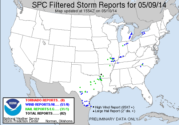
Well yesterday storms were quite impressive! As you see below this was all a High Wind event...got a .70 of rain yesterday we shall see how much we get early next week.

0 likes
The following post is NOT an official forecast and should not be used as such. It is just the opinion of the poster and may or may not be backed by sound meteorological data. It is NOT endorsed by any professional institution including storm2k.org For Official Information please refer to the NHC and NWS products.
-
weatherdude1108
- Category 5
- Posts: 4228
- Joined: Tue Dec 13, 2011 1:04 pm
- Location: Northwest Austin/Cedar Park, TX
EWX had a pretty interesting discussion this afternoon:
AREA FORECAST DISCUSSION
NATIONAL WEATHER SERVICE AUSTIN/SAN ANTONIO TX
316 PM CDT SAT MAY 10 2014
.LONG TERM (MONDAY THROUGH SATURDAY)...
AHEAD OF THE COLD FRONT...A DRYLINE WILL MOVE INTO OUR WESTERN
REGION DURING THE DAY MONDAY BRING A CHANCE FOR SHOWERS AND
THUNDERSTORMS TO THE NORTH AND WEST. MONDAY NIGHT THE FRONT WILL
MOVE THROUGH OUR CWA. AFTER THE FRONT PASSES THE UPPER TROUGH WILL
MOVE ACROSS AND MODELS ARE COMING INTO AGREEMENT ON THE TIMING ON
THIS FEATURE. THE GFS AND ECMWF SHOW SHOWERS AND THUNDERSTORMS
INTO TUESDAY NIGHT. MODELS ARE FORECASTING A SIGNIFICANT RAIN
EVENT WITH THIS SYSTEM. DO NOT WANT TO FOCUS ON QPF TOTALS AT THIS
TIME...BUT FLOODING IS POSSIBLE WITH THIS SOLUTION. MODEL SOUNDINGS
ARE MARGINAL FOR SEVERE WEATHER WITH SHALLOW LAPSE RATES IN THE
MID-LEVELS AND LOW WIND SHEAR. AFTER THIS SYSTEM PASSES HIGH
PRESSURE WILL DOMINATE THE REMAINDER OF THE FORECAST. COOLER AIR
WILL MOVE IN WEDNESDAY THEN PROGRESS TO THE EAST WITH DRY WEATHER
AND WARMING TEMPERATURES THROUGH THE END OF THE PERIOD.
0 likes
The preceding post is NOT an official forecast, and should not be used as such. It is only the opinion of the poster and may or may not be backed by sound meteorological data. It is NOT endorsed by any professional institution including storm2k.org. For Official Information please refer to the NHC and NWS products.
When all said and done some of you eastplexers may have received anywhere from 5-8" of rain in less than a week. That is a heck of a lot of rain for such a short span. That's too much, no more for you for several months! Share it with everyone else 

0 likes
The above post and any post by Ntxw is NOT an official forecast and should not be used as such. It is just the opinion of the poster and may or may not be backed by sound meteorological data. It is NOT endorsed by any professional institution including Storm2k. For official information, please refer to NWS products.
Help support Storm2K!
Help support Storm2K!
-
gboudx

- S2K Supporter
- Posts: 4090
- Joined: Thu Sep 04, 2003 1:39 pm
- Location: Rockwall, Tx but from Harvey, La
From Steve McCauley
The atmosphere will be prime for another widespread rain on Monday and Monday night, very similar to the system we just had, except this time, we should get a 100% coverage across ALL of north Texas for the period 6 AM Monday through 6 AM Tuesday. Once again, most areas will get at least 0.25" with numerous areas well over an inch. There will be a chance for some hail and damaging winds during the afternoon/early evening and then just transitioning to a heavy rain event at night.
I am concerned about serious flash flooding, especially for the eastern half of north Texas Monday night, as another multi-inch rain appears likely there.
Stay tuned for updates ...
0 likes
-
Hurricaneman

- Category 5
- Posts: 7404
- Age: 45
- Joined: Tue Aug 31, 2004 3:24 pm
- Location: central florida
Re: Texas Spring-2014
The rains there in Texas are because of the ST jet forcing by the oncoming El Nino so it wouldn't surprise me if this may become a more continuous pattern of wet
0 likes
Drought or no drought if this pans out by the WPC there would be significant flash flooding for quite a few areas. All droughts ends in a flood.

0 likes
The above post and any post by Ntxw is NOT an official forecast and should not be used as such. It is just the opinion of the poster and may or may not be backed by sound meteorological data. It is NOT endorsed by any professional institution including Storm2k. For official information, please refer to NWS products.
Help support Storm2K!
Help support Storm2K!
-
horselattitudesfarm

- Category 1

- Posts: 315
- Joined: Thu Jul 16, 2009 5:55 pm
- Location: Asheville, NC (formerly from Dallas, TX)
Re: Texas Spring-2014
I wanted to upload an image, but they changed the format of Imageshack, so now I don't know how to use it.....Just like about every other application I have learned to use....About the time I learn it.......they change it! Remember; all you young wipper-snappers out there with sharp quick minds programming all this stuff......you WILL become the elderly of tommorrow. Just remember that when you play tricks on us old people of today!
0 likes
Return to “USA & Caribbean Weather”
Who is online
Users browsing this forum: Brent, WeatherNewbie and 129 guests