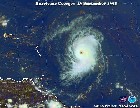
This is like an excersise up and down up and down but let's see if they go up at 00Z or stay south tonight.Colombia should be preparing.
18:00 UTC Tropical model suite=Isabel to Colombia !!!!!
Moderator: S2k Moderators
Forum rules

The posts in this forum are NOT official forecasts and should not be used as such. They are just the opinion of the poster and may or may not be backed by sound meteorological data. They are NOT endorsed by any professional institution or STORM2K. For official information, please refer to products from the National Hurricane Center and National Weather Service.
-
cycloneye

- Admin

- Posts: 149834
- Age: 69
- Joined: Thu Oct 10, 2002 10:54 am
- Location: San Juan, Puerto Rico
18:00 UTC Tropical model suite=Isabel to Colombia !!!!!
http://twister.sbs.ohio-state.edu/text/ ... s/03091118
This is like an excersise up and down up and down but let's see if they go up at 00Z or stay south tonight.Colombia should be preparing.
This is like an excersise up and down up and down but let's see if they go up at 00Z or stay south tonight.Colombia should be preparing.
Last edited by cycloneye on Thu Sep 11, 2003 2:10 pm, edited 4 times in total.
0 likes


-
rob8303
- Tropical Storm

- Posts: 147
- Joined: Sun Jul 20, 2003 10:20 pm
- Location: Montrose, B.C, Canada
- Contact:
Re: 18:00 UTC Tropical model suite=Are more south with track
cycloneye wrote:http://twister.sbs.ohio-state.edu/text/tropical/atlantic/models/03091118
This is like an excersise up and down up and down but let's see if they go up at 00Z or stay south tonight.
WOW!!!!
0 likes
-
ameriwx2003

- Category 4

- Posts: 980
- Joined: Tue Jul 22, 2003 10:45 am
-
ameriwx2003
- Category 4
- Posts: 980
- Joined: Tue Jul 22, 2003 10:45 am
-
weathergymnast

- Tropical Storm
- Posts: 123
- Joined: Sun Aug 31, 2003 11:47 am
- Contact:
-
Ground_Zero_92

- S2K Supporter

- Posts: 292
- Joined: Thu Sep 04, 2003 11:23 am
- Location: South Hutchinson Island / Stuart, FL
Re: 18:00 UTC Tropical model suite=Are more south with track
cycloneye wrote:This is like an excersise up and down up and down but let's see if they go up at 00Z or stay south tonight.
PULL OUT THE PROZAC!!!
I'm Happy
Geezz, we're all going to get Manic Depression if we keep looking at these models run to run!!
0 likes
-
Weathermaster
- Tropical Depression

- Posts: 79
- Joined: Thu Sep 04, 2003 10:33 am
- Location: Carolina, PR
Yes They Are
ameriwx2003 wrote:Luis.. nor do I.. Are the Tropical models run off the GFS data?. I am curious to know if they are or not:):)
The tropicals were run off the 6Z GFS at 12Z and the 18Z models go against the 12Z background. The 6Z gfs was a mess but it has sort of righted itself at 12Z which is why the models have come back to the left.
The GFS should stand for the Global Flipflop Suite.
MW
0 likes
-
stormernie
-
rob8303
- Tropical Storm
- Posts: 147
- Joined: Sun Jul 20, 2003 10:20 pm
- Location: Montrose, B.C, Canada
- Contact:
Re: Yes They Are
MWatkins wrote:ameriwx2003 wrote:Luis.. nor do I.. Are the Tropical models run off the GFS data?. I am curious to know if they are or not:):)
The tropicals were run off the 6Z GFS at 12Z and the 18Z models go against the 12Z background. The 6Z gfs was a mess but it has sort of righted itself at 12Z which is why the models have come back to the left.
The GFS should stand for the Global Flipflop Suite.
MW
Yes, the GFS has multiple personality disorder. MikeW, do you see this getting past the 75 w line?
0 likes
-
HeatherAKC

- S2K Supporter
- Posts: 286
- Joined: Thu Oct 10, 2002 2:28 pm
- Location: Miami Lakes, Florida
LOL!!
This is making me mad! Mad, crazy. Going north, going south, Sfla hit, NC hit, trough, high pressure, west, north. ACKKKK!!!!!! (Pulls out hair) It's *almost* funny. But somehow, not quite......
0 likes

Who is online
Users browsing this forum: hurricanes1234, JoshwaDone, tolakram, WaveBreaking and 95 guests