name of these cyclone clouds?

This is the general tropical discussion area. Anyone can take their shot at predicting a storms path.

Moderator: S2k Moderators

Forum rules

The posts in this forum are NOT official forecasts and should not be used as such. They are just the opinion of the poster and may or may not be backed by sound meteorological data. They are NOT endorsed by any professional institution or STORM2K. For official information, please refer to products from the National Hurricane Center and National Weather Service.

Help Support Storm2K
Message
Author
User avatar
DanieleItalyRm
Category 1
Category 1
Posts: 487
Age: 39
Joined: Mon Sep 22, 2008 7:52 am
Location: Rome - Italy - Mediterranean sea

name of these cyclone clouds?

#1 Postby DanieleItalyRm » Thu Oct 10, 2013 9:35 am

Hi Guys,
1 How you call these structures "rays" that are formed, often, around tropical cyclones?
2 What do these suggest?
3 Because they have this form-ray?
4 Are cirrus canopy? typical sign of outflow ?
5 These may indicate a system with a warm core?
6 Around a big thunderstorm complex can 'be a sign of a tropical system in formation?

Many Thanks,
Daniele - Italy

Image

Image

Image

Image

Uploaded with ImageShack.us
0 likes   

User avatar
brunota2003
S2K Supporter
S2K Supporter
Posts: 9476
Age: 34
Joined: Sat Jul 30, 2005 9:56 pm
Location: Stanton, KY...formerly Havelock, NC
Contact:

#2 Postby brunota2003 » Thu Oct 10, 2013 10:27 am

What you are seeing is the cirrus canopy fanning away from the system, and they can be used as an indicator of how well the outflow channels are working with the storm. The better venting a storm gets, the more likely it is to either maintain its strength or strengthen. Not the best answer in the world, but :lol:
0 likes   
Just a small town southern boy helping other humans.

User avatar
DESTRUCTION5
Category 5
Category 5
Posts: 4423
Age: 43
Joined: Wed Sep 03, 2003 11:25 am
Location: Stuart, FL

#3 Postby DESTRUCTION5 » Thu Oct 10, 2013 11:15 am

Those are its time to put up the shutters clouds.

(See Disclosure)
0 likes   
GATOR NATION IS E V E R Y W H E R E !

User avatar
Hurricane_Luis
Category 2
Category 2
Posts: 723
Age: 27
Joined: Sat Jun 23, 2012 3:14 pm
Location: Tiptree, Essex, United Kingdom
Contact:

Re: name of these cyclone clouds?

#4 Postby Hurricane_Luis » Thu Oct 10, 2013 11:28 am

They are cirrus clouds from the outflow of the storm. As warm air rises in the eye it spreads out over the top of the storm. And as Bruno said they indicate how well the outflow channels are working within the storm.

In this image what your looking at is labelled the Cirrus Outflow Sheild.
Image
0 likes   

User avatar
StarmanHDB
Tropical Storm
Tropical Storm
Posts: 201
Age: 60
Joined: Wed Sep 02, 2009 7:59 pm
Location: West Palm Beach, Florida

Re: name of these cyclone clouds?

#5 Postby StarmanHDB » Thu Oct 10, 2013 2:32 pm

As previously stated, those are very high altitude cirrus clouds which are the result of warm/moist air rising from the core/eye of a strong tropical cyclone. Once the warm air is literally sucked up to those altitudes, it flows outward in a reverse direction from the core resulting in the formation of those icy cirrus clouds.

Think of such a storm as a breathing entity - "inhaling" warm air and "exhaling" it into the high reaches of the upper atmosphere where it becomes very cold air. Furthermore, as breathing is an indicator of health, outflow indicates a very healthy, vigorous, strengthening storm.

Although I've yet to be in a hurricane since moving to South Florida, close to sunset during the approach of Tropical Storm Fay (2008), I can definitely say that strong outflow colors the sky the most eerie red I have ever seen.
0 likes   

hurricanes1234
Category 5
Category 5
Posts: 2907
Joined: Sat Jul 28, 2012 6:19 pm
Location: Trinidad and Tobago

Re: name of these cyclone clouds?

#6 Postby hurricanes1234 » Thu Oct 10, 2013 5:51 pm

Typhoon Nari in WPAC is displaying this phenomenon right now. Notice too, how deep the convection is. As all the previous posters said, this indicates a healthy system going through minimal wind shear, therefore, improving the outflow. However, I've seen a similar phenomenon with cirrus clouds fanning out from systems, like with Leslie last year, when the storm was going through high wind shear. I think it also happens with sheared storms, but maybe someone with more experience will shed some light on this.

Image
0 likes   
PLEASE NOTE: With the exception of information from weather agencies that I may copy and paste here, my posts will NEVER be official, since I am NOT a meteorologist. They are solely my amateur opinion, and may or may not be accurate. Therefore, please DO NOT use them as official details, particularly when making important decisions. Thank you.

User avatar
beoumont
Category 1
Category 1
Posts: 473
Joined: Sun Jul 10, 2011 4:13 pm
Location: East Central Florida
Contact:

Re: name of these cyclone clouds?

#7 Postby beoumont » Thu Oct 10, 2013 7:21 pm

I have always called them "spikes."

When I see that explosive outflow around a tropical system I get quite optimist for development or rapid intensification; although that optimism does sometimes get shattered as overall conditions worsen down the road.

Although the video frame below was not taken during the spiking stage of intensification, it shows the distinct curved cirrus shield of Hurricane Erin 1995 as the eye of the storm passed offshore, 105 miles NE of Miami. I shot the video from the parking lot of the NHC, on the FIU campus in west Miami. As is obvious, the deep blue tropical skies overhead are typical of the sinking air on the periphery of a well developed tropical cyclone. There was a pretty stiff hot NNW wind blowing at the time, and those suppressed fracto-cumulus clouds were whisking rapidly across the sky.

Image
0 likes   
List of 79 tropical cyclones intercepted by Richard Horodner:
http://www.canebeard.com/page/page/572246.htm

User avatar
DanieleItalyRm
Category 1
Category 1
Posts: 487
Age: 39
Joined: Mon Sep 22, 2008 7:52 am
Location: Rome - Italy - Mediterranean sea

Re: name of these cyclone clouds?

#8 Postby DanieleItalyRm » Thu Oct 10, 2013 8:16 pm

many many Thanks a lot guys, I'm happy for your answers, I would also be grateful you respond to each question in sequence.
BUT why these formations are also present in depressions and tropical storms? not only in strong hurricanes ...
although in a more 'limited ..

Image
0 likes   

User avatar
beoumont
Category 1
Category 1
Posts: 473
Joined: Sun Jul 10, 2011 4:13 pm
Location: East Central Florida
Contact:

Re: name of these cyclone clouds?

#9 Postby beoumont » Thu Oct 10, 2013 9:22 pm

I have seen massive spikes as some big blobs of unorganized thunderstorms have just moved off the west coast of Africa. It simply is the cloud signature or massive outflow radiating outward from and above the area of the rapidly rising air that created those thunderstorms in the first place.

The air converges at low levels, rises rapidly in the heated air above the warm ocean, then diverges outward at 40,000+ feet or so above those thunderclouds.

As far as your "why": there are other factors that have to coincide to develop a major hurricane; and those other factors are not always present.
0 likes   
List of 79 tropical cyclones intercepted by Richard Horodner:
http://www.canebeard.com/page/page/572246.htm

User avatar
AJC3
Admin
Admin
Posts: 3999
Age: 61
Joined: Tue Aug 31, 2004 7:04 pm
Location: Ballston Spa, New York
Contact:

#10 Postby AJC3 » Fri Oct 11, 2013 3:35 am

The radial "spikes" oriented normal (90 degrees) to the anticyclonic wind flow aloft are referred to as "transverse (cirrus) bands". They occur because of the strong horizontal divergence of the intense outflow winds at the top of the TC. They are also seen quite often in mesoscale convective systems (MCS), and in (linear) strong upper level jet streaks.

I would google "transverse bands" or "transverse cirrus bands" to get more information.

Here are some good reads...

http://www.atmos.ucla.edu/~fovell/paper ... r_etal.pdf
http://journals.ametsoc.org/doi/pdf/10. ... F2222285.1
http://nldr.library.ucar.edu/repository ... 00-186.pdf
http://cimss.ssec.wisc.edu/goes/misc/980721.html
http://www.eumetsat.int/website/home/Im ... _09_A.html
0 likes   

User avatar
DanieleItalyRm
Category 1
Category 1
Posts: 487
Age: 39
Joined: Mon Sep 22, 2008 7:52 am
Location: Rome - Italy - Mediterranean sea

Re: name of these cyclone clouds?

#11 Postby DanieleItalyRm » Fri Oct 11, 2013 6:22 am

Many thanks guys, I have been very useful, All of you,
So, these ray bands around these Mediterranean storms are the same thing, right?
cirrus from outflow ?

Image

Image
0 likes   

hurricanes1234
Category 5
Category 5
Posts: 2907
Joined: Sat Jul 28, 2012 6:19 pm
Location: Trinidad and Tobago

Re: name of these cyclone clouds?

#12 Postby hurricanes1234 » Fri Oct 11, 2013 7:20 am

DanieleItalyRm wrote:many many Thanks a lot guys, I'm happy for your answers, I would also be grateful you respond to each question in sequence.
BUT why these formations are also present in depressions and tropical storms? not only in strong hurricanes ...
although in a more 'limited ..

Image


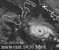
The bottom two pictures display exactly what I was talking about regarding sheared storms. The bottom right picture, Leslie, was going through heavy shear at the time of the picture, yet it still displayed that feature. I'm not sure if it's the same thing, but most probably it is. And to answer your last question, yes, those are the same phenomena in Mediterranean systems. Mediterranean systems are similar to fully-fledged tropical cyclones, except that they occur over much colder water. So they do share similar tendencies and appearances.
0 likes   
PLEASE NOTE: With the exception of information from weather agencies that I may copy and paste here, my posts will NEVER be official, since I am NOT a meteorologist. They are solely my amateur opinion, and may or may not be accurate. Therefore, please DO NOT use them as official details, particularly when making important decisions. Thank you.

User avatar
DanieleItalyRm
Category 1
Category 1
Posts: 487
Age: 39
Joined: Mon Sep 22, 2008 7:52 am
Location: Rome - Italy - Mediterranean sea

#13 Postby DanieleItalyRm » Fri Oct 11, 2013 8:05 am

Many Thanks hurricanes1234,
In mediterranean not always they are formed on colder water.
the two images above:
October 2006 system occured over +25°C Sea surface
December 2005 system (like a hurricane) occurd over +20 -22°C sea surface (like Karl 1980, Vince 2005, Grace 2009, Chris 2012)
September 2003 system occurd over +26 -27°C sea surface (one of the last examples that I put to top page).
0 likes   


Return to “Talkin' Tropics”

Who is online

Users browsing this forum: ElectricStorm, Lizzytiz1, Stratton23, USTropics and 43 guests