Annie Oakley wrote:
That looks straight-out wicked! I hope it doesn't hurt anyone..........
we have seen impressive sat images before
Moderator: S2k Moderators

Annie Oakley wrote:
That looks straight-out wicked! I hope it doesn't hurt anyone..........

SunnyThoughts wrote:blp wrote:
Surprise and it is 2013 in case you were wondering
Awesome looking system not to even be classified lol Just shows how looks are deceiving sometimes I guess.
TropicalAnalystwx13 wrote:Hammy wrote:latest recon shows the circulation collapsed so that may have been yet another eddy--SW of where the "circulation" was they're now finding light SE winds. No upgrade anytime in the near future.
Huh?

TropicalAnalystwx13 wrote:Hammy wrote:latest recon shows the circulation collapsed so that may have been yet another eddy--SW of where the "circulation" was they're now finding light SE winds. No upgrade anytime in the near future.
Huh?

jlauderdal wrote:Annie Oakley wrote:SouthFloridawx wrote:Holy Crap!
That looks straight-out wicked! I hope it doesn't hurt anyone..........
we have seen impressive sat images before


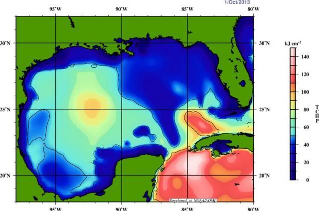
TreasureIslandFLGal wrote:wow, i work for the afternoon and so much changes so quickly. if this stays off teh Yuc, could it go over the loop current and bomb? or conditions aloft further norht just too hostile to worry about any rapid intensification?


Steve wrote:I disagree alien. There were several different better looking systems this year than what 97l looks like now. The spin and look are probably coming from the mid levels and the ridge over top. Having said that, it is looking better and better. Hopefully we won't get much more than a moderate TS out of it (assuming something classifiable forms). Models are pretty focused on sc la over to the big bend. There also doesn't seem to be that much time to impact. We are probably talking 3-5 days max (sat-mon). Some of the recent runs (GFS) had kind of showed a fairly slow moving system at landfall that maybe pulses a bit near the fl coast which could mean a buttload of rain for points near and east.
My Gun to the head/early morning line would be a 50-55mph system around Navarre/ft Walton early Sunday with heavy rainfall and rip currents as the major threats. We will see and should have a pretty good idea this time tomorrow what's going to happen (does it organize, where is the front and what's the timing, does it cross the channel or the NE tip of the yucatan etc). Again, I think any threat and most of the rain and squalls are east of here.
This post is NOT official.

panamatropicwatch wrote:Recon finding east winds to the west of where the center was thought to be forming. They should be out of the north. Or the west side winds don't extend out that far maybe?


Hammy wrote:Will the scheduled overnight flight still occur?


Users browsing this forum: No registered users and 81 guests