

Michael Lowry, Hurricane Specialist, The Weather Channel
Sep 2, 2013 5:28 am ET
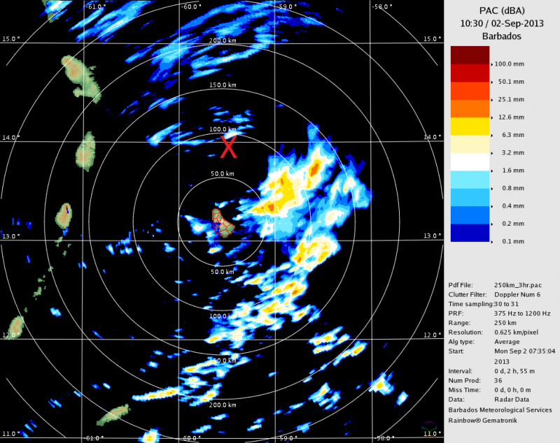
- Invest 97-L near the Lesser Antilles still disorganized but slow development possible
- Will bring heavy rains and gusty winds to Leeward and Windward Islands through Tuesday
INVEST 97-L
Thunderstorms waned over 97-L this Sunday evening. There remains a healthy spin just above the surface but near the ocean the circulation is still broad around an area of low pressure near the Lesser Antilles. Although upper level winds have weakened, evening atmospheric soundings still indicate the presence of dry air at about 15,000 feet up.
While the statistical and regional weather models that assume an already developed system intensify 97-L, the global weather models are slower to latch on to development. In fact the American (GFS) model now offers more support for the disturbance behind 97-L than it does for the low pressure area near the islands. Until a tropical depression or storm forms, it's difficult to say much about future track or intensity. With sporadic thunderstorm activity and a broad surface circulation, a developing system could form north or south along the wave axis. The difference in where formation might occur has meaningful consequences on future track.
Bottom line: The historical peak of the season is approaching and conditions appear generally favorable for slow organization as 97-L moves westward over the next few days. By the middle to latter part of the week, a weakness in high pressure steering to the north will carve a channel for 97-L to turn toward the northwest. While it's too early to speculate on U.S. impacts, the earliest threat will be late week into the weekend.
Regardless of development squally weather will spread through the Lesser Antilles tomorrow and Tuesday. Air Force Hurricane Hunter aircraft as well as a NASA Global Hawk drone may investigate 97-L on Tuesday.


