ATL: INVEST 92L
Moderator: S2k Moderators
- cycloneye
- Admin
- Posts: 139707
- Age: 67
- Joined: Thu Oct 10, 2002 10:54 am
- Location: San Juan, Puerto Rico
ATL: INVEST 92L
Aric here it is!!
BEGIN
NHC_ATCF
invest_al922013.invest
FSTDA
R
U
040
010
0000
201306061923
NONE
NOTIFY=ATRP
END
INVEST, AL, L, , , , , 92, 2013, DB, O, 2013060618, 9999999999, , , , , , METWATCH, , AL922013
AL, 92, 2013060618, , BEST, 0, 136N, 467W, 30, 0, DB, 0, , 0, 0, 0, 0,
BEGIN
NHC_ATCF
invest_al922013.invest
FSTDA
R
U
040
010
0000
201306061923
NONE
NOTIFY=ATRP
END
INVEST, AL, L, , , , , 92, 2013, DB, O, 2013060618, 9999999999, , , , , , METWATCH, , AL922013
AL, 92, 2013060618, , BEST, 0, 136N, 467W, 30, 0, DB, 0, , 0, 0, 0, 0,
0 likes
Visit the Caribbean-Central America Weather Thread where you can find at first post web cams,radars
and observations from Caribbean basin members Click Here
-
- Category 5
- Posts: 21228
- Age: 41
- Joined: Sun Sep 19, 2004 9:58 pm
- Location: Ready for the Chase.
- Contact:
haha finally.. lol
0 likes
Note: If I make a post that is brief. Please refer back to previous posts for the analysis or reasoning. I do not re-write/qoute what my initial post said each time.
If there is nothing before... then just ask
Space & Atmospheric Physicist, Embry-Riddle Aeronautical University,
I believe the sky is falling...
If there is nothing before... then just ask
Space & Atmospheric Physicist, Embry-Riddle Aeronautical University,
I believe the sky is falling...
- TropicalAnalystwx13
- Category 5
- Posts: 2109
- Age: 26
- Joined: Tue Jul 19, 2011 8:20 pm
- Location: Wilmington, NC
- Contact:
- Hurricane Andrew
- S2K Supporter
- Posts: 1891
- Age: 25
- Joined: Sun May 23, 2010 2:53 pm
- Location: KS
- Miami Storm Tracker
- Category 3
- Posts: 893
- Age: 66
- Joined: Sun Jun 13, 2010 10:12 pm
- Location: Key Largo, Fla.
- Contact:
-
- Admin
- Posts: 19183
- Age: 61
- Joined: Sun Aug 27, 2006 8:23 pm
- Location: Florence, KY (name is Mark)
Re: ATL: INVEST 92L
How about that!
Just in time for shear to rip it to shreds.
live loop vis: http://wwwghcc.msfc.nasa.gov/cgi-bin/ge ... umframes=5
IR: http://wwwghcc.msfc.nasa.gov/cgi-bin/ge ... umframes=5
Latest
Just in time for shear to rip it to shreds.
live loop vis: http://wwwghcc.msfc.nasa.gov/cgi-bin/ge ... umframes=5
IR: http://wwwghcc.msfc.nasa.gov/cgi-bin/ge ... umframes=5
Latest
0 likes
M a r k
- - - - -
Join us in chat: Storm2K Chatroom Invite. Android and IOS apps also available.
The posts in this forum are NOT official forecasts and should not be used as such. Posts are NOT endorsed by any professional institution or STORM2K.org. For official information and forecasts, please refer to NHC and NWS products.
- cycloneye
- Admin
- Posts: 139707
- Age: 67
- Joined: Thu Oct 10, 2002 10:54 am
- Location: San Juan, Puerto Rico
Re: ATL: INVEST 92L
Bouy close to low pressure.
0 likes
Visit the Caribbean-Central America Weather Thread where you can find at first post web cams,radars
and observations from Caribbean basin members Click Here
- Fego
- S2K Supporter
- Posts: 767
- Age: 64
- Joined: Sun Apr 18, 2004 7:58 pm
- Location: San Juan, Puerto Rico
- Contact:
Re: ATL: INVEST 92L
What a timing, as soon as Andrea got inland, they decided to keep the show running. Can't wait to see models first plots.
0 likes
Go Giants! Go Niners! Go Warriors!
- Weatherboy1
- Category 5
- Posts: 1169
- Age: 48
- Joined: Mon Jul 05, 2004 1:50 pm
- Location: Jupiter, FL
About time on this puppy! Glad they got around to at least designating. As others have noted, there is formidable shear ahead of 92. But the structure of the low pressure is very impressive with a large area of rotating low clouds and in the last few hours, a hefty blow up of convection around the center. We'll have to see if it can get its act together further. But that buoy report (along with the satellite presentation) certainly seem to suggest we have a very strong wave and almost borderline TD (in my opinion!)
0 likes
-
- Category 5
- Posts: 4966
- Joined: Wed Nov 14, 2012 10:43 am
Re: ATL: INVEST 92L
TXNT24 KNES 061946
TCSNTL
A. TROPICAL DISTURBANCE (92L)
B. 06/1745Z
C. 14.0N
D. 46.3W
E. FIVE/GOES-E
F. T1.0/1.0/D1.0/24HRS
G. IR/EIR/VIS
H. REMARKS...NO RECENT MICROWAVE PASSES ARE AVAILABLE BUT THE 0614Z SSMI
DID HINT AT A POSSIBLE CIRCULATION CENTER. LIMITED ACTIVE DEEP CONVECTION
IS SHEARED LT 1/2 DEGREE EAST OF THE CENTER. LOW LEVEL CLOUD LINES ARE
ELONGATED NW TO SE AND ARE NOT TIGHTLY CURVED. DT IS ASSIGNED 1.0 IN
SPITE OF THE CLOSE PROXIMITY OF THE CENTER TO THE CONVECTION BECAUSE THE
CONVECTION IS LIMITED AND THE CIRCULATION IS POORLY DEFINED. MET AND PT
ARE ALSO 1.0. FT IS BASED ON DT.
I. ADDL POSITIONS
NIL
...MCCARTHY
0 likes
- cycloneye
- Admin
- Posts: 139707
- Age: 67
- Joined: Thu Oct 10, 2002 10:54 am
- Location: San Juan, Puerto Rico
ATL: INVEST 92L - Models
00
CHGHUR
TROPICAL CYCLONE GUIDANCE MESSAGE
NWS NATIONAL HURRICANE CENTER MIAMI FL
2000 UTC THU JUN 6 2013
DISCLAIMER...NUMERICAL MODELS ARE SUBJECT TO LARGE ERRORS.
PLEASE REFER TO NHC OFFICIAL FORECASTS FOR TROPICAL CYCLONE
AND SUBTROPICAL CYCLONE INFORMATION.
ATLANTIC OBJECTIVE AIDS FOR
DISTURBANCE INVEST (AL922013) 20130606 1800 UTC
...00 HRS... ...12 HRS... ...24 HRS. .. ...36 HRS...
130606 1800 130607 0600 130607 1800 130608 0600
LAT LON LAT LON LAT LON LAT LON
BAMS 13.6N 46.7W 14.6N 49.1W 15.5N 51.7W 16.3N 54.3W
BAMD 13.6N 46.7W 14.6N 47.9W 15.3N 49.1W 16.0N 50.4W
BAMM 13.6N 46.7W 14.5N 48.7W 15.2N 50.7W 15.8N 52.8W
LBAR 13.6N 46.7W 14.4N 48.2W 15.2N 50.1W 15.7N 52.3W
SHIP 30KTS 31KTS 29KTS 25KTS
DSHP 30KTS 31KTS 29KTS 25KTS
...48 HRS... ...72 HRS... ...96 HRS. .. ..120 HRS...
130608 1800 130609 1800 130610 1800 130611 1800
LAT LON LAT LON LAT LON LAT LON
BAMS 17.0N 57.0W 18.3N 62.6W 19.7N 68.3W 21.2N 72.8W
BAMD 16.5N 51.6W 17.1N 53.2W 16.9N 53.2W 17.8N 52.3W
BAMM 16.3N 55.1W 17.1N 59.5W 17.8N 63.7W 19.4N 67.8W
LBAR 16.2N 54.7W 16.9N 59.3W 17.6N 62.8W 18.7N 64.5W
SHIP 22KTS 0KTS 0KTS 0KTS
DSHP 22KTS 0KTS 0KTS 0KTS
...INITIAL CONDITIONS...
LATCUR = 13.6N LONCUR = 46.7W DIRCUR = 295DEG SPDCUR = 10KT
LATM12 = 12.8N LONM12 = 45.0W DIRM12 = 292DEG SPDM12 = 9KT
LATM24 = 12.3N LONM24 = 43.1W
WNDCUR = 30KT RMAXWD = 30NM WNDM12 = 25KT
CENPRS = 1009MB OUTPRS = 1013MB OUTRAD = 100NM SDEPTH = S
RD34NE = 0NM RD34SE = 0NM RD34SW = 0NM RD34NW = 0NM
0 likes
Visit the Caribbean-Central America Weather Thread where you can find at first post web cams,radars
and observations from Caribbean basin members Click Here
- TheStormExpert
- Category 5
- Posts: 8487
- Age: 30
- Joined: Wed Feb 16, 2011 5:38 pm
- Location: Palm Beach Gardens, FL
Re: ATL: INVEST 92L
Fego wrote:What a timing, as soon as Andrea got inland, they decided to keep the show running. Can't wait to see models first plots.
I'm guessing it's too early in the season for the NHC to be keeping track of multiple areas.
0 likes
The following post is NOT an official forecast and should not be used as such. It is just the opinion of the poster and may or may not be backed by sound meteorological data. It is NOT endorsed by storm2k.org.
- cycloneye
- Admin
- Posts: 139707
- Age: 67
- Joined: Thu Oct 10, 2002 10:54 am
- Location: San Juan, Puerto Rico
Re: ATL: INVEST 92L - Models
Look at the very strong shear that awaits 92L.
22 26 36 41 35 39 31 36 33 36 34 44 40
ftp://ftp.nhc.noaa.gov/atcf/stext/13060 ... _ships.txt
22 26 36 41 35 39 31 36 33 36 34 44 40
ftp://ftp.nhc.noaa.gov/atcf/stext/13060 ... _ships.txt
0 likes
Visit the Caribbean-Central America Weather Thread where you can find at first post web cams,radars
and observations from Caribbean basin members Click Here
- Tireman4
- S2K Supporter
- Posts: 5679
- Age: 58
- Joined: Fri Jun 30, 2006 1:08 pm
- Location: Humble, Texas
- Contact:
Re: ATL: INVEST 92L
I'm guessing it's too early in the season for the NHC to be keeping track of multiple areas.
Oh my at that comment...LOL
*edited by sg to fix quotes
0 likes
-
- S2K Supporter
- Posts: 6617
- Joined: Wed Sep 03, 2003 11:27 am
- Location: Houston, TX
Shear go someplace else
Aric Dunn wrote:haha finally.. lol
Better late than never! Let's get this thing up to Berry because its time for the Atlantic to get wacky.
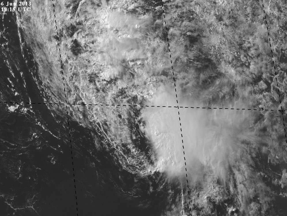
TropicalAnalystwx13 wrote:If this were any later in the season, I bet they'd upgrade this to at least a tropical depression.
I'm not so sure, I can't imagine the NHC acting like that in different ways because the criticism would build more against the agency. This situation is similar to June 2010 where there was some very early stuff coming off Africa and they did pay close attention to it then. There wasn't two systems ongoing at once though (IIRC), 2013 is special already.
cycloneye wrote:Look at the very strong shear that awaits 92L.
22 26 36 41 35 39 31 36 33 36 34 44 40
ftp://ftp.nhc.noaa.gov/atcf/stext/13060 ... _ships.txt
Lets see the shear go poof for once.
0 likes
- wxman57
- Moderator-Pro Met
- Posts: 22512
- Age: 66
- Joined: Sat Jun 21, 2003 8:06 pm
- Location: Houston, TX (southwest)
Re: ATL: INVEST 92L
Certainly an impressive wave for June. The high shear in its path will keep it in check. Could be a few storms for the northern islands in a few days.
0 likes
- SouthDadeFish
- Professional-Met
- Posts: 2835
- Joined: Thu Sep 23, 2010 2:54 pm
- Location: Miami, FL
- Contact:
Who is online
Users browsing this forum: No registered users and 3 guests