Texas Fall 2012

U.S. & Caribbean Weather Discussions and Severe Weather Events

Moderator: S2k Moderators

Forum rules

The posts in this forum are NOT official forecast and should not be used as such. They are just the opinion of the poster and may or may not be backed by sound meteorological data. They are NOT endorsed by any professional institution or STORM2K.

Help Support Storm2K
Message
Author
User avatar
Ntxw
Storm2k Moderator
Storm2k Moderator
Posts: 22784
Joined: Wed Oct 21, 2009 6:34 pm
Location: DFW, Texas

#321 Postby Ntxw » Thu Nov 15, 2012 2:13 pm

Long post today on the state of the season! First I wanted to say my thinking of a cool start to November was incorrect as my top analog year failed me.
___________________________________________________________________________________________________________________

So far for November 1976 has faded as the top analog due to the warmth. 2003 and 2009 are the two closest with the warmth. I will post maps on it tomorrow when the latest data comes in for the first 14 days.

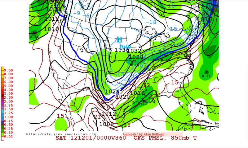
Right now we are in a +AO regime which is not favorable for cold air movement south. This is quite different than what October was when it was very negative. Of course there is a silver lining as the +AO allows cold air building in Canada, see below.

Image
By next week they will be some 20+ below average for the region which is crazy given where they already are.

We learned last year that a very cold Canada does not always equal a cold conus. We need blocking to dislodge it. There are a couple of ways for that to happen. First is a -AO. A Sudden Stratospheric warming event can do it, however it is very cold up there currently so no luck. Will continue to monitor it though through Nov and the winter as it's usually a precursor to arctic outbreaks.

Image

___________________________________________________________________________________________________________________

Next we have the PNA/NAO/EPO. Usually you need 2 of the 3 in tandem to bring meaningful cold down. None of the 3 right now is working for us.

http://www.esrl.noaa.gov/psd/forecasts/teleconn/

I have hope for the PNA and EPO as recent warming of the tropical Pacific and resulting subtropical jet will mean good things after Thanksgiving. If you haven't looked out your window lately, there's been a lot of mid and high level clouds this past week and it's a result of the unrest from the STJ. Not your typical puffy stuff :wink: Also kept temps cooler than progged as it should've been a quick moving shot.

Image

I believe this is why the GFS has trended wetter than the other models. But it is still alone right now in doing so, so there is hope if we're looking for any chance of rain.

Yeah yeah a lot of mumbo jumbo, when are we actually going to see cold outbreaks and rain?! Best guess is the last week of the month after Thanksgiving as my analogs are fuzzly atm. As for the holiday itself, we have every kind of weather possible by a wide range of super (computer) models. From hot to cold to wet and dry! :cheesy:
0 likes   
The above post and any post by Ntxw is NOT an official forecast and should not be used as such. It is just the opinion of the poster and may or may not be backed by sound meteorological data. It is NOT endorsed by any professional institution including Storm2k. For official information, please refer to NWS products.

  Help support Storm2K!
Help Support Storm2K

User avatar
Rgv20
S2K Supporter
S2K Supporter
Posts: 2466
Age: 38
Joined: Wed Jan 05, 2011 5:42 pm
Location: Edinburg/McAllen Tx

#322 Postby Rgv20 » Thu Nov 15, 2012 2:29 pm

:uarrow: Good Post Ntxw!

Here in the Valley we have not seen the Sun since Monday! It has been in the 60's and Cloudy the whole week...Tomorrow we should see some Drizzle :D
0 likes   
The following post is NOT an official forecast and should not be used as such. It is just the opinion of the poster and may or may not be backed by sound meteorological data. It is NOT endorsed by any professional institution including storm2k.org For Official Information please refer to the NHC and NWS products.

User avatar
Portastorm
Storm2k Moderator
Storm2k Moderator
Posts: 9914
Age: 63
Joined: Fri Jul 11, 2003 9:16 am
Location: Round Rock, TX
Contact:

Re: Texas Fall 2012

#323 Postby Portastorm » Thu Nov 15, 2012 3:06 pm

Yes Ntxw, good work!

The Portastorm Weather Center is seeing some hints in the models for a potential cold air outbreak for late November/early December.
0 likes   
Any forecasts under my name are to be taken with a grain of salt. Get your best forecasts from the National Weather Service and National Hurricane Center.

User avatar
somethingfunny
ChatStaff
ChatStaff
Posts: 3926
Age: 37
Joined: Thu May 31, 2007 10:30 pm
Location: McKinney, Texas

Re:

#324 Postby somethingfunny » Thu Nov 15, 2012 3:58 pm

gpsnowman wrote:Doesn't anybody have any long range 384hr la la land model maps we can drool over? I mean something that shows an enormous frozen blob sitting over DFW. Don't me wrong, the recent weather has been just about perfect. Just about. Patience young grasshopper. It will come. :ggreen:


Oh there's always something. :P

If you enjoy events where the cold air chases the precipitation, anyway....the 12z has something:

Image

Or this one from the 0z GFS...

Image

The GFS isn't being consistent with them though, so I'm not even in "wake me up when they get into range for the Euro" mode, yet.
0 likes   
I am not a meteorologist, and any posts made by me are not official forecasts or to be interpreted as being intelligent. These posts are just my opinions and are probably silly opinions.

weatherdude1108
Category 5
Category 5
Posts: 4228
Joined: Tue Dec 13, 2011 1:04 pm
Location: Northwest Austin/Cedar Park, TX

#325 Postby weatherdude1108 » Thu Nov 15, 2012 4:42 pm

Yeah, great post Ntxw! :D Puts some semblance of order in the chaos.

I agree with somethingfunny. These models change so fast lately. The other day, it showed 1.52 inches of rain some 10-14 days out. The next day, like 0.03 inches -- on the same day! :P
0 likes   
The preceding post is NOT an official forecast, and should not be used as such. It is only the opinion of the poster and may or may not be backed by sound meteorological data. It is NOT endorsed by any professional institution including storm2k.org. For Official Information please refer to the NHC and NWS products.

User avatar
Rgv20
S2K Supporter
S2K Supporter
Posts: 2466
Age: 38
Joined: Wed Jan 05, 2011 5:42 pm
Location: Edinburg/McAllen Tx

#326 Postby Rgv20 » Fri Nov 16, 2012 12:38 am

0zGFS continues to hint at some potential colder weather as we head late November to early December. :D

Image
0 likes   
The following post is NOT an official forecast and should not be used as such. It is just the opinion of the poster and may or may not be backed by sound meteorological data. It is NOT endorsed by any professional institution including storm2k.org For Official Information please refer to the NHC and NWS products.

gpsnowman
S2K Supporter
S2K Supporter
Posts: 3185
Joined: Fri Jan 07, 2011 10:35 am
Location: Grand Prairie Tx

#327 Postby gpsnowman » Fri Nov 16, 2012 1:09 am

Thanks for the maps guys. I feel much better now. :D
0 likes   

User avatar
Terri
Tropical Low
Tropical Low
Posts: 43
Joined: Sun Aug 12, 2012 11:54 am
Location: Williamson County - NW of Georgetown, Tx

Re: Texas Fall 2012

#328 Postby Terri » Fri Nov 16, 2012 6:19 am

Portastorm wrote:Yes Ntxw, good work!

The Portastorm Weather Center is seeing some hints in the models for a potential cold air outbreak for late November/early December.


:uarrow: hope is a good thing ... It reigns eternal at Rancho del Thibodeaux. :froze:
0 likes   
Terri
Rural Williamson County, Tx

weatherdude1108
Category 5
Category 5
Posts: 4228
Joined: Tue Dec 13, 2011 1:04 pm
Location: Northwest Austin/Cedar Park, TX

#329 Postby weatherdude1108 » Fri Nov 16, 2012 12:33 pm

More good news -- NOT.

Bob Rose reported on the updated drought outlook. Not positive (figuratively and literally). A combination of the ENSO neutral and negative PDO is not helping out Texas as far as rain is concerned. But, it is perfect if you like sunny and dry weather, or a periodic Pacific moisture tap -- enough to wring out -- sprinkles -- and spot up your dusty vehicle! :sun: 8-) :roll:

http://www.lcra.org/water/conditions/we ... olumn.html
0 likes   
The preceding post is NOT an official forecast, and should not be used as such. It is only the opinion of the poster and may or may not be backed by sound meteorological data. It is NOT endorsed by any professional institution including storm2k.org. For Official Information please refer to the NHC and NWS products.

User avatar
Ntxw
Storm2k Moderator
Storm2k Moderator
Posts: 22784
Joined: Wed Oct 21, 2009 6:34 pm
Location: DFW, Texas

Re:

#330 Postby Ntxw » Fri Nov 16, 2012 2:31 pm

weatherdude1108 wrote:More good news -- NOT.

Bob Rose reported on the updated drought outlook. Not positive (figuratively and literally). A combination of the ENSO neutral and negative PDO is not helping out Texas as far as rain is concerned. But, it is perfect if you like sunny and dry weather, or a periodic Pacific moisture tap -- enough to wring out -- sprinkles -- and spot up your dusty vehicle! :sun: 8-) :roll:

http://www.lcra.org/water/conditions/we ... olumn.html


There has been a sudden turn in the Global Wind Oscillation (GWO) cold PDO (temporarily) does not reign supreme. Just when everybody is ready to kill off the Nino! This potentially has big implications heading forward, I'm sensing some drastic changes in the ever changing weather patterns in the coming weeks.
0 likes   
The above post and any post by Ntxw is NOT an official forecast and should not be used as such. It is just the opinion of the poster and may or may not be backed by sound meteorological data. It is NOT endorsed by any professional institution including Storm2k. For official information, please refer to NWS products.


  Help support Storm2K!

Help Support Storm2K


weatherdude1108
Category 5
Category 5
Posts: 4228
Joined: Tue Dec 13, 2011 1:04 pm
Location: Northwest Austin/Cedar Park, TX

Re: Re:

#331 Postby weatherdude1108 » Fri Nov 16, 2012 3:03 pm

Ntxw wrote:
weatherdude1108 wrote:More good news -- NOT.

Bob Rose reported on the updated drought outlook. Not positive (figuratively and literally). A combination of the ENSO neutral and negative PDO is not helping out Texas as far as rain is concerned. But, it is perfect if you like sunny and dry weather, or a periodic Pacific moisture tap -- enough to wring out -- sprinkles -- and spot up your dusty vehicle! :sun: 8-) :roll:

http://www.lcra.org/water/conditions/we ... olumn.html


There has been a sudden turn in the Global Wind Oscillation (GWO) cold PDO (temporarily) does not reign supreme. Just when everybody is ready to kill off the Nino! This potentially has big implications heading forward, I'm sensing some drastic changes in the ever changing weather patterns in the coming weeks.

:uarrow:
Interesting!! You got me VERY curious.( :?: ) :)
0 likes   

User avatar
Ntxw
Storm2k Moderator
Storm2k Moderator
Posts: 22784
Joined: Wed Oct 21, 2009 6:34 pm
Location: DFW, Texas

Re: Re:

#332 Postby Ntxw » Fri Nov 16, 2012 8:27 pm

weatherdude1108 wrote:Interesting!! You got me VERY curious.( :?: ) :)


The October PDO index rose significantly to -0.79 from -2.21! While this is still the cold state, it is very near the point where it's not low enough to be a force (for the time being). As result the GWO (AAM) has risen as well. GWO measures the wind patterns around the globe and for the past 6+ months have been in a La Nina state, but now we see a more evident flip.
0 likes   
The above post and any post by Ntxw is NOT an official forecast and should not be used as such. It is just the opinion of the poster and may or may not be backed by sound meteorological data. It is NOT endorsed by any professional institution including Storm2k. For official information, please refer to NWS products.


  Help support Storm2K!

Help Support Storm2K


weather_novice
Tropical Low
Tropical Low
Posts: 11
Joined: Fri Mar 16, 2012 4:08 am
Location: San Antonio, TX

Re: Texas Fall 2012

#333 Postby weather_novice » Fri Nov 16, 2012 9:13 pm

Was out on a bike ride to Medina Lake and back on Tuesday afternoon when I was hit by pea-sized hail.

http://imageshack.us/a/img717/6320/img0 ... 131430.jpg
0 likes   

User avatar
horselattitudesfarm
Category 1
Category 1
Posts: 315
Joined: Thu Jul 16, 2009 5:55 pm
Location: Asheville, NC (formerly from Dallas, TX)

Re: Texas Fall 2012

#334 Postby horselattitudesfarm » Sat Nov 17, 2012 11:23 pm

The following is an excerpt from the study finished a while back showing how rising CO2 causes drought.

"Recent climate modeling has shown that reducing the concentration of carbon dioxide in the atmosphere would give Earth a wetter climate in the short term. New research from Carnegie Global Ecology scientists Long Cao and Ken Caldeira offers a novel explanation for why climates are wetter when atmospheric carbon dioxide (CO2) concentrations are decreasing. Their findings, published online March 24 by Geophysical Research Letters, show that cutting carbon dioxide concentrations could help prevent droughts caused by global warming. Cao and Caldeira's new work shows that this precipitation increase is due to the heat-trapping property of the greenhouse gas carbon dioxide in the atmosphere. Carbon dioxide traps heat in the middle of the atmosphere. This warm air higher in the atmosphere tends to prevent the rising air motions that create thunderstorms and rainfall.
As a result, an increase in the atmospheric concentration of carbon dioxide tends to suppress precipitation. Similarly, a decrease in the atmospheric concentration of carbon dioxide tends to increase precipitation." You can read more about it at:

http://www.sciencedaily.com/releases/20 ... 153504.htm
Can you say 'Mexican Plume?' This my personal belief on why it is getting stronger and stronger in the spring and inhibiting what used to be wet springs here. Not by any means the only reason, but a reason to watch nonetheless. If this study turns out to be why the Mexican Plume is getting stronger then we need to be afraid......really afraid :double: .
Read it and weep :cry:
0 likes   

orangeblood
S2K Supporter
S2K Supporter
Posts: 3714
Joined: Tue Dec 15, 2009 6:14 pm
Location: Fort Worth, TX

Re: Texas Fall 2012

#335 Postby orangeblood » Sun Nov 18, 2012 10:11 am

horselattitudesfarm wrote:The following is an excerpt from the study finished a while back showing how rising CO2 causes drought.

"Recent climate modeling has shown that reducing the concentration of carbon dioxide in the atmosphere would give Earth a wetter climate in the short term. New research from Carnegie Global Ecology scientists Long Cao and Ken Caldeira offers a novel explanation for why climates are wetter when atmospheric carbon dioxide (CO2) concentrations are decreasing. Their findings, published online March 24 by Geophysical Research Letters, show that cutting carbon dioxide concentrations could help prevent droughts caused by global warming. Cao and Caldeira's new work shows that this precipitation increase is due to the heat-trapping property of the greenhouse gas carbon dioxide in the atmosphere. Carbon dioxide traps heat in the middle of the atmosphere. This warm air higher in the atmosphere tends to prevent the rising air motions that create thunderstorms and rainfall.
As a result, an increase in the atmospheric concentration of carbon dioxide tends to suppress precipitation. Similarly, a decrease in the atmospheric concentration of carbon dioxide tends to increase precipitation." You can read more about it at:

http://www.sciencedaily.com/releases/20 ... 153504.htm
Can you say 'Mexican Plume?' This my personal belief on why it is getting stronger and stronger in the spring and inhibiting what used to be wet springs here. Not by any means the only reason, but a reason to watch nonetheless. If this study turns out to be why the Mexican Plume is getting stronger then we need to be afraid......really afraid :double: .
Read it and weep :cry:


Do you realize that CO2 accounts for a whopping .000387 of the Earth's atmosphere ?? There are many more causes you need to point to before looking at CO2, it is way down to totem pole. The Sun and Oceans are the biggest drivers. The current Pacific and Atlantic ocean cycles are very similar to where they were back in the 30's to 50's...coinciding with one the worst droughts Texas has ever had. The public needs to get off of this CO2 kick, IMO
0 likes   

User avatar
Portastorm
Storm2k Moderator
Storm2k Moderator
Posts: 9914
Age: 63
Joined: Fri Jul 11, 2003 9:16 am
Location: Round Rock, TX
Contact:

Re: Texas Fall 2012

#336 Postby Portastorm » Sun Nov 18, 2012 11:28 am

Hey guys, if you want to banter about CO2 and GW and all of that ... please move it to a new thread in the general discussion forum.

Thank you kindly! :wink:

Now, let's get back to what I think will be a pleasing development for us cold weather lovers. Late November/early December is looking promising!
0 likes   
Any forecasts under my name are to be taken with a grain of salt. Get your best forecasts from the National Weather Service and National Hurricane Center.

User avatar
vbhoutex
Storm2k Executive
Storm2k Executive
Posts: 29112
Age: 73
Joined: Wed Oct 09, 2002 11:31 pm
Location: Cypress, TX
Contact:

Re: Texas Fall 2012

#337 Postby vbhoutex » Sun Nov 18, 2012 2:50 pm

Portastorm wrote:Hey guys, if you want to banter about CO2 and GW and all of that ... please move it to a new thread in the general discussion forum.

Thank you kindly! :wink:

Now, let's get back to what I think will be a pleasing development for us cold weather lovers. Late November/early December is looking promising!
Oh you tease!!! Stop it!! :P :ggreen:
0 likes   
Skywarn, C.E.R.T.
Please click below to donate to STORM2K to help with the expenses of keeping the site going:
Image

User avatar
iorange55
Category 5
Category 5
Posts: 2388
Joined: Thu Nov 13, 2008 9:47 pm
Location: Big D

Re: Texas Fall 2012

#338 Postby iorange55 » Sun Nov 18, 2012 4:16 pm

It does look like cold air will be making its way down later in the month. I believe the latest EURO still shows a nice shot of cold air coming down at the end of the run.

Thanksgiving may be on the "warm" side, but at least December should start out cold!
0 likes   

User avatar
Ntxw
Storm2k Moderator
Storm2k Moderator
Posts: 22784
Joined: Wed Oct 21, 2009 6:34 pm
Location: DFW, Texas

#339 Postby Ntxw » Sun Nov 18, 2012 5:30 pm

Looks like we could get 2/3 of the blocking signals mostly from the NAO and EPO. Cold is certainly there to be had in Canada. If we can couple them with the PNA could be a wild ride, triple crown of blocking. Lets see if we can get the MJO into the right phases for some help in that department.

http://raleighwx.americanwx.com/models/ ... tions.html
0 likes   
The above post and any post by Ntxw is NOT an official forecast and should not be used as such. It is just the opinion of the poster and may or may not be backed by sound meteorological data. It is NOT endorsed by any professional institution including Storm2k. For official information, please refer to NWS products.


  Help support Storm2K!

Help Support Storm2K


User avatar
Rgv20
S2K Supporter
S2K Supporter
Posts: 2466
Age: 38
Joined: Wed Jan 05, 2011 5:42 pm
Location: Edinburg/McAllen Tx

Re: Texas Fall 2012

#340 Postby Rgv20 » Sun Nov 18, 2012 11:09 pm

Portastorm wrote: Late November/early December is looking promising!


I was looking at the Monthly ECMWF and it shows a pretty potent Arctic Outbreak (-15C 850mb for the Panhandle to the Wichita Falls area) for the state of Texas by late in the first week of December. :)
0 likes   
The following post is NOT an official forecast and should not be used as such. It is just the opinion of the poster and may or may not be backed by sound meteorological data. It is NOT endorsed by any professional institution including storm2k.org For Official Information please refer to the NHC and NWS products.


Return to “USA & Caribbean Weather”

Who is online

Users browsing this forum: AnnularCane, snownado and 25 guests