ATL: SANDY - Models
Moderator: S2k Moderators
-
pricetag56
- Tropical Storm

- Posts: 133
- Joined: Sat Aug 21, 2010 4:18 pm
Re: ATL: SANDY - Models
Can someone explain why these runs are going to be such a historic event?
0 likes
-
Aric Dunn
- Category 5

- Posts: 21238
- Age: 43
- Joined: Sun Sep 19, 2004 9:58 pm
- Location: Ready for the Chase.
- Contact:
Re: ATL: SANDY - Models
nogaps 42 hours. almost landfall.

48 lnadfall miami.

48 lnadfall miami.
0 likes
Note: If I make a post that is brief. Please refer back to previous posts for the analysis or reasoning. I do not re-write/qoute what my initial post said each time.
If there is nothing before... then just ask
Space & Atmospheric Physicist, Embry-Riddle Aeronautical University,
I believe the sky is falling...
If there is nothing before... then just ask
Space & Atmospheric Physicist, Embry-Riddle Aeronautical University,
I believe the sky is falling...

-
wxman57

- Moderator-Pro Met

- Posts: 23172
- Age: 68
- Joined: Sat Jun 21, 2003 8:06 pm
- Location: Houston, TX (southwest)
Re: ATL: SANDY - Models
GFS saying central to southern Maine. I get the run in a bit faster here.
0 likes
-
JamesCaneTracker
- Tropical Storm
- Posts: 207
- Joined: Fri Jun 22, 2012 1:33 pm
- Location: Portland, Maine
Re: ATL: SANDY - Models
wxman57 wrote:GFS saying central to southern Maine. I get the run in a bit faster here.
What sort of Winds and Surge would Portland be looking at?
0 likes
-
deltadog03

- Professional-Met

- Posts: 3580
- Joined: Tue Jul 05, 2005 6:16 pm
- Location: Macon, GA

Re: ATL: SANDY - Models
0 likes
-
Aric Dunn
- Category 5
- Posts: 21238
- Age: 43
- Joined: Sun Sep 19, 2004 9:58 pm
- Location: Ready for the Chase.
- Contact:
Re: ATL: SANDY - Models
nogaps.... 96 hrs. very similar to euro.

0 likes
Note: If I make a post that is brief. Please refer back to previous posts for the analysis or reasoning. I do not re-write/qoute what my initial post said each time.
If there is nothing before... then just ask
Space & Atmospheric Physicist, Embry-Riddle Aeronautical University,
I believe the sky is falling...
If there is nothing before... then just ask
Space & Atmospheric Physicist, Embry-Riddle Aeronautical University,
I believe the sky is falling...
-
deltadog03
- Professional-Met
- Posts: 3580
- Joined: Tue Jul 05, 2005 6:16 pm
- Location: Macon, GA
Re: ATL: SANDY - Models
wxman57 wrote:GFS saying central to southern Maine. I get the run in a bit faster here.
So, I would say the GFS is most DEF. coming back towards an EURO solution. I would say from the mid-atl to NE we have a potential HUGE problem
0 likes
-
tolakram
- Admin

- Posts: 20179
- Age: 62
- Joined: Sun Aug 27, 2006 8:23 pm
- Location: Florence, KY (name is Mark)
Re: ATL: SANDY - Models
Folks,
please do not directly embed images from other sites. This puts the traffic load on that site for everyone who even looks at this thread. We've asked over and over to copy images to an image hosting site before embedding them here.
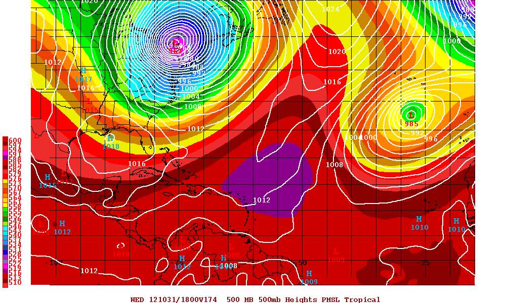
Saved images from the latest GFS run


please do not directly embed images from other sites. This puts the traffic load on that site for everyone who even looks at this thread. We've asked over and over to copy images to an image hosting site before embedding them here.
Saved images from the latest GFS run
0 likes
M a r k
- - - - -
Join us in chat: Storm2K Chatroom Invite. Android and IOS apps also available.
The posts in this forum are NOT official forecasts and should not be used as such. Posts are NOT endorsed by any professional institution or STORM2K.org. For official information and forecasts, please refer to NHC and NWS products.

Re: ATL: SANDY - Models
Shoot...OK...I jumped the gun (the NCEP site is ridiculously slow...probably all weather weenies are trying to get in, so I didn't see the connection)...that is a freaky track. Now the GFS is onboard.
0 likes
-
DESTRUCTION5

- Category 5
- Posts: 4430
- Age: 44
- Joined: Wed Sep 03, 2003 11:25 am
- Location: Stuart, FL

-
wxman57
- Moderator-Pro Met
- Posts: 23172
- Age: 68
- Joined: Sat Jun 21, 2003 8:06 pm
- Location: Houston, TX (southwest)
Re: ATL: SANDY - Models
deltadog03 wrote:wxman57 wrote:GFS saying central to southern Maine. I get the run in a bit faster here.
So, I would say the GFS is most DEF. coming back towards an EURO solution. I would say from the mid-atl to NE we have a potential HUGE problem
I'd look for the Euro to start shifting northward toward the GFS solution.
0 likes
-
DESTRUCTION5
- Category 5
- Posts: 4430
- Age: 44
- Joined: Wed Sep 03, 2003 11:25 am
- Location: Stuart, FL
-
tolakram
- Admin
- Posts: 20179
- Age: 62
- Joined: Sun Aug 27, 2006 8:23 pm
- Location: Florence, KY (name is Mark)
Re: ATL: SANDY - Models
For comparison here are two saved images from last nights euro run.


0 likes
M a r k
- - - - -
Join us in chat: Storm2K Chatroom Invite. Android and IOS apps also available.
The posts in this forum are NOT official forecasts and should not be used as such. Posts are NOT endorsed by any professional institution or STORM2K.org. For official information and forecasts, please refer to NHC and NWS products.
- - - - -
Join us in chat: Storm2K Chatroom Invite. Android and IOS apps also available.
The posts in this forum are NOT official forecasts and should not be used as such. Posts are NOT endorsed by any professional institution or STORM2K.org. For official information and forecasts, please refer to NHC and NWS products.
-
deltadog03
- Professional-Met
- Posts: 3580
- Joined: Tue Jul 05, 2005 6:16 pm
- Location: Macon, GA
Re: ATL: SANDY - Models
wxman57 wrote:deltadog03 wrote:wxman57 wrote:GFS saying central to southern Maine. I get the run in a bit faster here.
So, I would say the GFS is most DEF. coming back towards an EURO solution. I would say from the mid-atl to NE we have a potential HUGE problem
I'd look for the Euro to start shifting northward toward the GFS solution.
I would agree to that...More than likely somewhere in the middle. Either way, this will be bad for many. I will take the nice cool shot down here in GA tho..haha
0 likes
-
tolakram
- Admin
- Posts: 20179
- Age: 62
- Joined: Sun Aug 27, 2006 8:23 pm
- Location: Florence, KY (name is Mark)
Re:
DESTRUCTION5 wrote:Sorry Tolkram..Work wont let me use Imageshak for some reason..
How about imgur.com ?
You are welcome to post the link to the image, just don't put image tags around it.
0 likes
M a r k
- - - - -
Join us in chat: Storm2K Chatroom Invite. Android and IOS apps also available.
The posts in this forum are NOT official forecasts and should not be used as such. Posts are NOT endorsed by any professional institution or STORM2K.org. For official information and forecasts, please refer to NHC and NWS products.
- - - - -
Join us in chat: Storm2K Chatroom Invite. Android and IOS apps also available.
The posts in this forum are NOT official forecasts and should not be used as such. Posts are NOT endorsed by any professional institution or STORM2K.org. For official information and forecasts, please refer to NHC and NWS products.
-
tolakram
- Admin
- Posts: 20179
- Age: 62
- Joined: Sun Aug 27, 2006 8:23 pm
- Location: Florence, KY (name is Mark)
Re: ATL: SANDY - Models
Good grief
saved image
saved image
0 likes
M a r k
- - - - -
Join us in chat: Storm2K Chatroom Invite. Android and IOS apps also available.
The posts in this forum are NOT official forecasts and should not be used as such. Posts are NOT endorsed by any professional institution or STORM2K.org. For official information and forecasts, please refer to NHC and NWS products.
- - - - -
Join us in chat: Storm2K Chatroom Invite. Android and IOS apps also available.
The posts in this forum are NOT official forecasts and should not be used as such. Posts are NOT endorsed by any professional institution or STORM2K.org. For official information and forecasts, please refer to NHC and NWS products.


Who is online
Users browsing this forum: No registered users and 13 guests