ATL: LESLIE - Post-Tropical - Discussion

Moderator: S2k Moderators

Message
Author
LarryWx
S2K Supporter
S2K Supporter
Posts: 6305
Joined: Sun Sep 07, 2003 2:04 pm
Location: GA

Re: ATL: TWELVE - Tropical Depression - Discussion

#281 Postby LarryWx » Thu Aug 30, 2012 1:07 pm

KWT wrote:
LarryWx wrote:
drezee wrote:NW winds last hour w/ pressure down to 1009
center is likely N of 14.175


This is confirmed by the 2 PM NHC update, which has it up to 14.3 N vs. 14.1 N at 11 AM. So, it is moving WNW as opposed to straight west or south of due west.


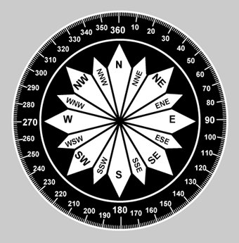
275 is certainly not WNW...not even close...thats far closer to due west than WNW!


1) I should have said north of due west instead of WNW. My point is that it isn't moving due west per the new coordinates. Some here have been saying due west or even a hair south of due west. which is not what these new coordinates as well as that buoy wind report suggest.

2) I see the 275 degree heading in the NHC update. However, if I were to use the raw data (moved 0.2 N by 0.9 W since 11 AM), the calculator gives me a 283 degree heading, which is on what I was basing my WNW mention (I should have said N of due west). Straight WNW is 292.5 while due west is 270. Based on that way of looking at it, it would pretty much be about halfway between due west and WNW fwiw.

3) Bottom line: it isn't moving due west or south of due west per the NHC and that buoy. It is north of due west.
Last edited by LarryWx on Thu Aug 30, 2012 1:15 pm, edited 1 time in total.
0 likes   
Personal Forecast Disclaimer:
The posts in this forum are NOT official forecasts and should not be used as such. They are just the opinion of the poster and may or may not be backed by sound meteorological data. They are NOT endorsed by any professional institution or storm2k.org. For official information, please refer to the NHC and NWS products.

User avatar
Gustywind
Category 5
Category 5
Posts: 12334
Joined: Mon Sep 03, 2007 7:29 am
Location: Baie-Mahault, GUADELOUPE

Re: ATL: LESLIE - Tropical Storm - Discussion

#282 Postby Gustywind » Thu Aug 30, 2012 1:10 pm

expat2carib wrote:
cycloneye wrote:
Here in the northeast Caribbean I'm confident that we will only see some outer band effects.


expat2carib, dont forget some high swells comming to the islands.


Yes! Thanks Luis for pointing this out. And BTW 5 degrees north of due west isn't that much as well. I keep confident in the NHC and other models. If not there will be a big surprise for the islanders :(

Personal Forecast Disclaimer:
The posts in this forum are NOT official forecast and should not be used as such. They are just the opinion of the poster and may or may not be backed by sound meteorological data. They are NOT endorsed by any professional institution or storm2k.org. For official information, please refer to the NHC and NWS products.

Yeah, keeping our fingers crossed. Can't imagine that type of surprise there :double: ! Especially when teachers back in school Monday and pupils Tuesday after holidays.
0 likes   

User avatar
cycloneye
Admin
Admin
Posts: 145304
Age: 68
Joined: Thu Oct 10, 2002 10:54 am
Location: San Juan, Puerto Rico

Re: ATL: LESLIE - Tropical Storm - Discussion

#283 Postby cycloneye » Thu Aug 30, 2012 1:13 pm

For those members who may not know all the different directions in degrees,here is a good compass that ilustrates every direction.

Image
0 likes   
Visit the Caribbean-Central America Weather Thread where you can find at first post web cams,radars
and observations from Caribbean basin members Click Here

Aric Dunn
Category 5
Category 5
Posts: 21238
Age: 42
Joined: Sun Sep 19, 2004 9:58 pm
Location: Ready for the Chase.
Contact:

#284 Postby Aric Dunn » Thu Aug 30, 2012 1:15 pm

the 275 is just them following the forecast since they cant get a accurate center fix they must assume the models are at least mostly correct and thus the position is based off the forecast not the actually movement. its still anywhere from 13.8 to 14.1 no way its 14.3 there is a curved band through there. with that well defined curved band establishing itself we could see this stregthen quite a bit sooner rather than later. islands not out of the woods yet. movement appears more 265 to 270 they are basing there 275 mostly on the basis of the forecast.
0 likes   
Note: If I make a post that is brief. Please refer back to previous posts for the analysis or reasoning. I do not re-write/qoute what my initial post said each time.
If there is nothing before... then just ask :)

Space & Atmospheric Physicist, Embry-Riddle Aeronautical University,
I believe the sky is falling...

User avatar
TheEuropean
Professional-Met
Professional-Met
Posts: 1796
Age: 59
Joined: Tue Sep 20, 2005 3:17 pm
Location: Voerde, Germany
Contact:

Re: ATL: TWELVE - Tropical Depression - Discussion

#285 Postby TheEuropean » Thu Aug 30, 2012 1:15 pm

LarryWx wrote:2) I see the 275 degree heading in the NHC update. However, if I were to use the raw data (moved 0.2 N by 0.9 W since 11 AM), the calculator gives me a 283 degree heading, which is on what I was basing my WNW mention (I shoud have said N of due west). Straight WNW is 292.5 while due west is 270. Based on that way of looking at it, it would pretty much be about halfway between due west and WNW fwiw.


Hi Larry,
but remember that a storm can be relocated, espacially if it is a new building storm. So you can't take the coordinates and calculate the motion only from the coordinates, I think.
0 likes   

User avatar
CalmBeforeStorm
Category 2
Category 2
Posts: 600
Age: 71
Joined: Tue Aug 10, 2004 7:55 pm
Location: Stuart, Florida

#286 Postby CalmBeforeStorm » Thu Aug 30, 2012 1:18 pm

Speculating on position and direction on a weak tropical storm that has just developed is....well....highly speculative. :wink:
0 likes   

floridasun78
Category 5
Category 5
Posts: 3755
Joined: Sun May 17, 2009 10:16 pm
Location: miami fl

Re: ATL: LESLIE - Tropical Storm - Discussion

#287 Postby floridasun78 » Thu Aug 30, 2012 1:19 pm

http://www.ssd.noaa.gov/PS/TROP/floater ... -long.html look it pass nhc forecast point you can click forecast point
0 likes   

User avatar
abajan
S2K Supporter
S2K Supporter
Posts: 4230
Joined: Sun Sep 07, 2003 5:10 am
Location: Barbados

Re: ATL: LESLIE - Tropical Storm - Discussion

#288 Postby abajan » Thu Aug 30, 2012 1:21 pm

cycloneye wrote:
Here in the northeast Caribbean I'm confident that we will only see some outer band effects.


expat2carib, dont forget some high swells comming to the islands.
Also, bear in mind that sometimes feeder bands can have surprisingly squally weather. Some years ago, Barbados was hit with south westerly tropical storm force wind gusts (actually, well above 39 mph), heavy rain and thunderstorms from a feeder band of a hurricane whose center had already passed well to our north a day or so before. Just recently, Trinidad & Tobago experienced significant flooding from Isaac whose center passed nowhere near them.

A word to the wise.
0 likes   

User avatar
CalmBeforeStorm
Category 2
Category 2
Posts: 600
Age: 71
Joined: Tue Aug 10, 2004 7:55 pm
Location: Stuart, Florida

Re: ATL: LESLIE - Tropical Storm - Discussion

#289 Postby CalmBeforeStorm » Thu Aug 30, 2012 1:22 pm

floridasun78 wrote:http://www.ssd.noaa.gov/PS/TROP/floaters/12L/flash-ir-long.html look it pass nhc forecast point you can click forecast point

Depends on where in that building blob of convection the center is. You could argue that the building blob is moving at least north of west.
0 likes   

Aric Dunn
Category 5
Category 5
Posts: 21238
Age: 42
Joined: Sun Sep 19, 2004 9:58 pm
Location: Ready for the Chase.
Contact:

Re: ATL: LESLIE - Tropical Storm - Discussion

#290 Postby Aric Dunn » Thu Aug 30, 2012 1:24 pm

floridasun78 wrote:http://www.ssd.noaa.gov/PS/TROP/floaters/12L/flash-ir-long.html look it pass nhc forecast point you can click forecast point


yep should go well south of that point in the next couple hours. which by the way is many hours faster than that.. which is the 00z forecast point. which about 4 to 5 hours faster a south of that point.
0 likes   
Note: If I make a post that is brief. Please refer back to previous posts for the analysis or reasoning. I do not re-write/qoute what my initial post said each time.
If there is nothing before... then just ask :)

Space & Atmospheric Physicist, Embry-Riddle Aeronautical University,
I believe the sky is falling...

floridasun78
Category 5
Category 5
Posts: 3755
Joined: Sun May 17, 2009 10:16 pm
Location: miami fl

Re: ATL: LESLIE - Tropical Storm - Discussion

#291 Postby floridasun78 » Thu Aug 30, 2012 1:26 pm

CalmBeforeStorm wrote:
floridasun78 wrote:http://www.ssd.noaa.gov/PS/TROP/floaters/12L/flash-ir-long.html look it pass nhc forecast point you can click forecast point

Depends on where in that building blob of convection the center is. You could argue that the building blob is moving at least north of west.

let see if nhc say nw
0 likes   

User avatar
x-y-no
Category 5
Category 5
Posts: 8359
Age: 65
Joined: Wed Aug 11, 2004 12:14 pm
Location: Fort Lauderdale, FL

#292 Postby x-y-no » Thu Aug 30, 2012 1:30 pm

Wind at bouy 41041 is trending back more northerly ... this may run right over the bouy or at least quite close ...

time direction speed
1750 NNW ( 341 deg ) 9.7 m/s
1740 NNW ( 342 deg ) 8.5 m/s
1730 N ( 349 deg ) 10.6 m/s
1720 NNW ( 337 deg ) 9.8 m/s
1710 NNW ( 331 deg ) 8.7 m/s
1700 NW ( 315 deg ) 8.5 m/s
0 likes   

User avatar
Gustywind
Category 5
Category 5
Posts: 12334
Joined: Mon Sep 03, 2007 7:29 am
Location: Baie-Mahault, GUADELOUPE

#293 Postby Gustywind » Thu Aug 30, 2012 1:30 pm

Hey look at these numbers from SSD. Looks like Leslie is more south than previous position... and continues to race westard.

30/1745 UTC 13.7N 44.2W T2.5/2.5 LESLIE
30/1145 UTC 13.9N 42.5W T2.0/2.0 98L
0 likes   

ozonepete
Professional-Met
Professional-Met
Posts: 4743
Joined: Mon Sep 07, 2009 3:23 pm
Location: From Ozone Park, NYC / Now in Brooklyn, NY

Re: ATL: LESLIE - Tropical Storm - Discussion

#294 Postby ozonepete » Thu Aug 30, 2012 1:31 pm

Aric Dunn wrote:
floridasun78 wrote:http://www.ssd.noaa.gov/PS/TROP/floaters/12L/flash-ir-long.html look it pass nhc forecast point you can click forecast point


yep should go well south of that point in the next couple hours. which by the way is many hours faster than that.. which is the 00z forecast point. which about 4 to 5 hours faster a south of that point.


I'm with you on this. Winds at 1750 at buoy 41041 were NNW again and it really looks to me like we'll get either easterly or variable before they go south.

Oh I see you pointed this out too, x-y-no. :)
0 likes   

User avatar
expat2carib
S2K Supporter
S2K Supporter
Posts: 458
Joined: Tue Jul 22, 2008 1:44 pm
Location: Sint Maarten

Re: ATL: LESLIE - Tropical Storm - Discussion

#295 Postby expat2carib » Thu Aug 30, 2012 1:33 pm

abajan wrote:
cycloneye wrote:
Here in the northeast Caribbean I'm confident that we will only see some outer band effects.


expat2carib, dont forget some high swells comming to the islands.
Also, bear in mind that sometimes feeder bands can have surprisingly squally weather. Some years ago, Barbados was hit with south westerly tropical storm force wind gusts (actually, well above 39 mph), heavy rain and thunderstorms from a feeder band of a hurricane whose center had already passed well to our north a day or so before. Just recently, Trinidad & Tobago experienced significant flooding from Isaac whose center passed nowhere near them.

A word to the wise.


You are 100% right abajan. I'm on alert but I think it's too early to start crying the wolfs are coming.The data available is telling me it will have a northerly parameter in the track. Let's see in the next 12/16 hours.
0 likes   

User avatar
ConvergenceZone
Category 5
Category 5
Posts: 5194
Joined: Fri Jul 29, 2005 1:40 am
Location: Northern California

#296 Postby ConvergenceZone » Thu Aug 30, 2012 1:34 pm

I don't think the islands have a thing to worry about. WXMAN mentioned
for sure that they have Luis and company have nothing to worry about, and for him to say that shows how much confidence he and the NHC has regarding a recurve....
WXMAN wouldn't say that unless he was absolutely certain...
I don't think a question of it not recurving will even come up.....

None of this is my opinion, but it does show mucho how trust and respect I have in WXMAN and he's got great history in his credibility when it comes to forecasting recurves in the past.
0 likes   

User avatar
cycloneye
Admin
Admin
Posts: 145304
Age: 68
Joined: Thu Oct 10, 2002 10:54 am
Location: San Juan, Puerto Rico

Re:

#297 Postby cycloneye » Thu Aug 30, 2012 1:34 pm

Gustywind wrote:Hey look at these numbers from SSD. Looks like Leslie is more south than previous position... and continues to race westard.

30/1745 UTC 13.7N 44.2W T2.5/2.5 LESLIE
30/1145 UTC 13.9N 42.5W T2.0/2.0 98L


Then it was right what some saw about a 265 degree movement.
0 likes   
Visit the Caribbean-Central America Weather Thread where you can find at first post web cams,radars
and observations from Caribbean basin members Click Here

Aric Dunn
Category 5
Category 5
Posts: 21238
Age: 42
Joined: Sun Sep 19, 2004 9:58 pm
Location: Ready for the Chase.
Contact:

Re: ATL: LESLIE - Tropical Storm - Discussion

#298 Postby Aric Dunn » Thu Aug 30, 2012 1:35 pm

ozonepete wrote:
Aric Dunn wrote:
floridasun78 wrote:http://www.ssd.noaa.gov/PS/TROP/floaters/12L/flash-ir-long.html look it pass nhc forecast point you can click forecast point


yep should go well south of that point in the next couple hours. which by the way is many hours faster than that.. which is the 00z forecast point. which about 4 to 5 hours faster a south of that point.


I'm with you on this. Winds at 1750 at buoy 41041 were NNW again and it really looks to me like we'll get either easterly or variable before they go south.

Oh I see you pointed this out too, x-y-no. :)


pressure this hour was falling rapidly. pressure is quite likely lower than the advisory
0 likes   
Note: If I make a post that is brief. Please refer back to previous posts for the analysis or reasoning. I do not re-write/qoute what my initial post said each time.
If there is nothing before... then just ask :)

Space & Atmospheric Physicist, Embry-Riddle Aeronautical University,
I believe the sky is falling...

floridasun78
Category 5
Category 5
Posts: 3755
Joined: Sun May 17, 2009 10:16 pm
Location: miami fl

Re:

#299 Postby floridasun78 » Thu Aug 30, 2012 1:43 pm

.
ConvergenceZone wrote:I don't think the islands have a thing to worry about. WXMAN mentioned
for sure that they have Luis and company have nothing to worry about, and for him to say that shows how much confidence he and the NHC has regarding a recurve....
WXMAN wouldn't say that unless he was absolutely certain...
I don't think a question of it not recurving will even come up.....

None of this is my opinion, but it does show mucho how trust and respect I have in WXMAN and he's got great history in his credibility when it comes to forecasting recurves in the past.

.WHICH WILL PROBABLY TURN THE
CYCLONE TO THE NORTHWEST AND NORTH. THERE IS A LOT OF UNCERTAINTY
IN THE LONG RANGE RELATED TO WHETHER THE SYSTEM RECURVES AHEAD OF
THE TROUGH OR GETS TRAPPED BENEATH A REBUILDING RIDGE. their not 100% sure of RECURVES
0 likes   

User avatar
cycloneye
Admin
Admin
Posts: 145304
Age: 68
Joined: Thu Oct 10, 2002 10:54 am
Location: San Juan, Puerto Rico

Re: ATL: LESLIE - Tropical Storm - Discussion

#300 Postby cycloneye » Thu Aug 30, 2012 1:47 pm

18z Best Track up to 40kts

AL, 12, 2012083018, , BEST, 0, 142N, 445W, 40, 1004, TS

ftp://ftp.nhc.noaa.gov/atcf/tcweb/inves ... 012.invest
0 likes   
Visit the Caribbean-Central America Weather Thread where you can find at first post web cams,radars
and observations from Caribbean basin members Click Here


Return to “2012”

Who is online

Users browsing this forum: No registered users and 7 guests