
ATL: ISAAC - Models
Moderator: S2k Moderators
-
Jevo

- S2K Supporter

- Posts: 1729
- Age: 47
- Joined: Tue Aug 03, 2004 8:45 pm
- Location: The Flemish Cap
- Contact:
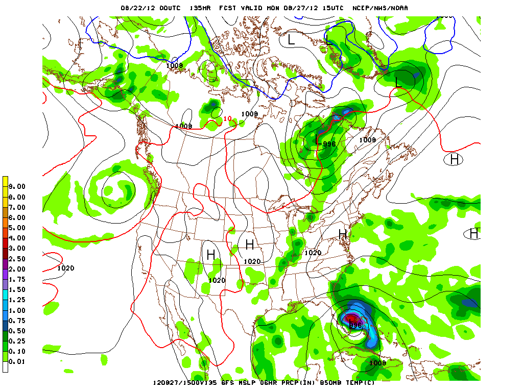
GFS +135 CONUS Landfall

0 likes
Disclaimer: 50% of the time I have no clue of what I am talking about. Chances are I am taking a less than educated guess that sounds good because 10 years ago I stole Mike Watkins book 'The Hurricane and its Impact'. For official information please direct yourself to the NHC and their cadre of weather geniuses.
Re: ATL: ISAAC - Models
ROCK wrote:Javlin wrote:Intense Cane half way up Kuba now 120hrs.
its 994mb so not that intense...it just went over Hispa, and the Cuban moutains...
I am looking at bars Rock and thought it was Wx57 said globals do not represent true stength,I am wrong?
0 likes
-
WilmingtonSandbar
- S2K Supporter
- Posts: 505
- Joined: Sun Aug 29, 2010 12:11 pm
- Location: Southport, NC
Re: ATL: ISAAC - Models
That GFS run is looking a lot like Bastardi's prediction from earlier. He had it sliding up the Florida coast and making landfall with 100kt winds around the SC/NC border.
0 likes
Diana X2 (look it up), Bertha, Fran, Bonnie, Floyd, Dennis, Charley, Ophelia, Ernesto, Irene, Matthew, And Florence

Re:
Jevo wrote:You guys are killing me with all these links LOL... Use imageshack damnit
0z GFS +129 CONUS
http://img171.imageshack.us/img171/4888 ... sl129g.gif
stop being lazy.....
0 likes
-
Jevo
- S2K Supporter
- Posts: 1729
- Age: 47
- Joined: Tue Aug 03, 2004 8:45 pm
- Location: The Flemish Cap
- Contact:
GFS CONUS +141

0 likes
Disclaimer: 50% of the time I have no clue of what I am talking about. Chances are I am taking a less than educated guess that sounds good because 10 years ago I stole Mike Watkins book 'The Hurricane and its Impact'. For official information please direct yourself to the NHC and their cadre of weather geniuses.

Re: ATL: ISAAC - Models
Landfall in Palm beach.
http://raleighwx.americanwx.com/models/ ... cal138.gif
http://raleighwx.americanwx.com/models/ ... cal138.gif
0 likes
The following post is NOT an official forecast and should not be used as such. It is just the opinion of the poster and may or may not be backed by sound meteorological data. It is NOT endorsed by any professional institution including storm2k.org For Official Information please refer to the NHC and NWS products.
-
SouthFLTropics

- Category 5

- Posts: 4258
- Age: 50
- Joined: Thu Aug 14, 2003 8:04 am
- Location: Port St. Lucie, Florida
Re: ATL: ISAAC - Models
SFT
0 likes
Fourth Generation Florida Native
Personal Storm History: David 79, Andrew 92, Erin 95, Floyd 99, Irene 99, Frances 04, Jeanne 04, Wilma 05, Matthew 16, Irma 17, Ian 22, Nicole 22, Milton 24
Personal Storm History: David 79, Andrew 92, Erin 95, Floyd 99, Irene 99, Frances 04, Jeanne 04, Wilma 05, Matthew 16, Irma 17, Ian 22, Nicole 22, Milton 24
Re: Re:
[/quote]ROCK wrote:Jevo wrote:You guys are killing me with all these links LOL... Use imageshack damnit
0z GFS +129 CONUS
http://img171.imageshack.us/img171/4888 ... sl129g.gif
stop being lazy.....
I think Rock just hit you with a 404
0 likes
-
Jevo
- S2K Supporter
- Posts: 1729
- Age: 47
- Joined: Tue Aug 03, 2004 8:45 pm
- Location: The Flemish Cap
- Contact:
Re: Re:
ROCK wrote:Jevo wrote:You guys are killing me with all these links LOL... Use imageshack damnit
0z GFS +129 CONUS
http://img171.imageshack.us/img171/4888 ... sl129g.gif
stop being lazy.....
IKR.. too late for clicky.. Im in total lazy.. let the other people do the work for me mode
0 likes
Disclaimer: 50% of the time I have no clue of what I am talking about. Chances are I am taking a less than educated guess that sounds good because 10 years ago I stole Mike Watkins book 'The Hurricane and its Impact'. For official information please direct yourself to the NHC and their cadre of weather geniuses.
Re: ATL: ISAAC - Models
Javlin wrote:ROCK wrote:Javlin wrote:Intense Cane half way up Kuba now 120hrs.
its 994mb so not that intense...it just went over Hispa, and the Cuban moutains...
I am looking at bars Rock and thought it was Wx57 said globals do not represent true stength,I am wrong?
isobars gives us a hint but looking at 132hr it has 994mb....not that intense but I guess it depends on the definition...no model can forecast exact intensity....
0 likes
Re: ATL: ISAAC - Models
So much for following the euro's trend. This looks more to the right.
0 likes
The following post is NOT an official forecast and should not be used as such. It is just the opinion of the poster and may or may not be backed by sound meteorological data. It is NOT endorsed by any professional institution including storm2k.org For Official Information please refer to the NHC and NWS products.
Re: ATL: ISAAC - Models
blp wrote:So much for following the euro's trend. This looks more to the right.
yep way different runs....GFS is slowly moving over to the NOGAPS, CMC camp now....
0 likes
-
SouthFLTropics
- Category 5
- Posts: 4258
- Age: 50
- Joined: Thu Aug 14, 2003 8:04 am
- Location: Port St. Lucie, Florida
Either the EURO is going to win big over the GFS and all the other models or it's going to bust big time for the second time this year. EURO's GOM solution is sticking out like a sore thumb right now and it has gone all in with it. Will it fold and come back...We'll know in a little over 2 hours.
SFT
SFT
0 likes
Fourth Generation Florida Native
Personal Storm History: David 79, Andrew 92, Erin 95, Floyd 99, Irene 99, Frances 04, Jeanne 04, Wilma 05, Matthew 16, Irma 17, Ian 22, Nicole 22, Milton 24
Personal Storm History: David 79, Andrew 92, Erin 95, Floyd 99, Irene 99, Frances 04, Jeanne 04, Wilma 05, Matthew 16, Irma 17, Ian 22, Nicole 22, Milton 24
Re: ATL: ISAAC - Models
its 994mb so not that intense...it just went over Hispa, and the Cuban moutains...
I am looking at bars Rock and thought it was Wx57 said globals do not represent true stength,I am wrong?[/quote]
isobars gives us a hint but looking at 132hr it has 994mb....not that intense but I guess it depends on the definition...no model can forecast exact intensity....
Historically the GFS does not properly show the true intensity. It is stronger than what it shows.
0 likes
The following post is NOT an official forecast and should not be used as such. It is just the opinion of the poster and may or may not be backed by sound meteorological data. It is NOT endorsed by any professional institution including storm2k.org For Official Information please refer to the NHC and NWS products.
-
hurricaneCW
- Category 5
- Posts: 1799
- Joined: Wed Mar 03, 2010 6:20 am
- Location: Toms River, NJ
Re: ATL: ISAAC - Models
I'm wondering if the ridge is being underestimated and we have Isaac hitting either S Florida or getting into the Eastern Gulf and striking the panhandle while very large and clearly developing 96L hits the east coast northeast of Florida.
0 likes
Re: ATL: ISAAC - Models
Well @150hrs looks like that this bad boy exploded over FL like FL is covered in water interesting run.
0 likes
-
SouthFLTropics
- Category 5
- Posts: 4258
- Age: 50
- Joined: Thu Aug 14, 2003 8:04 am
- Location: Port St. Lucie, Florida
Re: ATL: ISAAC - Models
ROCK wrote:blp wrote:So much for following the euro's trend. This looks more to the right.
yep way different runs....GFS is slowly moving over to the NOGAPS, CMC camp now....
So Rock are you saying that NOGAPS and CMC may have had this right all along??? What a coup that would be for those models. I'm going on my gut but I don't think you will see GFS go much further East. Maybe back west a hair. I'm thinking right up the spine of the state. GFS and the consensus are locking in on a solution.
SFT
0 likes
Fourth Generation Florida Native
Personal Storm History: David 79, Andrew 92, Erin 95, Floyd 99, Irene 99, Frances 04, Jeanne 04, Wilma 05, Matthew 16, Irma 17, Ian 22, Nicole 22, Milton 24
Personal Storm History: David 79, Andrew 92, Erin 95, Floyd 99, Irene 99, Frances 04, Jeanne 04, Wilma 05, Matthew 16, Irma 17, Ian 22, Nicole 22, Milton 24
Re: ATL: ISAAC - Models
blp wrote:
its 994mb so not that intense...it just went over Hispa, and the Cuban moutains...
I am looking at bars Rock and thought it was Wx57 said globals do not represent true stength,I am wrong?
isobars gives us a hint but looking at 132hr it has 994mb....not that intense but I guess it depends on the definition...no model can forecast exact intensity....
Historically the GFS does not properly show the true intensity. It is stronger than what it shows.[/quote]
yeah depends what resolution you are looking at also...
0 likes
-
Jevo
- S2K Supporter
- Posts: 1729
- Age: 47
- Joined: Tue Aug 03, 2004 8:45 pm
- Location: The Flemish Cap
- Contact:
Re: ATL: ISAAC - Models
0z GFS + 165 .. Just a trip up the spine of Florida

0 likes
Disclaimer: 50% of the time I have no clue of what I am talking about. Chances are I am taking a less than educated guess that sounds good because 10 years ago I stole Mike Watkins book 'The Hurricane and its Impact'. For official information please direct yourself to the NHC and their cadre of weather geniuses.
Who is online
Users browsing this forum: No registered users and 409 guests