ATL: ISAAC - Post-Tropical - Discussion

Moderator: S2k Moderators

Message
Author
tolakram
Admin
Admin
Posts: 20009
Age: 62
Joined: Sun Aug 27, 2006 8:23 pm
Location: Florence, KY (name is Mark)

Re: ATL: INVEST 94L

#561 Postby tolakram » Mon Aug 20, 2012 7:54 am

These large pictures are from ftp://goes.gsfc.nasa.gov/pub/goeseast/overview2/vis/

Note not all the images contain the entire area.

Image

Large section of areas in front and behind (96L) 94L: http://img803.imageshack.us/img803/3777/zzoverview1.jpg
0 likes   
M a r k
- - - - -
Join us in chat: Storm2K Chatroom Invite. Android and IOS apps also available.

The posts in this forum are NOT official forecasts and should not be used as such. Posts are NOT endorsed by any professional institution or STORM2K.org. For official information and forecasts, please refer to NHC and NWS products.

User avatar
gatorcane
S2K Supporter
S2K Supporter
Posts: 23691
Age: 47
Joined: Sun Mar 13, 2005 3:54 pm
Location: Boca Raton, FL

Re:

#562 Postby gatorcane » Mon Aug 20, 2012 7:58 am

Aric Dunn wrote:well all we need and have needed for the pasy 24 hours is convection. its rather strange there is none. plenty of moisture sal is not bad. May just need to slow down some.


The posts in this forum are NOT official forecast and should not be used as such. They are just the opinion of the poster and may or may not be backed by sound meteorological data. They are NOT endorsed by any professional institution or storm2k.org. For official information, please refer to the NHC and NWS products.

Aric there is alot of SAL surrounding the system still looking at the latest VIS loops. That is still keeping this system at check. SSTs start to warm a good amount a bit further west. Plus I notice that the ULL to the NW is pushing SW and clearing out the SAL. Conditions do look good for this thing to take off west of 65W, as long it is stays away from land.

Image
Last edited by gatorcane on Mon Aug 20, 2012 8:14 am, edited 4 times in total.
0 likes   

User avatar
Gustywind
Category 5
Category 5
Posts: 12334
Joined: Mon Sep 03, 2007 7:29 am
Location: Baie-Mahault, GUADELOUPE

#563 Postby Gustywind » Mon Aug 20, 2012 8:00 am

20/1145 UTC 15.7N 44.8W TOO WEAK 94L
20/0545 UTC 14.9N 42.1W TOO WEAK 94L
0 likes   

User avatar
Weatherboy1
Category 5
Category 5
Posts: 1189
Age: 49
Joined: Mon Jul 05, 2004 1:50 pm
Location: Jupiter/Sarasota, FL

#564 Postby Weatherboy1 » Mon Aug 20, 2012 8:10 am

It really is all just about convection over the center at this point. Everything else is in place for a TD to be declared -- IF we finally get some storms firing over the center and building, I think the NHC will give this puppy a number. I also think that will happen very soon as the low is progressing over warmer and warmer waters with each move west. It's also worth noting that SHIPS (and now the HWRF in its last run) are showing some decent intensification down the road.
0 likes   

tolakram
Admin
Admin
Posts: 20009
Age: 62
Joined: Sun Aug 27, 2006 8:23 pm
Location: Florence, KY (name is Mark)

Re: ATL: INVEST 94L

#565 Postby tolakram » Mon Aug 20, 2012 8:14 am

Looking here: http://rammb.cira.colostate.edu/product ... r=AL942012

Image

Center scooting away from convection, as per most systems in this area.
0 likes   
M a r k
- - - - -
Join us in chat: Storm2K Chatroom Invite. Android and IOS apps also available.

The posts in this forum are NOT official forecasts and should not be used as such. Posts are NOT endorsed by any professional institution or STORM2K.org. For official information and forecasts, please refer to NHC and NWS products.

Aric Dunn
Category 5
Category 5
Posts: 21238
Age: 42
Joined: Sun Sep 19, 2004 9:58 pm
Location: Ready for the Chase.
Contact:

Re: Re:

#566 Postby Aric Dunn » Mon Aug 20, 2012 8:16 am

gatorcane wrote:
Aric Dunn wrote:well all we need and have needed for the pasy 24 hours is convection. its rather strange there is none. plenty of moisture sal is not bad. May just need to slow down some.


The posts in this forum are NOT official forecast and should not be used as such. They are just the opinion of the poster and may or may not be backed by sound meteorological data. They are NOT endorsed by any professional institution or storm2k.org. For official information, please refer to the NHC and NWS products.

Aric there is alot of SAL surrounding the system still looking at the latest VIS loops. That is still keeping this system at check. SSTs start to warm a good amount a bit further west. Plus I notice that the ULL to the NW is pushing SW and clearing out the SAL. Conditions do look good for this thing to take off west of 65W, as long it is stays away from land.

[img]http://img706.imageshack.us/img706/3678/visl820.jpg[/mg]
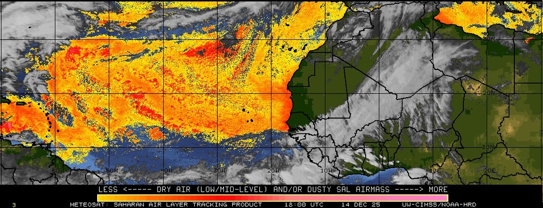

yes there is sal around but it is less than it has been for the last few weeks by far and around 94l is lower than with the two previous systems it well away from the center.

Image
0 likes   
Note: If I make a post that is brief. Please refer back to previous posts for the analysis or reasoning. I do not re-write/qoute what my initial post said each time.
If there is nothing before... then just ask :)

Space & Atmospheric Physicist, Embry-Riddle Aeronautical University,
I believe the sky is falling...

Stormlover2012
Category 1
Category 1
Posts: 262
Joined: Sat Jun 23, 2012 11:03 am

Re: ATL: INVEST 94L

#567 Postby Stormlover2012 » Mon Aug 20, 2012 8:19 am

this is going to be a slow process
0 likes   

User avatar
Weatherboy1
Category 5
Category 5
Posts: 1189
Age: 49
Joined: Mon Jul 05, 2004 1:50 pm
Location: Jupiter/Sarasota, FL

#568 Postby Weatherboy1 » Mon Aug 20, 2012 8:22 am

Aric - Good point about the SAL issue. I think that's why we're seeing more intermittent convection firing with 94 than the earlier systems that came through this area. As SSTs warm up, and the SAL issue becomes less of a problem, I think this system could fire up pretty quickly, especially if it stays in the NE Caribbean far enough away from South America. Definitely keeping an eye on this one, especially now that some of the intensity guidance (SHIPS, HWRF) is more bullish on development late in the period.
0 likes   

User avatar
cycloneye
Admin
Admin
Posts: 145328
Age: 68
Joined: Thu Oct 10, 2002 10:54 am
Location: San Juan, Puerto Rico

Re: ATL: INVEST 94L

#569 Postby cycloneye » Mon Aug 20, 2012 8:28 am

cycloneye wrote:Let's see if bouy 41041 that 94L will move thru soon provides some valuable information later today.

http://www.ndbc.noaa.gov/station_page.php?station=41041


The center of 94L was 80 miles to the north-northeast of buoy 41041 at 9 AM AST and the buoy recorded SSW winds of 16 mph. It'll be interesting to see if the winds go W at 10 am AST.
0 likes   
Visit the Caribbean-Central America Weather Thread where you can find at first post web cams,radars
and observations from Caribbean basin members Click Here

User avatar
Blown Away
S2K Supporter
S2K Supporter
Posts: 10146
Joined: Wed May 26, 2004 6:17 am

Re: ATL: INVEST 94L

#570 Postby Blown Away » Mon Aug 20, 2012 8:33 am

tolakram wrote:Center scooting away from convection, as per most systems in this area.


Yes, but over the past few hours the center went from mostly exposed to being slightly covered by the convection ball to the SE. We will have to see over the next few hours if this recent convection is the beginning of Isaac or maybe Joyce! :D
0 likes   
Hurricane Eye Experience: David 79, Irene 99, Frances 04, Jeanne 04, Wilma 05... EYE COMING MY WAY IN 2024…
Hurricane Brush Experience: Andrew 92, Erin 95, Floyd 99, Matthew 16, Irma 17, Ian 22, Nicole 22…

User avatar
wxman57
Moderator-Pro Met
Moderator-Pro Met
Posts: 22979
Age: 67
Joined: Sat Jun 21, 2003 8:06 pm
Location: Houston, TX (southwest)

Re: ATL: INVEST 94L

#571 Postby wxman57 » Mon Aug 20, 2012 8:36 am

There isn't any question of an LLC. The issue has been lack of deep convection persisting near the LLC. It needs that convection near the center to persist for a number of hours before the NHC will upgrade it. Could be this afternoon.
0 likes   

User avatar
cycloneye
Admin
Admin
Posts: 145328
Age: 68
Joined: Thu Oct 10, 2002 10:54 am
Location: San Juan, Puerto Rico

Re: ATL: INVEST 94L

#572 Postby cycloneye » Mon Aug 20, 2012 8:39 am

wxman57 wrote:There isn't any question of an LLC. The issue has been lack of deep convection persisting near the LLC. It needs that convection near the center to persist for a number of hours before the NHC will upgrade it. Could be this afternoon.


You think that even if the LLC is not fully under the convection,they will upgrade?
0 likes   
Visit the Caribbean-Central America Weather Thread where you can find at first post web cams,radars
and observations from Caribbean basin members Click Here

OuterBanker
S2K Supporter
S2K Supporter
Posts: 1731
Joined: Wed Feb 26, 2003 10:53 am
Location: Nags Head, NC
Contact:

Re: ATL: INVEST 94L

#573 Postby OuterBanker » Mon Aug 20, 2012 8:44 am

BTW, it has slowed slightly. 20 to 25 yesterday, 17 to 22 today.
0 likes   

User avatar
wxman57
Moderator-Pro Met
Moderator-Pro Met
Posts: 22979
Age: 67
Joined: Sat Jun 21, 2003 8:06 pm
Location: Houston, TX (southwest)

Re: ATL: INVEST 94L

#574 Postby wxman57 » Mon Aug 20, 2012 8:50 am

cycloneye wrote:
wxman57 wrote:There isn't any question of an LLC. The issue has been lack of deep convection persisting near the LLC. It needs that convection near the center to persist for a number of hours before the NHC will upgrade it. Could be this afternoon.


You think that even if the LLC is not fully under the convection,they will upgrade?


I wouldn't think they'd upgrade without convection over the center.
0 likes   

HurrMark
Category 2
Category 2
Posts: 769
Joined: Tue Aug 12, 2008 10:18 pm
Location: Somerville, MA

Re: ATL: INVEST 94L

#575 Postby HurrMark » Mon Aug 20, 2012 8:58 am

OuterBanker wrote:BTW, it has slowed slightly. 20 to 25 yesterday, 17 to 22 today.


Nope, that's in knots...speed is about the same.

1. A TROPICAL WAVE AND A LOW PRESSURE AREA LOCATED ABOUT 1100 MILES
EAST OF THE LESSER ANTILLES CONTINUES TO PRODUCE SHOWER AND
THUNDERSTORM ACTIVITY. ENVIRONMENTAL CONDITIONS ARE CONDUCIVE FOR A
TROPICAL DEPRESSION TO FORM DURING THE NEXT DAY OR SO AS THIS LARGE
DISTURBANCE MOVES WESTWARD AT 20 TO 25 MPH. THIS SYSTEM HAS A HIGH
CHANCE...80 PERCENT...OF BECOMING A TROPICAL CYCLONE DURING THE
NEXT 48 HOURS. INTERESTS IN THE LESSER ANTILLES SHOULD MONITOR THE
PROGRESS OF THIS SYSTEM.

0 likes   

User avatar
wxman57
Moderator-Pro Met
Moderator-Pro Met
Posts: 22979
Age: 67
Joined: Sat Jun 21, 2003 8:06 pm
Location: Houston, TX (southwest)

Re: ATL: INVEST 94L

#576 Postby wxman57 » Mon Aug 20, 2012 9:20 am

Note that I just measured a 3-hr speed of that LLC at 24.4kts. From 15.6N/44.16W at 1015Z to 15.7N/45.4W at 1315Z. That's 73.3NM in 3 hrs, or 24.4kts.

No question is moving quite fast now. That's why it's out-running the convection. Seven sped up to over 30 kts in 3-6hr movements as it approached the Lesser Antilles. That's what destroyed the LLC.
0 likes   

User avatar
TheBurn
Category 2
Category 2
Posts: 540
Joined: Thu Jul 28, 2005 4:00 pm
Location: Rincon, PR

Re: ATL: INVEST 94L

#577 Postby TheBurn » Mon Aug 20, 2012 9:20 am

13:00 UTC RGB / Natural Color

Image
0 likes   

User avatar
SouthDadeFish
Professional-Met
Professional-Met
Posts: 2835
Joined: Thu Sep 23, 2010 2:54 pm
Location: Miami, FL
Contact:

#578 Postby SouthDadeFish » Mon Aug 20, 2012 9:22 am

Winds at buoy 41041 are out of the SW at about 10 knots:

http://www.wunderground.com/MAR/buoy/41041.html

Current Weather/Wave Observations
Air Temperature: 76° F
Humidity: 100
Wind direction (W Dir): SW (215 - 224 Degrees)
Wind Speed (W Spd): 9.7 kts (11.2 mph)
Wind Gust (W Spd): 11.7 kts (13.4 mph)
Dominant Wave Period (DWP): 8 sec
Dominant Wave Height (DWH): 5.58 ft
Dominant Wave Range (DWR): exactly 5.6 ft
Wind Wave Period (WWP): 4 sec
Wind Wave Height (WWH): 1.64 ft
Wind Wave Range (WWR): 0.82 - 2.46 ft
Wave Swell Period (WSP): 8 sec
Wave Swell Height (WSH): 4.92 ft
Wave Swell Range (WSR): 4.10 - 5.74 ft
Atmospheric Pressure (AP): 29.88 in
Updated: 1:50 PM GMT on August 20, 2012
0 likes   

canes04
Category 1
Category 1
Posts: 302
Joined: Sat May 22, 2004 5:41 pm
Location: Miami, FL

Re: ATL: INVEST 94L

#579 Postby canes04 » Mon Aug 20, 2012 9:24 am

The overall size of this system is amazing. It will need to slow down to develop further.
0 likes   

User avatar
Bocadude85
Category 5
Category 5
Posts: 2991
Age: 38
Joined: Mon Apr 18, 2005 2:20 pm
Location: Honolulu,Hi

Re: ATL: INVEST 94L

#580 Postby Bocadude85 » Mon Aug 20, 2012 9:29 am

wxman57 wrote:There isn't any question of an LLC. The issue has been lack of deep convection persisting near the LLC. It needs that convection near the center to persist for a number of hours before the NHC will upgrade it. Could be this afternoon.


What are your thoughts on this system wxman57? track and intensity?
0 likes   


Return to “2012”

Who is online

Users browsing this forum: No registered users and 4 guests