JMA: 80 knots
TY 1214 (TEMBIN)
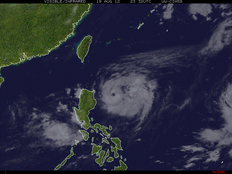
Issued at 06:45 UTC, 20 August 2012
<Analyses at 20/06 UTC>
Scale -
Intensity Strong
Center position N18°25'(18.4°)
E124°55'(124.9°)
Direction and speed of movement N Slowly
Central pressure 960hPa
Maximum wind speed near the center 40m/s(80kt)
Maximum wind gust speed 60m/s(115kt)
Area of 50kt winds or more ALL80km(45NM)
Area of 30kt winds or more ALL330km(180NM)
<Forecast for 21/06 UTC>
Intensity Very Strong
Center position of probability circle N21°05'(21.1°)
E125°55'(125.9°)
Direction and speed of movement NNE 15km/h(7kt)
Central pressure 945hPa
Maximum wind speed near the center 45m/s(85kt)
Maximum wind gust speed 60m/s(120kt)
Radius of probability circle 160km(85NM)
Storm warning area ALL280km(150NM)
<Forecast for 22/06 UTC>
Intensity Very Strong
Center position of probability circle N23°20'(23.3°)
E124°10'(124.2°)
Direction and speed of movement NW 15km/h(7kt)
Central pressure 940hPa
Maximum wind speed near the center 45m/s(90kt)
Maximum wind gust speed 65m/s(130kt)
Radius of probability circle 200km(110NM)
Storm warning area ALL350km(190NM)
<Forecast for 23/06 UTC>
Intensity Very Strong
Center position of probability circle N24°05'(24.1°)
E121°50'(121.8°)
Direction and speed of movement WNW 10km/h(6kt)
Central pressure 940hPa
Maximum wind speed near the center 45m/s(90kt)
Maximum wind gust speed 65m/s(130kt)
Radius of probability circle 300km(160NM)
Storm warning area ALL440km(240NM)