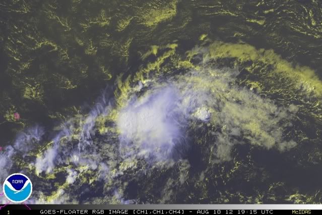
ATL: HELENE - Post-Tropical

Moderator: S2k Moderators

Message
Author
rainstorm

Re: ATL: SEVEN - Tropical Depression

#581 Postby rainstorm » Fri Aug 10, 2012 1:10 pm

SoupBone wrote:
wxman57 wrote:
Aric Dunn wrote:its trying to make a come back... some convection firing.


"Do or do not, there is no try!" That convection is south of what looks like a weakening LLC. Oh, and I just measured the last hour's movement at 270 deg and 36 kts.


36 knots? That's going from ludicrous speed heading to plaid. That's going to be incredibly tough to develop at that pace.


yea, but if its clouds hit you at 36 knots thats a tropical storm, hehe.
0 likes   

tolakram
Admin
Admin
Posts: 20009
Age: 62
Joined: Sun Aug 27, 2006 8:23 pm
Location: Florence, KY (name is Mark)

Re: ATL: SEVEN - Tropical Depression

#582 Postby tolakram » Fri Aug 10, 2012 1:12 pm

Doesn't look any better to me. Firing convection which will probably be left behind in a few hours.

Image
0 likes   
M a r k
- - - - -
Join us in chat: Storm2K Chatroom Invite. Android and IOS apps also available.

The posts in this forum are NOT official forecasts and should not be used as such. Posts are NOT endorsed by any professional institution or STORM2K.org. For official information and forecasts, please refer to NHC and NWS products.

User avatar
Kingarabian
S2K Supporter
S2K Supporter
Posts: 15981
Joined: Sat Aug 08, 2009 3:06 am
Location: Honolulu, Hawaii

#583 Postby Kingarabian » Fri Aug 10, 2012 1:14 pm

Wait, why is this moving so fast?
0 likes   
RIP Kobe Bryant

EyELeSs1
Tropical Storm
Tropical Storm
Posts: 220
Joined: Sat May 03, 2003 11:09 pm
Location: Antigua, W.I

#584 Postby EyELeSs1 » Fri Aug 10, 2012 1:25 pm

Also our friends at SAB seem to think it is better organized

10/1745 UTC 13.8N 51.1W T1.5/1.5 07L

and UW-CIMSS ADT also suggests something similar:

UW - CIMSS
ADVANCED DVORAK TECHNIQUE
ADT-Version 8.1.3
Tropical Cyclone Intensity Algorithm

----- Current Analysis -----
Date : 10 AUG 2012 Time : 171500 UTC
Lat : 13:43:35 N Lon : 50:10:37 W


CI# /Pressure/ Vmax
3.1 /1003.5mb/ 47.0kt


Final T# Adj T# Raw T#
2.9 3.2 3.5
0 likes   

User avatar
wkwally
Category 1
Category 1
Posts: 279
Joined: Sun Jun 27, 2010 9:18 pm
Location: Humble, Texas

#585 Postby wkwally » Fri Aug 10, 2012 1:26 pm

If this makes a come back than paint me blue and call me Babe

Personal Forecast Disclaimer:
The posts in this forum are NOT official forecast and should not be used as such. They are just the opinion of the poster and may or may not be backed by sound meteorological data. They are NOT endorsed by any professional institution or storm2k.org. For official information, please refer to the NHC and NWS products.
0 likes   

User avatar
tropicwatch
Category 5
Category 5
Posts: 3384
Age: 61
Joined: Sat Jun 02, 2007 10:01 am
Location: Panama City Florida
Contact:

Re: ATL: SEVEN - Tropical Depression

#586 Postby tropicwatch » Fri Aug 10, 2012 1:26 pm

Currently the upper level wind pattern above TD7 is not bad, it is shearing itself because it is moving so fast. Unless something changes, it will run into some actual wind shear and that will probably be all she wrote. In order to survive TD7 would have to slow down and maintain a decent upper level environment.

The shower activity this afternoon does look better.


Personal Forecast Disclaimer:
The posts in this forum are NOT official forecast and should not be used as such. They are just the opinion of the poster and may or may not be backed by sound meteorological data. They are NOT endorsed by any professional institution or storm2k.org. For official information, please refer to the NHC and NWS products.
0 likes   
Tropicwatch


Agnes 72', Eloise 75, Elena 85', Kate 85', Charley 86', Florence 88', Beryl 94', Dean 95', Erin 95', Opal 95', Earl 98', Georges 98', Ivan 2004', Arlene 2005', Dennis 2005', Ida 2009' Debby 2012' Irma 2017' Michael 2018'

User avatar
wxman57
Moderator-Pro Met
Moderator-Pro Met
Posts: 22979
Age: 67
Joined: Sat Jun 21, 2003 8:06 pm
Location: Houston, TX (southwest)

Re:

#587 Postby wxman57 » Fri Aug 10, 2012 1:31 pm

Kingarabian wrote:Wait, why is this moving so fast?


Screaming low level easterly winds that won't likely let up. Yes, it does stil have a circulation, but conditions in its path are more favorable for weakening to a wave than strengthening. Just a few squals for the eastern Caribbean tomorrow.
0 likes   

User avatar
knotimpaired
Category 1
Category 1
Posts: 495
Joined: Fri May 20, 2005 4:14 am
Location: Vieques, PR
Contact:

Re: ATL: SEVEN - Tropical Depression

#588 Postby knotimpaired » Fri Aug 10, 2012 1:39 pm

I'd like to ask a question to the Pro Mets.

Would you please name the top 3 models (Bamms, UKMet, Euro, etc for example) that you would consider have had the best track record for predicted course vs actual course.
0 likes   

User avatar
brunota2003
S2K Supporter
S2K Supporter
Posts: 9476
Age: 34
Joined: Sat Jul 30, 2005 9:56 pm
Location: Stanton, KY...formerly Havelock, NC
Contact:

#589 Postby brunota2003 » Fri Aug 10, 2012 1:53 pm

Nice little burst blew up over the LLC...and just prior to that, you could see the center, it is clearly tight and still very much alive.
0 likes   
Just a small town southern boy helping other humans.

Shuriken

Re:

#590 Postby Shuriken » Fri Aug 10, 2012 2:07 pm

colbroe wrote:I have just been looking at the last few frames and it looks like the system is consolidating, nice circular definition can be seen with better cloud coverage .
Agreed. This is a splendid example of a system which is actually being assisted by its marginal environment (e.g., drier surroundings stifling other convection which would otherwise pollute the LLC with outflow boundaries; result is a system which remains focused and can steadily albeit initially slowly intensify; the dry environment will be relatively more unstable as it moistens from the surface during westward progression; i.e., less of a capping problem -- contrast all that to sprawling, sloppy, moist TDs like prote-Ernesto which take forever to get their act together despite seemingly ideal environments).
Kingarabian wrote:Wait, why is this moving so fast?
It's not; it's moving at a fairly typical speed for a TD approaching the Windwards.
0 likes   

Aric Dunn
Category 5
Category 5
Posts: 21238
Age: 42
Joined: Sun Sep 19, 2004 9:58 pm
Location: Ready for the Chase.
Contact:

#591 Postby Aric Dunn » Fri Aug 10, 2012 2:12 pm

the deep convection has expanding and developed over the center with new convection starting on the west side. Also the to the NE of the center where no convection has been able to fire do to the sal is not starting to show some limited convection. looks like it will hang around a little longer.
0 likes   
Note: If I make a post that is brief. Please refer back to previous posts for the analysis or reasoning. I do not re-write/qoute what my initial post said each time.
If there is nothing before... then just ask :)

Space & Atmospheric Physicist, Embry-Riddle Aeronautical University,
I believe the sky is falling...

User avatar
ROCK
Category 5
Category 5
Posts: 9484
Age: 54
Joined: Tue Aug 17, 2004 7:30 am
Location: Kemah, Texas

Re: ATL: SEVEN - Tropical Depression

#592 Postby ROCK » Fri Aug 10, 2012 2:18 pm

Last Advisory still says a modest TS by the NHC at 5 days knocking on the GOM's door....if there is a weakness there at that time or it could just run into the Yucatan.

Forecast in 5 days is for the entire GOM to be protected? I challenge any forecast made after 5 days. Why would the NHC have a huge cone at 5 days. Thats the uncertainty. Even the models have shifted north some and offer a variety of solutions still.

The CMC has this as a TD at the channel, GFDL open but strong wave coming into the SGOM. 12z NOGAPS hits PR...I think we can all agree that this is not dead until it is inland and dissipated.
0 likes   

Shuriken

#593 Postby Shuriken » Fri Aug 10, 2012 2:20 pm

Eyeballing, IMO it's a very small 40kt tropical storm right now.

Not sure where this southwesterly shear is going to be coming from; I'm not seeing any hint of westerly bias in the upstream windbards at any level, nor are there any digging upper-lows ahead (the one to the north is providing a slight northerly regime aloft). If anything, it looks like our TD will ride at the vanguard of the massive blow-off plume of the huge new CV complex exiting Africa.
0 likes   

User avatar
Portastorm
Storm2k Moderator
Storm2k Moderator
Posts: 9914
Age: 63
Joined: Fri Jul 11, 2003 9:16 am
Location: Round Rock, TX
Contact:

Re: ATL: SEVEN - Tropical Depression

#594 Postby Portastorm » Fri Aug 10, 2012 2:21 pm

ROCK wrote:Last Advisory still says a modest TS by the NHC at 5 days knocking on the GOM's door....if there is a weakness there at that time or it could just run into the Yucatan.

Forecast in 5 days is for the entire GOM to be protected? I challenge any forecast made after 5 days. Why would the NHC have a huge cone at 5 days. Thats the uncertainty. Even the models have shifted north some and offer a variety of solutions still.

The CMC has this as a TD at the channel, GFDL open but strong wave coming into the SGOM. 12z NOGAPS hits PR...I think we can all agree that this is not dead until it is inland and dissipated.


I agree ROCK. I think the Gulf picture by the middle to end of next week is questionable. If there is a strong ridge over the Gulf, it'll probably be a narrow one at best. This morning, many of the Texas NWSFOs were talking about how the large and persistent ridge over the central-western US is going to break down. Massive storm system plowing into the US by the middle of next week.
0 likes   
Any forecasts under my name are to be taken with a grain of salt. Get your best forecasts from the National Weather Service and National Hurricane Center.

tolakram
Admin
Admin
Posts: 20009
Age: 62
Joined: Sun Aug 27, 2006 8:23 pm
Location: Florence, KY (name is Mark)

Re:

#595 Postby tolakram » Fri Aug 10, 2012 2:27 pm

Shuriken wrote:Eyeballing, IMO it's a very small 40kt tropical storm right now.

Not sure where this southwesterly shear is going to be coming from; I'm not seeing any hint of westerly bias in the upstream windbards at any level, nor are there any digging upper-lows ahead (the one to the north is providing a slight northerly regime aloft). If anything, it looks like our TD will ride at the vanguard of the massive blow-off plume of the huge new CV complex exiting Africa.


Latest shear map

Image

Seven is heading directly toward the area of west / SW shear, which looks to be around 20 kts.

There is also the fact that the lower levels, and the LLC, are moving to the west at over 20kts, which introduces shear in of itself, but combined with 20 kts's of shear from the west / sw it really seems far fetched to think this can survive. Just my opinion, based on how I understand the data.

Personal Forecast Disclaimer:
The posts in this forum are NOT official forecast and should not be used as such. They are just the opinion of the poster and may or may not be backed by sound meteorological data. They are NOT endorsed by any professional institution or storm2k.org. For official information, please refer to the NHC and NWS products.
0 likes   
M a r k
- - - - -
Join us in chat: Storm2K Chatroom Invite. Android and IOS apps also available.

The posts in this forum are NOT official forecasts and should not be used as such. Posts are NOT endorsed by any professional institution or STORM2K.org. For official information and forecasts, please refer to NHC and NWS products.

Aric Dunn
Category 5
Category 5
Posts: 21238
Age: 42
Joined: Sun Sep 19, 2004 9:58 pm
Location: Ready for the Chase.
Contact:

#596 Postby Aric Dunn » Fri Aug 10, 2012 2:31 pm

well considering its forward motion its probably TS.
0 likes   
Note: If I make a post that is brief. Please refer back to previous posts for the analysis or reasoning. I do not re-write/qoute what my initial post said each time.
If there is nothing before... then just ask :)

Space & Atmospheric Physicist, Embry-Riddle Aeronautical University,
I believe the sky is falling...

ozonepete
Professional-Met
Professional-Met
Posts: 4743
Joined: Mon Sep 07, 2009 3:23 pm
Location: From Ozone Park, NYC / Now in Brooklyn, NY

Re: ATL: SEVEN - Tropical Depression

#597 Postby ozonepete » Fri Aug 10, 2012 2:34 pm

And don't forget that shear is very fluid and changes quite rapidly at times. So the tongue of higher shear ahead of TD07 could be lower or gone by the time it gets there. It is just a very hard factor to measure well, let alone forecast well.
0 likes   

tolakram
Admin
Admin
Posts: 20009
Age: 62
Joined: Sun Aug 27, 2006 8:23 pm
Location: Florence, KY (name is Mark)

Re: ATL: SEVEN - Tropical Depression

#598 Postby tolakram » Fri Aug 10, 2012 2:40 pm

ozonepete wrote:And don't forget that shear is very fluid and changes quite rapidly at times. So the tongue of higher shear ahead of TD07 could be lower or gone by the time it gets there. It is just a very hard factor to measure well, let alone forecast well.


No doubt, but i was responding specifically to:

Not sure where this southwesterly shear is going to be coming from; I'm not seeing any hint of westerly bias in the upstream windbards at any level


The shear maps clearly show the SW flow, as it was measured a few hours ago. Shear being a measure of the difference between the flow layers, in this case low and high, not simply a direction of wind.

Image

Here are the high level and low level observed winds from the sat overlay.
0 likes   
M a r k
- - - - -
Join us in chat: Storm2K Chatroom Invite. Android and IOS apps also available.

The posts in this forum are NOT official forecasts and should not be used as such. Posts are NOT endorsed by any professional institution or STORM2K.org. For official information and forecasts, please refer to NHC and NWS products.

ozonepete
Professional-Met
Professional-Met
Posts: 4743
Joined: Mon Sep 07, 2009 3:23 pm
Location: From Ozone Park, NYC / Now in Brooklyn, NY

Re: ATL: SEVEN - Tropical Depression

#599 Postby ozonepete » Fri Aug 10, 2012 2:47 pm

:uarrow: Yeah I knew you were referring to that, Mark, and your answer (and follow-up now) was very good. :) I just wanted to point out to others the problems with measuring and forecasting it because so many people read those maps as if they remain the same for days on end, lol.
0 likes   

ozonepete
Professional-Met
Professional-Met
Posts: 4743
Joined: Mon Sep 07, 2009 3:23 pm
Location: From Ozone Park, NYC / Now in Brooklyn, NY

Re: ATL: SEVEN - Tropical Depression

#600 Postby ozonepete » Fri Aug 10, 2012 2:49 pm

Nice burst still growing over the center...

Image
0 likes   


Return to “2012”

Who is online

Users browsing this forum: No registered users and 3 guests