ATL: DEBBY - Post-Tropical
Moderator: S2k Moderators
-
Hurricaneman

- Category 5

- Posts: 7404
- Age: 45
- Joined: Tue Aug 31, 2004 3:24 pm
- Location: central florida
Re: ATL: INVEST 96L - Discussion
My prediction is pull out a map of the gulf coast, throw a dart at it and that will be the landfall location 
0 likes
-
Hurricane Andrew

- S2K Supporter

- Posts: 1891
- Age: 27
- Joined: Sun May 23, 2010 2:53 pm
- Location: KS

-
gatorcane

- S2K Supporter
- Posts: 23708
- Age: 48
- Joined: Sun Mar 13, 2005 3:54 pm
- Location: Boca Raton, FL
Re: ATL: INVEST 96L - Discussion
wxman57 wrote:Lower TX coast on Wednesday would be my first "guess", too. Debby in 4 hrs, officially, no doubt. NHC often likes the GFS - what will they do?
My guess is that they will go with the rest of the models and show a west bend. I can't remember the last time the Euro and GFS were in this much disagreement on a short-term forecast. I think they were hoping for more consistency in the 12Z GFS before classifying. I wonder if they will wait until the 12Z Euro before runs before classifying to see if it goes with the east solution like the GFS?
Any chance the new GFS software has an issue?
Last edited by gatorcane on Sat Jun 23, 2012 11:42 am, edited 1 time in total.
0 likes
-
Dave

- Retired Staff

- Posts: 13442
- Age: 75
- Joined: Tue Aug 01, 2006 3:57 pm
- Location: Milan Indiana
- Contact:
000
URNT15 KNHC 231636
AF302 01AAA INVEST HDOB 06 20120623
162900 2751N 08912W 6937 03205 0083 +080 +055 072027 028 018 000 00
162930 2749N 08912W 6937 03205 0084 +080 +062 074028 028 018 000 00
163000 2747N 08912W 6937 03205 0083 +080 +059 075028 029 019 000 00
163030 2745N 08912W 6935 03207 0083 +080 +063 077028 029 017 000 00
163100 2743N 08911W 7060 03059 0087 +085 +079 079027 028 016 001 00
163130 2742N 08911W 7233 02855 0087 +095 +088 080027 028 016 000 00
163200 2740N 08911W 7415 02644 0087 +105 +101 077026 027 016 000 00
163230 2738N 08911W 7604 02432 0083 +119 +105 075025 026 016 000 00
163300 2736N 08911W 7800 02226 0088 +134 +112 072026 026 016 000 00
163330 2734N 08911W 7996 02015 0089 +147 +103 066028 028 019 001 00
163400 2733N 08911W 8206 01791 0088 +158 +113 065028 029 018 001 00
163430 2731N 08911W 8418 01572 0089 +162 +144 068027 029 019 000 00
163500 2729N 08911W 8634 01353 0089 +171 +158 064024 026 019 000 00
163530 2728N 08911W 8850 01139 0093 +186 +175 070025 026 020 000 00
163600 2726N 08911W 9058 00942 0096 +190 +190 074026 026 020 000 01
163630 2724N 08911W 9260 00748 0090 +200 +200 073027 028 019 000 01
163700 2723N 08911W 9459 00557 0080 +210 +210 063027 029 020 002 01
163730 2721N 08911W 9633 00400 0082 +226 +221 056025 026 020 001 00
163800 2719N 08911W 9666 00369 0082 +230 +224 056024 025 018 003 03
163830 2718N 08910W 9668 00366 0081 +230 +221 056024 025 023 000 00
$$
0 likes
This post is NOT AN OFFICIAL FORECAST and should not be used as such. It is just the opinion of the poster and may or may not be backed by sound meteorological data. It is NOT endorsed by any professional institution including storm2k.org. For Official Information please refer to the NHC and NWS products.
-
Ivanhater

- Storm2k Moderator

- Posts: 11221
- Age: 39
- Joined: Fri Jul 01, 2005 8:25 am
- Location: Pensacola
Re: ATL: INVEST 96L - Models
12z Canadian coming in...sitting around New Orleans dumping heavy rain along the north central Gulf coast

0 likes
Michael
-
Dave
- Retired Staff
- Posts: 13442
- Age: 75
- Joined: Tue Aug 01, 2006 3:57 pm
- Location: Milan Indiana
- Contact:
000
UZNT13 KNHC 231632
XXAA 73167 99287 70893 08189 99010 27234 07020 00088 26430 07521
92773 21431 09020 85503 17644 08524 70144 09435 08019 88999 77999
31313 09608 81616
61616 AF302 01AAA INVEST OB 02
62626 SPL 2874N08933W 1620 MBL WND 07520 AEV 20802 DLM WND 08521
009696 WL150 07521 084 REL 2874N08930W 161604 SPG 2874N08933W 162
043 =
XXBB 73168 99287 70893 08189 00010 27234 11940 21604 22908 20844
33850 17644 44709 11240 55696 08433
21212 00010 07020 11877 09020 22850 08524 33696 08018
31313 09608 81616
61616 AF302 01AAA INVEST OB 02
62626 SPL 2874N08933W 1620 MBL WND 07520 AEV 20802 DLM WND 08521
009696 WL150 07521 084 REL 2874N08930W 161604 SPG 2874N08933W 162
043 =
;
0 likes
This post is NOT AN OFFICIAL FORECAST and should not be used as such. It is just the opinion of the poster and may or may not be backed by sound meteorological data. It is NOT endorsed by any professional institution including storm2k.org. For Official Information please refer to the NHC and NWS products.

Re: ATL: INVEST 96L - Models
0 likes
-
northjaxpro

- S2K Supporter
- Posts: 8900
- Joined: Mon Sep 27, 2010 11:21 am
- Location: Jacksonville, FL
Re:
SouthDadeFish wrote:My thoughts on Invest 96L here:
http://canefever.wordpress.com/2012/06/23/16z-atl-3/
Also, the latest 850mb vorticity analysis from CIMSS shows that vorticity continues to increase, although it is still a bit elongated to the SW.
Good analysis on the situation SDF.
0 likes
NEVER, EVER SAY NEVER in the tropics and weather in general, and most importantly, with life itself!!
________________________________________________________________________________________
Fay 2008 Beryl 2012 Debby 2012 Colin 2016 Hermine 2016 Julia 2016 Matthew 2016 Irma 2017 Dorian 2019
________________________________________________________________________________________
Fay 2008 Beryl 2012 Debby 2012 Colin 2016 Hermine 2016 Julia 2016 Matthew 2016 Irma 2017 Dorian 2019
-
Dave
- Retired Staff
- Posts: 13442
- Age: 75
- Joined: Tue Aug 01, 2006 3:57 pm
- Location: Milan Indiana
- Contact:
DECODED DROPSONDE
Code: Select all
Product: Air Force Temp Drop (Dropsonde) Message (UZNT13 KNHC)
Transmitted: 23rd day of the month at 16:32Z
Aircraft: Air Force Aircraft (Last 3 digits of the tail number are 302)
Mission Purpose: Investigate first suspect area (flight in the North Atlantic basin)
Mission Number: 1
Observation Number: 02

Part A...


Date: Near the closest hour of 16Z on the 23rd day of the month
Highest Mandatory Level For Which Wind Was Reported: 700mb
Coordinates: 28.7N 89.3W
Location: 99 miles (160 km) to the SSE (153°) from New Orleans, LA, USA.
Marsden Square: 081 (About)

Level Geo. Height Air Temp. Dew Point Wind Direction Wind Speed
1010mb (29.83 inHg) Sea Level (Surface) 27.2°C (81.0°F) 23.8°C (74.8°F) 70° (from the ENE) 20 knots (23 mph)
1000mb 88m (289 ft) 26.4°C (79.5°F) 23.4°C (74.1°F) 75° (from the ENE) 21 knots (24 mph)
925mb 773m (2,536 ft) 21.4°C (70.5°F) 18.3°C (64.9°F) 90° (from the E) 20 knots (23 mph)
850mb 1,503m (4,931 ft) 17.6°C (63.7°F) 13.2°C (55.8°F) 85° (from the E) 24 knots (28 mph)
700mb 3,144m (10,315 ft) 9.4°C (48.9°F) 5.9°C (42.6°F) 80° (from the E) 19 knots (22 mph)

Information About Radiosonde:
- Launch Time: 16:16Z
- About Sonde: A descending radiosonde tracked automatically by satellite navigation with no solar or infrared correction.

Remarks Section...


Splash Location: 28.74N 89.33W
Splash Time: 16:20Z

Release Location: 28.74N 89.3W View map)
Release Time: 16:16:04Z

Splash Location: 28.74N 89.33W (
Splash Time: 16:20:43Z

Mean Boundary Level Wind (mean wind in the lowest 500 geopotential meters of the sounding):
- Wind Direction: 75° (from the ENE)
- Wind Speed: 20 knots (23 mph)

Deep Layer Mean Wind (average wind over the depth of the sounding):
- Wind Direction: 85° (from the E)
- Wind Speed: 21 knots (24 mph)
- Depth of Sounding: From 696mb to 1009mb

Average Wind Over Lowest Available 150 geopotential meters (gpm) of the sounding:
- Lowest 150m: 159 gpm - 9 gpm (522 geo. feet - 30 geo. feet)
- Wind Direction: 75° (from the ENE)
- Wind Speed: 21 knots (24 mph)
0 likes
This post is NOT AN OFFICIAL FORECAST and should not be used as such. It is just the opinion of the poster and may or may not be backed by sound meteorological data. It is NOT endorsed by any professional institution including storm2k.org. For Official Information please refer to the NHC and NWS products.
-
Ivanhater
- Storm2k Moderator
- Posts: 11221
- Age: 39
- Joined: Fri Jul 01, 2005 8:25 am
- Location: Pensacola
Re: ATL: INVEST 96L - Models
ROCK wrote:ok this is the 12Z CMC run for today?
http://www.weatheroffice.gc.ca/data/mod ... 12_000.jpg
No, the black and white charts update first..out to 84 hours
0 likes
Michael
-
vbhoutex

- Storm2k Executive

- Posts: 29146
- Age: 74
- Joined: Wed Oct 09, 2002 11:31 pm
- Location: Cypress, TX
- Contact:
Re: ATL: INVEST 96L - Discussion
gatorcane wrote:wxman57 wrote:Lower TX coast on Wednesday would be my first "guess", too. Debby in 4 hrs, officially, no doubt. NHC often likes the GFS - what will they do?
My guess is that they will go with the rest of the models and show a west bend. I can't remember the last time the Euro and GFS were in this much disagreement on a short-term forecast. I think they were hoping for more consistency in the 12Z GFS before classifying. I wonder if they will wait until the 12Z Euro before runs before classifying to see if it goes with the east solution like the GFS?
They will classify as soon as they get the obs in from the HH imo. Right now everything we can find points to 96L being at a TS, but it is never official till NHC says so. I do not think they will call until they do get the obs in though.
0 likes
Skywarn, C.E.R.T.
Please click below to donate to STORM2K to help with the expenses of keeping the site going:

Please click below to donate to STORM2K to help with the expenses of keeping the site going:
Re: ATL: INVEST 96L - Discussion
The difference between the IR and VIS show once again that VIS is better - it shows the LLC displaced from the MLC by about 75 miles and explains why the NHC is waiting for recon to determine what's going on...
0 likes
-
Hurricane Andrew
- S2K Supporter
- Posts: 1891
- Age: 27
- Joined: Sun May 23, 2010 2:53 pm
- Location: KS

-
SouthDadeFish

- Professional-Met

- Posts: 2835
- Joined: Thu Sep 23, 2010 2:54 pm
- Location: Miami, FL
- Contact:
Re: Re:
northjaxpro wrote:SouthDadeFish wrote:My thoughts on Invest 96L here:
http://canefever.wordpress.com/2012/06/23/16z-atl-3/
Also, the latest 850mb vorticity analysis from CIMSS shows that vorticity continues to increase, although it is still a bit elongated to the SW.
Good analysis on the situation SDF.
Thank you, I really appreciate it.
Center is still exposed:

Looks like your typical June Gulf TS
0 likes
-
tropicwatch

- Category 5
- Posts: 3426
- Age: 62
- Joined: Sat Jun 02, 2007 10:01 am
- Location: Panama City Florida
- Contact:
Where ever this thing ends up going. It looks like most of Florida is going to be quite wet for the next few days.
Personal Forecast Disclaimer:
The posts in this forum are NOT official forecast and should not be used as such. They are just the opinion of the poster and may or may not be backed by sound meteorological data. They are NOT endorsed by any professional institution or storm2k.org. For official information, please refer to the NHC and NWS products.
0 likes
Tropicwatch
Agnes 72', Eloise 75, Elena 85', Kate 85', Charley 86', Florence 88', Beryl 94', Dean 95', Erin 95', Opal 95', Earl 98', Georges 98', Ivan 2004', Arlene 2005', Dennis 2005', Ida 2009' Debby 2012' Irma 2017' Michael 2018'
Agnes 72', Eloise 75, Elena 85', Kate 85', Charley 86', Florence 88', Beryl 94', Dean 95', Erin 95', Opal 95', Earl 98', Georges 98', Ivan 2004', Arlene 2005', Dennis 2005', Ida 2009' Debby 2012' Irma 2017' Michael 2018'
-
caneman
Re: ATL: INVEST 96L - Discussion
Frank2 wrote:The difference between the IR and VIS show once again that VIS is better - it shows the LLC displaced from the MLC by about 75 miles and explains why the NHC is waiting for recon to determine what's going on...
Yep, beat me to it Frank. Looks like the LLC wants to trek on West (naked) and the MLC and all its convection want to go North.
0 likes
Re: ATL: INVEST 96L - Discussion
maybe that was what the GFS kept picking up....a sheared out MLC heading up the EC with the trof....hmmmm
0 likes
-
Dave
- Retired Staff
- Posts: 13442
- Age: 75
- Joined: Tue Aug 01, 2006 3:57 pm
- Location: Milan Indiana
- Contact:
000
URNT15 KNHC 231646
AF302 01AAA INVEST HDOB 07 20120623
163900 2717N 08909W 9662 00372 0080 +230 +222 055024 024 023 000 00
163930 2716N 08907W 9664 00369 0080 +230 +223 057025 026 026 001 00
164000 2715N 08906W 9661 00372 0080 +220 +220 064024 027 029 004 01
164030 2714N 08905W 9663 00369 0079 +229 +221 062023 024 023 001 00
164100 2713N 08904W 9665 00367 0078 +228 +219 060028 030 024 002 00
164130 2712N 08903W 9663 00368 0077 +232 +215 060030 030 025 001 00
164200 2711N 08901W 9663 00367 0076 +234 +205 063029 030 026 000 00
164230 2710N 08900W 9666 00365 0076 +231 +209 061028 028 026 001 00
164300 2709N 08859W 9662 00368 0076 +226 +221 058025 028 025 001 00
164330 2708N 08858W 9666 00364 0076 +225 +222 060024 025 026 001 00
164400 2707N 08857W 9663 00366 0075 +225 +223 059024 025 024 001 00
164430 2705N 08855W 9666 00364 0075 +225 +224 055023 024 025 001 00
164500 2704N 08854W 9663 00366 0074 +220 +220 057024 024 024 001 01
164530 2703N 08853W 9665 00362 0073 +220 +220 057024 025 025 001 01
164600 2702N 08852W 9664 00363 0073 +220 +220 054024 025 026 001 01
164630 2701N 08851W 9667 00359 0072 +220 +220 058025 026 025 000 01
164700 2700N 08849W 9663 00363 0071 +220 +220 060024 026 025 001 01
164730 2659N 08848W 9667 00358 0071 +220 +220 057024 025 026 001 01
164800 2658N 08847W 9668 00356 0070 +229 +228 057025 026 025 001 00
164830 2657N 08846W 9665 00360 0069 +230 +228 058025 026 024 001 00
$$
;
0 likes
This post is NOT AN OFFICIAL FORECAST and should not be used as such. It is just the opinion of the poster and may or may not be backed by sound meteorological data. It is NOT endorsed by any professional institution including storm2k.org. For Official Information please refer to the NHC and NWS products.

Re: ATL: INVEST 96L - Discussion
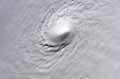
cool double barrel center on vis sat right now @ 26n 88w
Two distinct Vorts next to each other
Two distinct Vorts next to each other
0 likes
Who is online
Users browsing this forum: No registered users and 55 guests