ATL: DEBBY - Post-Tropical

Moderator: S2k Moderators

Message
Author
SunnyThoughts
Category 5
Category 5
Posts: 2263
Joined: Wed Jul 09, 2003 12:42 pm
Location: Pensacola, Florida

Re: ATL: INVEST 96L - Models

#381 Postby SunnyThoughts » Thu Jun 21, 2012 11:17 pm

EmeraldCoast93 wrote:Yikes! that would put me in the right front quadrant for 48 hours! :double:


Yeah, would more than likely pump a LOT of rain into the panhandle for sure. Hopefully its just a sloppy mess sitting there for that long in one place. Too much rain is a disaster in and of itself...hopefully it heads to where people need the rain the most.
0 likes   

User avatar
ROCK
Category 5
Category 5
Posts: 9484
Age: 54
Joined: Tue Aug 17, 2004 7:30 am
Location: Kemah, Texas

Re: ATL: INVEST 96L - Models

#382 Postby ROCK » Thu Jun 21, 2012 11:17 pm

144hr still sitting there....ok I am done watching it now....
0 likes   

CYCLONE MIKE
Category 5
Category 5
Posts: 2183
Joined: Tue Aug 31, 2004 6:04 pm
Location: Gonzales, LA

Re: ATL: INVEST 96L - Models

#383 Postby CYCLONE MIKE » Thu Jun 21, 2012 11:18 pm

Means the gfs has no clue what is going on. Trough doesn't pull it up and out and building high doesn't push it west. So good role gfs just keeps it stationary for a week lol
Last edited by CYCLONE MIKE on Thu Jun 21, 2012 11:25 pm, edited 1 time in total.
0 likes   

User avatar
Rgv20
S2K Supporter
S2K Supporter
Posts: 2466
Age: 38
Joined: Wed Jan 05, 2011 5:42 pm
Location: Edinburg/McAllen Tx

#384 Postby Rgv20 » Thu Jun 21, 2012 11:18 pm

Hopefully tonight's GFS Ensembles gives us something useful..
0 likes   
The following post is NOT an official forecast and should not be used as such. It is just the opinion of the poster and may or may not be backed by sound meteorological data. It is NOT endorsed by any professional institution including storm2k.org For Official Information please refer to the NHC and NWS products.

User avatar
southerngale
Retired Staff
Retired Staff
Posts: 27418
Joined: Thu Oct 10, 2002 1:27 am
Location: Southeast Texas (Beaumont area)

#385 Postby southerngale » Thu Jun 21, 2012 11:20 pm

I could buy a stall, but sitting there for days and days and days seems unrealistic.
0 likes   
Please support Storm2k by making a donation today. It is greatly appreciated! Click here: Image

Image my Cowboys Image my RocketsImage my Astros

User avatar
cycloneye
Admin
Admin
Posts: 145305
Age: 68
Joined: Thu Oct 10, 2002 10:54 am
Location: San Juan, Puerto Rico

Re: ATL: INVEST 96L - Models

#386 Postby cycloneye » Thu Jun 21, 2012 11:21 pm

If GFS is right and stalls for many days,then upwelling becomes a factor.
0 likes   
Visit the Caribbean-Central America Weather Thread where you can find at first post web cams,radars
and observations from Caribbean basin members Click Here

User avatar
Rgv20
S2K Supporter
S2K Supporter
Posts: 2466
Age: 38
Joined: Wed Jan 05, 2011 5:42 pm
Location: Edinburg/McAllen Tx

Re: ATL: INVEST 96L - Models

#387 Postby Rgv20 » Thu Jun 21, 2012 11:21 pm

ROCK wrote:144hr still sitting there....ok I am done watching it now....


I quit watching it since 108hrs! lol

At least in the short term is somewhat in agreement with the Euro. Intensity wise I think the 0zGFS was very quick to ramp it up..
Last edited by Rgv20 on Thu Jun 21, 2012 11:23 pm, edited 1 time in total.
0 likes   
The following post is NOT an official forecast and should not be used as such. It is just the opinion of the poster and may or may not be backed by sound meteorological data. It is NOT endorsed by any professional institution including storm2k.org For Official Information please refer to the NHC and NWS products.

User avatar
ROCK
Category 5
Category 5
Posts: 9484
Age: 54
Joined: Tue Aug 17, 2004 7:30 am
Location: Kemah, Texas

Re: ATL: INVEST 96L - Models

#388 Postby ROCK » Thu Jun 21, 2012 11:22 pm

I cant help it.....150 still in the same place.... :lol:
0 likes   

bella_may
Category 4
Category 4
Posts: 908
Joined: Wed Dec 22, 2010 2:13 pm
Location: SE Mississippi coast

#389 Postby bella_may » Thu Jun 21, 2012 11:23 pm

it appears to to brush the LA/MS/AL/FL coast for 5 days and then move back to the south or southest? weird :?: :double:
0 likes   

User avatar
Tampa Bay Hurricane
Category 5
Category 5
Posts: 5597
Age: 37
Joined: Fri Jul 22, 2005 7:54 pm
Location: St. Petersburg, FL

#390 Postby Tampa Bay Hurricane » Thu Jun 21, 2012 11:24 pm

Did someone feed bath salts to the GFS? If this verifies there will be major flooding on the gulf coast from torrential rain.
0 likes   

User avatar
AJC3
Admin
Admin
Posts: 3999
Age: 61
Joined: Tue Aug 31, 2004 7:04 pm
Location: Ballston Spa, New York
Contact:

Re: ATL: INVEST 96L - Models

#391 Postby AJC3 » Thu Jun 21, 2012 11:26 pm

CYCLONE MIKE wrote:Means the gfs has absolutely no idea what is going on. Doesn't get up nor pushed west by building high so just keeps it in same spot for days. :roll:


Quite the contrary - what the solution is showing is that the circulation consolidates far enough east that it gets trapped in the col region between the ridge to the NW and the trough axis to the NE. Now, whether that is realistic or not - that's another matter, but to say the model "has absolutely no idea" isn't really the case.
0 likes   

User avatar
Hurricaneman
Category 5
Category 5
Posts: 7351
Age: 45
Joined: Tue Aug 31, 2004 3:24 pm
Location: central florida

Re:

#392 Postby Hurricaneman » Thu Jun 21, 2012 11:28 pm

bella_may wrote:it appears to to brush the LA/MS/AL/FL coast for 5 days and then move back to the south or southest? weird :?: :double:


The 0z GFS needs to go in the trash heap IMO, this run makes no sense

The posts in this forum are NOT official forecast and should not be used as such. They are just the opinion of the poster and may or may not be backed by sound meteorological data. They are NOT endorsed by any professional institution or storm2k.org. For official information, please refer to the NHC and NWS products
0 likes   

Jagno
Category 3
Category 3
Posts: 825
Joined: Tue Sep 07, 2004 10:40 pm
Location: SW Louisiana

Re:

#393 Postby Jagno » Thu Jun 21, 2012 11:29 pm

Tampa Bay Hurricane wrote:Did someone feed bath salts to the GFS? If this verifies there will be major flooding on the gulf coast from torrential rain.


Why? Does it get naked and eat a human?
Sorry, I just couldn't resist.

A GFS set up would have evacuations from Alabama to Brownsville. Crazy!
0 likes   

EmeraldCoast93
Tropical Low
Tropical Low
Posts: 24
Age: 31
Joined: Sun Jan 09, 2011 4:40 pm
Location: Shalimar, FL | Mobile, AL
Contact:

#394 Postby EmeraldCoast93 » Thu Jun 21, 2012 11:29 pm

I'm really fascinated by what the GFS is outputting, but it would be truly devastating. I'm sure Pensacola residents don't want this considering almost 2 weeks ago they had 10-25+ inches of rain.

168 hrs. - Still in the same place, albeit weaker
0 likes   
Cameron
University of South Alabama meteorology major - Class of 2016

User avatar
ROCK
Category 5
Category 5
Posts: 9484
Age: 54
Joined: Tue Aug 17, 2004 7:30 am
Location: Kemah, Texas

Re: ATL: INVEST 96L - Models

#395 Postby ROCK » Thu Jun 21, 2012 11:32 pm

0Z NOGAPS say Brownsville....sort of.... :lol:


https://www.fnmoc.navy.mil/wxmap_cgi/cg ... t=Tropical
0 likes   

User avatar
Tampa Bay Hurricane
Category 5
Category 5
Posts: 5597
Age: 37
Joined: Fri Jul 22, 2005 7:54 pm
Location: St. Petersburg, FL

#396 Postby Tampa Bay Hurricane » Thu Jun 21, 2012 11:32 pm

Current GFS would be a flood disaster for Pensacola on top of what they had a week ago... :eek:
0 likes   

User avatar
Rgv20
S2K Supporter
S2K Supporter
Posts: 2466
Age: 38
Joined: Wed Jan 05, 2011 5:42 pm
Location: Edinburg/McAllen Tx

#397 Postby Rgv20 » Thu Jun 21, 2012 11:32 pm

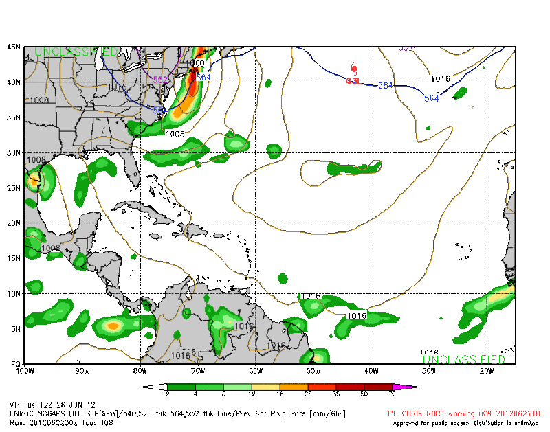
0zNOGAPS has it on top of Brownsville by Tuesday Morning.

Image
0 likes   
The following post is NOT an official forecast and should not be used as such. It is just the opinion of the poster and may or may not be backed by sound meteorological data. It is NOT endorsed by any professional institution including storm2k.org For Official Information please refer to the NHC and NWS products.

User avatar
wkwally
Category 1
Category 1
Posts: 279
Joined: Sun Jun 27, 2010 9:18 pm
Location: Humble, Texas

#398 Postby wkwally » Thu Jun 21, 2012 11:33 pm

Can sure use the rain here in Brownsville From what I have been reading and looking at it seems as if we are still in this. I will watch more closley on Sat. see what the jet will do
0 likes   

User avatar
cycloneye
Admin
Admin
Posts: 145305
Age: 68
Joined: Thu Oct 10, 2002 10:54 am
Location: San Juan, Puerto Rico

Re: ATL: INVEST 96L - Models

#399 Postby cycloneye » Thu Jun 21, 2012 11:34 pm

Now let's wait for the first runs by GFDL/HWRF and CMC.But the most important one,the ECMWF.
0 likes   
Visit the Caribbean-Central America Weather Thread where you can find at first post web cams,radars
and observations from Caribbean basin members Click Here

User avatar
vaffie
Category 3
Category 3
Posts: 898
Joined: Sat Sep 11, 2004 5:11 pm
Location: Houston, Texas

Re: ATL: INVEST 96L - Models

#400 Postby vaffie » Thu Jun 21, 2012 11:34 pm

ROCK wrote:0Z NOGAPS say Brownsville....sort of.... :lol:


https://www.fnmoc.navy.mil/wxmap_cgi/cg ... t=Tropical


The last couple NOGAPS runs have been just bizarre, with two storms spinning around each other like that. It's just not plausible. I don't know what to make of it.
0 likes   


Return to “2012”

Who is online

Users browsing this forum: No registered users and 8 guests