ATL: DEBBY - Post-Tropical

Moderator: S2k Moderators

Message
Author
Javlin
Category 5
Category 5
Posts: 1620
Age: 64
Joined: Fri Jul 09, 2004 7:58 pm
Location: ms gulf coast

Re: ATL: INVEST 96L - Discussion

#301 Postby Javlin » Thu Jun 21, 2012 8:57 pm

ROCK wrote:I disagree....I think that is the MLC as the cloud tops have warmed. The COC is inland and has been for most of today IMO....

http://rammb.cira.colostate.edu/ramsdis ... opical.asp


But how long can a COC survive overland before another LP takes over?There is a rotation at 86'/22' could be MLC(?) I have to give it that but being over water all day/night now and the other over land all night one has to ask which prevails?water.
Last edited by Javlin on Thu Jun 21, 2012 8:59 pm, edited 1 time in total.
0 likes   

User avatar
Jevo
S2K Supporter
S2K Supporter
Posts: 1729
Age: 47
Joined: Tue Aug 03, 2004 8:45 pm
Location: The Flemish Cap
Contact:

Re: ATL: INVEST 96L - Discussion

#302 Postby Jevo » Thu Jun 21, 2012 8:59 pm

wxman57 wrote:Obs indicate a very broad low center, perhaps 150 miles across with a lobe near the Yucatan and another off to the NNE a good ways. Sort of like Frances of 1998.


A Frances type storm would make for a nice drought buster for our friends in Texas
0 likes   
Disclaimer: 50% of the time I have no clue of what I am talking about. Chances are I am taking a less than educated guess that sounds good because 10 years ago I stole Mike Watkins book 'The Hurricane and its Impact'. For official information please direct yourself to the NHC and their cadre of weather geniuses.

User avatar
Clint_TX
Tropical Storm
Tropical Storm
Posts: 197
Joined: Thu May 01, 2003 8:31 am

Re: ATL: INVEST 96L - Discussion

#303 Postby Clint_TX » Thu Jun 21, 2012 9:04 pm

wxman57 wrote:Obs indicate a very broad low center, perhaps 150 miles across with a lobe near the Yucatan and another off to the NNE a good ways. Sort of like Frances of 1998.


Possible hybrid?
0 likes   

ozonepete
Professional-Met
Professional-Met
Posts: 4743
Joined: Mon Sep 07, 2009 3:23 pm
Location: From Ozone Park, NYC / Now in Brooklyn, NY

Re: ATL: INVEST 96L - Discussion

#304 Postby ozonepete » Thu Jun 21, 2012 9:05 pm

It's consolidating around 22.5N 85.5W

Personal Forecast Disclaimer:
The posts in this forum are NOT official forecast and should not be used as such. They are just the opinion of the poster and may or may not be backed by sound meteorological data. They are NOT endorsed by any professional institution or storm2k.org. For official information, please refer to the NHC and NWS products
0 likes   

crimi481
Category 2
Category 2
Posts: 602
Joined: Thu Sep 09, 2004 4:47 pm

Re: ATL: INVEST 96L - Discussion

#305 Postby crimi481 » Thu Jun 21, 2012 9:07 pm

ULL 's rule. They are everywhere
Like a chipper shedder
0 likes   

ozonepete
Professional-Met
Professional-Met
Posts: 4743
Joined: Mon Sep 07, 2009 3:23 pm
Location: From Ozone Park, NYC / Now in Brooklyn, NY

Re: ATL: INVEST 96L - Discussion

#306 Postby ozonepete » Thu Jun 21, 2012 9:08 pm

:uarrow: Did you mean LLC?
0 likes   

User avatar
ROCK
Category 5
Category 5
Posts: 9484
Age: 54
Joined: Tue Aug 17, 2004 7:30 am
Location: Kemah, Texas

Re: ATL: INVEST 96L - Discussion

#307 Postby ROCK » Thu Jun 21, 2012 9:11 pm

wxman57 wrote:Obs indicate a very broad low center, perhaps 150 miles across with a lobe near the Yucatan and another off to the NNE a good ways. Sort of like Frances of 1998.


ahh....thanks WXMN57!! I knew I wasnt seeing things...
0 likes   

Aric Dunn
Category 5
Category 5
Posts: 21238
Age: 42
Joined: Sun Sep 19, 2004 9:58 pm
Location: Ready for the Chase.
Contact:

#308 Postby Aric Dunn » Thu Jun 21, 2012 9:12 pm

only timr will tell. just some rotational dynamics ... will see but i dont se much north of the yucatsn
0 likes   
Note: If I make a post that is brief. Please refer back to previous posts for the analysis or reasoning. I do not re-write/qoute what my initial post said each time.
If there is nothing before... then just ask :)

Space & Atmospheric Physicist, Embry-Riddle Aeronautical University,
I believe the sky is falling...

User avatar
Ntxw
Storm2k Moderator
Storm2k Moderator
Posts: 22784
Joined: Wed Oct 21, 2009 6:34 pm
Location: DFW, Texas

Re: ATL: INVEST 96L - Models

#309 Postby Ntxw » Thu Jun 21, 2012 9:13 pm

MississippiHurricane wrote:I do wonder if the models are seeing this front that supposed to stall out and thus steering 96L away at a quick pace like that to the NE.


The front is associated with the trough :wink:. The models (particularly Euro/CMC) are projecting that the ridge out west will take over and push the trough east.
0 likes   
The above post and any post by Ntxw is NOT an official forecast and should not be used as such. It is just the opinion of the poster and may or may not be backed by sound meteorological data. It is NOT endorsed by any professional institution including Storm2k. For official information, please refer to NWS products.

  Help support Storm2K!
Help Support Storm2K

crimi481
Category 2
Category 2
Posts: 602
Joined: Thu Sep 09, 2004 4:47 pm

Re: ATL: INVEST 96L - Discussion

#310 Postby crimi481 » Thu Jun 21, 2012 9:15 pm

No ULL
Too much shear still - some dry air
0 likes   

User avatar
NDG
S2K Supporter
S2K Supporter
Posts: 15446
Joined: Sun Jul 09, 2006 10:14 pm
Location: Orlando, FL

#311 Postby NDG » Thu Jun 21, 2012 9:16 pm

The much trusted TVCA/TVCN concensus model by the NHC:

Image
0 likes   

User avatar
Ivanhater
Storm2k Moderator
Storm2k Moderator
Posts: 11161
Age: 38
Joined: Fri Jul 01, 2005 8:25 am
Location: Pensacola

Re: ATL: INVEST 96L - Models

#312 Postby Ivanhater » Thu Jun 21, 2012 9:16 pm

Just reviewing the Euro and Canadian from this afternoon....they are so close to getting picked up it is not even funny. Just where the center consolidates and how far north she gets is crucial....what a tough forecast.
0 likes   
Michael

User avatar
ROCK
Category 5
Category 5
Posts: 9484
Age: 54
Joined: Tue Aug 17, 2004 7:30 am
Location: Kemah, Texas

Re: ATL: INVEST 96L - Discussion

#313 Postby ROCK » Thu Jun 21, 2012 9:17 pm

Low level convergence is not impressive attm but it is where the best track is....

http://tropic.ssec.wisc.edu/real-time/w ... oom=&time=
0 likes   

User avatar
'CaneFreak
Category 5
Category 5
Posts: 1486
Joined: Mon Jun 05, 2006 10:50 am
Location: New Bern, NC

Re: ATL: INVEST 96L - Discussion

#314 Postby 'CaneFreak » Thu Jun 21, 2012 9:19 pm

Actually the shear is letting up and dry air is becoming less and less of an issue

crimi481 wrote:No ULL
Too much shear still - some dry air
0 likes   

jeff
Professional-Met
Professional-Met
Posts: 831
Joined: Sun Sep 12, 2004 6:14 pm
Location: Houston, TX
Contact:

Re:

#315 Postby jeff » Thu Jun 21, 2012 9:21 pm

Aric Dunn wrote:only timr will tell. just some rotational dynamics ... will see but i dont se much north of the yucatsn


The circulation is ill defined and spans upwards of 150 miles as stated by wxman. NHC will track the broad center and not the vorticity centers that can/will rotate around the main broad center. Again this is very much like a large monsoon trough/depression...large and sprawling....it will take time to consolidate.

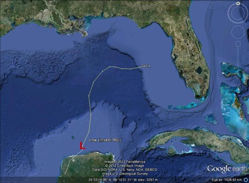
Things are actually playing out to some degree much like the models showed last week with a weak and broad low ejecting out of MX into the BOC (the broad low as done just that, but slightly more to the north and east than the models were showing last week). That slight NE ejection seems to have been the starting point of the differences between the models with respect to FL or the W Gulf. Ensemble means continue to favor the western Gulf with the GFS ensembles more split into the two camps. Hopefully some of this will clear up before NHC has to put out a 5 day forecast...luckily they have slow motion on their side.
0 likes   

User avatar
'CaneFreak
Category 5
Category 5
Posts: 1486
Joined: Mon Jun 05, 2006 10:50 am
Location: New Bern, NC

Re: ATL: INVEST 96L - Discussion

#316 Postby 'CaneFreak » Thu Jun 21, 2012 9:22 pm

However, highest vorticity resides to the northeast :P

http://tropic.ssec.wisc.edu/real-time/w ... oom=&time=

ROCK wrote:Low level convergence is not impressive attm but it is where the best track is....

http://tropic.ssec.wisc.edu/real-time/w ... oom=&time=
0 likes   

User avatar
Hurricaneman
Category 5
Category 5
Posts: 7351
Age: 45
Joined: Tue Aug 31, 2004 3:24 pm
Location: central florida

Re: ATL: INVEST 96L - Discussion

#317 Postby Hurricaneman » Thu Jun 21, 2012 9:23 pm

If this somehow relocates 200 miles or more farther east, would that possibly make the up and out scenerio that the GFS shows more likely
0 likes   

User avatar
Rgv20
S2K Supporter
S2K Supporter
Posts: 2466
Age: 38
Joined: Wed Jan 05, 2011 5:42 pm
Location: Edinburg/McAllen Tx

Re:

#318 Postby Rgv20 » Thu Jun 21, 2012 9:26 pm

NDG wrote:The much trusted TVCA/TVCN concensus model by the NHC:

http://i20.photobucket.com/albums/b245/ ... z-tvca.jpg


Looks like they only used the GFS.....New runs of the UKMET and ECMWF make a left turn.
0 likes   
The following post is NOT an official forecast and should not be used as such. It is just the opinion of the poster and may or may not be backed by sound meteorological data. It is NOT endorsed by any professional institution including storm2k.org For Official Information please refer to the NHC and NWS products.

ozonepete
Professional-Met
Professional-Met
Posts: 4743
Joined: Mon Sep 07, 2009 3:23 pm
Location: From Ozone Park, NYC / Now in Brooklyn, NY

Re: ATL: INVEST 96L - Discussion

#319 Postby ozonepete » Thu Jun 21, 2012 9:26 pm

Hurricaneman wrote:If this somehow relocates 200 miles or more farther east, would that possibly make the up and out scenerio that the GFS shows more likely


Sure it would. But there's no proof of that at all yet. It's all just speculation until surface obs and whatever satelliite data we have starts consolidating.
0 likes   

User avatar
cycloneye
Admin
Admin
Posts: 145299
Age: 68
Joined: Thu Oct 10, 2002 10:54 am
Location: San Juan, Puerto Rico

Re: ATL: INVEST 96L - Discussion

#320 Postby cycloneye » Thu Jun 21, 2012 9:26 pm

jeff, in your estimation,how strong this system may get?
0 likes   
Visit the Caribbean-Central America Weather Thread where you can find at first post web cams,radars
and observations from Caribbean basin members Click Here


Return to “2012”

Who is online

Users browsing this forum: No registered users and 1 guest