ATL: DEBBY - Post-Tropical
Moderator: S2k Moderators
-
Tampa_God

- Category 1

- Posts: 333
- Age: 36
- Joined: Wed May 31, 2006 7:27 pm
- Location: New Port Richey/Trinity, FL
Re: ATL: INVEST 96L - Models
I was going to say, the models have been all over the place with this disturbance. Models were forecasting a BOC storm, then a east Gulf storm, then a central Gulf storm. For a storm that just recently became an invest, putting much faith in any of these models right now is foolish.
0 likes
Re: ATL: INVEST 96L - Discussion
Well was out in D'iberville(old N.Biloxi) this afternoon and C-130's in the air a lot tag-team up something you do not see to often and not much distance between them.Having known this was out there makes you wonder....
0 likes

Re: ATL: INVEST 96L - Discussion
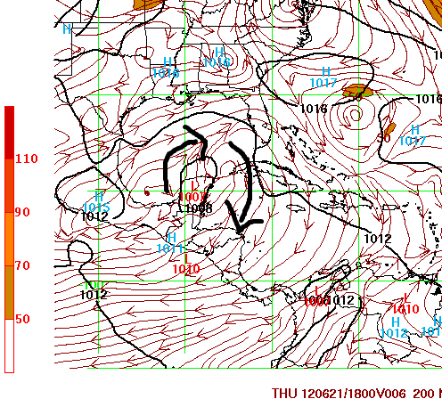
Gcane your right that anti-cyclone is right on top of it...creating an ideal environment..ie reducing shear
0 likes
-
Hurricane Andrew

- S2K Supporter

- Posts: 1891
- Age: 27
- Joined: Sun May 23, 2010 2:53 pm
- Location: KS

Re: ATL: INVEST 96L - Discussion
ROCK wrote:Gcane your right that anti-cyclone is right on top of it...creating an ideal environment..ie reducing shear
Tomorrow morning could see some big convection fire up.
0 likes
-
pricetag56
- Tropical Storm

- Posts: 133
- Joined: Sat Aug 21, 2010 4:18 pm
Re: ATL: INVEST 96L - Models
Tampa_God wrote:I was going to say, the models have been all over the place with this disturbance. Models were forecasting a BOC storm, then a east Gulf storm, then a central Gulf storm. For a storm that just recently became an invest, putting much faith in any of these models right now is foolish.
Maybe so but you cannot deny the trend right now....maybe the trof picks it up. However we got one of the best models out there flipping to the extreme like this we have to take notice...along with the CMC showing the same track for a day and half...now the EURO flips. I am not being foolish I am be vigilant...
0 likes
-
HURRICANELONNY
- Category 5

- Posts: 1392
- Joined: Wed May 07, 2003 6:48 am
- Location: HOLLYWOOD.FL
ATL: INVEST 96L - Models
As I told my friend yesterday. As soon as 96L gets going the rain will stop here in S. FL. They had it at 80% here last night. The NWS always gets hexed when they put chances that high. We have to get up on his roof today. Guess what. NO RAIN. All organizing with 96L. Should head north then west. Most likely Texas. They need the rain. 
0 likes
hurricanelonny
Re: ATL: INVEST 96L - Discussion
pricetag56 wrote:how does an anticyclone look?
look at current shear map...see that big swirling thing by the Yuc...thats an anti-cyclone...
http://tropic.ssec.wisc.edu/real-time/w ... oom=&time=
0 likes

We have been watching this steady WNW migration for a while now, there was even a hint of circulation way back near -80W 16N. The convection will probably stay off to the east till it has a chance to wrap as the center moves a little further NW from the coast. Latest burst of convection in the Yuc channel should die off I don't think we will see a deep center form further east.
0 likes
-
cycloneye

- Admin

- Posts: 149822
- Age: 69
- Joined: Thu Oct 10, 2002 10:54 am
- Location: San Juan, Puerto Rico
Re: ATL: INVEST 96L - Discussion
Low pressure just off north coast of Yucatan.

0 likes
Visit the Caribbean-Central America Weather Thread where you can find at first post web cams,radars
and observations from Caribbean basin members Click Here
and observations from Caribbean basin members Click Here
-
tolakram
- Admin
- Posts: 20188
- Age: 62
- Joined: Sun Aug 27, 2006 8:23 pm
- Location: Florence, KY (name is Mark)
Re: ATL: INVEST 96L - Models
Folks, lets take most of this conversation to the discussion thread. This thread should be restricted to model output and comments directly related to that output. Thanks!
0 likes
M a r k
- - - - -
Join us in chat: Storm2K Chatroom Invite. Android and IOS apps also available.
The posts in this forum are NOT official forecasts and should not be used as such. Posts are NOT endorsed by any professional institution or STORM2K.org. For official information and forecasts, please refer to NHC and NWS products.
Re: ATL: INVEST 96L - Discussion
pricetag56 wrote:how does an anticyclone look?
Its the clockwise wind vectors shown in this image
http://tropic.ssec.wisc.edu/real-time/a ... wg8shr.GIF
What it indicates is a raising of the tropopause which allows a vorticity column (called PV - potential vorticity) to expand vertically.
The vertical expansion causes faster spinning due to conservation of angular momentum.
The old spinning skater pulling in arms analogy.
0 likes
-
pricetag56
- Tropical Storm
- Posts: 133
- Joined: Sat Aug 21, 2010 4:18 pm
Re: ATL: INVEST 96L - Discussion
ROCK wrote:pricetag56 wrote:how does an anticyclone look?
look at current shear map...see that big swirling thing by the Yuc...thats an anti-cyclone...
http://tropic.ssec.wisc.edu/real-time/w ... oom=&time=
ok thanks yea its pretty obvious now lol
0 likes
Re: ATL: INVEST 96L - Discussion
GCANE wrote:pricetag56 wrote:how does an anticyclone look?
Its the clockwise wind vectors shown in this image
http://tropic.ssec.wisc.edu/real-time/a ... wg8shr.GIF
What it indicates is a raising of the tropopause which allows a vorticity column (called PV - potential vorticity) to expand vertically.
The vertical expansion causes faster spinning due to conservation of angular momentum.
The old spinning skater pulling in arms analogy.
I called it a swirly thing....
0 likes
-
pricetag56
- Tropical Storm
- Posts: 133
- Joined: Sat Aug 21, 2010 4:18 pm
Re: ATL: INVEST 96L - Discussion
GCANE wrote:pricetag56 wrote:how does an anticyclone look?
Its the clockwise wind vectors shown in this image
http://tropic.ssec.wisc.edu/real-time/a ... wg8shr.GIF
What it indicates is a raising of the tropopause which allows a vorticity column (called PV - potential vorticity) to expand vertically.
The vertical expansion causes faster spinning due to conservation of angular momentum.
The old spinning skater pulling in arms analogy.
Thanks that was very helpful
0 likes

-
pricetag56
- Tropical Storm
- Posts: 133
- Joined: Sat Aug 21, 2010 4:18 pm
Re: ATL: INVEST 96L - Discussion
Debby by tomorrow?
0 likes
"People might not get all they work for in this world, but they must certainly work for all they get."- Frederick Douglass
Re: ATL: INVEST 96L - Discussion
pricetag56 wrote:so basically it creates a good environment for it
You get rising air with the thunderstorms but eventually when it hits the top of the troposphere it needs somewhere else to go since it can't keep going up. It needs to get vented away from the center of the storm. The anticyclone acts as a bit exhaust system creating outflow.
0 likes
Who is online
Users browsing this forum: No registered users and 11 guests