MESOSCALE DISCUSSION 0781
NWS STORM PREDICTION CENTER NORMAN OK
0718 PM CDT THU MAY 10 2012
AREAS AFFECTED...PORTIONS OF SOUTH/CENTRAL TX EWD TO THE
LOWER/MIDDLE TX COAST
CONCERNING...SEVERE POTENTIAL...TORNADO WATCH LIKELY
VALID 110018Z - 110115Z
PROBABILITY OF WATCH ISSUANCE...95 PERCENT
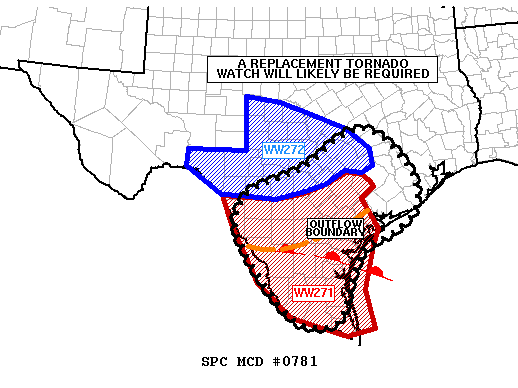
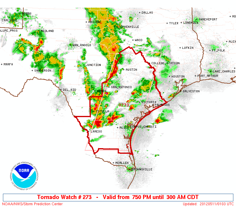
SUMMARY...A NEW TORNADO WATCH WILL LIKELY BE REQUIRED BY 01Z...WHICH
WOULD REPLACE PORTIONS OF BOTH TORNADO WATCH 271 AND SEVERE
THUNDERSTORM WATCH 272...AND CONTINUE THROUGH THE OVERNIGHT HOURS.
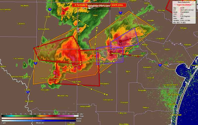
DISCUSSION...PRESENT INDICATIONS ARE THAT SUPERCELLS WILL CONTINUE
TRACKING EWD INVOF A QUASI-STATIONARY OUTFLOW BOUNDARY EXTENDING
FROM WEBB COUNTY EWD TOWARD LIVE OAK COUNTY AND NEWD INTO VICTORIA
COUNTY...WITH THIS ACTIVITY EVENTUALLY REACHING THE LOWER/MIDDLE TX
COAST BY LATE EVENING.
ADDITIONAL STORMS CONTINUE DEVELOPING IN ASSOCIATION WITH ISENTROPIC
ASCENT NORTH OF THE OUTFLOW BOUNDARY. AS SURFACE-BASED BUOYANCY
ADVANCES NWD NEAR AND SOUTH OF A WARM FRONT EXTENDING FROM WEBB TO
NUECES COUNTIES...THESE STORMS WILL HAVE THE POTENTIAL TO BECOME
SFC-BASED DURING THE NEXT FEW HOURS...WHILE MORE ISOLATED SFC-BASED
CONVECTION MOVES ACROSS THE WARM SECTOR -- E.G. SUPERCELL
APPROACHING ZAPATA COUNTY FROM THE WEST.
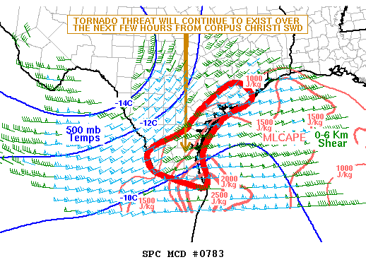
LARGE HAIL -- POTENTIALLY SIGNIFICANT -- AND DMGG WIND GUSTS WILL BE
THE GREATEST CONCERN WITH THE STORMS...AS 00Z CORPUS
CHRISTI/BROWNSVILLE RAOBS SUGGEST THE PRESENCE OF STRONG
INSTABILITY. ALSO...AS BELOW-1-KM-AGL FLOW MAINTAINS AN ELY
COMPONENT BENEATH MODERATE WLY MID-LEVEL FLOW ALOFT...EFFECTIVE SRH
VALUES ON THE ORDER OF 150-300 M2/S2 -- HIGHEST INVOF THE
AFOREMENTIONED BOUNDARIES -- WILL SUPPORT A TORNADO
THREAT...PARTICULARLY WITH ANY DISCRETE/SEMI-DISCRETE SUPERCELLS.
HOWEVER...AS LARGE-SCALE ASCENT INCREASES AMIDST THE RICH LOW-LEVEL
MOISTURE...INCREASING CONVECTIVE COVERAGE WILL LIKELY SUPPORT AN
EVOLUTION TOWARD ONE OR MORE FORWARD-PROPAGATING CONVECTIVE
SYSTEMS...WITH AN INCREASING CONCERN FOR DMGG WIND GUSTS THROUGH THE
LATE EVENING/OVERNIGHT HOURS AS STORMS MOVE TOWARD THE LOWER/MIDDLE
TX COAST.
..COHEN/CARBIN.. 05/11/2012
ATTN...WFO...HGX...FWD...CRP...EWX...BRO...
LAT...LON 28250027 28830030 29369984 29809855 30749693 29769567
28879553 28329608 27899698 27029738 26239772 26259871
27179958 28250027


