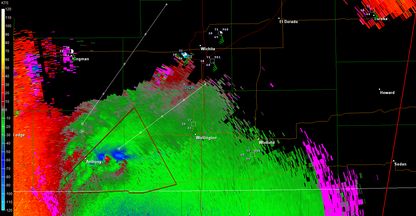
CrazyC83 wrote:Greensburg dodged a bullet there too...
Aside from the cliche just used again, its actually possible they didn't dodge it as a massive debris ball is showing up on it. I'm even thinking it was so close that just the inflow or whatever was so strong there is probably damage anyways. Reguardless, there might be a EF5 tornado on the ground right now based on the gtg well above 200 kts!!!!!!!