Down to 60%
TROPICAL WEATHER OUTLOOK
NWS NATIONAL HURRICANE CENTER MIAMI FL
800 AM EDT SUN OCT 23 2011
FOR THE NORTH ATLANTIC...CARIBBEAN SEA AND THE GULF OF MEXICO...
SHOWERS AND THUNDERSTORMS ASSOCIATED WITH AN AREA OF LOW PRESSURE
CENTERED ABOUT 150 MILES EAST-SOUTHEAST OF THE NICARAGUA AND
HONDURAS BORDER HAVE CHANGED LITTLE IN ORGANIZATION EARLY THIS
MORNING. ENVIRONMENTAL CONDITIONS ARE FORECAST TO BECOME A
LITTLE MORE CONDUCIVE FOR DEVELOPMENT...AND A TROPICAL DEPRESSION
COULD FORM DURING THE NEXT DAY OR SO. THIS SYSTEM HAS A HIGH
CHANCE...60 PERCENT...OF BECOMING A TROPICAL CYCLONE DURING THE
NEXT 48 HOURS AS IT MOVES SLOWLY NORTHWARD AND THEN NORTHWESTWARD.
REGARDLESS OF DEVELOPMENT...LOCALLY HEAVY RAINS AND GUSTY WINDS
COULD AFFECT PORTIONS OF HONDURAS AND NORTHEASTERN NICARAGUA
THROUGH MONDAY.
$$
FORECASTER BROWN/PASCH
ATL: RINA - Post-Tropical - Discussion
Moderator: S2k Moderators
-
cycloneye

- Admin

- Posts: 149426
- Age: 69
- Joined: Thu Oct 10, 2002 10:54 am
- Location: San Juan, Puerto Rico
Re: ATL: INVEST 96L - Discussion
0 likes
Visit the Caribbean-Central America Weather Thread where you can find at first post web cams,radars
and observations from Caribbean basin members Click Here
and observations from Caribbean basin members Click Here
-
SouthDadeFish

- Professional-Met

- Posts: 2835
- Joined: Thu Sep 23, 2010 2:54 pm
- Location: Miami, FL
- Contact:
-
cycloneye
- Admin
- Posts: 149426
- Age: 69
- Joined: Thu Oct 10, 2002 10:54 am
- Location: San Juan, Puerto Rico
Re: ATL: INVEST 96L - Discussion
0 likes
Visit the Caribbean-Central America Weather Thread where you can find at first post web cams,radars
and observations from Caribbean basin members Click Here
and observations from Caribbean basin members Click Here
-
Blown Away

- S2K Supporter

- Posts: 10253
- Joined: Wed May 26, 2004 6:17 am
Re: ATL: INVEST 96L - Discussion

72 hour TAFB shooting the Yucatan/Cuba gap as a "Possible Tropical Cyclone"
0 likes
Hurricane Eye Experience: David 79, Irene 99, Frances 04, Jeanne 04, Wilma 05… Hurricane Brush Experience: Andrew 92, Erin 95, Floyd 99, Matthew 16, Irma 17, Ian 22, Nicole 22…
-
wxman57

- Moderator-Pro Met

- Posts: 23174
- Age: 68
- Joined: Sat Jun 21, 2003 8:06 pm
- Location: Houston, TX (southwest)
Re:
SouthDadeFish wrote:This is one strange system. %'s are all over the place.
Those percent chances of development are not objective - they're purely subjective. There is no formula for precisely calculating the chances of development within the next 48 hrs. Each forecaster is different in how he/she estimates development potential. Some tend to go lower, some higher (like Stewart). Mathematically, the chance of development within 48 hours is either 100% or 0% (a perfect forecast). Either it will develop or it won't within that time period. Any variance from a 0% or 100% prediction just reflects the forecaster's uncertainty.
0 likes
-
cycloneye
- Admin
- Posts: 149426
- Age: 69
- Joined: Thu Oct 10, 2002 10:54 am
- Location: San Juan, Puerto Rico
Re: ATL: INVEST 96L - Discussion
12z Best Track
AL, 96, 2011102312, , BEST, 0, 145N, 810W, 25, 1006, LO
ftp://ftp.tpc.ncep.noaa.gov/atcf/tcweb/ ... 011.invest
AL, 96, 2011102312, , BEST, 0, 145N, 810W, 25, 1006, LO
ftp://ftp.tpc.ncep.noaa.gov/atcf/tcweb/ ... 011.invest
0 likes
Visit the Caribbean-Central America Weather Thread where you can find at first post web cams,radars
and observations from Caribbean basin members Click Here
and observations from Caribbean basin members Click Here


Re: ATL: INVEST 96L - Discussion
I think S FL and the Keys have to pay attention to 96L. Both the GFDL and HWRF (experimental and regular) intensify this system to a hurricane and bring it in the general direction of the Keys - heading NE ahead of a cold front. As usual, timing will be everything. I expect shear to increase as it enters the SE GOM so it will probably be a weakening storm as it heads that way but could still pack a punch.
0 likes
-
Blown Away
- S2K Supporter
- Posts: 10253
- Joined: Wed May 26, 2004 6:17 am
Re: ATL: INVEST 96L - Models
TROPICAL CYCLONE GUIDANCE MESSAGE
NWS NATIONAL HURRICANE CENTER MIAMI FL
1221 UTC SUN OCT 23 2011
DISCLAIMER...NUMERICAL MODELS ARE SUBJECT TO LARGE ERRORS.
PLEASE REFER TO NHC OFFICIAL FORECASTS FOR TROPICAL CYCLONE
AND SUBTROPICAL CYCLONE INFORMATION.
ATLANTIC OBJECTIVE AIDS FOR
DISTURBANCE INVEST (AL962011) 20111023 1200 UTC
...00 HRS... ...12 HRS... ...24 HRS. .. ...36 HRS...
111023 1200 111024 0000 111024 1200 111025 0000
LAT LON LAT LON LAT LON LAT LON
BAMS 14.5N 81.0W 15.1N 81.5W 15.4N 82.3W 15.5N 83.4W
BAMD 14.5N 81.0W 15.4N 81.6W 16.3N 82.3W 16.9N 83.1W
BAMM 14.5N 81.0W 15.2N 81.4W 15.5N 82.2W 15.5N 83.4W
LBAR 14.5N 81.0W 15.8N 81.3W 17.7N 81.5W 19.9N 81.5W
SHIP 25KTS 27KTS 28KTS 32KTS
DSHP 25KTS 27KTS 28KTS 32KTS
...48 HRS... ...72 HRS... ...96 HRS. .. ..120 HRS...
111025 1200 111026 1200 111027 1200 111028 1200
LAT LON LAT LON LAT LON LAT LON
BAMS 14.9N 84.9W 13.1N 89.3W 11.7N 93.2W 10.5N 96.7W
BAMD 17.3N 84.1W 18.1N 86.3W 20.4N 87.1W 23.6N 83.6W
BAMM 15.0N 85.0W 13.5N 89.6W 12.7N 94.1W 12.3N 97.8W
LBAR 22.2N 81.1W 26.6N 80.3W 29.4N 75.4W 32.1N 66.4W
SHIP 35KTS 35KTS 34KTS 34KTS
DSHP 28KTS 27KTS 28KTS 29KTS
...INITIAL CONDITIONS...
LATCUR = 14.5N LONCUR = 81.0W DIRCUR = 10DEG SPDCUR = 5KT
LATM12 = 13.6N LONM12 = 81.4W DIRM12 = 14DEG SPDM12 = 4KT
LATM24 = 12.9N LONM24 = 81.4W
WNDCUR = 25KT RMAXWD = 90NM WNDM12 = 25KT
CENPRS = 1006MB OUTPRS = 1010MB OUTRAD = 225NM SDEPTH = M
RD34NE = 0NM RD34SE = 0NM RD34SW = 0NM RD34NW = 0NM

12z models getting away from burying 96L in the Yucatan.
NWS NATIONAL HURRICANE CENTER MIAMI FL
1221 UTC SUN OCT 23 2011
DISCLAIMER...NUMERICAL MODELS ARE SUBJECT TO LARGE ERRORS.
PLEASE REFER TO NHC OFFICIAL FORECASTS FOR TROPICAL CYCLONE
AND SUBTROPICAL CYCLONE INFORMATION.
ATLANTIC OBJECTIVE AIDS FOR
DISTURBANCE INVEST (AL962011) 20111023 1200 UTC
...00 HRS... ...12 HRS... ...24 HRS. .. ...36 HRS...
111023 1200 111024 0000 111024 1200 111025 0000
LAT LON LAT LON LAT LON LAT LON
BAMS 14.5N 81.0W 15.1N 81.5W 15.4N 82.3W 15.5N 83.4W
BAMD 14.5N 81.0W 15.4N 81.6W 16.3N 82.3W 16.9N 83.1W
BAMM 14.5N 81.0W 15.2N 81.4W 15.5N 82.2W 15.5N 83.4W
LBAR 14.5N 81.0W 15.8N 81.3W 17.7N 81.5W 19.9N 81.5W
SHIP 25KTS 27KTS 28KTS 32KTS
DSHP 25KTS 27KTS 28KTS 32KTS
...48 HRS... ...72 HRS... ...96 HRS. .. ..120 HRS...
111025 1200 111026 1200 111027 1200 111028 1200
LAT LON LAT LON LAT LON LAT LON
BAMS 14.9N 84.9W 13.1N 89.3W 11.7N 93.2W 10.5N 96.7W
BAMD 17.3N 84.1W 18.1N 86.3W 20.4N 87.1W 23.6N 83.6W
BAMM 15.0N 85.0W 13.5N 89.6W 12.7N 94.1W 12.3N 97.8W
LBAR 22.2N 81.1W 26.6N 80.3W 29.4N 75.4W 32.1N 66.4W
SHIP 35KTS 35KTS 34KTS 34KTS
DSHP 28KTS 27KTS 28KTS 29KTS
...INITIAL CONDITIONS...
LATCUR = 14.5N LONCUR = 81.0W DIRCUR = 10DEG SPDCUR = 5KT
LATM12 = 13.6N LONM12 = 81.4W DIRM12 = 14DEG SPDM12 = 4KT
LATM24 = 12.9N LONM24 = 81.4W
WNDCUR = 25KT RMAXWD = 90NM WNDM12 = 25KT
CENPRS = 1006MB OUTPRS = 1010MB OUTRAD = 225NM SDEPTH = M
RD34NE = 0NM RD34SE = 0NM RD34SW = 0NM RD34NW = 0NM
12z models getting away from burying 96L in the Yucatan.
0 likes
Hurricane Eye Experience: David 79, Irene 99, Frances 04, Jeanne 04, Wilma 05… Hurricane Brush Experience: Andrew 92, Erin 95, Floyd 99, Matthew 16, Irma 17, Ian 22, Nicole 22…

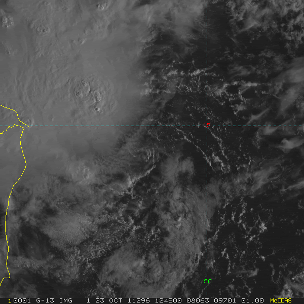
Re: ATL: INVEST 96L - Discussion
First visible, center looks exposed SE of the main ball of convection.
http://www.ssd.noaa.gov/goes/flt/t1/flash-vis.html
http://www.ssd.noaa.gov/goes/flt/t1/flash-vis.html
0 likes
The following post is NOT an official forecast and should not be used as such. It is just the opinion of the poster and may or may not be backed by sound meteorological data. It is NOT endorsed by any professional institution including storm2k.org For Official Information please refer to the NHC and NWS products.
-
cycloneye
- Admin
- Posts: 149426
- Age: 69
- Joined: Thu Oct 10, 2002 10:54 am
- Location: San Juan, Puerto Rico
ATL: RINA - Recon
The first mission is planned to depart at 11:00 AM EDT. But,NHC didn't mention it at 8 AM TWO. Let's see what occurs.
SUSPECT AREA (WESTERN CARIBBEAN)
FLIGHT ONE -- TEAL 70
A. 23/1900Z
B. AFXXX 01KKA INVEST
C. 23/1500Z
D. 14.6N 82.5W
E. 23/1830Z TO 23/2230Z
F. SFC TO 10,000 FT
SUSPECT AREA (WESTERN CARIBBEAN)
FLIGHT ONE -- TEAL 70
A. 23/1900Z
B. AFXXX 01KKA INVEST
C. 23/1500Z
D. 14.6N 82.5W
E. 23/1830Z TO 23/2230Z
F. SFC TO 10,000 FT
0 likes
Visit the Caribbean-Central America Weather Thread where you can find at first post web cams,radars
and observations from Caribbean basin members Click Here
and observations from Caribbean basin members Click Here

Look at any of the long Infrared or WV loops. The convection has been marching North steadily and you can see a front digging down off the Texas coast. That should be enough to keep whatever develops out of Central America.
The trough is likely to stall over Florida so I agree with the models that have this pulling out NE close to SE Florida rather than moving it up into the gulf. Once this spins up we need to be looking at the shear forecast to get some idea about intensity.
The trough is likely to stall over Florida so I agree with the models that have this pulling out NE close to SE Florida rather than moving it up into the gulf. Once this spins up we need to be looking at the shear forecast to get some idea about intensity.
0 likes
-
cycloneye
- Admin
- Posts: 149426
- Age: 69
- Joined: Thu Oct 10, 2002 10:54 am
- Location: San Juan, Puerto Rico
Re: ATL: INVEST 96L - Discussion
Interesting discussion that Rob of Crown Weather made this morning about 96L.
http://www.crownweather.com/?page_id=4557
http://www.crownweather.com/?page_id=4557
0 likes
Visit the Caribbean-Central America Weather Thread where you can find at first post web cams,radars
and observations from Caribbean basin members Click Here
and observations from Caribbean basin members Click Here
Re: ATL: INVEST 96L - Models
...This just goes to show that we have soooooo much more to learn about weather forecasting.
I agree totally - the models are good in some ways but the bad thing about them is that it allows the forecaster to rely on them instead of his or her God-given instincts, per what was mentioned in the movie Twister...
"He has the technology but doesn't have the instincts"
being a good weather forecaster is the same as being a good farmer or fisherman - all rely on having good instincts of the earth and sea and sky, and none of that comes from technology...
In the old days men would rely on their instincts and often they were correct - sure satellite is a great tool and gives us a view that people wish they had in the old times, but even that doesn't replace a person's instincts for what might be coming...
Some of the old NHC Hurricane Specialists had great instincts and it made them good hurricane forecasters - sure, they had the education but education without instincts is like a boat on dry land...
Frank
0 likes
-
SFLcane

- S2K Supporter
- Posts: 10281
- Age: 48
- Joined: Sat Jun 05, 2010 1:44 pm
- Location: Lake Worth Florida
Re: ATL: INVEST 96L - Models
European back on board with some development before it gets decapitated by strong shear in the gulf. Just dont see this being a significant threat to SFL with those hostile conditions.

0 likes


-
SFLcane
- S2K Supporter
- Posts: 10281
- Age: 48
- Joined: Sat Jun 05, 2010 1:44 pm
- Location: Lake Worth Florida
Re: ATL: INVEST 96L - Models
Anyone know why some of the 06z models were not run? Dont see any HWRF or GFDL.
0 likes
-
MGC

- S2K Supporter
- Posts: 5940
- Joined: Sun Mar 23, 2003 9:05 pm
- Location: Pass Christian MS, or what is left.
Re: ATL: INVEST 96L - Discussion
I'm on vacation down in the keys and am watching this very closely. Sure looks like there is a circulation this morning....MGC
0 likes
-
cycloneye
- Admin
- Posts: 149426
- Age: 69
- Joined: Thu Oct 10, 2002 10:54 am
- Location: San Juan, Puerto Rico
Re: ATL: INVEST 96L - Recon
Recon will go this afternoon
There is any remark that says the contrary.
000
NOUS42 KNHC 231415
WEATHER RECONNAISSANCE FLIGHTS
CARCAH, NATIONAL HURRICANE CENTER, MIAMI, FL.
1015 AM EDT SUN 23 OCTOBER 2011
SUBJECT: TROPICAL CYCLONE PLAN OF THE DAY (TCPOD)
VALID 24/1100Z TO 25/1100Z OCTOBER 2011
TCPOD NUMBER.....11-145
I. ATLANTIC REQUIREMENTS
1. SUSPECT AREA (WESTERN CARIBBEAN)
FLIGHT ONE -- TEAL 71
A. 24/1800Z
B. AFXXX 0218A CYCLONE
C. 24/1445Z
D. 16.6N 82.4W
E. 24/1730Z TO 24/2100Z
F. SFC TO 10,000 FT
FLIGHT TWO -- TEAL 72
A. 25/0600Z
B. AFXXX 0318A CYCLONE
C. 25/0245Z
D. 16.9N 83.3W
E. 25/0530Z TO 25/0900Z
F. SFC TO 10,000 FT
2. OUTLOOK FOR SUCCEEDING DAY: CONTINUE 12-HRLY FIXES
IF SYSTEM REMAINS A THREAT.
0 likes
Visit the Caribbean-Central America Weather Thread where you can find at first post web cams,radars
and observations from Caribbean basin members Click Here
and observations from Caribbean basin members Click Here
-
cycloneye
- Admin
- Posts: 149426
- Age: 69
- Joined: Thu Oct 10, 2002 10:54 am
- Location: San Juan, Puerto Rico
Re: ATL: INVEST 96L - Discussion
Is very good that they decided to have a plane this afternoon as this is if not a TD,very close.
0 likes
Visit the Caribbean-Central America Weather Thread where you can find at first post web cams,radars
and observations from Caribbean basin members Click Here
and observations from Caribbean basin members Click Here
Who is online
Users browsing this forum: No registered users and 15 guests