C/S TX Weather: Seasonal with some rains

U.S. & Caribbean Weather Discussions and Severe Weather Events

Moderator: S2k Moderators

Forum rules

The posts in this forum are NOT official forecast and should not be used as such. They are just the opinion of the poster and may or may not be backed by sound meteorological data. They are NOT endorsed by any professional institution or STORM2K.

Help Support Storm2K
Message
Author
User avatar
Portastorm
Storm2k Moderator
Storm2k Moderator
Posts: 9914
Age: 63
Joined: Fri Jul 11, 2003 9:16 am
Location: Round Rock, TX
Contact:

Re:

#1021 Postby Portastorm » Thu Aug 25, 2011 4:37 pm

ndale wrote:Still have not received a drop here in north Austin.


Yep. Today's rain was mostly on the east side, southeast, and southwest ... and it wasn't much at all. Maybe .01 or .02 inches of rain. But hey ... maybe it is a prelude to more in the near future. That is my hope!
0 likes   
Any forecasts under my name are to be taken with a grain of salt. Get your best forecasts from the National Weather Service and National Hurricane Center.

User avatar
~FlipFlopGirl~
Tropical Depression
Tropical Depression
Posts: 52
Age: 46
Joined: Sat Jul 24, 2010 7:43 pm
Location: Waco,TX

#1022 Postby ~FlipFlopGirl~ » Thu Aug 25, 2011 6:58 pm

In Waco all we got was wind and flying trash- I can't take this intense heat much more! Come on Oct!
0 likes   

User avatar
cctxhurricanewatcher
Category 5
Category 5
Posts: 1206
Joined: Sun Sep 12, 2004 8:53 pm
Location: Corpus Christi, Texas

#1023 Postby cctxhurricanewatcher » Fri Aug 26, 2011 9:03 am

I got anout 1/3 of an inch in my rain guage. Just enought to wash the dust off everything and was able to capture some run off for my potted plants. They looked happy.
0 likes   

User avatar
gboudx
S2K Supporter
S2K Supporter
Posts: 4080
Joined: Thu Sep 04, 2003 1:39 pm
Location: Rockwall, Tx but from Harvey, La

#1024 Postby gboudx » Fri Aug 26, 2011 12:39 pm

DFW continues with the hope.

OF INTEREST IN THE EXTENDED...BY DAY NINE BOTH THE ECMWF AND GFS
SPLIT THE RIDGE...WITH ONE HIGH CENTER OVER NORTHERN MEXICO AND
THE OTHER OVER THE OHIO VALLEY/SOUTHEAST. IF THIS OCCURS...WE MAY
SEE MORE EXTENSIVE RAIN CHANCES THAN WE HAVE HAD FOR A LONG
TIME...AS WELL AS A BREAK FROM 100 DEGREE HIGHS.
0 likes   

User avatar
Portastorm
Storm2k Moderator
Storm2k Moderator
Posts: 9914
Age: 63
Joined: Fri Jul 11, 2003 9:16 am
Location: Round Rock, TX
Contact:

Re:

#1025 Postby Portastorm » Fri Aug 26, 2011 12:41 pm

gboudx wrote:DFW continues with the hope.

OF INTEREST IN THE EXTENDED...BY DAY NINE BOTH THE ECMWF AND GFS
SPLIT THE RIDGE...WITH ONE HIGH CENTER OVER NORTHERN MEXICO AND
THE OTHER OVER THE OHIO VALLEY/SOUTHEAST. IF THIS OCCURS...WE MAY
SEE MORE EXTENSIVE RAIN CHANCES THAN WE HAVE HAD FOR A LONG
TIME...AS WELL AS A BREAK FROM 100 DEGREE HIGHS.


The Grey Goose vodka-swilling mets in the Portastorm Weather Center say: "I'll drink to that!"

8-)
0 likes   
Any forecasts under my name are to be taken with a grain of salt. Get your best forecasts from the National Weather Service and National Hurricane Center.

Shoshana
Category 5
Category 5
Posts: 1414
Joined: Thu Sep 09, 2004 7:50 pm
Location: NE Austin

#1026 Postby Shoshana » Fri Aug 26, 2011 3:03 pm

Austin:

(Mabry) Fri Day 71 100+ (New All Time Record)

Day 1 in a row 100+

Day 19 105+

Day 0 in a row 105

27 in a row 100+ current record 2011!

(Bergstrom) Fri Day 58 100+ (New All Time Record)
Last edited by Shoshana on Fri Aug 26, 2011 5:23 pm, edited 1 time in total.
0 likes   

User avatar
Ntxw
Storm2k Moderator
Storm2k Moderator
Posts: 22785
Joined: Wed Oct 21, 2009 6:34 pm
Location: DFW, Texas

Re: C/S TX Weather: Frying Pan Summer

#1027 Postby Ntxw » Fri Aug 26, 2011 4:29 pm

Is this just not gorgeous or what, to continue the hope posts I've been putting in. It's been a loooong time since us Texans have seen such optimism from the models. For the doubters, good reason to be but just know the ensembles too are supportive of a pattern change Labor Day.

Image

Uploaded with ImageShack.us

Ensembles ECM 0z

Image

Uploaded with ImageShack.us
Last edited by Ntxw on Fri Aug 26, 2011 4:33 pm, edited 2 times in total.
0 likes   
The above post and any post by Ntxw is NOT an official forecast and should not be used as such. It is just the opinion of the poster and may or may not be backed by sound meteorological data. It is NOT endorsed by any professional institution including Storm2k. For official information, please refer to NWS products.

  Help support Storm2K!
Help Support Storm2K

User avatar
Portastorm
Storm2k Moderator
Storm2k Moderator
Posts: 9914
Age: 63
Joined: Fri Jul 11, 2003 9:16 am
Location: Round Rock, TX
Contact:

Re: C/S TX Weather: Frying Pan Summer

#1028 Postby Portastorm » Fri Aug 26, 2011 4:30 pm

Nice to see Texas underneath the break between ridges of high pressure. Let's hope it verifies!
0 likes   
Any forecasts under my name are to be taken with a grain of salt. Get your best forecasts from the National Weather Service and National Hurricane Center.

User avatar
Rgv20
S2K Supporter
S2K Supporter
Posts: 2466
Age: 38
Joined: Wed Jan 05, 2011 5:42 pm
Location: Edinburg/McAllen Tx

#1029 Postby Rgv20 » Fri Aug 26, 2011 10:59 pm

I'm on the "change of the pattern after Labor Day" bandwagon! :lol: There are even hints by the ECMWF&GFS of a tropical disturbance taking shape in the Bay Of Campeche around Labor Day.. :D
0 likes   
The following post is NOT an official forecast and should not be used as such. It is just the opinion of the poster and may or may not be backed by sound meteorological data. It is NOT endorsed by any professional institution including storm2k.org For Official Information please refer to the NHC and NWS products.

User avatar
South Texas Storms
Professional-Met
Professional-Met
Posts: 4226
Joined: Thu Jun 24, 2010 12:28 am
Location: Houston, TX

Re:

#1030 Postby South Texas Storms » Fri Aug 26, 2011 11:30 pm

Rgv20 wrote:I'm on the "change of the pattern after Labor Day" bandwagon! :lol: There are even hints by the ECMWF&GFS of a tropical disturbance taking shape in the Bay Of Campeche around Labor Day.. :D


Me too! I'm very excited and hopeful! :D
0 likes   

User avatar
Portastorm
Storm2k Moderator
Storm2k Moderator
Posts: 9914
Age: 63
Joined: Fri Jul 11, 2003 9:16 am
Location: Round Rock, TX
Contact:

Re:

#1031 Postby Portastorm » Sat Aug 27, 2011 11:09 am

Rgv20 wrote:I'm on the "change of the pattern after Labor Day" bandwagon! :lol: There are even hints by the ECMWF&GFS of a tropical disturbance taking shape in the Bay Of Campeche around Labor Day.. :D


Not sure if there is a correlation here or not ... but on Friday, JB tweeted that the Gulf needs to be watched Labor Day weekend and earlier on the week he had mentioned the Western Gulf as an area of interest. Perhaps that is what he was on about.

Frankly, I don't care of the delivery method ... I just want rain and non triple-digit high temps. Is that asking too much?! :cheesy:
0 likes   
Any forecasts under my name are to be taken with a grain of salt. Get your best forecasts from the National Weather Service and National Hurricane Center.

User avatar
Rgv20
S2K Supporter
S2K Supporter
Posts: 2466
Age: 38
Joined: Wed Jan 05, 2011 5:42 pm
Location: Edinburg/McAllen Tx

#1032 Postby Rgv20 » Sat Aug 27, 2011 11:33 am

:uarrow: While the new 0zECMWF Operational run shows a tropical cyclone moving to the Northern Gulf Coast, Most of the ECMWF Ensembles favor a track to the Western Gulf Coast. Interesting days ahead :D


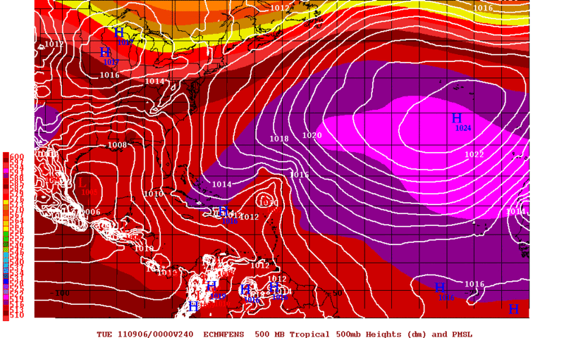
0zECMWF Ensembles Mean Forecast for Day 10. Just below 25N they have a 1005mb low pressure area..
Image
0 likes   
The following post is NOT an official forecast and should not be used as such. It is just the opinion of the poster and may or may not be backed by sound meteorological data. It is NOT endorsed by any professional institution including storm2k.org For Official Information please refer to the NHC and NWS products.

User avatar
Portastorm
Storm2k Moderator
Storm2k Moderator
Posts: 9914
Age: 63
Joined: Fri Jul 11, 2003 9:16 am
Location: Round Rock, TX
Contact:

Re: C/S TX Weather: Frying Pan Summer

#1033 Postby Portastorm » Sat Aug 27, 2011 11:46 am

That is encouraging news, Rgv20! Both the GFS and Euro continue to support the erosion of the death ridge by Labor Day weekend. I think we've had enough consistency over the last few days to have more confidence in this change.

Admittedly, I'm a Euro hugger and still feel it is the model to beat. If the Euro suggests potential in the Gulf, it has my attention!

Thanks for keeping us posted Rgv20 with the model updates.
0 likes   
Any forecasts under my name are to be taken with a grain of salt. Get your best forecasts from the National Weather Service and National Hurricane Center.

User avatar
~FlipFlopGirl~
Tropical Depression
Tropical Depression
Posts: 52
Age: 46
Joined: Sat Jul 24, 2010 7:43 pm
Location: Waco,TX

Re: C/S TX Weather: Frying Pan Summer

#1034 Postby ~FlipFlopGirl~ » Sat Aug 27, 2011 12:01 pm

Even just cloud cover would be nice- My electric bill was 402 and I by no means live in a large house but do have an 15 old Rheem unit- I am close to hanging foil in the windows as this heat is getting old and too costly! The high for Waco today is suppose to be 109 :cry:
0 likes   

Shoshana
Category 5
Category 5
Posts: 1414
Joined: Thu Sep 09, 2004 7:50 pm
Location: NE Austin

#1035 Postby Shoshana » Sat Aug 27, 2011 1:13 pm

Our next door neighbor says hers has been over $400 too. Their house is a little bit smaller than ours.

We have never come close to $400.

Austin:

(Mabry) Sat Day 72 100+ (New All Time Record)

Day 2 in a row 100+

Day 20 105+

Day 1 in a row 105

27 in a row 100+ current record 2011!

(Bergstrom) Sat Day 59 100+ (New All Time Record)

Mabry @ 1pm had 105. I think it's going to be over the 107 forecasted. Oddly enough our thermometer is registering between 104.8 and 105.5. Which is odd because I fully expected it to read 111 since it seems to read high.

3pm 106 Mabry (record tied) 106 Bergstrom (new record)

4pm 107 Mabry (new record) 107 Bergstrom (new record) 109.4 at our house and it feels like a blast furnace out there.

Final tally: 110 Mabry (new record) 108 Bergstrom (new record)
0 likes   

User avatar
Portastorm
Storm2k Moderator
Storm2k Moderator
Posts: 9914
Age: 63
Joined: Fri Jul 11, 2003 9:16 am
Location: Round Rock, TX
Contact:

Re: C/S TX Weather: Frying Pan Summer

#1036 Postby Portastorm » Sun Aug 28, 2011 10:14 am

Today should be similar in terms of temps here in Austin ... but ... but ... wait for it ... wait ... for ... it ... YES! The models (both the GFS and Euro) still show a cooler and wetter pattern for Labor Day weekend! :D
0 likes   
Any forecasts under my name are to be taken with a grain of salt. Get your best forecasts from the National Weather Service and National Hurricane Center.

Shoshana
Category 5
Category 5
Posts: 1414
Joined: Thu Sep 09, 2004 7:50 pm
Location: NE Austin

#1037 Postby Shoshana » Sun Aug 28, 2011 12:19 pm

Mabry 105 at noon. I'm hopin for that Labor Day break!!!

Mabry 108 1 pm Bergstrom 103. Both are above record highs for the day. Wonder if we will get new record all time high? (record is 112)

Mabry 109 2 pm

Mabry 110 at 3pm Bergstrom 108

Austin:

(Mabry) Sun Day 73 100+ (New All Time Record)

Day 3 in a row 100+

Day 21 105+

Day 2 in a row 105

27 in a row 100+ current record 2011!

(Bergstrom) Sun Day 60 100+ (New All Time Record)
Last edited by Shoshana on Sun Aug 28, 2011 3:06 pm, edited 3 times in total.
0 likes   

User avatar
gboudx
S2K Supporter
S2K Supporter
Posts: 4080
Joined: Thu Sep 04, 2003 1:39 pm
Location: Rockwall, Tx but from Harvey, La

#1038 Postby gboudx » Sun Aug 28, 2011 12:53 pm

Snippet from jeff regarding the change.

HOPE:
Starting yesterday models have been suggesting a significant upper air pattern change over TX by the middle of this upcoming week which could bring significant rainfall to the area, but also open the state up to potential impacts from tropical systems. Ridge of high pressure is forecast to move westward and eastward developing a weakness over TX. Favorable position of the eastern high will guide deep tropical moisture over the Gulf of Mexico and Caribbean toward the TX coast by late Wednesday. Forecast models show a strong tropical wave/weak low pressure system attempting to form over the western Gulf by the end of next week and this would support some of the highest rain chances we have seen in months. Stay tuned…
0 likes   

User avatar
Ntxw
Storm2k Moderator
Storm2k Moderator
Posts: 22785
Joined: Wed Oct 21, 2009 6:34 pm
Location: DFW, Texas

#1039 Postby Ntxw » Sun Aug 28, 2011 2:11 pm

ECMWF and GFS are STILL advertising what could be the demise of the 2011 death ridge. As of now doesn't seem like it will be a one or two day event but rather implications on longer term patterns.
0 likes   
The above post and any post by Ntxw is NOT an official forecast and should not be used as such. It is just the opinion of the poster and may or may not be backed by sound meteorological data. It is NOT endorsed by any professional institution including Storm2k. For official information, please refer to NWS products.


  Help support Storm2K!

Help Support Storm2K


Shoshana
Category 5
Category 5
Posts: 1414
Joined: Thu Sep 09, 2004 7:50 pm
Location: NE Austin

#1040 Postby Shoshana » Sun Aug 28, 2011 2:24 pm

Austin Humane Society has lost all their a/c thru Tues because a transformer blew and burned out the motors.

They are adopting out the animals today and tomorrow w no fee.

This is the shelter on 183 just west of I35

If we didn't have Peanut we'd go get a pup.
0 likes   


Return to “USA & Caribbean Weather”

Who is online

Users browsing this forum: 869MB and 18 guests