MiamiensisWx wrote:The posts in this forum are NOT official forecast and should not be used as such. They are just the opinion of the poster and may or may not be backed by sound meteorological data. They are NOT endorsed by any professional institution or storm2k.org. For official information, please refer to the NHC and NWS products.
The 00Z ECMWF and the 06Z GFS reasonably concur as to track, with the ECMWF slightly slower and deeper through T+96. The models appear to differ as to the strength of Irene: in the next twenty-four hours before Hispaniola, the ECMWF shows significantly more intensification than does the GFS. The ECMWF in fact shows a minimal hurricane striking near Santo Domingo, whereas the GFS keeps a weaker, faster system farther southwest. Consequently, the ECMWF is, and has been, near the northern edge of the model consensus through T+36. This discrepancy is important to note, for Irene's intensity within 24hr should influence how much Irene interacts with the developing weakness in the subtropical ridge. Given Irene's relatively small inner core, I don't believe that the current mid-level dry air intrusion will exert significant influence beyond T+12, for the ridge to the north will erode somewhat due to falling heights off New England. If I were to make an informed guess, I would suggest a compromise between the ECMWF and the GFS as far as intensity is concerned.
The earlier,
00Z GFS forecast soundings for SJU, PR, show that the pronounced mid-level inversion will begin to erode about this time, and the latest
12Z sounding shows that this is indeed occurring, albeit slower than what the model had projected. Also,
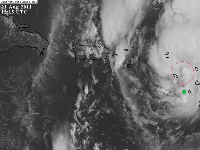
recent satellite images show a strong convective band developing on the north side of the mid-level circulation. I believe this is to be anticipated due to deepening moisture flux in the northern quadrant. As instability increases through the afternoon, I suspect that this convection will increase due to greater lifting, which will be facilitated by the weakening inversion. As a result, this band should begin to curve around the northwest quadrant and link directly to the MLC. Within about twelve to eighteen hours, I think the re-intensification will commence.
Insofar as track is concerned, I think the convective pattern itself may force a heading near 280 degrees (N of due west) within the next 18hr. Observations suggest that the low-level circulation has become somewhat more disorganized in the past six hours due to the mid-level dry air intrusion. As the convection will be concentrated on the N and NW sides, the chance of a deviation to the WNW would tend to increase. Indeed, this is the reason as to why I believe another center reformation to the NNW will likely occur as Irene begins to reorganize SSE of Puerto Rico.


