Folks, anybody starting to see a mid-level spin here now? I think I see one developing...its starting to come together...I say code red by tomorrow AM at the latest.
http://www.ssd.noaa.gov/goes/flt/t2/loop-vis.html
ATL: IRENE - Remnants - Discussion
Moderator: S2k Moderators
-
ozonepete
- Professional-Met

- Posts: 4743
- Joined: Mon Sep 07, 2009 3:23 pm
- Location: From Ozone Park, NYC / Now in Brooklyn, NY
Re: ATL: INVEST 97L - Discussion
shaggy wrote:Looking at the RGB you can see some inflow in the lower clouds. I'd certainly put the center north of 14N. If the models have missed this and it forms north of where they think the entire track could shift north and if it develops more rapidly it could even turn that much further north and miss wide right by a hundred miles.
Point is until theres an actual center this is all up in the air. I'd imagine with the rapidly improving satellite appearance they will be warming a plane up for a flight by tomorrow or sunday am?
I believe one is scheduled for tomorrow, right cyclone?
0 likes
-
Scorpion
-
ozonepete
- Professional-Met
- Posts: 4743
- Joined: Mon Sep 07, 2009 3:23 pm
- Location: From Ozone Park, NYC / Now in Brooklyn, NY
Re:
gatorcane wrote:Folks, anybody starting to see a mid-level spin here now? I think I see one developing...its starting to come together...I say code red by tomorrow AM at the latest.
http://www.ssd.noaa.gov/goes/flt/t2/loop-vis.html
I think red by 8PM.
0 likes

Re: ATL: INVEST 97L - Discussion
Aric Dunn wrote:shaggy wrote:Looking at the RGB you can see some inflow in the lower clouds. I'd certainly put the center north of 14N. If the models have missed this and it forms north of where they think the entire track could shift north and if it develops more rapidly it could even turn that much further north and miss wide right by a hundred miles.
Point is until theres an actual center this is all up in the air. I'd imagine with the rapidly improving satellite appearance they will be warming a plane up for a flight by tomorrow or sunday am?
they have it set for tomorrow. I bet at 8pm they go up to at least 50% maybe 60%
Really impressive organization over the past 12 hours. I am in no way confident in any model solution at this point if this decides to ramp up quickly. The dry air seems to have been choked out and away from the system and with the help of dmax tonight anything could happen at the rate it showed organization today.
0 likes
-
Blown Away

- S2K Supporter

- Posts: 10253
- Joined: Wed May 26, 2004 6:17 am
Re: ATL: INVEST 97L - Discussion
CourierPR wrote:JB has it at 15N and 50W.
That's @90 miles N of 18Z, if he is right that could affect the Hispaniola ride.
0 likes
Hurricane Eye Experience: David 79, Irene 99, Frances 04, Jeanne 04, Wilma 05… Hurricane Brush Experience: Andrew 92, Erin 95, Floyd 99, Matthew 16, Irma 17, Ian 22, Nicole 22…
-
Aric Dunn
- Category 5

- Posts: 21238
- Age: 43
- Joined: Sun Sep 19, 2004 9:58 pm
- Location: Ready for the Chase.
- Contact:
Re:
gatorcane wrote:Folks, anybody starting to see a mid-level spin here now? I think I see one developing...its starting to come together...I say code red by tomorrow AM at the latest.
http://www.ssd.noaa.gov/goes/flt/t2/loop-vis.html
I mentioned it on the last page.
Last edited by Aric Dunn on Fri Aug 19, 2011 2:50 pm, edited 1 time in total.
0 likes
Note: If I make a post that is brief. Please refer back to previous posts for the analysis or reasoning. I do not re-write/qoute what my initial post said each time.
If there is nothing before... then just ask
Space & Atmospheric Physicist, Embry-Riddle Aeronautical University,
I believe the sky is falling...
If there is nothing before... then just ask
Space & Atmospheric Physicist, Embry-Riddle Aeronautical University,
I believe the sky is falling...
-
Blown Away
- S2K Supporter
- Posts: 10253
- Joined: Wed May 26, 2004 6:17 am
Re:
gatorcane wrote:Folks, anybody starting to see a mid-level spin here now? I think I see one developing...its starting to come together...I say code red by tomorrow AM at the latest.
http://www.ssd.noaa.gov/goes/flt/t2/loop-vis.html
If the 18z position is correct all that convection is NW of the circulation, so that isn't that organized. If a LLC tucks closer to the convection then maybe TD by tomorrow. It's definitely getting better organized as time goes by.
Last edited by Blown Away on Fri Aug 19, 2011 2:51 pm, edited 1 time in total.
0 likes
Hurricane Eye Experience: David 79, Irene 99, Frances 04, Jeanne 04, Wilma 05… Hurricane Brush Experience: Andrew 92, Erin 95, Floyd 99, Matthew 16, Irma 17, Ian 22, Nicole 22…

-
painkillerr
- S2K Supporter
- Posts: 129
- Age: 70
- Joined: Wed Aug 25, 2010 5:17 pm
- Location: San Juan, PR
Re: ATL: INVEST 97L - Discussion
Blown Away wrote:IMO, the difference between 97L being a big cane for Florida or not will be Hispaniola. Many models go down the spine, if there is a shift of @100 miles N of Hispaniola SFL better watch out, JMHO!!
Hey Florida guys... keep an eye on us here in the islands!!
0 likes
-
DESTRUCTION5

- Category 5
- Posts: 4430
- Age: 44
- Joined: Wed Sep 03, 2003 11:25 am
- Location: Stuart, FL
Re: Re:
Blown Away wrote:gatorcane wrote:Folks, anybody starting to see a mid-level spin here now? I think I see one developing...its starting to come together...I say code red by tomorrow AM at the latest.
http://www.ssd.noaa.gov/goes/flt/t2/loop-vis.html
If the 18z position is correct all that convection is NW of the circulation, so that isn't that organized. If that LLC tucks closer to the convection then maybe TD by tomorrow. It's definitely getting better organized as time goes by.
Still has the feathery look though where there are no deep Tstorms and one gulp of that dry air all around it could push the reset button..
0 likes
GATOR NATION IS E V E R Y W H E R E !
-
gatorcane

- S2K Supporter
- Posts: 23708
- Age: 48
- Joined: Sun Mar 13, 2005 3:54 pm
- Location: Boca Raton, FL
Re: Re:
ozonepete wrote:gatorcane wrote:Folks, anybody starting to see a mid-level spin here now? I think I see one developing...its starting to come together...I say code red by tomorrow AM at the latest.
http://www.ssd.noaa.gov/goes/flt/t2/loop-vis.html
I think red by 8PM.
I would say yes but the NHC will probably gradually ramp up, though 60% is a possibility...which would be code red.
0 likes
-
Aric Dunn
- Category 5
- Posts: 21238
- Age: 43
- Joined: Sun Sep 19, 2004 9:58 pm
- Location: Ready for the Chase.
- Contact:
Re: ATL: INVEST 97L - Discussion
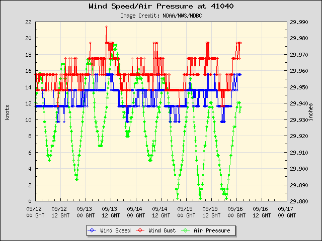
its going to pass right over this buoy later tonight and in the morning.. pressure falling pretty fast. already 1008 and my estimated center is still about a 100 miles away. pressure likely down to 1004 to 1005
0 likes
Note: If I make a post that is brief. Please refer back to previous posts for the analysis or reasoning. I do not re-write/qoute what my initial post said each time.
If there is nothing before... then just ask
Space & Atmospheric Physicist, Embry-Riddle Aeronautical University,
I believe the sky is falling...
If there is nothing before... then just ask
Space & Atmospheric Physicist, Embry-Riddle Aeronautical University,
I believe the sky is falling...
-
plasticup
-
ozonepete
- Professional-Met
- Posts: 4743
- Joined: Mon Sep 07, 2009 3:23 pm
- Location: From Ozone Park, NYC / Now in Brooklyn, NY
Re: Re:
gatorcane wrote:ozonepete wrote:gatorcane wrote:Folks, anybody starting to see a mid-level spin here now? I think I see one developing...its starting to come together...I say code red by tomorrow AM at the latest.
http://www.ssd.noaa.gov/goes/flt/t2/loop-vis.html
I think red by 8PM.
I would say yes but the NHC will probably gradually ramp up, though 60% is a possibility...which would be code red.
That's exactly what I'm thinkin'.
0 likes
-
Aric Dunn
- Category 5
- Posts: 21238
- Age: 43
- Joined: Sun Sep 19, 2004 9:58 pm
- Location: Ready for the Chase.
- Contact:
Re:
gatorcane wrote:Aric, do you expect convection to really blow up later tonight with DMAX?
Yes especially if we do have a weak LLC developing ( which seems to be the case) and given the dry air is quickly moistening up and the low level convergence continues to increase as well as good upper support. the likely hood of it has come up substantially. development tomorrow seem highly likely.
0 likes
Note: If I make a post that is brief. Please refer back to previous posts for the analysis or reasoning. I do not re-write/qoute what my initial post said each time.
If there is nothing before... then just ask
Space & Atmospheric Physicist, Embry-Riddle Aeronautical University,
I believe the sky is falling...
If there is nothing before... then just ask
Space & Atmospheric Physicist, Embry-Riddle Aeronautical University,
I believe the sky is falling...
-
gatorcane
- S2K Supporter
- Posts: 23708
- Age: 48
- Joined: Sun Mar 13, 2005 3:54 pm
- Location: Boca Raton, FL
Yeah the more I look at it, the more I really think it is coming together especially the last few hours. Really impressive progress on this one today. Looks like I still see a slight north of west movement (no WSW movement)...looks like it is gaining a little bit of lattitude.
Will be interesting to see what the NHC says at the next advisory, but code red seems likely.
Will be interesting to see what the NHC says at the next advisory, but code red seems likely.
0 likes
-
Aric Dunn
- Category 5
- Posts: 21238
- Age: 43
- Joined: Sun Sep 19, 2004 9:58 pm
- Location: Ready for the Chase.
- Contact:
Also note the shift to NNE at the buoy its approaching.. if that switches to N or even NW tonight ... we are probably looking at a TD tomorrow sooner rather than later..
0 likes
Note: If I make a post that is brief. Please refer back to previous posts for the analysis or reasoning. I do not re-write/qoute what my initial post said each time.
If there is nothing before... then just ask
Space & Atmospheric Physicist, Embry-Riddle Aeronautical University,
I believe the sky is falling...
If there is nothing before... then just ask
Space & Atmospheric Physicist, Embry-Riddle Aeronautical University,
I believe the sky is falling...
-
Blown Away
- S2K Supporter
- Posts: 10253
- Joined: Wed May 26, 2004 6:17 am
Re: ATL: INVEST 97L - Discussion
painkillerr wrote:Blown Away wrote:IMO, the difference between 97L being a big cane for Florida or not will be Hispaniola. Many models go down the spine, if there is a shift of @100 miles N of Hispaniola SFL better watch out, JMHO!!
Hey Florida guys... keep an eye on us here in the islands!!
Blown Away wrote:You know Luis & Gusty, looking like you guys might have to deal with at least a TS at this point! Models tightly clustered over you. JMHO, I'm thinking this will be a cane near PR.
For the record, I hollered out to my island homies a few hours ago and didn't get any love back! We are watching!!
0 likes
Hurricane Eye Experience: David 79, Irene 99, Frances 04, Jeanne 04, Wilma 05… Hurricane Brush Experience: Andrew 92, Erin 95, Floyd 99, Matthew 16, Irma 17, Ian 22, Nicole 22…
Who is online
Users browsing this forum: No registered users and 6 guests