ok, paying much closer attention now. it seems it will either bomb out or get totally ripped apart by Hispanola. all or nothing kind of scenario.
the earlier models overnight and GFS path now are quite unsettling going up the eastern GOM. That's scary territory for my interests. However, this far out, maybe it is good the models are there. They should shift one way or another by storm time... hopefully.
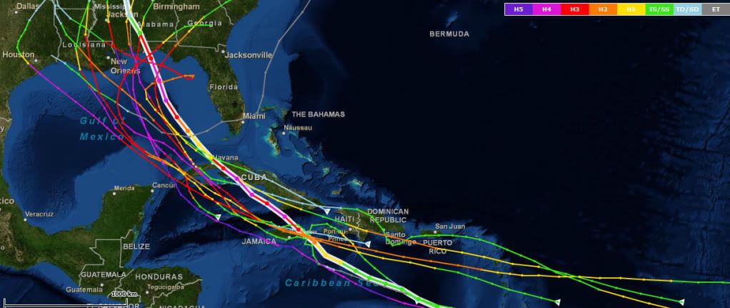
ATL: IRENE - Models
Moderator: S2k Moderators
-
TreasureIslandFLGal

- S2K Supporter

- Posts: 1584
- Age: 58
- Joined: Sun Aug 15, 2004 6:16 pm
- Location: Cancun, Mexico (northeast Yucatan coast)

-
Ivanhater

- Storm2k Moderator

- Posts: 11221
- Age: 39
- Joined: Fri Jul 01, 2005 8:25 am
- Location: Pensacola
Re: ATL: INVEST 97L-Models
It is likely going to turn north and at this long range it hard to pin down the angle of approach. Any delay and you have a north central gulf problem like the models have been showing. Any sooner and you have a Florida Peninsula problem. We are only talking about a 24 hour time frame of when the turn happens that will have a big issue on who it strikes. Long way to go.
0 likes
Michael
-
TreasureIslandFLGal
- S2K Supporter
- Posts: 1584
- Age: 58
- Joined: Sun Aug 15, 2004 6:16 pm
- Location: Cancun, Mexico (northeast Yucatan coast)
Re: ATL: INVEST 97L-Models
I sense the possibility of an Emily repeat here. This is pretty much the same discussion we had a few weeks ago. Also, I suspect the upper low just north of PR, as Jeff Masters noted, and the interaction with the mountains of Hispainola will be more influential than the models are currently showing.
0 likes
-
SouthFLTropics

- Category 5

- Posts: 4258
- Age: 50
- Joined: Thu Aug 14, 2003 8:04 am
- Location: Port St. Lucie, Florida
Re: ATL: INVEST 97L-Models
JPmia wrote:I sense the possibility of an Emily repeat here. This is pretty much the same discussion we had a few weeks ago. Also, I suspect the upper low just north of PR, as Jeff Masters noted, and the interaction with the mountains of Hispainola will be more influential than the models are currently showing.
You may be onto something here. The tracks could be very much the same. I think the big difference in 97L is that it already has a VERY strong vorticity to work with whereas Emily struggled all along to get itself stacked.
SFT
0 likes
Fourth Generation Florida Native
Personal Storm History: David 79, Andrew 92, Erin 95, Floyd 99, Irene 99, Frances 04, Jeanne 04, Wilma 05, Matthew 16, Irma 17, Ian 22, Nicole 22, Milton 24
Personal Storm History: David 79, Andrew 92, Erin 95, Floyd 99, Irene 99, Frances 04, Jeanne 04, Wilma 05, Matthew 16, Irma 17, Ian 22, Nicole 22, Milton 24
-
ConvergenceZone
.gif)
- Category 5
- Posts: 5241
- Joined: Fri Jul 29, 2005 1:40 am
- Location: Northern California
Re: ATL: INVEST 97L-Models
JPmia wrote:I sense the possibility of an Emily repeat here. This is pretty much the same discussion we had a few weeks ago. Also, I suspect the upper low just north of PR, as Jeff Masters noted, and the interaction with the mountains of Hispainola will be more influential than the models are currently showing.
The difference is that Emily was a recurve and this storm shouldn't be one, according to the model consensus of the strong high building to the North.
0 likes

Re: ATL: INVEST 97L-Models
JPmia wrote:I sense the possibility of an Emily repeat here. This is pretty much the same discussion we had a few weeks ago. Also, I suspect the upper low just north of PR, as Jeff Masters noted, and the interaction with the mountains of Hispainola will be more influential than the models are currently showing.
yup....agree. seems like we've heard this story before. although climatologically, it would seem more likely that this would form into something.
0 likes
-
weatherguy2
- Tropical Depression

- Posts: 72
- Joined: Sun Aug 01, 2010 2:45 am
Re: ATL: INVEST 97L-Models
Using the best consensus, I think we might end up having a path similar to one of these:
Frederic 1979
Camille 1969
Lili 2002
Elena 1985
Ivan 2004
Gustav 2008 (2008 a good analog year for 2011)
Dennis 2005 (2005 a good analog year for 2011)
1915 Galveston hurricane
1909 central LA hurricane
1851 FL panhandle hurricane
1917 FL panhandle hurricane
Frederic 1979
Camille 1969
Lili 2002
Elena 1985
Ivan 2004
Gustav 2008 (2008 a good analog year for 2011)
Dennis 2005 (2005 a good analog year for 2011)
1915 Galveston hurricane
1909 central LA hurricane
1851 FL panhandle hurricane
1917 FL panhandle hurricane
Last edited by weatherguy2 on Fri Aug 19, 2011 5:50 pm, edited 5 times in total.
0 likes
Re: ATL: INVEST 97L-Models
Yeah, i agree with all of you that if this gets going it could spell trouble for southeast US and that all these factors could delay development increasing the chances of a Gulf Coast/FL solution or just straight into Central America like we see with TD 8.
The preceding post is NOT an official forecast but just the opinion of the poster and may or may not be backed by sound meteorological data. It is NOT endorsed by any institution including storm2k.org. For Official Information please refer to the NHC and NWS products.
The preceding post is NOT an official forecast but just the opinion of the poster and may or may not be backed by sound meteorological data. It is NOT endorsed by any institution including storm2k.org. For Official Information please refer to the NHC and NWS products.
0 likes

I'd be surprised if it ends up in Central America, the big difference is there is a large weakness and the upper high that has been a perma feature backs off a little (I wouldn't say it totally goes but its far smaller and weaker...for a little while anyway)
GFS should be coming out in an hour or so.
GFS should be coming out in an hour or so.
0 likes
Personal Forecast Disclaimer:
The posts in this forum are NOT official forecast and should not be used as such. They are just the opinion of the poster and may or may not be backed by sound meteorological data. They are NOT endorsed by any professional institution or storm2k.org. For official information, please refer to the NHC and NWS products
The posts in this forum are NOT official forecast and should not be used as such. They are just the opinion of the poster and may or may not be backed by sound meteorological data. They are NOT endorsed by any professional institution or storm2k.org. For official information, please refer to the NHC and NWS products
-
ConvergenceZone
- Category 5
- Posts: 5241
- Joined: Fri Jul 29, 2005 1:40 am
- Location: Northern California
-
CrazyC83
- Professional-Met

- Posts: 34315
- Joined: Tue Mar 07, 2006 11:57 pm
- Location: Deep South, for the first time!
Re:
ConvergenceZone wrote:This probably won't "bomb" until it gets into the Western Carib were conditions should cause much quicker intensification. As long as it doesn't go over the high mountains, it won't weaken much.
If it misses the islands, it could become an extremely dangerous hurricane. Land will judge intensity through the Caribbean.
0 likes
-
HurricaneWarning92
- Category 2

- Posts: 520
- Joined: Sat Jul 23, 2011 4:33 pm
- Location: Pembroke Pines, S. Florida (Lat: 26.00N, Lon: 80.22W)
Re:
gatorcane wrote:Flip-flopping continues. Looks like the globals like peninsula Florida on this run. Consensus track is into Hispaniola and the models are generally moving this towards the SE CONUS. Less central and western GOM runs now. Look how some of the GFS ensembles are east of Florida. Some through South Florida.
Notice the GFDL does not develop and the HWRF develops this system and takes it north of hispaniola
http://my.sfwmd.gov/sfwmd/common/images ... orm_97.gif
And notice how some models and ensembles have this moving wsw at start, and then turn wnw... so far its been moving just north of west, so track could shift a bit to the right.
Last edited by HurricaneWarning92 on Fri Aug 19, 2011 9:52 am, edited 1 time in total.
0 likes
The posts in this forum are NOT official forecast and should not be used as such. They are just the opinion of the poster and may or may not be backed by sound meteorological data. They are NOT endorsed by any professional institution or storm2k.org. For official information, please refer to the NHC and NWS products.
-
Bocadude85

- Category 5
- Posts: 2991
- Age: 39
- Joined: Mon Apr 18, 2005 2:20 pm
- Location: Honolulu,Hi
Re: ATL: INVEST 97L-Models
weatherguy2 wrote:Using the best consensus, I think we might end up having a path similar to one of these:
Frederic 1979
Camille 1969
Lili 2002
Elena 1985
Ivan 2004
Gustav 2008 (2008 a good analog year for 2011)
Dennis 2005 (2005 a good analog year for 2011)
1915 Galveston hurricane
1909 central LA hurricane
1851 FL panhandle hurricane
1917 FL panhandle hurricane
Just curious what consensus are you using? Because thats not the consensus I see the models showing.
0 likes
-
Aric Dunn
- Category 5
- Posts: 21238
- Age: 43
- Joined: Sun Sep 19, 2004 9:58 pm
- Location: Ready for the Chase.
- Contact:
I see the models went back to their earlier solutions before 12z yesterday BEYOND 4 to 5 DAY" model consistency still has not changed before 5 Days. pretty amazing.
0 likes
Note: If I make a post that is brief. Please refer back to previous posts for the analysis or reasoning. I do not re-write/qoute what my initial post said each time.
If there is nothing before... then just ask
Space & Atmospheric Physicist, Embry-Riddle Aeronautical University,
I believe the sky is falling...
If there is nothing before... then just ask
Space & Atmospheric Physicist, Embry-Riddle Aeronautical University,
I believe the sky is falling...
-
wxman57

- Moderator-Pro Met

- Posts: 23174
- Age: 68
- Joined: Sat Jun 21, 2003 8:06 pm
- Location: Houston, TX (southwest)
Re: Re:
HurricaneWarning92 wrote:And notice how some models and ensembles have this moving wsw at start, and then turn wnw... so far its been moving just north of west, so track could shift a bit to the right.
Or the track will shift more to the left/west as the models were forecasting it to be nearly a TS by now and they were clearly wrong on the early development. I think I'm seeing increasing evidence that it will track west of Florida.
0 likes
Re: ATL: INVEST 97L-Models
12Z NAM (I know I know) shows this cutting Puerto Rico by the middle and emerging on its NE coast
http://www.nco.ncep.noaa.gov/pmb/nwprod ... loop.shtml
http://www.nco.ncep.noaa.gov/pmb/nwprod ... loop.shtml
0 likes
-
Rgv20

- S2K Supporter
- Posts: 2466
- Age: 39
- Joined: Wed Jan 05, 2011 5:42 pm
- Location: Edinburg/McAllen Tx
Re: ATL: INVEST 97L-Models
Ivanhater wrote:00Z Euro Ensembles still take this into the central Gulf
Taking a look at the Ensembles spread its still could track anywhere in the GOM to the East of Florida. Needless to say the track is very very murky in the 8 to 10 day time frame.
0 likes
The following post is NOT an official forecast and should not be used as such. It is just the opinion of the poster and may or may not be backed by sound meteorological data. It is NOT endorsed by any professional institution including storm2k.org For Official Information please refer to the NHC and NWS products.
-
ConvergenceZone
- Category 5
- Posts: 5241
- Joined: Fri Jul 29, 2005 1:40 am
- Location: Northern California
Re: Re:
wxman57 wrote:HurricaneWarning92 wrote:And notice how some models and ensembles have this moving wsw at start, and then turn wnw... so far its been moving just north of west, so track could shift a bit to the right.
Or the track will shift more to the left/west as the models were forecasting it to be nearly a TS by now and they were clearly wrong on the early development. I think I'm seeing increasing evidence that it will track west of Florida.
Wow, that can be very bad news for the Gulf States if this misses the islands.
0 likes
Re: ATL: INVEST 97L-Models
00z UKMET (not sure if posted) shows it just missing Hispaniola to the south and tracking between Jamaica and Cuba
http://raleighwx.americanwx.com/models/ ... cal120.gif
http://raleighwx.americanwx.com/models/ ... cal120.gif
0 likes
Who is online
Users browsing this forum: No registered users and 22 guests