WPAC: Tropical Depression (INVEST 95W)
Moderator: S2k Moderators
WPAC: Tropical Depression (INVEST 95W)
Rob pointed this out in the Talking Tropics thread, and now it's an invest NE of Guam:
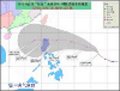
20110818.2301.mtsat2.x.vis1km_high.95WINVEST.15kts-NAmb-170N-1500E.100pc.jpg
Last edited by supercane on Tue Aug 23, 2011 10:31 am, edited 3 times in total.
0 likes
- StormingB81
- S2K Supporter
- Posts: 5676
- Age: 42
- Joined: Thu Aug 27, 2009 1:45 am
- Location: Rockledge, Florida
- climateconcern23
- Tropical Low
- Posts: 35
- Age: 33
- Joined: Sat Mar 05, 2011 4:38 am
- Location: Philippines
- Contact:
Re: WPAC: INVEST 95W
AN AREA OF CONVECTION IS LOCATED NEAR 16.5N 150.4E,
APPROXIMATELY 360 NM EAST-NORTHEAST OF ANDERSEN AFB, GUAM. ANIMATED
MULTISPECTRAL SATELLITE IMAGERY AND A 182224Z AMSU IMAGE DEPICT A
POORLY-DEFINED LOW-LEVEL CIRCULATION CENTER (LLCC) WITH A
PERSISTENT, CURVED CONVECTIVE BAND OVER THE EASTERN SEMI-CIRCLE. THE
LLCC IS LOCATED UNDER A WESTWARD EXTENSION OF THE UPPER-LEVEL
SUBTROPICAL RIDGE BETWEEN AN ANTICYCLONE CENTERED NEAR 18N 155E AND
A TUTT CELL NEAR 22N 140E. UPPER-LEVEL CONDITIONS ARE FAVORABLE FOR
FURTHER DEVELOPMENT WITH WEAK VERTICAL WIND SHEAR (10-15 KNOTS) AND
STRONG POLEWARD OUTFLOW ENHANCED BY THE AFOREMENTIONED ANTICYCLONE
AND TUTT CELL. DYNAMIC MODELS SUPPORT SLOW (BUT UNANIMOUS)
DEVELOPMENT BETWEEN TAU 48 AND TAU 72 AFTER THE SYSTEM TRACKS WEST
OF THE NORTHERN MARIANAS. MAXIMUM SUSTAINED SURFACE WINDS ARE
ESTIMATED AT 10 TO 15 KNOTS. MINIMUM SEA LEVEL PRESSURE IS ESTIMATED
TO BE NEAR 1008 MB. BASED ON THE ILL-DEFINED, FORMATIVE LLCC, THE
POTENTIAL FOR THE DEVELOPMENT OF A SIGNIFICANT TROPICAL CYCLONE
WITHIN THE NEXT 24 HOURS IS LOW.
0 likes
Re: WPAC: INVEST 95W
I thought I noticed something firing up...
0 likes
NOTICE: I cannot give an expert analysis. Most of my "observations" are made visually with the help of only vital information provided by public advisories.
Re: WPAC: INVEST 95W
Dear West Pacific,
I always look to other basins to track tropical cyclones when you are quiet but over the past week or so since you last developed a storm, the tropics have been boring with more weak tropical storms than typhoons and hurricanes. Please wake up soon and make things interesting again. Thank you...
0 likes
Remember, all of my post aren't official. For official warnings and discussions, Please refer to your local NWS products...
NWS for the Western Pacific
https://www.weather.gov/gum/
NWS for the Western Pacific
https://www.weather.gov/gum/
-
- Category 5
- Posts: 3408
- Joined: Sat Oct 24, 2009 11:50 pm
Re: WPAC: INVEST 95W
And I'm certain this is the one euro's talking about for some time now...
Well that's the 12z ECM run, if some still don't know. It's kinda hard to determine the center of a closed low pressure system and its track if you're gonna look at the graphic images on their site, then I found this euro-plotted track map that helped me see model tracks straightforward.
A "deafening" silence in the WPAC last week...it can be expected that there will be a break in TC activity but I'm pretty sure that things will heat up as we now approach the "-ber" months, where most intense tropical cyclones form but sadly affect many areas around the WPAC basin. If I'm not mistaken, the last quarter of the year is that time when the high over north Asia is at its peak strength, thus causing more cyclones to make landfall, isn't it? All of us should now be ready.
0 likes
Personal Forecast Disclaimer:
The posts in this forum are NOT official forecast and should not be used as such. They are just the opinion of the poster and may or may not be backed by sound meteorological data. They are NOT endorsed by any professional institution or storm2k.org. For official information, please refer to the NHC and NWS products.
-
- Category 5
- Posts: 3408
- Joined: Sat Oct 24, 2009 11:50 pm
Just want to say that ECMWF is the big thing right now. It's become reliable this year and so when it says that something is gonna form and affect this, people tend to care more.
0 likes
Personal Forecast Disclaimer:
The posts in this forum are NOT official forecast and should not be used as such. They are just the opinion of the poster and may or may not be backed by sound meteorological data. They are NOT endorsed by any professional institution or storm2k.org. For official information, please refer to the NHC and NWS products.
-
- WesternPacificWeather.com
- Posts: 1215
- Age: 40
- Joined: Wed Oct 11, 2006 11:37 am
- Location: Hong Kong
- Contact:
-
- Category 2
- Posts: 637
- Joined: Wed Mar 24, 2010 3:10 am
- Location: Holbrook, NY (Long Island)
-
- WesternPacificWeather.com
- Posts: 1215
- Age: 40
- Joined: Wed Oct 11, 2006 11:37 am
- Location: Hong Kong
- Contact:
Latest ECMWF 00z run is like a Muifa II but with a faster track. Much closer to Okinawa with a recurve into S Korea. Much weaker ridge in that run (interestingly ECMWF also recurves 93L in the Atlantic along the Flordia coast and into N Carolina - I wonder if there's any correlation with the weaker ridges in this run?)
0 likes
-
- Category 2
- Posts: 637
- Joined: Wed Mar 24, 2010 3:10 am
- Location: Holbrook, NY (Long Island)
Re:
Typhoon Hunter wrote:Latest ECMWF 00z run is like a Muifa II but with a faster track. Much closer to Okinawa with a recurve into S Korea. Much weaker ridge in that run (interestingly ECMWF also recurves 93L in the Atlantic along the Flordia coast and into N Carolina - I wonder if there's any correlation with the weaker ridges in this run?)
both have strong troughs moving into the two ridges, weaken it, and allow the storms to move poleward... i'm sure there's a correlation between the troughs as well... still too early to tell the track though...
95W looking good with another hot tower firing off.. looks like an anticyclone near it too..
0 likes
-
- WesternPacificWeather.com
- Posts: 1215
- Age: 40
- Joined: Wed Oct 11, 2006 11:37 am
- Location: Hong Kong
- Contact:
Re: WPAC: INVEST 95W
You know the more I look at the ECMWF run I don't think it's this Invest out near Guam which it develops. In the early stages you can see an LPA forming east of Mindanao and tracking NE before it forms into a TC and gets pushed NW by the expanding ridge.
Certainly an interesting evolution set to take place - everything far from certain!
0 likes
-
- WestPACMet
- Posts: 1616
- Joined: Fri Sep 17, 2010 2:26 am
- Location: Tokyo, Japan
- Contact:
Re: WPAC: INVEST 95W
Pretty good consensus of this developing and running up towards the Kanto plain right now, great when I'm not home!
0 likes
Satellites, Charts and Forecasting tools for East Asia at WESTERNPACIFICWEATHER.COM
-
- WestPACMet
- Posts: 1616
- Joined: Fri Sep 17, 2010 2:26 am
- Location: Tokyo, Japan
- Contact:
Re: WPAC: INVEST 95W
Pretty good moisture circulation around this as well..
0 likes
Satellites, Charts and Forecasting tools for East Asia at WESTERNPACIFICWEATHER.COM
- StormingB81
- S2K Supporter
- Posts: 5676
- Age: 42
- Joined: Thu Aug 27, 2009 1:45 am
- Location: Rockledge, Florida
Yes and ECMWF has changed alot since last night Rob with bringing it more north...WHich is kind of good because when I saw the firth models and saw a chance it could come close to here I was like this is crazy...Of all the fesitivals we have had this year they have pretty much ALL been canceled because of Tropical weather...I was like I guess we are not supposed to have any of them this year!
0 likes
-
- Tropical Depression
- Posts: 79
- Joined: Mon May 09, 2011 3:47 am
Re: WPAC: INVEST 95W
To all the folks hoping for a good storm, please stop! I *JUST* unbanded my lawn furniture!! Muifa was enough for me - I'm perfectly happy to serve out my time here without another storm this season and then head back to the states!! kthxbye
0 likes
- StormingB81
- S2K Supporter
- Posts: 5676
- Age: 42
- Joined: Thu Aug 27, 2009 1:45 am
- Location: Rockledge, Florida
Re: WPAC: INVEST 95W
rdhdstpchld wrote:To all the folks hoping for a good storm, please stop! I *JUST* unbanded my lawn furniture!! Muifa was enough for me - I'm perfectly happy to serve out my time here without another storm this season and then head back to the states!! kthxbye
well all models are saying not even close to here more north japan..we shall see though
0 likes
-
- Category 2
- Posts: 637
- Joined: Wed Mar 24, 2010 3:10 am
- Location: Holbrook, NY (Long Island)
Re: WPAC: INVEST 95W
Typhoon Hunter wrote:You know the more I look at the ECMWF run I don't think it's this Invest out near Guam which it develops. In the early stages you can see an LPA forming east of Mindanao and tracking NE before it forms into a TC and gets pushed NW by the expanding ridge.
yeah it's not the one... Euro keeps it as an open wave or at least a weak TD although the ensembles kinda support some development for 95W...
i'm more concerned on the area near Palau/Yap...
The posts in this forum are NOT official forecast and should not be used as such. They are just the opinion of the poster and may or may not be backed by sound meteorological data. They are NOT endorsed by any professional institution or storm2k.org. For official information, please refer to the JTWC and JMA products.
0 likes
Who is online
Users browsing this forum: No registered users and 1 guest