somethingfunny wrote:Since Emily's LLC has completely dissipated, wouldn't any new vortex that forms from the remnants be named Franklin?
Remember Ivan?
I think the reasoning is that if there's any continuity at all, it gets the same name.
Moderator: S2k Moderators


somethingfunny wrote:Since Emily's LLC has completely dissipated, wouldn't any new vortex that forms from the remnants be named Franklin?
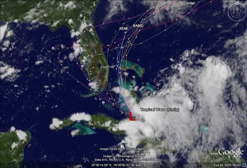
ronjon wrote:1011 mb low spotted by SSD now S-SW of Andros Island. Circulation looks elongated east-west but may be tightening up. Convection certainly on the increase.
http://www.ssd.noaa.gov/goes/flt/t2/loop-vis.html
x-y-no wrote:somethingfunny wrote:Since Emily's LLC has completely dissipated, wouldn't any new vortex that forms from the remnants be named Franklin?
Remember Ivan?
I think the reasoning is that if there's any continuity at all, it gets the same name.


x-y-no wrote:somethingfunny wrote:Since Emily's LLC has completely dissipated, wouldn't any new vortex that forms from the remnants be named Franklin?
Remember Ivan?
I think the reasoning is that if there's any continuity at all, it gets the same name.


plasticup wrote:x-y-no wrote:somethingfunny wrote:Since Emily's LLC has completely dissipated, wouldn't any new vortex that forms from the remnants be named Franklin?
Remember Ivan?
I think the reasoning is that if there's any continuity at all, it gets the same name.
Basin-crossers get two names!

cpdaman wrote:ronjon wrote:1011 mb low spotted by SSD now S-SW of Andros Island. Circulation looks elongated east-west but may be tightening up. Convection certainly on the increase.
http://www.ssd.noaa.gov/goes/flt/t2/loop-vis.html
that low seems to have dissipated....they have had difficulty all day with placement of that low
this morning at 10 it was along N central coast then at 1 pm they moved it toward 22/76 (just read nhc 2pm disco) now it's back to the west and appears to have disintergrated. IMO the real deal is still at 23 /76.5 and soon to blossome right under deep tops as upper levels shear/flow now becomes more alligned with low level flow (FINALLY)
that blow up right near 23 along 76.5 is where i believe the LLC will be or is
http://aviationweather.gov/adds/satelli ... g&itype=ir
best vorticity right there SE OF andros island
http://tropic.ssec.wisc.edu/real-time/w ... oom=&time=
the other crap further west is more eddy like IMO and ditto a spin further n near 25/75

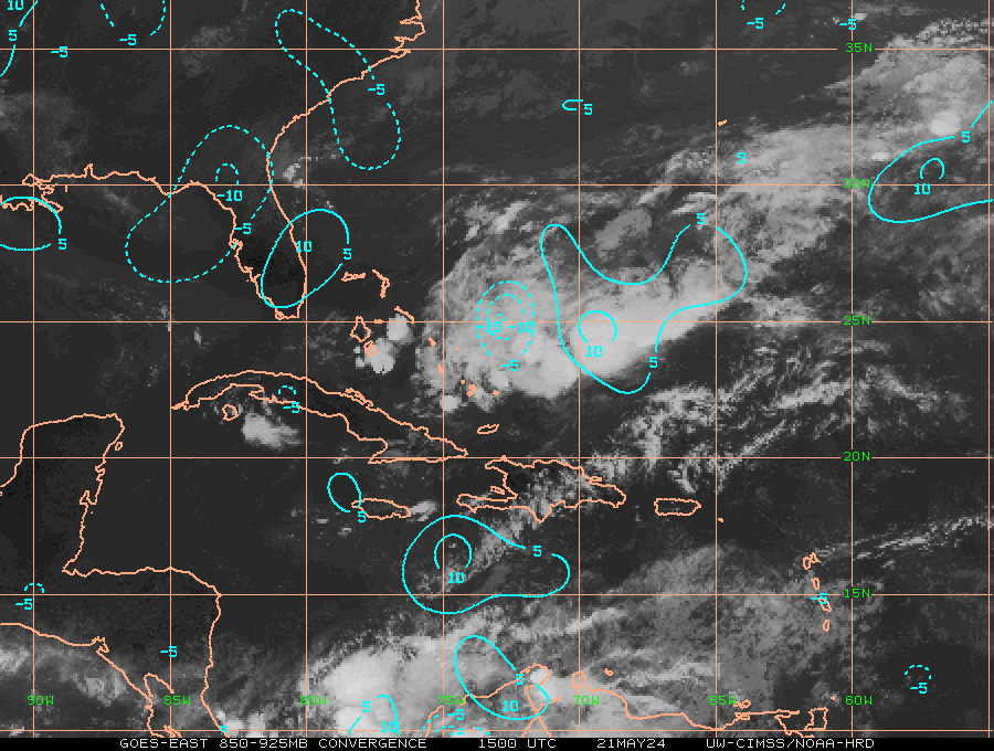
NDG wrote:I don't think she even had this much convergence when she was a full blown storm.

mutley wrote:NDG wrote:I don't think she even had this much convergence when she was a full blown storm.
Could you give me a very simple definition of what "convergence" is exactly?


Users browsing this forum: No registered users and 28 guests


