ATL: EMILY - Remnants

Moderator: S2k Moderators

Message
Author
User avatar
TreasureIslandFLGal
S2K Supporter
S2K Supporter
Posts: 1581
Age: 57
Joined: Sun Aug 15, 2004 6:16 pm
Location: Clearwater, Florida ~3 miles from the coast now. We finally moved safely off the barrier island!

Re: ATL: EMILY - Tropical Storm - Discussion

#7001 Postby TreasureIslandFLGal » Thu Aug 04, 2011 5:56 am

GCANE wrote:Outflow - speaks for itself:

http://www.goes.noaa.gov/HURRLOOPS/huwvloop.html


Is there a way to see just lower level outflow though, since the center may still be a bit disrupted from the other heights within the storm?

ok...that didn't even make sense to post....lower level doesn't really outflow. haha it inflows!
0 likes   
Chrissy & Ligeia
:flag:

User avatar
wzrgirl1
S2K Supporter
S2K Supporter
Posts: 1325
Joined: Sat Sep 04, 2004 6:44 am
Location: Pembroke Pines, Florida

Re:

#7002 Postby wzrgirl1 » Thu Aug 04, 2011 5:58 am

TreasureIslandFLGal wrote:this is still pretty weak, and definitely still being steered by lower level influences.


So hard to believe.....looks are deceiving.
0 likes   

User avatar
artist
Category 5
Category 5
Posts: 9792
Joined: Mon Jun 06, 2005 3:26 pm
Location: West Palm

#7003 Postby artist » Thu Aug 04, 2011 5:58 am

000
URNT15 KNHC 041056
AF305 1105A EMILY HDOB 12 20110804
104630 1702N 07125W 8431 01567 0100 +163 +121 176036 036 043 006 00
104700 1704N 07127W 8429 01566 0099 +162 +123 177037 038 043 007 00
104730 1705N 07128W 8430 01562 0096 +162 +123 171039 040 044 007 03
104800 1707N 07129W 8429 01562 0094 +160 +123 168042 042 046 009 00
104830 1708N 07131W 8432 01557 0093 +158 +122 165044 044 047 009 00
104900 1709N 07132W 8430 01556 0096 +150 +122 163042 044 046 010 00
104930 1711N 07134W 8421 01563 0100 +143 +121 162044 046 047 016 00
105000 1712N 07135W 8439 01546 0104 +139 +121 161047 050 051 020 00
105030 1713N 07137W 8433 01557 0103 +142 +120 150045 052 051 030 00
105100 1715N 07138W 8426 01560 0101 +141 +119 137045 048 057 037 00
105130 1716N 07140W 8429 01561 0101 +142 +120 137043 045 055 032 03
105200 1718N 07141W 8429 01552 0091 +151 +120 138039 045 057 023 03
105230 1719N 07143W 8433 01558 0090 +164 +120 129037 039 /// /// 03
105300 1719N 07145W 8432 01547 0082 +165 +119 120039 041 052 018 03
105330 1718N 07146W 8425 01558 0093 +153 +120 114034 041 041 016 03
105400 1717N 07147W 8426 01550 0088 +146 +121 107029 031 036 016 03
105430 1715N 07148W 8440 01540 0074 +168 +121 105024 030 039 008 03
105500 1713N 07148W 8445 01529 0051 +193 +122 072018 021 042 010 03
105530 1712N 07148W 8430 01538 0060 +175 +125 082023 027 042 013 00
105600 1710N 07147W 8422 01545 0067 +157 +127 099018 020 032 014 03
$$
0 likes   

User avatar
GCANE
S2K Supporter
S2K Supporter
Posts: 11501
Joined: Mon Oct 22, 2007 8:03 am

Re: ATL: EMILY - Tropical Storm - Discussion

#7004 Postby GCANE » Thu Aug 04, 2011 6:00 am

Looks like she fought off dry-air intrusion.

Currently has a nice in-feed from the ITCZ.

Could connect to the west Carb soon; if so, a good ramp up is likely.

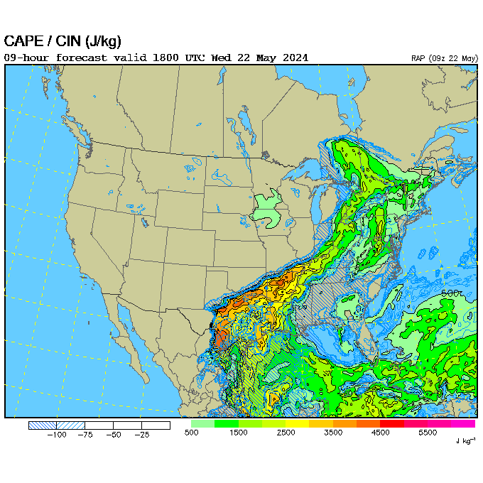
RUC is forecasting 3000 to 3500 CAPE at 20Z.


Image


Image
0 likes   

User avatar
cycloneye
Admin
Admin
Posts: 145643
Age: 68
Joined: Thu Oct 10, 2002 10:54 am
Location: San Juan, Puerto Rico

Re: ATL: EMILY - Recon

#7005 Postby cycloneye » Thu Aug 04, 2011 6:00 am

Let's have the comments posted at the recon discussion thread to have this one only for the data,thank you for the cooperation.
0 likes   
Visit the Caribbean-Central America Weather Thread where you can find at first post web cams,radars
and observations from Caribbean basin members Click Here

User avatar
cycloneye
Admin
Admin
Posts: 145643
Age: 68
Joined: Thu Oct 10, 2002 10:54 am
Location: San Juan, Puerto Rico

Re: ATL: EMILY - Recon Discussion

#7006 Postby cycloneye » Thu Aug 04, 2011 6:01 am

Hopefully,this mornings mission doesn't have problems.
0 likes   
Visit the Caribbean-Central America Weather Thread where you can find at first post web cams,radars
and observations from Caribbean basin members Click Here

User avatar
GCANE
S2K Supporter
S2K Supporter
Posts: 11501
Joined: Mon Oct 22, 2007 8:03 am

Re: ATL: EMILY - Tropical Storm - Discussion

#7007 Postby GCANE » Thu Aug 04, 2011 6:02 am

TreasureIslandFLGal wrote:
GCANE wrote:Outflow - speaks for itself:

http://www.goes.noaa.gov/HURRLOOPS/huwvloop.html


Is there a way to see just lower level outflow though, since the center may still be a bit disrupted from the other heights within the storm?

ok...that didn't even make sense to post....lower level doesn't really outflow. haha it inflows!


This one is probably the best:

http://rammb.cira.colostate.edu/product ... 1108040600
0 likes   

USTropics
Professional-Met
Professional-Met
Posts: 2659
Joined: Sun Aug 12, 2007 3:45 am
Location: Florida State University

Re: ATL: EMILY - Tropical Storm - Discussion

#7008 Postby USTropics » Thu Aug 04, 2011 6:04 am

First visible image of the day. Looking good.

Image
0 likes   

User avatar
wxman57
Moderator-Pro Met
Moderator-Pro Met
Posts: 22984
Age: 67
Joined: Sat Jun 21, 2003 8:06 pm
Location: Houston, TX (southwest)

Re: Re:

#7009 Postby wxman57 » Thu Aug 04, 2011 6:07 am

jlauderdal wrote:
Texashawk wrote:Still not even a tropical storm watch for Jamaica? Very irresponsible in my opinion.


Here are their definitions so clearly they dont think the criteria is going to be met. Complacency a huge issue generated by too many watches/warnings..besides its a mid rang tropical storm that's disorganized, anyone really think they will be caught off guard..folks in the Caribbean are pros at this stuff and know what to do, they handle tropical situations better than the USA.

Tropical Storm Watch : Indicates that Tropical Storm conditions pose a possible threat within 36 hours.

Tropical Storm Warning : Indicates that Tropical Storm conditions, including possible sustained wind speeds of 34-63 knots or 63-117 km/h, are expected within 24 hours or less.


Note that those are the old criteria for watches/warnings. The times that have been in effect unofficially since 2005 (until 2009) are 48 hours for watches, 36 hrs for warnings. This was made official a few years ago.

From the NHC website:

Tropical Storm Warning:
An announcement that tropical storm conditions (sustained winds of 39 to 73 mph) are expected somewhere within the specified area within 36 hours.

Tropical Storm Watch:
An announcement that tropical storm conditions (sustained winds of 39 to 73 mph) are possible within the specified area within 48 hours.
0 likes   

User avatar
artist
Category 5
Category 5
Posts: 9792
Joined: Mon Jun 06, 2005 3:26 pm
Location: West Palm

#7010 Postby artist » Thu Aug 04, 2011 6:08 am

000
UZNT13 KNHC 040504
XXAA 54054 99173 70663 04376 99012 28844 11522 00109 27834 10520
92796 23042 13027 85531 19858 12521 70177 09850 14026 50588 06917
16030 40759 16336 19026 88999 77999
31313 09608 80431
61616 AF309 1005A EMILY OB 02
62626 SPL 1740N06637W 0443 MBL WND 11022 AEV 20802 DLM WND 14525
012376 WL150 11021 084 REL 1733N06633W 043158 SPG 1740N06637W 044
254 =
XXBB 54058 99173 70663 04376 00012 28844 11950 24026 22850 19858
33694 09450 44594 00924 55578 00708 66536 03711 77433 14734 88402
16132 99390 165// 11376 191//
21212 00012 11522 11994 11020 22984 11023 33903 13027 44850 12521
55714 13027 66664 15526 77549 15033 88418 17029 99376 /////
31313 09608 80431
61616 AF309 1005A EMILY OB 02
62626 SPL 1740N06637W 0443 MBL WND 11022 AEV 20802 DLM WND 14525
012376 WL150 11021 084 REL 1733N06633W 043158 SPG 1740N06637W 044
254 =
;
0 likes   

User avatar
TreasureIslandFLGal
S2K Supporter
S2K Supporter
Posts: 1581
Age: 57
Joined: Sun Aug 15, 2004 6:16 pm
Location: Clearwater, Florida ~3 miles from the coast now. We finally moved safely off the barrier island!

#7011 Postby TreasureIslandFLGal » Thu Aug 04, 2011 6:08 am

good morning wxman57 8-)
0 likes   
Chrissy & Ligeia
:flag:

User avatar
artist
Category 5
Category 5
Posts: 9792
Joined: Mon Jun 06, 2005 3:26 pm
Location: West Palm

#7012 Postby artist » Thu Aug 04, 2011 6:08 am

000
URNT11 KNHC 041034
97779 10314 50163 70718 15200 16036 17119 /2512
RMK AF305 1105A EMILY OB 01
SWS = 27 KTS
0 likes   

User avatar
artist
Category 5
Category 5
Posts: 9792
Joined: Mon Jun 06, 2005 3:26 pm
Location: West Palm

#7013 Postby artist » Thu Aug 04, 2011 6:08 am

000
URNT15 KNHC 041106
AF305 1105A EMILY HDOB 13 20110804
105630 1708N 07147W 8432 01532 0065 +157 +127 099011 014 030 012 03
105700 1707N 07148W 8426 01536 0055 +173 +127 109007 008 029 005 03
105730 1705N 07148W 8436 01527 0052 +178 +127 127004 005 028 007 03
105800 1704N 07149W 8432 01532 0059 +166 +129 045003 005 025 006 03
105830 1703N 07150W 8428 01538 0061 +166 +129 016012 018 /// /// 03
105900 1703N 07152W 8429 01539 0060 +170 +130 020024 028 025 006 03
105930 1704N 07153W 8433 01536 0054 +186 +131 020031 033 024 007 00
110000 1704N 07153W 8433 01536 0051 +197 +131 010031 032 020 006 00
110030 1705N 07156W 8433 01544 0057 +195 +134 009028 029 021 004 03
110100 1706N 07158W 8424 01553 0055 +200 +138 010027 027 /// /// 03
110130 1707N 07159W 8431 01550 0056 +205 +142 019028 029 026 006 00
110200 1708N 07200W 8431 01551 0059 +201 +146 025029 030 025 005 00
110230 1709N 07202W 8426 01557 0062 +197 +149 029027 029 025 006 00
110300 1710N 07203W 8432 01555 0067 +191 +152 033025 026 030 005 00
110330 1710N 07205W 8429 01558 0069 +192 +154 035025 026 030 005 00
110400 1711N 07206W 8429 01560 0072 +190 +155 038023 024 029 005 03
110430 1712N 07208W 8430 01560 0072 +191 +156 038022 023 032 004 00
110500 1713N 07209W 8425 01566 0073 +192 +156 037020 020 032 002 00
110530 1714N 07210W 8429 01566 0078 +190 +157 044022 023 031 003 00
110600 1715N 07212W 8432 01563 0078 +189 +157 053024 025 031 003 00
$$
;
0 likes   

jlauderdal
S2K Supporter
S2K Supporter
Posts: 7185
Joined: Wed May 19, 2004 5:46 am
Location: NE Fort Lauderdale
Contact:

Re: Re:

#7014 Postby jlauderdal » Thu Aug 04, 2011 6:11 am

wxman57 wrote:
jlauderdal wrote:
Texashawk wrote:Still not even a tropical storm watch for Jamaica? Very irresponsible in my opinion.


Here are their definitions so clearly they dont think the criteria is going to be met. Complacency a huge issue generated by too many watches/warnings..besides its a mid rang tropical storm that's disorganized, anyone really think they will be caught off guard..folks in the Caribbean are pros at this stuff and know what to do, they handle tropical situations better than the USA.

Tropical Storm Watch : Indicates that Tropical Storm conditions pose a possible threat within 36 hours.

Tropical Storm Warning : Indicates that Tropical Storm conditions, including possible sustained wind speeds of 34-63 knots or 63-117 km/h, are expected within 24 hours or less.


Note that those are the old criteria for watches/warnings. The times that have been in effect unofficially since 2005 (until 2010) are 48 hours for watches, 36 hrs for warnings. This was made official last year.

From the NHC website:

Tropical Storm Warning:
An announcement that tropical storm conditions (sustained winds of 39 to 73 mph) are expected somewhere within the specified area within 36 hours.

Tropical Storm Watch:
An announcement that tropical storm conditions (sustained winds of 39 to 73 mph) are possible within the specified area within 48 hours.


We were talking jamaica so I pulled the definitions off their website, ya mon. :lol:
0 likes   

User avatar
TreasureIslandFLGal
S2K Supporter
S2K Supporter
Posts: 1581
Age: 57
Joined: Sun Aug 15, 2004 6:16 pm
Location: Clearwater, Florida ~3 miles from the coast now. We finally moved safely off the barrier island!

#7015 Postby TreasureIslandFLGal » Thu Aug 04, 2011 6:13 am

bamms staying with the westward, gulf-bound solution this morning. one says hello to Tampa Bay even, aka a Charlie-like path.
Emily better make that turn asap. -cuz I have some Rays games to go to this weekend! (Seeing the GoGo's after Friday's game. ) :P
0 likes   
Chrissy & Ligeia
:flag:

User avatar
cycloneye
Admin
Admin
Posts: 145643
Age: 68
Joined: Thu Oct 10, 2002 10:54 am
Location: San Juan, Puerto Rico

Re: ATL: EMILY - Tropical Storm - Discussion

#7016 Postby cycloneye » Thu Aug 04, 2011 6:13 am

Lowest pressure found was 1005.1 mbs.

Code: Select all

0051
0 likes   
Visit the Caribbean-Central America Weather Thread where you can find at first post web cams,radars
and observations from Caribbean basin members Click Here

User avatar
GCANE
S2K Supporter
S2K Supporter
Posts: 11501
Joined: Mon Oct 22, 2007 8:03 am

Re: ATL: EMILY - Tropical Storm - Discussion

#7017 Postby GCANE » Thu Aug 04, 2011 6:13 am

Ascent is forecast to be pretty strong between Jamaica and Haiti.

Looks like a good opportunity for Emily to ramp up there.


Image
0 likes   

User avatar
GCANE
S2K Supporter
S2K Supporter
Posts: 11501
Joined: Mon Oct 22, 2007 8:03 am

Re:

#7018 Postby GCANE » Thu Aug 04, 2011 6:15 am

TreasureIslandFLGal wrote:bamms staying with the westward, gulf-bound solution this morning. one says hello to Tampa Bay even, aka a Charlie-like path.
Emily better make that turn asap. -cuz I have some Rays games to go to this weekend! (Seeing the GoGo's after Friday's game. ) :P


To tell you the truth, that has been my gut feeling with Emily since day one.
0 likes   

User avatar
artist
Category 5
Category 5
Posts: 9792
Joined: Mon Jun 06, 2005 3:26 pm
Location: West Palm

#7019 Postby artist » Thu Aug 04, 2011 6:15 am

anyone able to do images for me? I have the obs.
0 likes   

User avatar
cycloneye
Admin
Admin
Posts: 145643
Age: 68
Joined: Thu Oct 10, 2002 10:54 am
Location: San Juan, Puerto Rico

Re: ATL: EMILY - Tropical Storm - Discussion

#7020 Postby cycloneye » Thu Aug 04, 2011 6:17 am

GCANE, for those who may not know,what is Ascent?
0 likes   
Visit the Caribbean-Central America Weather Thread where you can find at first post web cams,radars
and observations from Caribbean basin members Click Here


Return to “2011”

Who is online

Users browsing this forum: No registered users and 0 guests