dwsqos2 wrote:http://imageshack.us/photo/my-images/28/201108030078486skewt.gif/
Time-sensitive link:
http://weather.uwyo.edu/cgi-bin/soundin ... STNM=78486
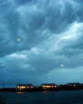
Someone observed this on another board, and this is actually his image. So don't accuse me of plagiarism. But, it's worth noting here. Observe the 300 mb winds out of the NW at 20 knots and the 850 mb winds out the NE at 27 knots. Very different velocities at very different altitudes, in other words there is quite strong 850-300 mb shear present. This is pretty obvious to me on visible satellite as well. Shear undercutting the outflow layer tends to be pretty noxious to tropical cyclones see Tomas and Erika as examples.
That makes sense in why Emily has its current presentation and until that shear abates if ever, this will not become a strong system