WPAC: MUIFA (Kabayan) - Tropical Depression
Moderator: S2k Moderators
-
phwxenthusiast
- Category 2

- Posts: 637
- Joined: Wed Mar 24, 2010 3:10 am
- Location: Holbrook, NY (Long Island)
Re: WPAC: MUIFA (Kabayan) - Typhoon
Does it look like it's taking on dry air to anyone else? Wondering if what happened to Ma-On could end up happening here...
0 likes
- hawaiigirl
- Tropical Depression

- Posts: 51
- Age: 41
- Joined: Thu Aug 06, 2009 6:38 pm
-
phwxenthusiast
- Category 2

- Posts: 637
- Joined: Wed Mar 24, 2010 3:10 am
- Location: Holbrook, NY (Long Island)
http://tropic.ssec.wisc.edu/real-time/m ... /main.html
anyway: latest MI, EWRC seems to be well underway now..

0 likes
Re: WPAC: MUIFA (Kabayan) - Typhoon
hawaiigirl wrote:Hurricanes fascinate me. But I do hope this one spares lives. Is Okinawa prepared in your opinion?
I think so. Songda, the typhoon that hit a few months ago, was a great wakeup for everyone about what happens when you take the "It's not going to hit us" mentality to the extreme and make NO preparations. Yesterday, you wouldn't have even known a typhoon was coming. Monday, the start of the work week and everyone going back to work, word spread fast. Now, EVERYONE is talking about this typhoon and preparing. Except for the locals, of course. I'd imagine I'll probably see them starting their clean-ups tomorrow if everything is still on track.
That said, I don't know if it's looking all that great, right now. Wonder if she's going to recover from that EWRC?
0 likes
Looks like the inner core has been badly weakened by events of the last 36hrs. Its pretty interesting to see just how strong it was for a brief while b ut it went down as fast as it went up...classic reaction of a system with a tiny core.
0 likes
Personal Forecast Disclaimer:
The posts in this forum are NOT official forecast and should not be used as such. They are just the opinion of the poster and may or may not be backed by sound meteorological data. They are NOT endorsed by any professional institution or storm2k.org. For official information, please refer to the NHC and NWS products
The posts in this forum are NOT official forecast and should not be used as such. They are just the opinion of the poster and may or may not be backed by sound meteorological data. They are NOT endorsed by any professional institution or storm2k.org. For official information, please refer to the NHC and NWS products
WTPQ21 RJTD 010900
RSMC TROPICAL CYCLONE ADVISORY
NAME TY 1109 MUIFA (1109)
ANALYSIS
PSTN 010900UTC 20.3N 134.1E GOOD
MOVE N 09KT
PRES 945HPA
MXWD 085KT
GUST 120KT
50KT 90NM
30KT 300NM SOUTHEAST 200NM NORTHWEST
FORECAST
24HF 020900UTC 23.0N 132.9E 70NM 70%
MOVE NW 07KT
PRES 945HPA
MXWD 085KT
GUST 120KT
45HF 030600UTC 24.2N 131.0E 110NM 70%
MOVE NW 07KT
PRES 945HPA
MXWD 085KT
GUST 120KT
69HF 040600UTC 25.4N 128.3E 160NM 70%
MOVE WNW 07KT
PRES 950HPA
MXWD 080KT
GUST 115KT =
0 likes
-
Typhoon Hunter
- WesternPacificWeather.com

- Posts: 1222
- Joined: Wed Oct 11, 2006 11:37 am
- Location: Tokyo
- Contact:
Re: WPAC: MUIFA (Kabayan) - Typhoon
Overall it seems the presentation is starting to look a little better near the centre on MTSAT IR imagery.
I see some of the models are doing silly things with Muifa:

Uploaded with ImageShack.us
I see some of the models are doing silly things with Muifa:

Uploaded with ImageShack.us
Last edited by Typhoon Hunter on Mon Aug 01, 2011 6:58 am, edited 1 time in total.
0 likes
Wow...
I've never ever seenthe ECM go that strong for a system before, 899mbs for a global models is insane.
Pretty unlikely but that really would be shocking if it even came close.
I've never ever seenthe ECM go that strong for a system before, 899mbs for a global models is insane.
Pretty unlikely but that really would be shocking if it even came close.
0 likes
Personal Forecast Disclaimer:
The posts in this forum are NOT official forecast and should not be used as such. They are just the opinion of the poster and may or may not be backed by sound meteorological data. They are NOT endorsed by any professional institution or storm2k.org. For official information, please refer to the NHC and NWS products
The posts in this forum are NOT official forecast and should not be used as such. They are just the opinion of the poster and may or may not be backed by sound meteorological data. They are NOT endorsed by any professional institution or storm2k.org. For official information, please refer to the NHC and NWS products
Re: WPAC: MUIFA (Kabayan) - Typhoon
Definitely looking better than it did an hour ago! Will have to see how it holds out overnight and if she bombs again.
0 likes
-
Typhoon Hunter
- WesternPacificWeather.com

- Posts: 1222
- Joined: Wed Oct 11, 2006 11:37 am
- Location: Tokyo
- Contact:
Re:
KWT wrote:Wow...
I've never ever seenthe ECM go that strong for a system before, 899mbs for a global models is insane.
Pretty unlikely but that really would be shocking if it even came close.
I agree especially given the latitude and proximity to Chinese coast. It's still interesting to track and save those insane charts though but for the sake of Okinawa and Zhejiang Province I hope it doesn't verify!
0 likes
-
dexterlabio
- Category 5

- Posts: 3506
- Joined: Sat Oct 24, 2009 11:50 pm
Re: WPAC: MUIFA (Kabayan) - Typhoon
I'm giving this system one more shot before it makes landfall to a large mass of land. It would still linger in the sea for some time and will be having time to finish the EWRC successfully. I'm thinking that this could bomb as it passes Okinawa...or maybe after it passes through the island. Presentation looks quite better than it was hours ago but it still needs to work on many things if it still wants to strengthen further.
0 likes
Personal Forecast Disclaimer:
The posts in this forum are NOT official forecast and should not be used as such. They are just the opinion of the poster and may or may not be backed by sound meteorological data. They are NOT endorsed by any professional institution or storm2k.org. For official information, please refer to the NHC and NWS products.
The posts in this forum are NOT official forecast and should not be used as such. They are just the opinion of the poster and may or may not be backed by sound meteorological data. They are NOT endorsed by any professional institution or storm2k.org. For official information, please refer to the NHC and NWS products.
-
Typhoon Hunter
- WesternPacificWeather.com

- Posts: 1222
- Joined: Wed Oct 11, 2006 11:37 am
- Location: Tokyo
- Contact:
Re: WPAC: MUIFA (Kabayan) - Typhoon
dexterlabio wrote:I'm giving this system one more shot before it makes landfall to a large mass of land. It would still linger in the sea for some time and will be having time to finish the EWRC successfully. I'm thinking that this could bomb as it passes Okinawa...or maybe after it passes through the island. Presentation looks quite better than it was hours ago but it still needs to work on many things if it still wants to strengthen further.
I agree Dexter - ECM certainly showing significant intensification near Okinawa over the last couple of runs so it's definitely worth paying real close attention to. Will be interesting to see what we all wake up to tomorrow morning!
0 likes
WTPQ21 RJTD 011200
RSMC TROPICAL CYCLONE ADVISORY
NAME TY 1109 MUIFA (1109)
ANALYSIS
PSTN 011200UTC 20.6N 134.2E GOOD
MOVE N 09KT
PRES 945HPA
MXWD 085KT
GUST 120KT
50KT 90NM
30KT 300NM EAST 200NM WEST
FORECAST
24HF 021200UTC 23.0N 132.7E 70NM 70%
MOVE NW 07KT
PRES 945HPA
MXWD 085KT
GUST 120KT
48HF 031200UTC 24.3N 130.2E 110NM 70%
MOVE WNW 07KT
PRES 945HPA
MXWD 085KT
GUST 120KT
72HF 041200UTC 25.5N 127.7E 160NM 70%
MOVE WNW 06KT
PRES 950HPA
MXWD 080KT
GUST 115KT =
0 likes
-
euro6208
Re: WPAC: MUIFA (Kabayan) - Typhoon
Typhoon Hunter wrote:Overall it seems the presentation is starting to look a little better near the centre on MTSAT IR imagery.
I see some of the models are doing silly things with Muifa:
Uploaded with ImageShack.us
if that were to come true, 899 mb off the chinese coast near shanghai is a nightmare!
0 likes
-
dexterlabio
- Category 5

- Posts: 3506
- Joined: Sat Oct 24, 2009 11:50 pm
Re: WPAC: MUIFA (Kabayan) - Typhoon
It is now starting from scratch to rebuild a decent eye...and I'm expecting a wider and more intense one...  If it verifies, it would be fascinating for the observers like us but nasty for those along its path.
0 likes
Personal Forecast Disclaimer:
The posts in this forum are NOT official forecast and should not be used as such. They are just the opinion of the poster and may or may not be backed by sound meteorological data. They are NOT endorsed by any professional institution or storm2k.org. For official information, please refer to the NHC and NWS products.
The posts in this forum are NOT official forecast and should not be used as such. They are just the opinion of the poster and may or may not be backed by sound meteorological data. They are NOT endorsed by any professional institution or storm2k.org. For official information, please refer to the NHC and NWS products.
-
RobWESTPACWX
- WestPACMet

- Posts: 1616
- Joined: Fri Sep 17, 2010 2:26 am
- Location: Tokyo, Japan
- Contact:
Re: WPAC: MUIFA (Kabayan) - Typhoon
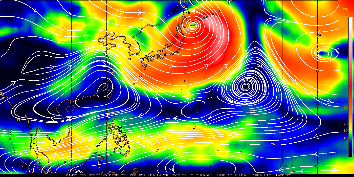
I noticed this earlier today and held my tongue on it as I was not 100% sure, but I think the ridge over china is holding on and will keep Okinawa in a better position compared to the storm. noting the most recent model runs below. and also the stream line analysis with a anticyclone over the East China Sea.


Anyone else notice this?

Anyone else notice this?
0 likes
Satellites, Charts and Forecasting tools for East Asia at WESTERNPACIFICWEATHER.COM
Re: WPAC: MUIFA (Kabayan) - Typhoon
RobWESTPACWX wrote:I noticed this earlier today and held my tongue on it as I was not 100% sure, but I think the ridge over china is holding on and will keep Okinawa in a better position compared to the storm. noting the most recent model runs below. and also the stream line analysis with a anticyclone over the East China Sea.
Anyone else notice this?
You used the wrong level.
Now, it should use this one.
0 likes
Something of a spread there on the models, some heading NW, some others go to the North/NNE...
Wonder if the ECM will go as agressive as it did on its 00z run.
Wonder if the ECM will go as agressive as it did on its 00z run.
0 likes
Personal Forecast Disclaimer:
The posts in this forum are NOT official forecast and should not be used as such. They are just the opinion of the poster and may or may not be backed by sound meteorological data. They are NOT endorsed by any professional institution or storm2k.org. For official information, please refer to the NHC and NWS products
The posts in this forum are NOT official forecast and should not be used as such. They are just the opinion of the poster and may or may not be backed by sound meteorological data. They are NOT endorsed by any professional institution or storm2k.org. For official information, please refer to the NHC and NWS products
Who is online
Users browsing this forum: No registered users and 23 guests
