ATL: EMILY - Remnants
Moderator: S2k Moderators
-
StormClouds63
- Category 2

- Posts: 583
- Age: 62
- Joined: Tue May 13, 2008 11:56 am
- Location: Southwest Louisiana
Re: ATL: INVEST 91L - Discussion
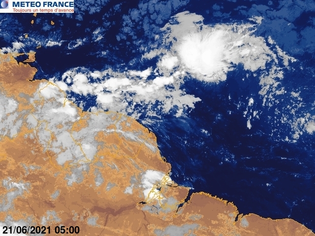
A hint of organization at approximately 13N and 44W ... still a large, disorganized system with a long way to go.
0 likes

-
Gustywind

- Category 5

- Posts: 12334
- Joined: Mon Sep 03, 2007 7:29 am
- Location: Baie-Mahault, GUADELOUPE
000
AXNT20 KNHC 292337
TWDAT
TROPICAL WEATHER DISCUSSION
NWS NATIONAL HURRICANE CENTER MIAMI FL
805 PM EDT FRI JUL 29 2011
TROPICAL WEATHER DISCUSSION FOR NORTH AMERICA...CENTRAL
AMERICA...GULF OF MEXICO...CARIBBEAN SEA...NORTHERN SECTIONS OF
SOUTH AMERICA...AND ATLANTIC OCEAN TO THE AFRICAN COAST FROM THE
EQUATOR TO 32N. THE FOLLOWING INFORMATION IS BASED ON SATELLITE
IMAGERY...WEATHER OBSERVATIONS...RADAR...AND METEOROLOGICAL
ANALYSIS.
BASED ON 1800 UTC SURFACE ANALYSIS AND SATELLITE IMAGERY THROUGH
2315 UTC.
...SPECIAL FEATURES...
TROPICAL WAVE IS ANALYZED FROM 20N45W TO 10N42W MOVING W AT
15-20 KT. A 1007 MB LOW IS CENTERED NEAR THE SOUTHERN EXTENT OF
THE WAVE NEAR 10N42W AND CONTINUES TO BE LOCATED BENEATH THE
SOUTHERN PERIPHERY OF AN UPPER LEVEL ANTICYCLONIC CIRCULATION
OVER THE CENTRAL TROPICAL ATLC CENTERED NEAR 15N41W. AN AREA OF
INCREASED TOTAL PRECIPITABLE WATER ALSO COINCIDES WITH THE WAVE
AXIS. ISOLATED MODERATE CONVECTION IS FROM 06N-14N BETWEEN
35W-48W. THIS WAVE WARRANTS WATCHING AS SOME MODELS FORECAST
DEVELOPMENT WITH A THREAT TO THE LESSER ANTILLES.
$$
FORMOSA
0 likes
-
HURAKAN

- Professional-Met

- Posts: 46084
- Age: 39
- Joined: Thu May 20, 2004 4:34 pm
- Location: Key West, FL
- Contact:
Loop: http://www.ssd.noaa.gov/goes/flt/t2/flash-rgb.html
This is a better loop and IN MY OPINION, it appears to be getting better organized although it's large.
This is a better loop and IN MY OPINION, it appears to be getting better organized although it's large.
0 likes
-
SouthDadeFish

- Professional-Met
- Posts: 2835
- Joined: Thu Sep 23, 2010 2:54 pm
- Location: Miami, FL
- Contact:
-
Aric Dunn
- Category 5
- Posts: 21238
- Age: 43
- Joined: Sun Sep 19, 2004 9:58 pm
- Location: Ready for the Chase.
- Contact:
Re: ATL: INVEST 91L - Discussion
Well on its way for a tc late tomorrow.
0 likes
Note: If I make a post that is brief. Please refer back to previous posts for the analysis or reasoning. I do not re-write/qoute what my initial post said each time.
If there is nothing before... then just ask
Space & Atmospheric Physicist, Embry-Riddle Aeronautical University,
I believe the sky is falling...
If there is nothing before... then just ask
Space & Atmospheric Physicist, Embry-Riddle Aeronautical University,
I believe the sky is falling...
-
cycloneye

- Admin

- Posts: 149429
- Age: 69
- Joined: Thu Oct 10, 2002 10:54 am
- Location: San Juan, Puerto Rico
Re:
Gustywind wrote:Hey Cycloneye, maybe a poll is in the air? no? TD or not tommorow?
You posted the question
0 likes
Visit the Caribbean-Central America Weather Thread where you can find at first post web cams,radars
and observations from Caribbean basin members Click Here
and observations from Caribbean basin members Click Here
-
cycloneye
- Admin
- Posts: 149429
- Age: 69
- Joined: Thu Oct 10, 2002 10:54 am
- Location: San Juan, Puerto Rico
Re: ATL: INVEST 91L - Discussion
This system has a huge moisture envelope that will help fend off the dry air.

0 likes
Visit the Caribbean-Central America Weather Thread where you can find at first post web cams,radars
and observations from Caribbean basin members Click Here
and observations from Caribbean basin members Click Here
-
AJC3

- Admin
- Posts: 4155
- Age: 62
- Joined: Tue Aug 31, 2004 7:04 pm
- Location: Ballston Spa, New York
- Contact:
Re: Re:
KWT wrote:gatorcane wrote:
Sure but we are talking 180 hours plus here. Still alot of room for error.
I need to see the ECMWF showing that kind of trough that far out and I will be more convinced. Right now the ECMWF (and CMC) build back a ridge along the Eastern Coast of the US pretty quickly by then....
Though even so we are still 8+ days away at least and models can flip-flop....
ECM has no rebuilding ridge...look at the *heights*, there is a CLEAR weakness.
http://www.ecmwf.int/products/forecasts ... !chart.gif
EVen stronger at 196hrs:
http://www.ecmwf.int/products/forecasts ... !chart.gif
Overdone that is though IMO!!!
you can even see a small upper low present between the upper ridges...and troughing present between 65-80W...not too strong but enough to turn a decent system northwards I'd have thought.
It'd have to stay sub-hurricane to miss the weakness both the GFs/ECM have...
As you say, long ole way to go yet though...but the broad pattern is usually quite good at this range.
Those charts are from the 00 UTC run on 7/25.
0 likes
-
cycloneye
- Admin
- Posts: 149429
- Age: 69
- Joined: Thu Oct 10, 2002 10:54 am
- Location: San Juan, Puerto Rico
Re: ATL: INVEST 91L - Discussion
The San Juan NWS continues to discuss about this wave.
AREA FORECAST DISCUSSION
NATIONAL WEATHER SERVICE SAN JUAN PR
1050 PM AST FRI JUL 29 2011
.UPDATE...
INDUCED LOW TO MID LEVEL TROUGH JUST EAST OF THE REGION IS HELPING
TO CREATE A MODERATE EAST NORTHEAST LOW LEVEL WIND FLOW ACROSS THE
LOCAL AREA. THIS IS ALSO HELPING TO TRANSPORT PATCHES OF TRADE
WIND SHOWERS AND LOW TO MID LEVEL CLOUDINESS ACROSS THE LOCAL WATERS
AND PARTS OF THE ISLANDS. EXPECT A GRADUAL SHIFT BACK TO THE EAST
BY SATURDAY MORNING AS SURFACE HIGH PRESSURE SINKS SLIGHTLY FURTHER
SOUTH ACROSS THE NORTHEAST CARIBBEAN PRODUCING MODERATE TO STRONG
EASTERLIES. ON SATURDAY EXPECT LINGERING MOISTURE ALONG WITH LOCAL
AND DIURNAL EFFECTS TO INDUCE AFTERNOON CONVECTION ONCE AGAIN ACROSS
PARTS OF THE ISLANDS...BUT NO WIDESPREAD RAINFALL IS EXPECTED AT
THIS TIME.
THE MAIN CONCERN AT THE MOMENT IS THE NEXT TROPICAL WAVE NOW LOCATED
NEAR 42/43 WEST. THIS FEATURE AND ASSOCIATED AREA OF LOW PRESSURE IS
EXPECTED TO SLOWLY DEVELOP AND ENTER THE EASTERN CARIBBEAN LATE
TUESDAY OR EARLY WEDNESDAY. BASED ON LATEST INFORMATION FROM THE
NATIONAL HURRICANE CENTER IN MIAMI...THIS SYSTEM HAS A MEDIUM CHANCE
OF BECOMING A TROPICAL CYCLONE DURING THE NEXT 48 HOURS AS IT MOVES
WESTWARD OR WEST NORTHWESTWARD AND ENCOUNTERS MORE FAVORABLE
CONDITIONS FOR DEVELOPMENT.
REGARDLESS OF DEVELOPMENT...IT WILL BRING AN INCREASE IN WINDS
AND SEAS ACROSS THE LOCAL WATERS BY THE MIDDLE OF NEXT WEEK. THIS
IS STILL SOME WAY OUT...AND AS USUAL MODELS WILL MAKE ADJUSTMENTS
WITH TIME...SO WILL CONTINUE TO MONITOR OVER THE NEXT FEW DAYS.
RESIDENTS AND VISITORS ARE HOWEVER URGED TO STAY TUNED AND MONITOR
THE LATEST FORECASTS AND TROPICAL WEATHER OUTLOOK ISSUED BY WFO
SAN JUAN AND THE NWS NATIONAL HURRICANE CENTER. NO MAJOR CHANGES
MADE TO SHORT TERM GRIDS...BUT DID MAKE ADJUSTMENTS TO THE POPS...
WEATHER AND WINDS FOR THE LONG TERM GRIDS BASED ON LATEST MODEL
GUIDANCE.
0 likes
Visit the Caribbean-Central America Weather Thread where you can find at first post web cams,radars
and observations from Caribbean basin members Click Here
and observations from Caribbean basin members Click Here
-
dixiebreeze
- S2K Supporter

- Posts: 5140
- Joined: Wed Sep 03, 2003 5:07 pm
- Location: crystal river, fla.
-
HurricaneWarning92
- Category 2
- Posts: 520
- Joined: Sat Jul 23, 2011 4:33 pm
- Location: Pembroke Pines, S. Florida (Lat: 26.00N, Lon: 80.22W)
yeah it looks pretty impressive.
0 likes
The posts in this forum are NOT official forecast and should not be used as such. They are just the opinion of the poster and may or may not be backed by sound meteorological data. They are NOT endorsed by any professional institution or storm2k.org. For official information, please refer to the NHC and NWS products.


-
Hurricaneman

- Category 5
- Posts: 7404
- Age: 45
- Joined: Tue Aug 31, 2004 3:24 pm
- Location: central florida
Re: ATL: INVEST 91L - Discussion
this is looking good, looks like this will be Emily unless something forms out of nowhere
0 likes
Who is online
Users browsing this forum: No registered users and 23 guests