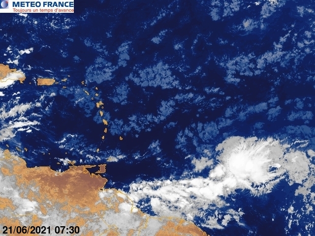
colbroe wrote:A tropical wave approaching the Lesser Antilles is from 19n54w
to 9n56w moving W at 10-15 kt. Satellite imagery and
derived winds indicate broad cyclonic low-level flow in the
vicinity of the wave axis. This wave is also embedded within a
deep moisture surge on total precipitable water imagery. Widely
scattered moderate convection is from 9n-16n between 51w-58w.
Umm, what is the lat/long's for this wave, this says it's along 54W, but the Canadian run has a wave near the islands in 144 hours? Can't be the same because this wave (54W) is almost at the islands??


