I was surprised to not see this posted anywhere. Unless I messed the thread. Anyone else notice the spin just West of Tampa. Any models picking up on this?
http://www.baynews9.com/weather/klystron9
Spin Just West of Tampa
Moderator: S2k Moderators
Forum rules

The posts in this forum are NOT official forecasts and should not be used as such. They are just the opinion of the poster and may or may not be backed by sound meteorological data. They are NOT endorsed by any professional institution or STORM2K. For official information, please refer to products from the National Hurricane Center and National Weather Service.

Re: Spin Just West of Tampa
Just some weak vorticity associated with the tail end of a frontal trough. You can get development sometimes when the end of a trough breaks off. I don't see that in this case as convection would really have to increase to lower pressures at the surface. 200 mb winds are favorable in the EGOM if something did eventually organize.

0 likes

Re: Spin Just West of Tampa
The same, with area off the east coast of Fla.

0 likes
The following post is NOT an official forecast and should not be used as such. It is just the opinion of the poster and may or may not be backed by sound meteorological data. It is NOT endorsed by any professional institution including storm2k.org For Official Information please refer to the NHC and NWS products.
-
tropicwatch

- Category 5

- Posts: 3427
- Age: 62
- Joined: Sat Jun 02, 2007 10:01 am
- Location: The Villages, Florida
- Contact:
Re: Spin Just West of Tampa
Surface winds indicate a weak circulation in the eastern GOM:
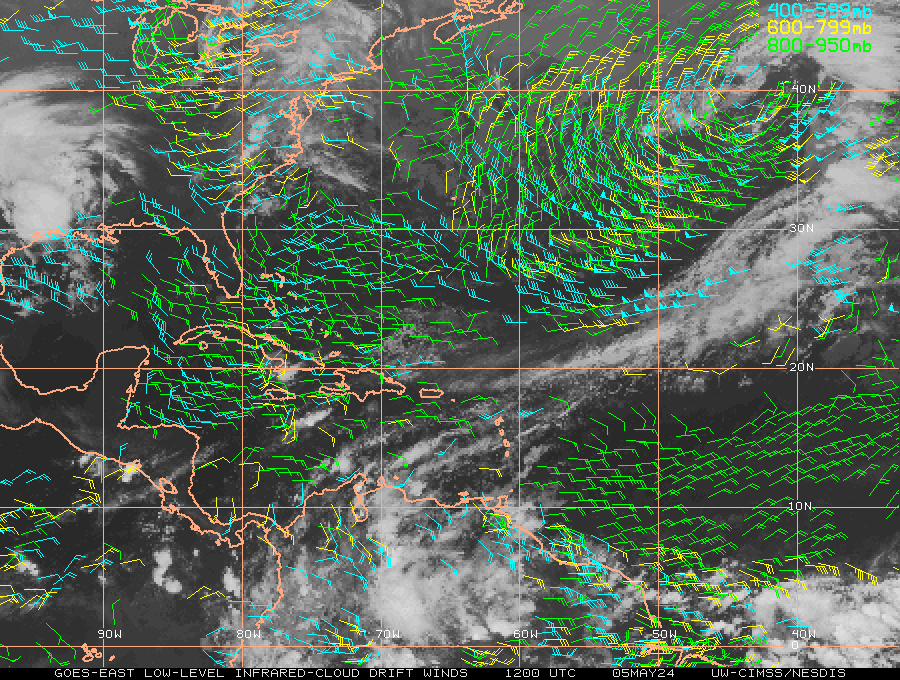
Winds aloft are minimal:

But the buoys in the eastern Gulf are not indicating falling pressure yet. The thunderstorm activity is increasing so this area might be worth watching.
Tropicwatch
Winds aloft are minimal:
But the buoys in the eastern Gulf are not indicating falling pressure yet. The thunderstorm activity is increasing so this area might be worth watching.
Tropicwatch
0 likes
-
JonathanBelles
- Professional-Met

- Posts: 11430
- Age: 35
- Joined: Sat Dec 24, 2005 9:00 pm
- Location: School: Florida State University (Tallahassee, FL) Home: St. Petersburg, Florida
- Contact:
-
srainhoutx

- S2K Supporter

- Posts: 6919
- Age: 68
- Joined: Sun Jan 14, 2007 11:34 am
- Location: Haywood County, NC
- Contact:
Re: Spin Just West of Tampa
The GFS suggests a weak disturbance in the Central Gulf from this. We will see if increased rain chances are ahead for the drought parched Northern and Western Gulf regions.
0 likes
Carla/Alicia/Jerry(In The Eye)/Michelle/Charley/Ivan/Dennis/Katrina/Rita/Wilma/Ike/Harvey
Member: National Weather Association
Wx Infinity Forums
http://wxinfinity.com/index.php
Facebook.com/WeatherInfinity
Twitter @WeatherInfinity
Member: National Weather Association
Wx Infinity Forums
http://wxinfinity.com/index.php
Facebook.com/WeatherInfinity
Twitter @WeatherInfinity
-
brunota2003

- S2K Supporter
- Posts: 9476
- Age: 35
- Joined: Sat Jul 30, 2005 9:56 pm
- Location: Stanton, KY...formerly Havelock, NC
- Contact:
Re:
brunota2003 wrote:I see plenty of outflow boundaries there.
That's pretty typical at this stage right? I mean this would take 2 or 3 days to really show signs of tropical development.
0 likes
The following post is NOT an official forecast and should not be used as such. It is just the opinion of the poster and may or may not be backed by sound meteorological data. It is NOT endorsed by any professional institution including storm2k.org For Official Information please refer to the NHC and NWS products.
Re: Spin Just West of Tampa
Happy Independence Day S2Kers I'm putting out a loose naked swirl alert out for the NE TX.\La. gulf coast.
You can expect a shower to hit right after you lite the BBQ pit and maybe a breeze but mostly a sunny hot day!

This is the tail end of that trough that was near Tampa a few days ago.
You can expect a shower to hit right after you lite the BBQ pit and maybe a breeze but mostly a sunny hot day!
This is the tail end of that trough that was near Tampa a few days ago.
0 likes
The following post is NOT an official forecast and should not be used as such. It is just the opinion of the poster and may or may not be backed by sound meteorological data. It is NOT endorsed by any professional institution including storm2k.org For Official Information please refer to the NHC and NWS products.
Who is online
Users browsing this forum: No registered users and 416 guests