
Gulf Disturbance Week of June 27th (Is invest 95L)
Moderator: S2k Moderators
Forum rules

The posts in this forum are NOT official forecasts and should not be used as such. They are just the opinion of the poster and may or may not be backed by sound meteorological data. They are NOT endorsed by any professional institution or STORM2K. For official information, please refer to products from the National Hurricane Center and National Weather Service.
-
MississippiWx

- S2K Supporter

- Posts: 1720
- Joined: Sat Aug 14, 2010 1:44 pm
- Location: Hattiesburg, Mississippi
Re: Possible Gulf Disturbance (Next week)
180 hours:
0 likes
This post is not an official forecast and should not be used as such. It is just the opinion of MississippiWx and may or may not be backed by sound meteorological data. It is not endorsed by any professional institution including storm2k.org. For Official Information please refer to the NHC and NWS products.
-
Ivanhater

- Storm2k Moderator

- Posts: 11222
- Age: 39
- Joined: Fri Jul 01, 2005 8:25 am
- Location: Pensacola
Re: Possible Gulf Disturbance (Next week)
Ridge is getting elongated from SW to NE over Missouri allowing the ridge to break down in the Gulf...interesting

0 likes
Michael
-
MississippiWx
- S2K Supporter
- Posts: 1720
- Joined: Sat Aug 14, 2010 1:44 pm
- Location: Hattiesburg, Mississippi
Re: Possible Gulf Disturbance (Next week)
And 192 hours...We have landfall at Brownsville:

0 likes
This post is not an official forecast and should not be used as such. It is just the opinion of MississippiWx and may or may not be backed by sound meteorological data. It is not endorsed by any professional institution including storm2k.org. For Official Information please refer to the NHC and NWS products.
-
MississippiWx
- S2K Supporter
- Posts: 1720
- Joined: Sat Aug 14, 2010 1:44 pm
- Location: Hattiesburg, Mississippi
Re: Possible Gulf Disturbance (Next week)
Ivanhater wrote:Landfall Brownsville
About a 100 mile northward jump from the 12z GFS. Of course, the 18z is normally the worst run. We'll have to see if it's a trend on the 00z. All in all, I think it's safe to say that we will more than likely have a TD to deal with at the end of this weekend or Monday.
0 likes
This post is not an official forecast and should not be used as such. It is just the opinion of MississippiWx and may or may not be backed by sound meteorological data. It is not endorsed by any professional institution including storm2k.org. For Official Information please refer to the NHC and NWS products.

Re: Possible Gulf Disturbance (Next week)
pressure dropped a good bit the last 12hrs also, I imagine we'll get a few more changes in the coming days.
0 likes
The following post is NOT an official forecast and should not be used as such. It is just the opinion of the poster and may or may not be backed by sound meteorological data. It is NOT endorsed by any professional institution including storm2k.org For Official Information please refer to the NHC and NWS products.
-
cycloneye

- Admin

- Posts: 149789
- Age: 69
- Joined: Thu Oct 10, 2002 10:54 am
- Location: San Juan, Puerto Rico
Re: Possible Gulf Disturbance (Next week)
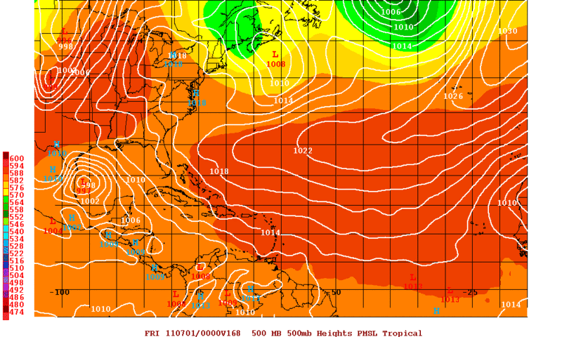
Already the development potential is present.

Uploaded by imageshack,us
Uploaded by imageshack,us
0 likes
Visit the Caribbean-Central America Weather Thread where you can find at first post web cams,radars
and observations from Caribbean basin members Click Here
and observations from Caribbean basin members Click Here


Model consistency continues to grow today. Looking more and more like TS Arlene may be in the WGOM next week. We need rain here in TX and Arlene would be very welcomed. Time to model watch in more detail this weekend.
0 likes
The following post is NOT an official forecast and should not be used as such. It is just the opinion of the poster and may or may not be backed by sound meteorological data. It is NOT endorsed by any professional institution including storm2k.org For Official Information please refer to the NHC and NWS products.
-
flwxwatcher
- Category 4

- Posts: 926
- Joined: Wed May 16, 2007 3:35 pm
- Location: Central Florida
Re:
KWT wrote:FWIW the ECM was too far south with Alex as well by a fair amount...though the GFS was too far north to balance things out...
Very true, though since Alex the GFS did get upgraded. A nice little test to see if the poleward bias has been corrected??
Last edited by flwxwatcher on Thu Jun 23, 2011 8:17 pm, edited 1 time in total.
0 likes
-
Dean4Storms
- S2K Supporter
- Posts: 6358
- Age: 63
- Joined: Sun Aug 31, 2003 1:01 pm
- Location: Miramar Bch. FL

Tonight I feel confident that a tropical cyclone is looking very likely to develop in the next 3-5 days in the Western Caribbean/BOC due to the models' persistence.
As far as a track is concerned I feel that the ECMWF is too far south while the GFS might be too far north that leaves the CMC in the middle of the two which might have the right idea, though I feel that as usual the CMC is too fast with the movement of the possible tropical system past 72 hrs.
The euro past its 96-120 hr forecast has been too strong with ridges in the past month at least while the GFS is too weak, most times.
If a weakness develops in the NW GOM if the southern ridge gains some latitude by the end of next week I think the possible system will gain latitude inching closer to S TX.
The posts in this forum are NOT official forecast and should not be used as such. They are just the opinion of the poster and may or may not be backed by sound meteorological data. They are NOT endorsed by any professional institution or storm2k.org. For official information, please refer to the NHC and NWS products
0 likes
-
wxman57

- Moderator-Pro Met

- Posts: 23176
- Age: 68
- Joined: Sat Jun 21, 2003 8:06 pm
- Location: Houston, TX (southwest)
Re: Possible Gulf Disturbance (Next week)
Lots of uncertainties. The fact that the models haven't dropped the notion of development this close (3-4 days) from the event is a concern. GFS is the slowest of the models with the system, probably too slow. Trend is toward a slightly stronger ridge over TX/LA by later next week. That would mean a threat to northern Mexico or the lower TX coast vs. up here. I'm thinking 40% development chances next Mon-Wed. Probably will flare up considerably just before moving into the Yucatan late Saturday.
0 likes
-
South Texas Storms

- Professional-Met

- Posts: 4263
- Joined: Thu Jun 24, 2010 12:28 am
- Location: Houston, TX
Re: Possible Gulf Disturbance (Next week)
00z GFS makes landfall at Brownsville at 186 hours. This run looks very similar to the 18z run.
0 likes
-
Rgv20

- S2K Supporter
- Posts: 2466
- Age: 39
- Joined: Wed Jan 05, 2011 5:42 pm
- Location: Edinburg/McAllen Tx
0zGFS with the strongest run yet with a 997mb low.
0 likes
The following post is NOT an official forecast and should not be used as such. It is just the opinion of the poster and may or may not be backed by sound meteorological data. It is NOT endorsed by any professional institution including storm2k.org For Official Information please refer to the NHC and NWS products.

Re: Possible Gulf Disturbance (Next week)
lest not forget Alex as it emerged off the Yuc and had those center reformations. I remember that very well....models are all over this so safe to say we will have something in the BOC and WGOM next week. Being its June/July I tend to think a MX or Lower TX coast attm.....EURO out in a few....not staying up for it this early....save it for the weekend... 
0 likes


The following post is NOT an official forecast and should not be used as such. It is just the opinion of the poster and may or may not be backed by sound meteorological data. It is NOT endorsed by any professional institution including storm2k.org. For Official Information please refer to the NHC and NWS products.
The trend is usually your friend and the GFS has continued to suggest development next week over the boc. IMO, I expect a surface reflection to take shape by late Sunday near the Yucatan. By Tuesday evening I expect a developing TD about 200 miles ESE of Tampico. In the longer range I'm calling a TS to approach the Brownsville area late next week. It appears copious rainfall in excess of 10" is a good bet from northern Mexico to Corpus Christi. Refer to Nhc and local Nws outlets. This forecast is my opinion and NOT official based on my analysis of current and forecasted Synoptics from guidance.
The trend is usually your friend and the GFS has continued to suggest development next week over the boc. IMO, I expect a surface reflection to take shape by late Sunday near the Yucatan. By Tuesday evening I expect a developing TD about 200 miles ESE of Tampico. In the longer range I'm calling a TS to approach the Brownsville area late next week. It appears copious rainfall in excess of 10" is a good bet from northern Mexico to Corpus Christi. Refer to Nhc and local Nws outlets. This forecast is my opinion and NOT official based on my analysis of current and forecasted Synoptics from guidance.
0 likes
-
dwsqos2
Re: Possible Gulf Disturbance (Next week)
Yeah, with the 6Z gfs, I would bet against genesis of anything significant. The 0Z cmc was more suppressed as well. I am close to voting no Arlene.
The posts in this forum are NOT official forecast and should not be used as such. They are just the opinion of the poster and may or may not be backed by sound meteorological data. They are NOT endorsed by any professional institution or storm2k.org. For official information, please refer to the NHC and NWS products.
The posts in this forum are NOT official forecast and should not be used as such. They are just the opinion of the poster and may or may not be backed by sound meteorological data. They are NOT endorsed by any professional institution or storm2k.org. For official information, please refer to the NHC and NWS products.
0 likes
-
plasticup
Re: Possible Gulf Disturbance (Next week)
If the trend is your friend, then it is worth noting that the trend includes a building ridge in FL/LA and even into TX. The result is that this system is being pushed father and farther south. The models are now so far south that even the tiniest bump will keep it out of the Gulf entirely and blow over central Mexico as a bit of rain.
0 likes
Who is online
Users browsing this forum: No registered users and 191 guests