GFS develops early EPAC system
Moderator: S2k Moderators
Forum rules

The posts in this forum are NOT official forecasts and should not be used as such. They are just the opinion of the poster and may or may not be backed by sound meteorological data. They are NOT endorsed by any professional institution or STORM2K. For official information, please refer to products from the National Hurricane Center and National Weather Service.
-
srainhoutx

- S2K Supporter

- Posts: 6919
- Age: 68
- Joined: Sun Jan 14, 2007 11:34 am
- Location: Haywood County, NC
- Contact:
Re: GFS develops early EPAC system
Keep an eye SW of the Gulf of Tehuantepec. Models are suggesting a spin up in that area in the days ahead.
0 likes
Carla/Alicia/Jerry(In The Eye)/Michelle/Charley/Ivan/Dennis/Katrina/Rita/Wilma/Ike/Harvey
Member: National Weather Association
Wx Infinity Forums
http://wxinfinity.com/index.php
Facebook.com/WeatherInfinity
Twitter @WeatherInfinity
Member: National Weather Association
Wx Infinity Forums
http://wxinfinity.com/index.php
Facebook.com/WeatherInfinity
Twitter @WeatherInfinity
-
Florida1118
Re: GFS develops early EPAC system
ZCZC MIATWOEP ALL
TTAA00 KNHC DDHHMM
TROPICAL WEATHER OUTLOOK
NWS NATIONAL HURRICANE CENTER MIAMI FL
1100 PM PDT SUN MAY 29 2011
FOR THE EASTERN NORTH PACIFIC...EAST OF 140 DEGREES WEST LONGITUDE..
1. A BROAD AREA OF LOW PRESSURE LOCATED SEVERAL HUNDRED MILES SOUTH OF
ACAPULCO MEXICO IS PRODUCING DISORGANIZED SHOWERS AND
THUNDERSTORMS. DEVELOPMENT...IF ANY...OF THIS DISTURBANCE IS
EXPECTED TO BE SLOW TO OCCUR. THERE IS A LOW CHANCE...10
PERCENT...OF THIS SYSTEM BECOMING A TROPICAL CYCLONE DURING THE
NEXT 48 HOURS AS IT MOVES SLOWLY WESTWARD.
ELSEWHERE...TROPICAL CYCLONE FORMATION IS NOT EXPECTED DURING THE
NEXT 48 HOURS.
$$
FORECASTER CANGIALOSI
NNNN
0 likes
-
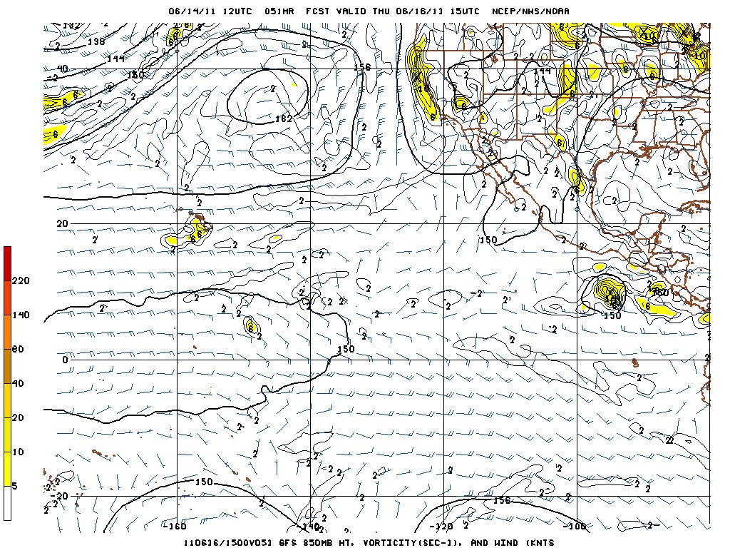
KyleEverett
- Tropical Low

- Posts: 39
- Joined: Sun Jun 27, 2010 9:13 pm
Re: GFS develops early EPAC system

Uploaded with ImageShack.us

That looks like a major hurricane. GFS has it go on to landfall after the resolution reduction.
0 likes
-
dwsqos2
-
srainhoutx
- S2K Supporter
- Posts: 6919
- Age: 68
- Joined: Sun Jan 14, 2007 11:34 am
- Location: Haywood County, NC
- Contact:
Re: GFS develops early EPAC system
The favorable MJO pulse and Kelvin wave will arrive in the EPAC first, before crossing over into the Atlantic Basin. TC genesis looks to happen by late week if the GFS and UKMET are correct.
0 likes
Carla/Alicia/Jerry(In The Eye)/Michelle/Charley/Ivan/Dennis/Katrina/Rita/Wilma/Ike/Harvey
Member: National Weather Association
Wx Infinity Forums
http://wxinfinity.com/index.php
Facebook.com/WeatherInfinity
Twitter @WeatherInfinity
Member: National Weather Association
Wx Infinity Forums
http://wxinfinity.com/index.php
Facebook.com/WeatherInfinity
Twitter @WeatherInfinity
-
srainhoutx
- S2K Supporter
- Posts: 6919
- Age: 68
- Joined: Sun Jan 14, 2007 11:34 am
- Location: Haywood County, NC
- Contact:
Re: GFS develops early EPAC system
The 12Z GFS continues to advertise TC genesis this weekend. What is interesting via that model is the area of lower pressure left behind near the Gulf of Tehuantepec and some translation over to the BoC. Something to watch in the days ahead.
0 likes
Carla/Alicia/Jerry(In The Eye)/Michelle/Charley/Ivan/Dennis/Katrina/Rita/Wilma/Ike/Harvey
Member: National Weather Association
Wx Infinity Forums
http://wxinfinity.com/index.php
Facebook.com/WeatherInfinity
Twitter @WeatherInfinity
Member: National Weather Association
Wx Infinity Forums
http://wxinfinity.com/index.php
Facebook.com/WeatherInfinity
Twitter @WeatherInfinity
-
srainhoutx
- S2K Supporter
- Posts: 6919
- Age: 68
- Joined: Sun Jan 14, 2007 11:34 am
- Location: Haywood County, NC
- Contact:
Re: GFS develops early EPAC system
HWRF run for 93L sniffing out future Adrian...

0 likes
Carla/Alicia/Jerry(In The Eye)/Michelle/Charley/Ivan/Dennis/Katrina/Rita/Wilma/Ike/Harvey
Member: National Weather Association
Wx Infinity Forums
http://wxinfinity.com/index.php
Facebook.com/WeatherInfinity
Twitter @WeatherInfinity
Member: National Weather Association
Wx Infinity Forums
http://wxinfinity.com/index.php
Facebook.com/WeatherInfinity
Twitter @WeatherInfinity
-
srainhoutx
- S2K Supporter
- Posts: 6919
- Age: 68
- Joined: Sun Jan 14, 2007 11:34 am
- Location: Haywood County, NC
- Contact:
Re: GFS develops early EPAC system
Virtaully all the models are onboard with TC genesis near the Gulf of Tehuantepec later this week into the weekend at this time. The ensembles also suggest Beatiz will form as well.
0 likes
Carla/Alicia/Jerry(In The Eye)/Michelle/Charley/Ivan/Dennis/Katrina/Rita/Wilma/Ike/Harvey
Member: National Weather Association
Wx Infinity Forums
http://wxinfinity.com/index.php
Facebook.com/WeatherInfinity
Twitter @WeatherInfinity
Member: National Weather Association
Wx Infinity Forums
http://wxinfinity.com/index.php
Facebook.com/WeatherInfinity
Twitter @WeatherInfinity
-
srainhoutx
- S2K Supporter
- Posts: 6919
- Age: 68
- Joined: Sun Jan 14, 2007 11:34 am
- Location: Haywood County, NC
- Contact:
Re: GFS develops early EPAC system
srainhoutx wrote:Virtaully all the models are onboard with TC genesis near the Gulf of Tehuantepec later this week into the weekend at this time. The ensembles also suggest Beatiz will form as well.
0 likes
Carla/Alicia/Jerry(In The Eye)/Michelle/Charley/Ivan/Dennis/Katrina/Rita/Wilma/Ike/Harvey
Member: National Weather Association
Wx Infinity Forums
http://wxinfinity.com/index.php
Facebook.com/WeatherInfinity
Twitter @WeatherInfinity
Member: National Weather Association
Wx Infinity Forums
http://wxinfinity.com/index.php
Facebook.com/WeatherInfinity
Twitter @WeatherInfinity
-
srainhoutx
- S2K Supporter
- Posts: 6919
- Age: 68
- Joined: Sun Jan 14, 2007 11:34 am
- Location: Haywood County, NC
- Contact:
Re: GFS develops early EPAC system
TROPICAL WEATHER OUTLOOK
NWS NATIONAL HURRICANE CENTER MIAMI FL
1100 AM PDT TUE JUN 14 2011
FOR THE EASTERN NORTH PACIFIC...EAST OF 140 DEGREES WEST LONGITUDE..
DISORGANIZED SHOWERS AND THUNDERSTORMS HAVE DEVELOPED IN ASSOCATION
WITH AN AREA OF DISTURBED WEATHER LOCATED SEVERAL HUNDRED MILES TO
THE SOUTHEAST OF ACAPULCO MEXICO. ENVIRONMENTAL CONDITIONS ARE
FORECAST TO BE CONDUCIVE FOR SOME SLOW DEVELOPMENT OF THIS SYSTEM
OVER THE NEXT COUPLE OF DAYS. THERE IS A LOW CHANCE...10
PERCENT...OF THIS SYSTEM BECOMING A TROPICAL CYCLONE DURING THE
NEXT 48 HOURS AS IT MOVES LITTLE.
$$
FORECASTER KIMBERLAIN
0 likes
Carla/Alicia/Jerry(In The Eye)/Michelle/Charley/Ivan/Dennis/Katrina/Rita/Wilma/Ike/Harvey
Member: National Weather Association
Wx Infinity Forums
http://wxinfinity.com/index.php
Facebook.com/WeatherInfinity
Twitter @WeatherInfinity
Member: National Weather Association
Wx Infinity Forums
http://wxinfinity.com/index.php
Facebook.com/WeatherInfinity
Twitter @WeatherInfinity
-
dwsqos2
Re: GFS develops early EPAC system
Yuck.
Dear Atmosphere,
Please turn off the EPAC.
Sincerely,
dwsqos2
Dear Atmosphere,
Please turn off the EPAC.
Sincerely,
dwsqos2
0 likes
-
srainhoutx
- S2K Supporter
- Posts: 6919
- Age: 68
- Joined: Sun Jan 14, 2007 11:34 am
- Location: Haywood County, NC
- Contact:
Re: GFS develops early EPAC system
TROPICAL WEATHER OUTLOOK
NWS NATIONAL HURRICANE CENTER MIAMI FL
500 AM PDT WED JUN 15 2011
FOR THE EASTERN NORTH PACIFIC...EAST OF 140 DEGREES WEST LONGITUDE..
DISORGANIZED SHOWERS AND THUNDERSTORMS ASSOCIATED WITH AN ELONGATED
SURFACE TROUGH OF LOW PRESSURE EXTEND FROM CENTRAL AMERICA WESTWARD
FOR SEVERAL HUNDRED MILES. ENVIRONMENTAL CONDITIONS APPEAR
CONDUCIVE FOR SOME SLOW DEVELOPMENT OF THIS SYSTEM OVER THE NEXT
SEVERAL DAYS...BUT THERE IS A LOW CHANCE...10 PERCENT...OF TROPICAL
CYCLONE FORMATION DURING THE NEXT 48 HOURS.
$$
FORECASTER KIMBERLAIN
0 likes
Carla/Alicia/Jerry(In The Eye)/Michelle/Charley/Ivan/Dennis/Katrina/Rita/Wilma/Ike/Harvey
Member: National Weather Association
Wx Infinity Forums
http://wxinfinity.com/index.php
Facebook.com/WeatherInfinity
Twitter @WeatherInfinity
Member: National Weather Association
Wx Infinity Forums
http://wxinfinity.com/index.php
Facebook.com/WeatherInfinity
Twitter @WeatherInfinity
000
ABPZ20 KNHC 160543
TWOEP
TROPICAL WEATHER OUTLOOK
NWS NATIONAL HURRICANE CENTER MIAMI FL
1100 PM PDT WED JUN 15 2011
FOR THE EASTERN NORTH PACIFIC...EAST OF 140 DEGREES WEST LONGITUDE..
A BROAD SURFACE TROUGH OF LOW PRESSURE IS LOCATED SEVERAL HUNDRED
MILES SOUTH OF GUATEMALA AND SOUTHEASTERN MEXICO. WHILE THE
ASSOCIATED SHOWER AND THUNDERSTORM ACTIVITY IS SOMEWHAT LIMITED AND
DISORGANIZED AT THIS TIME...GRADUAL DEVELOPMENT IS POSSIBLE AS A
TROPICAL WAVE NEAR CENTRAL AMERICA INTERACTS WITH THIS SYSTEM OVER
THE NEXT COUPLE OF DAYS. THERE IS A MEDIUM CHANCE...30 PERCENT...
OF TROPICAL CYCLONE FORMATION DURING THE NEXT 48 HOURS.
ELSEWHERE...TROPICAL CYCLONE FORMATION IS NOT EXPECTED DURING THE
NEXT 48 HOURS.
$$
FORECASTER BERG
Perhaps this thread should be relabeled as a general E Pac thread or spun off. Of course this may be an invest soon enough and get its own thread anyways.
0 likes
-
cycloneye

- Admin

- Posts: 149777
- Age: 69
- Joined: Thu Oct 10, 2002 10:54 am
- Location: San Juan, Puerto Rico
Re: GFS develops early EPAC system
Is now invest 92E.
0 likes
Visit the Caribbean-Central America Weather Thread where you can find at first post web cams,radars
and observations from Caribbean basin members Click Here
and observations from Caribbean basin members Click Here
-
srainhoutx
- S2K Supporter
- Posts: 6919
- Age: 68
- Joined: Sun Jan 14, 2007 11:34 am
- Location: Haywood County, NC
- Contact:
Re: GFS develops early EPAC system
The Euro, GFS and Canadian suggest a weak TC forming later in the week...
TROPICAL WEATHER OUTLOOK
NWS NATIONAL HURRICANE CENTER MIAMI FL
1100 PM PDT SUN JUL 3 2011
FOR THE EASTERN NORTH PACIFIC...EAST OF 140 DEGREES WEST LONGITUDE..
A BROAD AREA OF LOW PRESSURE LOCATED ABOUT 300 MILES SOUTH OF THE
BORDER OF GUATEMALA AND EL SALVADOR IS PRODUCING WIDESPREAD
CLOUDINESS BUT LIMITED SHOWER ACTIVITY. HOWEVER...ENVIRONMENTAL
CONDITIONS APPEAR FAVORABLE FOR SOME GRADUAL DEVELOPMENT OF THIS
DISTURBANCE AS IT MOVES WEST-NORTHWESTWARD AT 5 TO 10 MPH OVER THE
NEXT COUPLE OF DAYS. THERE IS A LOW CHANCE...10 PERCENT...OF THIS
SYSTEM BECOMING A TROPICAL CYCLONE IN THE NEXT 48 HOURS.
ELSEWHERE...TROPICAL CYCLONE FORMATION IS NOT EXPECTED DURING THE
NEXT 48 HOURS.
$$
FORECASTER STEWART
0 likes
Carla/Alicia/Jerry(In The Eye)/Michelle/Charley/Ivan/Dennis/Katrina/Rita/Wilma/Ike/Harvey
Member: National Weather Association
Wx Infinity Forums
http://wxinfinity.com/index.php
Facebook.com/WeatherInfinity
Twitter @WeatherInfinity
Member: National Weather Association
Wx Infinity Forums
http://wxinfinity.com/index.php
Facebook.com/WeatherInfinity
Twitter @WeatherInfinity
-
Kingarabian

- S2K Supporter
- Posts: 16383
- Joined: Sat Aug 08, 2009 3:06 am
- Location: Honolulu, Hawaii
Re: GFS develops early EPAC system
Gotta love the EPAC and the fishies that it spawns!
0 likes
RIP Kobe Bryant
Who is online
Users browsing this forum: No registered users and 349 guests