

Perhaps an early start to the season.
Miami AFD:
AN INTERESTING PATTERN SHOWN BY BOTH THE GFS AND ECMWF OVER THE
UPCOMING DAYS. A TROUGH CURRENTLY LIES OVER THE ATLANTIC TO THE
NORTHEAST OF THE LEEWARD ISLANDS (ALONG APPROX 60W 20-25N). BOTH
GFS/ECMWF DEVELOP THIS INTO A LOW (SUBTROPICAL?) AND TUCK THIS
FEATURE UNDERNEATH A RIDGE WHICH BUILDS OVER THE WESTERN ATLANTIC
LATE...TAKING THE LOW TOWARDS THE S-SW TOWARDS THE TURKS AND
CAICOS ISLANDS WHILE OPENING UP INTO AN INVERTED TROUGH EVENTUALLY
MOVING W-NW AND ACROSS SOUTH FL/KEYS LATE MON-EARLY TUE. SHOULD
THIS OCCUR...SOME BENEFICIAL RAIN WOULD BE POSSIBLE NEXT WEEK ON A
MOIST/MODERATELY UNSTABLE SE WIND FLOW BEHIND THE INVERTED TROUGH
AXIS.
Subtropical Development N of Leewards
Moderator: S2k Moderators
Forum rules

The posts in this forum are NOT official forecasts and should not be used as such. They are just the opinion of the poster and may or may not be backed by sound meteorological data. They are NOT endorsed by any professional institution or STORM2K. For official information, please refer to products from the National Hurricane Center and National Weather Service.
Subtropical Development N of Leewards
0 likes
The following post is NOT an official forecast and should not be used as such. It is just the opinion of the poster and may or may not be backed by sound meteorological data. It is NOT endorsed by any professional institution including storm2k.org For Official Information please refer to the NHC and NWS products.
Re: Subtropical Development N of Leewards
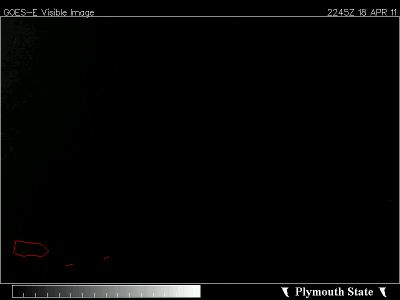
I thought it might be "thread worthy", kind of a naked swirl around 21 56

0 likes
-
Evil Jeremy

- S2K Supporter

- Posts: 5463
- Age: 32
- Joined: Mon Apr 10, 2006 2:10 pm
- Location: Los Angeles, CA
Re: Subtropical Development N of Leewards
Possible subtropical storm threat with SFL involved?
*checks calender*
Ugh, too soon.
Here are some of the frames from the 06z GFS run:
72 hours: http://www.nco.ncep.noaa.gov/pmb/nwprod ... n_072m.gif
120 hours: http://www.nco.ncep.noaa.gov/pmb/nwprod ... n_120m.gif
180 hours: http://www.nco.ncep.noaa.gov/pmb/nwprod ... n_180m.gif
*checks calender*
Ugh, too soon.
Here are some of the frames from the 06z GFS run:
72 hours: http://www.nco.ncep.noaa.gov/pmb/nwprod ... n_072m.gif
120 hours: http://www.nco.ncep.noaa.gov/pmb/nwprod ... n_120m.gif
180 hours: http://www.nco.ncep.noaa.gov/pmb/nwprod ... n_180m.gif
0 likes
Frances 04 / Jeanne 04 / Katrina 05 / Wilma 05 / Fay 08 / Debby 12 / Andrea 13 / Colin 16 / Hermine 16 / Matthew 16 / Irma 17
-
AJC3

- Admin

- Posts: 4156
- Age: 62
- Joined: Tue Aug 31, 2004 7:04 pm
- Location: Ballston Spa, New York
- Contact:
Re: Subtropical Development N of Leewards
In spite of the model guidance insistence on consolidating/deepening this system, it seems really unlikely that it will become a STC.
What's been going on the past several days is leftover frontal remnants over the west central Atlantic from late last week intesified slightly into a broad inverted trough N-NE of the islands as they interacted with a mid/upper trough that developed near and to the west of it. The upper trough has been fairly stationary since this past weekend, with the strong upper jet producing divergence (not to mention shear) on it's east side. Several transient, and rather weak low level circulations (swirls is a better word) have formed and have been carried westward underneath the upper trough, away from the area of forced ascent, but still in a high-shear environment. Conseuqently they weakened and opened up - you can barely see what's left of a couple from the past few days between 20-25N and 60-65W. I would expect the small vortex near 22N 57W will do the same.
Another thing to mention is that in absence of jet-forced UVM (upward vertical motion), the thermodynamic environment in that area is marginal at best - SST's aren't all that great, and there isn't really enough deep layer moisture/instability for any semblance of a warm core process to get started. It's just too much of an unfavorable mess out there right now, gang.
I think you'll see more of the same over the next few days - a weak baroclinic (i.e. extratropical) inverted surface trough with convection firing on the east side...pressures lower in that area...a weak eddy or two starts to form, but then gets ripped westward through a high shear, thermodynamically unfavorable environment...rinse lather repeat... until the entire setup falls apart. There could be some weak surface trough or ripple that ultimately gets sent west toward Florida by week's end, but the key word here is *weak*. I don't see it producing much other than some showers.
My 2 cents...as always YOMV.
0 likes


Re: Subtropical Development N of Leewards
With so much support from global models, I am surprised that 91L has not been declared yet.
If this disturbed wx gets under a mid and UL cyclonic circulation it will have the chance to escape the strong westerly shear thus gain some organization, I see it getting at least some subtropical charecteristics before UL conditions worsen by the weekend. SSTs in the 70s, more than plenty warm for a subtropical system to potentially form if it catches a break from UL conditions, if not nothing much will come out of this.
If this disturbed wx gets under a mid and UL cyclonic circulation it will have the chance to escape the strong westerly shear thus gain some organization, I see it getting at least some subtropical charecteristics before UL conditions worsen by the weekend. SSTs in the 70s, more than plenty warm for a subtropical system to potentially form if it catches a break from UL conditions, if not nothing much will come out of this.
0 likes

Re: Subtropical Development N of Leewards
Looks like some broad area of mid-level PV is firing weak convection from shear induced by the TUTT.
MIMIC-TPW is showing a good in-feed of boundary-layer moisture from the ITCZ.
Interesting that CMC is forecasting it moving west and phasing into a warm-core.
It could possibly see lower shear in the coming days due to the fact that it may get under an UL High in the Bahamas.
This may be induced from the WV surge seen coming across the lower GOM, thru the FL-straits & Cuba, and into the Bahamas.
A high WV signature indicates a higher tropopause height.
http://www.ssd.noaa.gov/goes/east/tatl/flash-wv.html
0 likes
-
srainhoutx

- S2K Supporter
- Posts: 6919
- Age: 68
- Joined: Sun Jan 14, 2007 11:34 am
- Location: Haywood County, NC
- Contact:
Re: Subtropical Development N of Leewards
HPC:
THE 00Z CANADIANS SUBTROPICAL/TROPICAL-LIKE CYCLONE OFFSHORE THE
CAROLINAS LATE IN THE PERIOD WAS NOT BELIEVED AT THE CURRENT TIME.
WHILE THUNDERSTORM ACTIVITY IS TRYING TO DEVELOP IN A CRESCENT
AROUND THE LOWS EASTERN AND NORTHERN SIDES /TO THE NORTHEAST OF
THE LEEWARD ISLANDS/...A STRONG SURFACE HIGH MOVING OFFSHORE THE
NORTHEAST/ATLANTIC CANADA EARLY IN THE PERIOD SHOULD FORCE THE
SYSTEM TO SHEAR APART SATURDAY AND SUNDAY DUE TO STRONG LOW LEVEL
EASTERLY FLOW...AS IMPLIED BY THE 12Z GLOBAL ENSEMBLE GUIDANCE.
0 likes
Carla/Alicia/Jerry(In The Eye)/Michelle/Charley/Ivan/Dennis/Katrina/Rita/Wilma/Ike/Harvey
Member: National Weather Association
Wx Infinity Forums
http://wxinfinity.com/index.php
Facebook.com/WeatherInfinity
Twitter @WeatherInfinity
Member: National Weather Association
Wx Infinity Forums
http://wxinfinity.com/index.php
Facebook.com/WeatherInfinity
Twitter @WeatherInfinity

Re: Subtropical Development N of Leewards
Yeah it has always been under about 50kts of shear, though yesterdays eddy is still there at ~22.5 60. That cmc graphic doesn't look right with the warm core.
0 likes
-
HURAKAN

- Professional-Met

- Posts: 46084
- Age: 39
- Joined: Thu May 20, 2004 4:34 pm
- Location: Key West, FL
- Contact:
Re: Subtropical Development N of Leewards
JEFF MASTERS:

Atlantic tropical disturbance
As a reminder that hurricane season is not that far away, an area of disturbed weather has formed in the Atlantic near 23N, 80W, about 700 miles northeast of Puerto Rico. This system is under a hefty 60 knots of wind shear, but does have a surface circulation. The disturbance's heavy thunderstorm activity has been removed well to the northeast of the surface circulation center by the high wind shear. The storm is expected to move northwest into a region of lower wind shear on Thursday and Friday, and should begin building more heavy thunderstorms during the next three days. The storm is not a threat to any land areas, and will likely be ripped apart by high wind shear this weekend. It has perhaps a 10% chance of becoming a subtropical depression before then. Climatology argues against this storm becoming the first named storm of the year; there has only been once named April storm in the Atlantic since 1851, Tropical Storm Ana of 2003.
Link: http://www.wunderground.com/blog/JeffMa ... commenttop
0 likes
-
HURAKAN
- Professional-Met
- Posts: 46084
- Age: 39
- Joined: Thu May 20, 2004 4:34 pm
- Location: Key West, FL
- Contact:
Re: Subtropical Development N of Leewards
wxman57 wrote:Bad link to Dr. Masters' blog, HURAKAN.
the link takes me to the blog
0 likes
-
wxman57

- Moderator-Pro Met

- Posts: 23176
- Age: 68
- Joined: Sat Jun 21, 2003 8:06 pm
- Location: Houston, TX (southwest)
Re: Subtropical Development N of Leewards
HURAKAN wrote:wxman57 wrote:Bad link to Dr. Masters' blog, HURAKAN.
the link takes me to the blog
I finally found it on that page, had to scroll up a ways.
0 likes
