

wxman57 wrote: Next week I'll be donning my shorts in celebration of the end of winter!
Don't be teasing us Wxman!

Moderator: S2k Moderators
 The posts in this forum are NOT official forecast and should not be used as such. They are just the opinion of the poster and may or may not be backed by sound meteorological data. They are NOT endorsed by any professional institution or STORM2K.
txagwxman wrote:wxman57 wrote:txagwxman wrote:Well this is my best shot for sleet in Tomball...
SO IT GONNA HAPPEN.
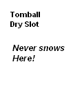
Or as my avatar says, I will get dry slotted.
Give it up. I think it's only a remote chance with such a shallow layer of sub-freezing air.
You are too dependent on the models...and it is a little shallow...but this is my last shot of the year.
http://www.twisterdata.com/data/tmp/scr ... .0000W.png


downsouthman1 wrote:Pecos (82) & Amarillo (3). Difference: 279 miles & 79 degrees.

 my Cowboys my Rockets my Astros
wxman57 wrote:txagwxman wrote:You are too dependent on the models...and it is a little shallow...but this is my last shot of the year.
http://www.twisterdata.com/data/tmp/scr ... .0000W.png
I expect that the models are not going to handle the surface temps too well (they'll be a little warm), but this airmass is quite shallow (sub-freezing layer). It will take some much colder air aloft than the models are forecasting for sleet to fall. Go ahead and enjoy your 1-2 sleet pellets if they fall. Next week I'll be donning my shorts in celebration of the end of winter!
wxman57 wrote:I expect that the models are not going to handle the surface temps too well (they'll be a little warm), but this airmass is quite shallow (sub-freezing layer). It will take some much colder air aloft than the models are forecasting for sleet to fall. Go ahead and enjoy your 1-2 sleet pellets if they fall. Next week I'll be donning my shorts in celebration of the end of winter!

downsouthman1 wrote:WV loops kind of give me the feeling that the cold air will slow down because the shortwave is gonna hold it up. I know that was said yesterday, but at least earlier today that seemed to not be the case.
http://www.atmo.arizona.edu/products/wx ... 0mbwv.html
wxman57 wrote:I expect that the models are not going to handle the surface temps too well (they'll be a little warm), but this airmass is quite shallow (sub-freezing layer). It will take some much colder air aloft than the models are forecasting for sleet to fall. Go ahead and enjoy your 1-2 sleet pellets if they fall. Next week I'll be donning my shorts in celebration of the end of winter!


SouthernMet wrote:Childress from 50 to below freezing in last hour...
SouthernMet wrote:SouthernMet wrote:Childress from 50 to below freezing in last hour...
Now 20 in Childress
kb75007 wrote:SouthernMet wrote:SouthernMet wrote:Childress from 50 to below freezing in last hour...
Now 20 in Childress
Which map do you use to track the front or what is a good one?

Ivanhater wrote:I'm not sure txag.

GRAYSONCO.WX wrote:Ivanhater wrote:I'm not sure txag.
Can you post what the HRRR is showing, please?!
Users browsing this forum: Stratton23, txtwister78 and 105 guests


