Today's Evening Update, Thanks all for the information you pass here.
[youtube]http://www.youtube.com/watch?v=I0gPNVc70tk[/youtube]
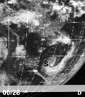
SPAC: YASI (14U /11P) - Severe Tropical Cyclone
Moderator: S2k Moderators
-
RobWESTPACWX
- WestPACMet

- Posts: 1616
- Joined: Fri Sep 17, 2010 2:26 am
- Location: Tokyo, Japan
- Contact:
Re: SPAC: YASI (09F/11P) - Tropical Cyclone
0 likes
Satellites, Charts and Forecasting tools for East Asia at WESTERNPACIFICWEATHER.COM

Re: SPAC: YASI (09F/11P) - Tropical Cyclone

Queensland braces for 'huge' Cyclone Yasi
Patients are being evacuated from hospitals in the north Queensland city of Cairns as Cyclone Yasi roars closer to the Australian coastline.
Troops are flying patients to Brisbane, while residents in coastal areas are being urged to find safer locations.
Yasi is expected to hit the state as a category four storm early on Thursday, bringing a storm surge and heavy rain.
Queensland Premier Anna Bligh has described the cyclone as "huge and life-threatening".
"This is potentially a deadly storm and we need to take it absolutely seriously," she said.
"If you are in a low-lying or waterfront area in the danger zone and beyond, you need to relocate yourself and your family to safety."
The storm has changed course in the last 24 hours and now appears set to spare central and southern parts of the state devastated by recent flooding.
It now looks likely to hit the Cairns area, but forecasters say its effects may be felt hundreds of kilometres away.

Airlines have put on extra flights to northern Queensland to help evacuate residents and tourists, while holiday-makers have been leaving resort islands.
About 250 patients from two hospitals in Cairns are being flown by the air force to Brisbane, because of expected flooding by the storm surge.
Queensland Deputy Police Commissioner Ian Stewart urged residents in affected areas to evacuate their homes on Tuesday and head south to safer regions.
"At about 0800 tomorrow, on current predictions, it will become dangerous to be driving about or walking about or doing anything outside due to the force of the winds," he said.
Officials say mandatory evacuations are likely to be enforced in Cairns.
Yasi is expected to be more powerful than Cyclone Larry, which slammed into Queensland in March 2006, leaving thousands of people homeless.
0 likes
-
Rod Hagen
- Tropical Storm

- Posts: 237
- Joined: Fri Sep 23, 2005 6:22 am
- Location: Lives in Melbourne, works in N Queensland
Re: SPAC: YASI (09F/11P) - Tropical Cyclone
Today's Evening Update, Thanks all for the information you pass here.
Many thanks for all your work with the vids, Rob. I've managed to get quite a few people in Australia to take a look at them through other discussion boards, twitter and the like. They've all found them immensely helpful in understanding Yasi - much more useful than the local mainstream media in fact.
Give yourself a pat on the back from grateful Australians!
0 likes


Yasi is now 100 kts (10-minute sustained) from the BOM, with wind gusts to 140 kt (260 km/h).
AXAU21 ABRF 011303
IDQ20018
TROPICAL CYCLONE TECHNICAL BULLETIN: AUSTRALIA - EASTERN REGION
Issued by BRISBANE TROPICAL CYCLONE WARNING CENTRE
at: 1303 UTC 01/02/2011
Name: Severe Tropical Cyclone Yasi
Identifier: 14U
Data At: 1200 UTC
Latitude: 15.0S
Longitude: 153.1E
Location Accuracy: within 20 nm [35 km]
Movement Towards: west southwest [252 deg]
Speed of Movement: 18 knots [34 km/h]
Maximum 10-Minute Wind: 100 knots [185 km/h]
Maximum 3-Second Wind Gust: 140 knots [260 km/h]
Central Pressure: 940 hPa
Radius of 34-knot winds NE quadrant: 160 nm [295 km]
Radius of 34-knot winds SE quadrant: 250 nm [465 km]
Radius of 34-knot winds SW quadrant: 250 nm [465 km]
Radius of 34-knot winds NW quadrant: 120 nm [220 km]
Radius of 48-knot winds NE quadrant: 90 nm [165 km]
Radius of 48-knot winds SE quadrant: 120 nm [220 km]
Radius of 48-knot winds SW quadrant: 120 nm [220 km]
Radius of 48-knot winds NW quadrant: 60 nm [110 km]
Radius of 64-knot winds:
Radius of Maximum Winds: 20 nm [35 km]
Dvorak Intensity Code: T6.0/6.0/D1.0/24HRS
Pressure of outermost isobar: 1002 hPa
Radius of outermost closed isobar: 210 nm [390 km]
Storm Depth: Deep
FORECAST DATA
Date/Time : Location : Loc. Accuracy: Max Wind : Central Pressure
[UTC] : degrees : nm [km]: knots[km/h]: hPa
+12: 02/0000: 16.1S 149.6E: 050 [095]: 105 [195]: 937
+24: 02/1200: 17.1S 146.0E: 080 [150]: 105 [195]: 937
+36: 03/0000: 18.4S 142.8E: 110 [205]: 050 [095]: 986
+48: 03/1200: 19.6S 140.0E: 130 [240]: 030 [060]: 998
+60: 04/0000: 20.8S 137.5E: 160 [295]: 025 [045]: 1001
+72: 04/1200: 21.5S 135.4E: 190 [350]: 025 [045]: 1000
REMARKS:
Yasi has intensified in the last 6 hours. The environment of low shear and good
upper level outflow, assisted by an upper low to the south, is conducive to
maintaining current intensity. There is the possibility of some further
intensification before landfall.
Dvorak intensity based on eye pattern [EIR B surround, OW eye] giving DT=6.0,
consistent with adjusted MET. Mean winds estimated at 100 knots.
Forecast motion is steady to the west southwest with a persisting mid-level
ridge to the south. Models are quite consistent with the forecast motion.
The combined factors of being intense, large, and motion at 18 knots are
conducive for greater wave/swell generation to the south of of the forecast
track.
With the expectation of being a large and intense system, cyclone intensity may
be maintained further inland than normal.
Copyright Commonwealth of Australia
==
The next bulletin for this system will be issued by: 01/1900 UTC by Brisbane
TCWC.
0 likes
IDQP0005
Australian Government Bureau of Meteorology
Queensland
Tropical Cyclone Warning Centre
Media: The Standard Emergency Warning Signal should NOT be used with this
warning.
TOP PRIORITY
TROPICAL CYCLONE ADVICE NUMBER 9
Issued by the Bureau of Meteorology, Brisbane
Issued at 10:59pm EST on Tuesday the 1st of February 2011
A Cyclone WARNING is current for coastal areas from Cape Melville to Sarina,
extending inland to east of Croydon to Hughenden.
A Cyclone WATCH is current for coastal areas from Lockhart River to Cape
Melville, and in the tropical interior north of Winton to Sarina.
At 10:00 pm EST Severe Tropical Cyclone Yasi, Category 4 was estimated to be
810 kilometres east northeast of Cairns and 820 kilometres northeast of
Townsville moving west southwest at 30 kilometres per hour.
YASI IS LARGE AND POWERFUL TROPICAL CYCLONE AND POSES A SERIOUS THREAT TO NORTH
QUEENSLAND COMMUNITIES
The Cyclone will continue to intensify and move in a west-southwesterly
direction overnight and during Wednesday.
DAMAGING WINDS with gusts to 90 km/hr are expected to develop on coastal islands
during Wednesday morning, then extend onto the coast during the day, and further
inland across the northern tropical interior overnight.
Between Cooktown and Ingham these winds will become DESTRUCTIVE with gusts in
excess of 125km/hr on Wednesday afternoon and VERY DESTRUCTIVE with gusts above
200 km/hr between Port Douglas and Cardwell during the evening as the cyclone
approaches. These VERY DESTRUCTIVE winds will extend onto the coastal ranges
including the Atherton Tablelands on Wednesday evening.
As the centre approaches and crosses the coast SEA LEVELS between Cairns and
Townsville will rise significantly above the normal tide with DAMAGING WAVES,
STRONG CURRENTS and FLOODING of low lying areas in coastal parts.
FLOODING RAINS will develop from Cooktown to Sarina during Wednesday afternoon
and then extend inland overnight.
People between Cape Melville and Sarina, extending inland to east of Croydon to
Hughenden should immediately commence or continue preparations, especially
securing boats and property.
- For cyclone preparedness and safety advice, visit Queensland's Disaster
Management Services website [www.disaster.qld.gov.au]
- For emergency assistance call the Queensland State Emergency Service [SES] on
132 500 [for assistance with storm damage, rising flood water, fallen trees on
buildings or roof damage].
People between Lockhart River and Cape Melville, and in the tropical interior
north of Winton to Sarina should consider what action they will need to take if
the cyclone threat increases.
- Information is available from your local government
- For cyclone preparedness and safety advice, visit Queensland's Disaster
Management Services website [www.disaster.qld.gov.au]
- For emergency assistance call the Queensland State Emergency Service [SES] on
132 500 [for assistance with storm damage, rising flood water, fallen trees on
buildings or roof damage].
Details of Severe Tropical Cyclone Yasi at 10:00 pm EST:
.Centre located near...... 15.0 degrees South 153.1 degrees East
.Location accuracy........ within 35 kilometres
.Recent movement.......... towards the west southwest at 30 kilometres per hour
.Wind gusts near centre... 260 kilometres per hour
.Severity category........ 4
.Central pressure......... 940 hectoPascals
Please ensure that neighbours have heard and understood this message,
particularly new arrivals or those who may not fully understand English.
The next advice will be issued by 2:00 am EST Wednesday 02 February.
This warning is also available through TV and Radio Broadcasts; the Bureau's
website at http://www.bom.gov.au or call 1300 659 212. The Bureau and the State
Emergency Service would appreciate this warning being broadcast regularly.
0 likes


-
WeatherGuesser
- Category 5

- Posts: 2672
- Joined: Tue Jun 29, 2010 6:46 am

-
RobWESTPACWX
- WestPACMet
- Posts: 1616
- Joined: Fri Sep 17, 2010 2:26 am
- Location: Tokyo, Japan
- Contact:
Re: SPAC: YASI (09F/11P) - Tropical Cyclone
I agree, the rainfall factor after this gets inland is going to be huge! Good thing is much of there area inland is remote, yet the population that is there will really be effected by this.
Also, a few rain showers popping up on radar now, just a few isolated ones, wouldn't really call it rain banding just yet
http://www.bom.gov.au/weather/radar/
Also, a few rain showers popping up on radar now, just a few isolated ones, wouldn't really call it rain banding just yet
http://www.bom.gov.au/weather/radar/
0 likes
Satellites, Charts and Forecasting tools for East Asia at WESTERNPACIFICWEATHER.COM

Re: SPAC: YASI (09F/11P) - Tropical Cyclone
That monster is huge!!!!  I'm glad that they're already making preparations. I think it's already a 115-120 kt cyclone, Let's see how strong it is on the next JTWC .
0 likes
JTWC 12z warning issued at 15z is out:
120G145KT
Landfall forecast for 12z tomorrow, around 10-11 pm local time, at 135G160 kt.
WTPS31 PGTW 011500
MSGID/GENADMIN/NAVMARFCSTCEN PEARL HARBOR HI/JTWC//
SUBJ/TROPICAL CYCLONE 11P (YASI) WARNING NR 006//
RMKS/
1. TROPICAL CYCLONE 11P (YASI) WARNING NR 006
01 ACTIVE TROPICAL CYCLONE IN SOUTHPAC
MAX SUSTAINED WINDS BASED ON ONE-MINUTE AVERAGE
WIND RADII VALID OVER OPEN WATER ONLY
---
WARNING POSITION:
011200Z --- NEAR 14.9S 153.2E
MOVEMENT PAST SIX HOURS - 255 DEGREES AT 17 KTS
POSITION ACCURATE TO WITHIN 020 NM
POSITION BASED ON EYE FIXED BY SATELLITE
PRESENT WIND DISTRIBUTION:
MAX SUSTAINED WINDS - 120 KT, GUSTS 145 KT
WIND RADII VALID OVER OPEN WATER ONLY
RADIUS OF 064 KT WINDS - 040 NM NORTHEAST QUADRANT
050 NM SOUTHEAST QUADRANT
050 NM SOUTHWEST QUADRANT
040 NM NORTHWEST QUADRANT
RADIUS OF 050 KT WINDS - 090 NM NORTHEAST QUADRANT
100 NM SOUTHEAST QUADRANT
100 NM SOUTHWEST QUADRANT
090 NM NORTHWEST QUADRANT
RADIUS OF 034 KT WINDS - 180 NM NORTHEAST QUADRANT
200 NM SOUTHEAST QUADRANT
200 NM SOUTHWEST QUADRANT
180 NM NORTHWEST QUADRANT
REPEAT POSIT: 14.9S 153.2E
---
FORECASTS:
12 HRS, VALID AT:
020000Z --- 15.9S 149.7E
MAX SUSTAINED WINDS - 130 KT, GUSTS 160 KT
WIND RADII VALID OVER OPEN WATER ONLY
RADIUS OF 064 KT WINDS - 050 NM NORTHEAST QUADRANT
060 NM SOUTHEAST QUADRANT
060 NM SOUTHWEST QUADRANT
050 NM NORTHWEST QUADRANT
RADIUS OF 050 KT WINDS - 100 NM NORTHEAST QUADRANT
110 NM SOUTHEAST QUADRANT
110 NM SOUTHWEST QUADRANT
100 NM NORTHWEST QUADRANT
RADIUS OF 034 KT WINDS - 190 NM NORTHEAST QUADRANT
210 NM SOUTHEAST QUADRANT
210 NM SOUTHWEST QUADRANT
190 NM NORTHWEST QUADRANT
VECTOR TO 24 HR POSIT: 250 DEG/ 18 KTS
---
24 HRS, VALID AT:
021200Z --- 17.1S 146.2E
MAX SUSTAINED WINDS - 130 KT, GUSTS 160 KT
WIND RADII VALID OVER OPEN WATER ONLY
RADIUS OF 064 KT WINDS - 050 NM NORTHEAST QUADRANT
060 NM SOUTHEAST QUADRANT
060 NM SOUTHWEST QUADRANT
050 NM NORTHWEST QUADRANT
RADIUS OF 050 KT WINDS - 100 NM NORTHEAST QUADRANT
110 NM SOUTHEAST QUADRANT
110 NM SOUTHWEST QUADRANT
100 NM NORTHWEST QUADRANT
RADIUS OF 034 KT WINDS - 190 NM NORTHEAST QUADRANT
210 NM SOUTHEAST QUADRANT
210 NM SOUTHWEST QUADRANT
190 NM NORTHWEST QUADRANT
VECTOR TO 36 HR POSIT: 245 DEG/ 17 KTS
---
36 HRS, VALID AT:
030000Z --- 18.5S 143.0E
MAX SUSTAINED WINDS - 080 KT, GUSTS 100 KT
WIND RADII VALID OVER OPEN WATER ONLY
DISSIPATING AS A SIGNIFICANT TROPICAL CYCLONE OVER LAND
VECTOR TO 48 HR POSIT: 245 DEG/ 15 KTS
---
EXTENDED OUTLOOK:
48 HRS, VALID AT:
031200Z --- 19.7S 140.2E
MAX SUSTAINED WINDS - 045 KT, GUSTS 055 KT
WIND RADII VALID OVER OPEN WATER ONLY
DISSIPATING AS A SIGNIFICANT TROPICAL CYCLONE OVER LAND
VECTOR TO 72 HR POSIT: 245 DEG/ 12 KTS
---
72 HRS, VALID AT:
041200Z --- 21.7S 135.6E
MAX SUSTAINED WINDS - 030 KT, GUSTS 040 KT
WIND RADII VALID OVER OPEN WATER ONLY
DISSIPATED AS A SIGNIFICANT TROPICAL CYCLONE OVER LAND
---
REMARKS:
011500Z POSITION NEAR 15.2S 152.3E.
TROPICAL CYCLONE (TC) 11P (YASI), LOCATED APPROXIMATELY 450 NM EAST-
NORTHEAST OF CAIRNS, AUSTRALIA, HAS TRACKED WEST-SOUTHWESTWARD AT 17
KNOTS OVER THE PAST SIX HOURS. ANIMATED INFRARED SATELLITE IMAGERY
SHOWS A 10 NM EYE, FROM WHICH THE INITIAL POSITION WAS BASED. THE
INITIAL INTENSITY WAS BASED ON PGTW AND ABRF DVORAK ESTIMATES
RANGING FROM 115 TO 127 KNOTS. A POLEWARD OUTFLOW CHANNEL INTO AN
UPPER LEVEL LOW TO THE SOUTH, ALONG WITH GOOD EQUATORWARD OUTFLOW
HAS ALLOWED FOR RAPID INTENSIFICATION WITHIN THE PAST 12 HOURS. TC
11P IS CURRENTLY TRACKING ALONG THE NORTHERN PERIPHERY OF A DEEP
LAYER SUBTROPICAL STEERING RIDGE AND IS EXPECTED TO TRACK GENERALLY
WEST-SOUTHWESTWARD THROUGHOUT THE FORECAST PERIOD. THE SYSTEM SHOULD
CONTINUE TO INTENSIFY DUE TO EXCELLENT OUTFLOW, LOW VERTICAL WIND
SHEAR, AND FAVORABLE OCEANIC CONDITIONS. AROUND TAU 24, THE SYSTEM
IS FORECAST TO MAKE LANDFALL JUST SOUTH OF CAIRNS AND BEGIN
WEAKENING AS IT TRACKS INLAND. THE AVAILABLE NUMERICAL MODEL
GUIDANCE IS IN TIGHT AGREEMENT AND TRACK CONFIDENCE IS HIGH.
MAXIMUM SIGNIFICANT WAVE HEIGHT AT 011200Z IS 38 FEET. NEXT WARNINGS
AT 020300Z AND 021500Z.//
0 likes
Willis Island observations: http://www.bom.gov.au/products/IDQ60801 ... 4299.shtml
Peak sustained wind observed so far: 41 kt at 01/1052 UTC
Peak gust observed so far: 47 kt
Minimum sea-level pressure observed so far: 999.8 hPa
Peak sustained wind observed so far: 41 kt at 01/1052 UTC
Peak gust observed so far: 47 kt
Minimum sea-level pressure observed so far: 999.8 hPa
0 likes
http://www.bom.gov.au/qld/qld-observations-map.shtml
Useful link for quickly referencing any point for observations.
Useful link for quickly referencing any point for observations.
0 likes
-
Graham1973
- Tropical Low

- Posts: 42
- Joined: Sun Jan 30, 2011 6:35 am


Re: SPAC: YASI (14U /11P) - Severe Tropical Cyclone
Yasi eye is now on Wallis Island radar. Looks like a direct hit coming so don't expect this to last too long
http://www.weatherzone.com.au/radar.jsp?lt=radar&lc=041
Brad Ambrose and Geoff Mackley are on their way up the coast to film.
http://www.weatherzone.com.au/radar.jsp?lt=radar&lc=041
Brad Ambrose and Geoff Mackley are on their way up the coast to film.
0 likes
Who is online
Users browsing this forum: No registered users and 8 guests