Well it looks like the Canadian is coming in line with the DGEX. It shows an almost identical snowstorm spreading across north Texas into southern Oklahoma new years day. Hopefully the NWS and local mets will start to catch onto this developing trend.
Note: the 00Z GFS appears to be showing a little precip breaking out across west Texas around the same time frame but not to near the magnitude of the models mentioned above.
Texas Winter 2010-2011
Moderator: S2k Moderators
Forum rules
 The posts in this forum are NOT official forecast and should not be used as such. They are just the opinion of the poster and may or may not be backed by sound meteorological data. They are NOT endorsed by any professional institution or STORM2K.

The posts in this forum are NOT official forecast and should not be used as such. They are just the opinion of the poster and may or may not be backed by sound meteorological data. They are NOT endorsed by any professional institution or STORM2K.
-
orangeblood
- S2K Supporter

- Posts: 3895
- Joined: Tue Dec 15, 2009 6:14 pm
- Location: Fort Worth, TX
Re: Texas Winter 2010-2011
0 likes

Re: Texas Winter 2010-2011
And then the Euro comes swooping down and squashes our hopes and dreams! Barely even gives us rain with it....
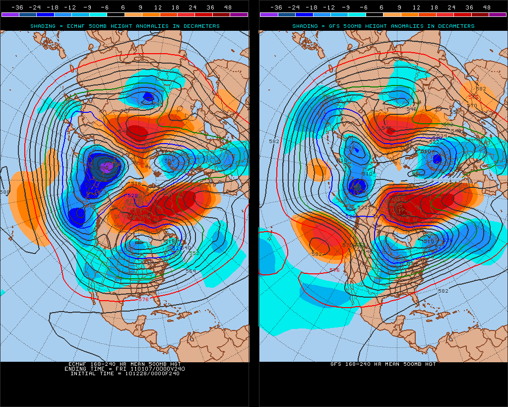
Long term 0z runs tonight says possible GOA vortex returning with the PNA going downhill again after early/mid January...Yuck!
Long term 0z runs tonight says possible GOA vortex returning with the PNA going downhill again after early/mid January...Yuck!
Last edited by Ntxw on Tue Dec 28, 2010 2:02 am, edited 1 time in total.
0 likes
The above post and any post by Ntxw is NOT an official forecast and should not be used as such. It is just the opinion of the poster and may or may not be backed by sound meteorological data. It is NOT endorsed by any professional institution including Storm2k. For official information, please refer to NWS products.
Help support Storm2K!


Re: Texas Winter 2010-2011
iorange55 wrote:This winter better not be a total bust.
There's always next winter
0 likes
The above post and any post by Ntxw is NOT an official forecast and should not be used as such. It is just the opinion of the poster and may or may not be backed by sound meteorological data. It is NOT endorsed by any professional institution including Storm2k. For official information, please refer to NWS products.
Help support Storm2K!
Help support Storm2K!
Re: Texas Winter 2010-2011
Ntxw wrote:iorange55 wrote:This winter better not be a total bust.
There's always next winter. Analog history is on our side. If history repeats itself next year should be a cold winter with El Nino again. Guess we saw this coming. Mild, dry La Nina this winter with some cool spells in between. The blocking was the saving grace from a blowtorch.
I refuse to give up hope! It's been awhile since we haven't seen any kind of winter weather. I suppose if we have to we can wait till next winter, though. When we get another snow storm that leaves us with a foot of snow.
0 likes

Re: Texas Winter 2010-2011
Well we have a few sleet pellets falling this morning in Texarkana. Nothing wide spread but I guess here is my winter weather for the year. 
0 likes
-
srainhoutx

- S2K Supporter
- Posts: 6919
- Age: 68
- Joined: Sun Jan 14, 2007 11:34 am
- Location: Haywood County, NC
- Contact:
Re: Texas Winter 2010-2011
HPC Medium Range Updated Prelim discussion goes just beyond New Years Eve, but brings up some interesting reasons why the GFS and its ensembles should be disregarded for now...
PRELIMINARY EXTENDED FORECAST DISCUSSION
NWS HYDROMETEOROLOGICAL PREDICTION CENTER CAMP SPRINGS MD
853 AM EST TUE DEC 28 2010
VALID 12Z SAT JAN 01 2011 - 12Z TUE JAN 04 2011
CURRENT MODELS SHOW EXCELLENT LONGWAVE AGREEMENT DAYS 3-7 WITH THE
POSITIVE PHASE OF THE NORTH ATLANTIC OSCILLATION STRENGTHENING
WHICH SHOULD STEER THE CUT-OFF LOW OVER THE ROCKIES EARLY IN THE
PERIOD TOWARD ONTARIO/QUEBEC...RESULTING IN A POSITIVELY-TILTED
LONGWAVE TROUGH EXTENDING INTO THE DESERT SOUTHWEST. ALTHOUGH THE
00-06Z GFS ARE SUSPICIOUSLY FAST AND OUT OF SYNC WITH OTHER
GUIDANCE WITH THE BASE OF THE CUT-OFF LOW PROGRESSING THROUGH NEW
ENGLAND. OTHERWISE...THE MAIN MODELING DIFFERENCES CONCERN THE
SPLITTING FLOW REACHING WESTERN NORTH AMERICA BY DAYS 4/5 WITH
NEARLY ALL GUIDANCE EXCEPT THE 00-06Z GFS AND MOST OF ITS ENSEMBLE
MEMBERS (BOTH 00Z AND 06Z RUNS) CONSIDERABLY MORE PROGRESSIVE AND
AT TIMES OUT OF PHASE WITH THE 00Z ECMWF/UKMET/CANADIAN. OF
PARTICULAR IMPORTANCE IS A SECONDARY CUT-OFF LOW CONSTITUTING THE
SOUTHERN STREAM WHICH STANDS TO BRING ADDITIONAL PRECIPITATION TO
PARTS OF CALIFORNIA. THE EXACT POSITION/TIMING OF THE LOW ARE
DIFFICULT TO PINPOINT DUE TO THE INCREASING SOLUTION SPREAD...AND
FOR NOW HAVE CHOSEN AN INTERMEDIATE SOLUTION WHICH CONSIDERS ALL
NON-NCEP GUIDANCE...OR ON AVERAGE...ABOUT MIDWAY BETWEEN THE
ECMWF/CANADIAN. THUS...THE UPDATED PRESSURES/FRONTS BLENDED
NON-NCEP GUIDANCE...WITH THE GFS AND GEFS MEAN NOT USED.
Also an interesting pattern developing in the medium extended range as well.
0 likes
Carla/Alicia/Jerry(In The Eye)/Michelle/Charley/Ivan/Dennis/Katrina/Rita/Wilma/Ike/Harvey
Member: National Weather Association
Wx Infinity Forums
http://wxinfinity.com/index.php
Facebook.com/WeatherInfinity
Twitter @WeatherInfinity
Member: National Weather Association
Wx Infinity Forums
http://wxinfinity.com/index.php
Facebook.com/WeatherInfinity
Twitter @WeatherInfinity
-
Portastorm

- Storm2k Moderator

- Posts: 9955
- Age: 63
- Joined: Fri Jul 11, 2003 9:16 am
- Location: Round Rock, TX
- Contact:
Re: Texas Winter 2010-2011
Geez, outside of srainhoutx, the rest of you sure "gave up the ghost" quickly on any potential wintry weather for Texas! 
Ntxw, I wouldn't get too hung up on the operational GFS runs and what they do with the Aleutian low. The key atmospheric signals (MJO, PNA, AO, NAO) as we discussed yesterday will set the table for some potential in January. I'm not saying we'll actually GET wintry weather. Just sayin' the potential should be there.
I've seen some halfway decent ice storms in the Austin area during La Nina winters. In fact, it was only several winters ago during a La Nina when we had about 40 hours of sub-freezing temps and a consistent drizzle which frosty-coated roads and surfaces here in AUS and essentially shut things down for two days.
0 likes
-
srainhoutx
- S2K Supporter
- Posts: 6919
- Age: 68
- Joined: Sun Jan 14, 2007 11:34 am
- Location: Haywood County, NC
- Contact:
Re: Texas Winter 2010-2011
I suspect way too much model hugging, Portastorm. The pattern is looking mighty interesting just after the New Year. Remember, we have mentioned that the models would struggle as the pattern change unfolded and that is exactly what we are seeing. 
0 likes
Carla/Alicia/Jerry(In The Eye)/Michelle/Charley/Ivan/Dennis/Katrina/Rita/Wilma/Ike/Harvey
Member: National Weather Association
Wx Infinity Forums
http://wxinfinity.com/index.php
Facebook.com/WeatherInfinity
Twitter @WeatherInfinity
Member: National Weather Association
Wx Infinity Forums
http://wxinfinity.com/index.php
Facebook.com/WeatherInfinity
Twitter @WeatherInfinity
-
WacoWx
- Category 2

- Posts: 692
- Joined: Mon Dec 28, 2009 4:14 pm
- Location: NOT Waco, TX ----> Dallas, TX
Re: Texas Winter 2010-2011
The following post is NOT an official forecast and should not be used as such. It is just the opinion of the poster and may or may not be backed by sound meteorological data. It is NOT endorsed by any professional institution including storm2k.org. For Official Information please refer to the NHC and NWS products.
I, for one, embrace said change.
*BOLD PREDICTION*
Ice storm 2011 will occur on Jan 24, 2011 and last for 2, no make it 3 days. Mark it.
(This is not a professional forecast, even though all of the models I posted to back up my opinion may make it appear to be of a profesisonal origin.)
Edited by Portastorm to include forecast disclaimer
0 likes
Re: Texas Winter 2010-2011
WacoWx wrote:The following post is NOT an official forecast and should not be used as such. It is just the opinion of the poster and may or may not be backed by sound meteorological data. It is NOT endorsed by any professional institution including storm2k.org. For Official Information please refer to the NHC and NWS products.
I, for one, embrace said change.
*BOLD PREDICTION*
Ice storm 2011 will occur on Jan 24, 2011 and last for 2, no make it 3 days. Mark it.
(This is not a professional forecast, even though all of the models I posted to back up my opinion may make it appear to be of a profesisonal origin.)
Edited by Portastorm to include forecast disclaimer
What models are you referring to (the one's that you say back up your opinion). Thanks.
0 likes
Any forecast I make is based on my opinion only. Please refer to the NWS or NHC for official forecasts.
I am a model hugger Portastorm! Lol. Well when there's a consensus anyway. See this is why I am not a pro met! I do not forecast the weather like many of the wonderful people on here do who have extensive knowledge on patterns, charts, experience etc, I simply interpret the models .
Btw the radar is starting to light up quite nicely. Good soaker coming for Texas.

The New Year's time frame is really giving me a hard time. It's not like there's a true 'system' to watch crashing into the west coast which we can follow (how strong, weak, etc etc). It's going to be diving from the north and getting it's act together over the inter-mountain west. Only adds to the complexion.
Adding to the ice storm threats, I don't have a good feeling for ice storms. It seems lately (few years or so) it's been snow or rain. I think the cold PDO has something to do with it. These air masses haven't been nearly shallow as they have been in years past. There hasn't been a good ice storm for pretty much anyone in the country the past two years. Lots of big snowstorms though.
Btw the radar is starting to light up quite nicely. Good soaker coming for Texas.
The New Year's time frame is really giving me a hard time. It's not like there's a true 'system' to watch crashing into the west coast which we can follow (how strong, weak, etc etc). It's going to be diving from the north and getting it's act together over the inter-mountain west. Only adds to the complexion.
Adding to the ice storm threats, I don't have a good feeling for ice storms. It seems lately (few years or so) it's been snow or rain. I think the cold PDO has something to do with it. These air masses haven't been nearly shallow as they have been in years past. There hasn't been a good ice storm for pretty much anyone in the country the past two years. Lots of big snowstorms though.
0 likes
The above post and any post by Ntxw is NOT an official forecast and should not be used as such. It is just the opinion of the poster and may or may not be backed by sound meteorological data. It is NOT endorsed by any professional institution including Storm2k. For official information, please refer to NWS products.
Help support Storm2K!
Help support Storm2K!
-
Portastorm
- Storm2k Moderator
- Posts: 9955
- Age: 63
- Joined: Fri Jul 11, 2003 9:16 am
- Location: Round Rock, TX
- Contact:
Re: Texas Winter 2010-2011
Ntxw, if you're looking for some hope, check out the 12z GFS at 120 hrs ... you'll see we have a nice Polar airmass over Texas ... check out the upper levels (anywhere from 500 mb to 850 mb) and you'll see hints of moisture and vorticity to our west/southwest. Over the next 48 hours, the operational model runs may change their 'tune' for next week and our forecasts may become a little more interesting.
Nothing wrong with hugging models ... unless you're spoken for. (ba-da-boom, ba-da-bing!)
Nothing wrong with hugging models ... unless you're spoken for. (ba-da-boom, ba-da-bing!)
0 likes
-
Portastorm
- Storm2k Moderator
- Posts: 9955
- Age: 63
- Joined: Fri Jul 11, 2003 9:16 am
- Location: Round Rock, TX
- Contact:
Re:
WacoWx wrote:So apparently my disclaimer was not official enough. I didnt have any models as that was the joke. Not a whole lot of personality over here. Still stickin with my BP though.
Carry on.
Sorry I missed the joke, WacoWx. Just doing my job and trying to keep it all real (and legal).
Keep posting.
0 likes
-
orangeblood
- S2K Supporter
- Posts: 3895
- Joined: Tue Dec 15, 2009 6:14 pm
- Location: Fort Worth, TX
Re: Texas Winter 2010-2011
Portastorm wrote:Ntxw, if you're looking for some hope, check out the 12z GFS at 120 hrs ... you'll see we have a nice Polar airmass over Texas ... check out the upper levels (anywhere from 500 mb to 850 mb) and you'll see hints of moisture and vorticity to our west/southwest. Over the next 48 hours, the operational model runs may change their 'tune' for next week and our forecasts may become a little more interesting.
Nothing wrong with hugging models ... unless you're spoken for. (ba-da-boom, ba-da-bing!)
Agreed Portastorm, that vorticity max hugging the California coast this weekend needs to watched closely over the next few days. The NOGAPS at 180 hours shows a winter storm moving through Texas from that energy coming out of California.
0 likes
Snow or no snow here in Texas, this is going to be a pretty potent and dynamic system out west. There are watches for snow as far south as the desert in Tucson, AZ and flurries possible in Las Vegas. Pretty uncommon to see snow there. Widespread winter storm advisories from border to border.
As for the comments about the next system beyond new years, just 24 hours ago it was just a wave of energy. Today's 18z it's a strong cutoff low off of California which is promising. Lets see if that trend continues.
Today on the NAM 18z

12z NAM
 +
+
Yesterday's 18z GFS for around the same time

As for the comments about the next system beyond new years, just 24 hours ago it was just a wave of energy. Today's 18z it's a strong cutoff low off of California which is promising. Lets see if that trend continues.
Today on the NAM 18z
12z NAM
+Yesterday's 18z GFS for around the same time
0 likes
The above post and any post by Ntxw is NOT an official forecast and should not be used as such. It is just the opinion of the poster and may or may not be backed by sound meteorological data. It is NOT endorsed by any professional institution including Storm2k. For official information, please refer to NWS products.
Help support Storm2K!
Help support Storm2K!
-
srainhoutx
- S2K Supporter
- Posts: 6919
- Age: 68
- Joined: Sun Jan 14, 2007 11:34 am
- Location: Haywood County, NC
- Contact:
Re: Texas Winter 2010-2011
There is still a lot of uncertainty regarding the New Years Eve front via guidance. The GFS continues to be on the faster side of the solutions, while the Euro is about 6-12 hours slower. There also is some concern that the storm currently nearing N California may dig deeper S than is forecast at this time before making the turn to the NE into the Central/Northern Plains. Also some questions still arise concerning a trailing Upper Low and how that will fit into the mix. Of note is Tucson, AZ is expecting snow and freezing temps denoting the cold nature of these systems. Infact at this hour there are Winter Watches/Warnings from the Canadian border S to the Mexican border. With the volatility via guidance, a cautious approach is the theme of the day from various NWS offices regarding frontal timing, rain chances and how quickly things will clear out after the front. Sound familiar? Just last weekend there was tremendous volatility in the guidance regarding the East Coast winter storm. It is a bit clearer that tomorrow could be a very active and interesting day for Central and East TX into LA. I would not be surprised to see some severe surface based storms fire near the Coastal regions and elevated storms further north. The Upper Air disturbance is rather strong and the dynamics associated will need to be watched closely overnight into tomorrow morning.
0 likes
Carla/Alicia/Jerry(In The Eye)/Michelle/Charley/Ivan/Dennis/Katrina/Rita/Wilma/Ike/Harvey
Member: National Weather Association
Wx Infinity Forums
http://wxinfinity.com/index.php
Facebook.com/WeatherInfinity
Twitter @WeatherInfinity
Member: National Weather Association
Wx Infinity Forums
http://wxinfinity.com/index.php
Facebook.com/WeatherInfinity
Twitter @WeatherInfinity
-
srainhoutx
- S2K Supporter
- Posts: 6919
- Age: 68
- Joined: Sun Jan 14, 2007 11:34 am
- Location: Haywood County, NC
- Contact:
Re: Texas Winter 2010-2011
A very interesting discussion from Dodge City tonight. Hmmm...
DAYS 3-7...
NEARLY ALL OF THE EXCITEMENT IN THE DAY THREE TO SEVEN PERIOD OCCURS
THURSDAY NIGHT AND FRIDAY WITH THE HIGH AMPLITUDE TROUGH THAT MOVES
THROUGH THE CENTRAL PART OF THE UNITED STATES. CHALLENGES INCLUDE
THE TYPE AND AMOUNT OF PRECIPITATION THURSDAY NIGHT AND TEMPERATURES
IN THE FRIGID ARCTIC AIR THAT INVADES THE CENTRAL PART OF THE
COUNTRY THURSDAY NIGHT AND FRIDAY. DAILY VARIATIONS AFTER PASSAGE OF
THE HIGH AMPLITUDE TROUGH WILL BE RELATIVELY MINOR AND WILL HAVE
LITTLE IMPACT ON HUMAN ACTIVITIES.
TROPICAL THUNDERSTORM ACTIVITY HAS INCREASED IN THE EASTERN INDIAN
OCEAN IN RECENT DAYS WHILE REMAINING ANOMALOUSLY WIDESPREAD ACROSS
THE MARITIME CONTINENT. RELATIVE ANGULAR MOMENTUM VALUES STILL ARE 1
TO 2 STANDARD DEVIATIONS BELOW CLIMATOLOGY, AS WOULD BE EXPECTED IN
A LA NINA YEAR. MOUNTAIN TORQUE STILL IS POSITIVE WITH MUCH OF THE
POSITIVE CONTRIBUTION COMING FROM NORTH AMERICA, BUT THE MOUNTAIN
TORQUE AND THE CALCULATED RELATIVE ANGULAR MOMENTUM TENDENCY ARE
DECREASING. THE ATMOSPHERE APPEARS TO BE ORBITING BACK TOWARD PHASE
2-3 IN THE GLOBAL WIND OSCILLATION PHASE SPACE DIAGRAM, ALTHOUGH THE
GWO SIGNAL IS WEAK AT BEST. THE WHEELER-HENDON MJO PHASE SPACE
DIAGRAM HAS PICKED UP ON THE INCREASED CONVECTION IN THE EASTERN
INDIAN OCEAN AND SUGGESTS THAT THE ATMOSPHERE IS IN PHASE 5 OF THE
MJO PHASE SPACE DIAGRAM, WHICH FAVORS ANTICYCLONIC FLOW IN WESTERN
CANADA. ADDING COMPLEXITY TO THE FLOW IS THE PERSISTENT RIDGING NEAR
GREENLAND. THE BLOCKING RIDGE NEAR GREENLAND APPEARS TO HAVE
WEAKENED TEMPORARILY, BUT MOST OF THE GFS ENSEMBLE MEMBERS ARE
SUGGESTING INCREASINGLY NEGATIVE VALUES FOR THE ARCTIC OSCILLATION
IN EARLY JANUARY. THE NET RESULT LIKELY WILL BE ONLY TEMPORARY
TROUGHING IN THE CENTRAL UNITED STATES WITH A RETURN TO BLOCKING IN
THE ATLANTIC AFTER THE FIRST OF THE YEAR, A SPLIT FLOW IN THE
EASTERN PACIFIC AND A GENERALLY PROGRESSIVE PATTERN ACROSS THE
UNITED STATES.
THE MODELS ARE IN REASONABLE AGREEMENT THROUGH DAY SEVEN, ALTHOUGH
THERE ARE DIFFERENCES IN SYNOPTIC SCALE DETAILS. THE ECMWF HAS BEEN
MOST CONSISTENT WITH HANDLING THE CENTRAL UNITED STATES UPPER LEVEL
TROUGH AND LARGELY WAS USED FOR GRID ADJUSTMENTS.
THE STRONG UPPER LEVEL TROUGH NEAR 52N/140W WILL CONTINUE DIVING
SOUTHEASTWARD INTO THE WESTERN UNITED STATES AND WILL APPROACH THE
CENTRAL PLAINS THURSDAY NIGHT. THE ECMWF CLOSES OFF A MID LEVEL
CIRCULATION IN EAST CENTRAL COLORADO BY FRIDAY MORNING AND
SUBSEQUENTLY DEEPENS THE CLOSED CYCLONE AS IT LIFTS NORTHEAST INTO
SOUTH DAKOTA BY FRIDAY EVENING. A MINOR WAVE THAT WAS NEAR 40N/140W
THIS AFTERNOON WILL MOVE THROUGH THE CENTRAL UNITED STATES DURING
THE DAY THURSDAY, AND LOW LEVEL FLOW WILL VEER BEHIND THE FIRST
TROUGH, RESULTING IN LIMITED AVAILABILITY OF LOW LEVEL MOISTURE FOR
THE STRONGER UPPER LEVEL CYCLONE. THE TRAJECTORY OF THE UPPER LEVEL
LOW IS NOT FAVORABLE FOR SIGNIFICANT PRECIPITATION IN SOUTHWEST
KANSAS, ALTHOUGH A BRIEF PERIOD UPWARD VERTICAL MOTION CAN BE
EXPECTED THURSDAY NIGHT WITH THE APPROACH OF THE UPPER LEVEL CYCLONE
AND FRONTOGENETIC FORCING. VERY COLD ARCTIC AIR ORIGINATING IN THE
NORTHWEST TERRITORIES WILL SURGE SOUTHWARD BEHIND THE TROUGH
THURSDAY NIGHT AND EARLY FRIDAY. THERE MAY BE A BRIEF PERIOD OF
LIGHT FREEZING RAIN AS THE SHALLOW ARCTIC AIR SURGES UNDER RICHER
LOW LEVEL MOISTURE IN SOUTH CENTRAL KANSAS AFTER MIDNIGHT THURSDAY,
BUT THE TRANSITION TO LIGHT SNOW WILL BE QUICK. SNOW ACCUMULATIONS
IN SOUTHWEST KANSAS LIKELY WILL BE LESS THAN AN INCH.
TEMPERATURES FRIDAY MORNING WILL DROP TO NEAR 10 DEGREES AND WILL BE
SLOW TO RECOVER WITH CONTINUED COLD AIR ADVECTION FRIDAY. THE
CANADIAN GEM IS COLDEST OF THE MODELS WITH H8 TEMPERATURES NEAR -20C
ALONG I70 FRIDAY. HIGHS LIKELY WILL REMAIN IN THE TEENS IN NORTHERN
KANSAS, WHILE CONSIDERABLE SUN AND THE ABSENCE OF SNOW COVER WILL
ALLOW TEMPERATURES TO RISE INTO THE MID 20S ALONG THE OKLAHOMA
BORDER. WINDS WILL DIMINISH TO LIGHT AND VARIABLE FRIDAY NIGHT AS
ARCTIC HIGH PRESSURE BUILDS IN WESTERN KANSAS. WITH VERY COLD AIR
ALOFT UNDER THE DEEP UPPER LEVEL TROUGH, TEMPERATURES LIKELY WILL
DROP TO NEAR ZERO IN MANY AREAS EVEN WITHOUT SNOW COVER SATURDAY
MORNING. THE TROUGH WILL MOVE EAST SATURDAY, AND DOWNSLOPE FLOW WILL
BECOME ESTABLISHED IN THE CENTRAL PLAINS. MODERATION OF THE FRIGID
AIR WILL BEGIN SUNDAY AND WILL CONTINUE INTO THE FIRST PART OF NEXT
WEEK. A ZONAL FLOW REGIME WILL BECOME ESTABLISHED EARLY NEXT WEEK,
BUT AMPLIFICATION OF THE EASTERN UNITED STATES TROUGH CAN BE
EXPECTED BY LATE NEXT WEEK. TEMPERATURES WILL BE RELATIVELY MILD IN
THE CENTRAL PLAINS WITH LITTLE CHANCE FOR SIGNIFICANT PRECIPITATION
AS MINOR WAVES RIPPLE THROUGH THE ZONAL FLOW.
0 likes
Carla/Alicia/Jerry(In The Eye)/Michelle/Charley/Ivan/Dennis/Katrina/Rita/Wilma/Ike/Harvey
Member: National Weather Association
Wx Infinity Forums
http://wxinfinity.com/index.php
Facebook.com/WeatherInfinity
Twitter @WeatherInfinity
Member: National Weather Association
Wx Infinity Forums
http://wxinfinity.com/index.php
Facebook.com/WeatherInfinity
Twitter @WeatherInfinity
Re: Texas Winter 2010-2011
GFS 0z still not showing much of anything, but to me it seems like it still shows some energy lacking behind. Still thinking something might pass over us.
I'm just reaching for the snowy stars, though.
I'm just reaching for the snowy stars, though.
0 likes
Who is online
Users browsing this forum: No registered users and 256 guests