12z ECWMF valid 6am Thanksgiving morning:
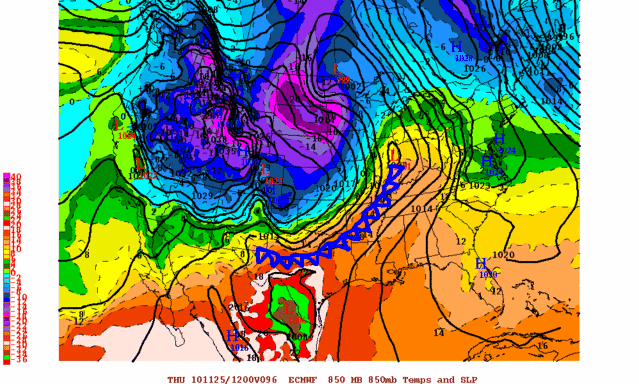 not all the fronts on this map are depicted, only the ones important to my discussion
I have added the approximate location of the surface front (which will precede the 850mb front), to give an idea of where it thinks the cold air will be by that point. If this run is correct, then the surface front will be through Oklahoma and most of the N. Texas metro areas by sunrise on Thanksgiving day, with central and SE Texas still on the warm side.
This is a very fast moving punch of colder air though, and 24 hours later the front is already reaching the east coast of the USA! The great lakes region and upper Mississippi valley region look very cold Friday, and some nice lake effect bands will likely set up in that region. For the southern plains, the ECMWF drops the 1030mb surface high into west-central Texas, bringing chilly air into much of the region. However, it definitely looks like just a glancing blow compared to what
could have happened if the coldest "punch" of air was directed more toward the south rather than east. None the less, the chilliest readings of the season are still likely for the entire southern plains region Thursday through Saturday, with it obviously colder and colder the further north you go.
6am Friday morning:
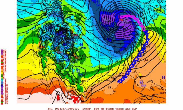 not all the fronts on this map are depicted, only the ones important to my discussionOf course, everything stated and shown above is dependent on the ECMWF being correct, which may not be the case. As many have pointed out, cold airmasses can sometimes drop southward down the plains much more quickly than the models forecast. If this is the case, then the front might actually be much further into Texas by Thanksgiving morning.
  The posts in this forum are NOT official forecast and should not be used as such. They are just the opinion of the poster and may or may not be backed by sound meteorological data. They are NOT endorsed by any professional institution or


But you are right Portastorm, you called it buddy.


