ATL: MATTHEW - Models

Moderator: S2k Moderators

Message
Author
xironman
S2K Supporter
S2K Supporter
Posts: 2522
Joined: Sun Jun 10, 2007 4:53 pm
Location: NoVA

Re:

#881 Postby xironman » Thu Sep 23, 2010 12:41 pm

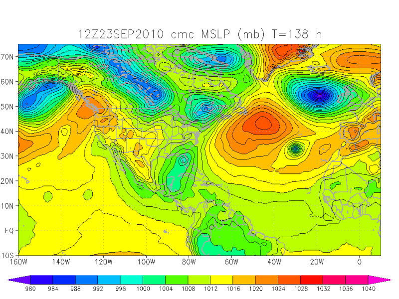
Vortex wrote:Imo, I think the Nogaps looks most reasonable....

It is possible, but I always take into account the NOGAPS grain of salt rule
0 likes   

User avatar
Vortex
S2K Supporter
S2K Supporter
Posts: 4644
Age: 53
Joined: Fri Aug 01, 2003 9:34 pm
Location: Hilton Head, SC

#882 Postby Vortex » Thu Sep 23, 2010 12:45 pm

12Z canadian sure DOES NOT clear things up
0 likes   

emeraldislencguy
S2K Supporter
S2K Supporter
Posts: 207
Joined: Sun Aug 27, 2006 4:35 pm
Location: emerald isle nc
Contact:

Re: ATL: INVEST 95L - Models

#883 Postby emeraldislencguy » Thu Sep 23, 2010 12:46 pm

A TROPICAL DEPRESSION HAS FORMED AN ADVISORY AT 2 pm
0 likes   

User avatar
ColinDelia
S2K Supporter
S2K Supporter
Posts: 918
Joined: Mon Aug 29, 2005 5:52 am
Location: The Beach, FL

Re: ATL: INVEST 95L - Models

#884 Postby ColinDelia » Thu Sep 23, 2010 12:49 pm

All these model runs just leave me saying "say what?"
0 likes   

hurricaneCW
Category 5
Category 5
Posts: 1794
Joined: Wed Mar 03, 2010 6:20 am
Location: Toms River, NJ

Re: ATL: INVEST 95L - Models

#885 Postby hurricaneCW » Thu Sep 23, 2010 12:50 pm

It's certainly not TD 15 because the further east low doesn't even form until around day 5-6. I do believe TD 15 is helping to lower the Caribbean pressures even further and possibly supplying some energy that allows a new system to spin up further east and head to the NW. Most impressive run I've seen in a while from the gfs with the Florida storm though, definitely a hurricane.

Being that the low pressures are going to be so low in the Caribbean for a few weeks along with the favorable MJO and record ocean heat content, we'll likely see several Caribbean systems spawn over the next few weeks, but we just don't know where they will go.
0 likes   

Wx_Warrior
Category 5
Category 5
Posts: 2718
Joined: Thu Aug 03, 2006 3:58 pm
Location: Beaumont, TX

Re: ATL: TD FIFTEEN - Models

#886 Postby Wx_Warrior » Thu Sep 23, 2010 1:01 pm

We don't know exactly, but have a decent idea in area. air pattern is changing folks.

CMC = Florida

Image
0 likes   

invest man
Tropical Storm
Tropical Storm
Posts: 206
Joined: Sun Aug 17, 2008 8:12 pm

#887 Postby invest man » Thu Sep 23, 2010 1:02 pm

Looks like NHC has taken the usual track close to the tvcn and notice that it appears like a NE movement and also still hurricance force still over land or very closely off shore. IM
0 likes   

User avatar
Weatherboy1
Category 5
Category 5
Posts: 1189
Age: 49
Joined: Mon Jul 05, 2004 1:50 pm
Location: Jupiter/Sarasota, FL

#888 Postby Weatherboy1 » Thu Sep 23, 2010 1:17 pm

That CMC run seems to also hint at two different low pressure centers, no? Kind of like GFS idea, just with the lows forming in different locations. What a mess!
0 likes   

User avatar
Comanche
Category 1
Category 1
Posts: 381
Age: 53
Joined: Wed Jul 06, 2005 9:33 am
Location: Clear Lake City Texas

#889 Postby Comanche » Thu Sep 23, 2010 1:21 pm

Maybe the ULL running with TD15, to the NE, will ultimately kill it, and the backside of the ULL vents anything that is in the wake?!?!?
0 likes   

User avatar
Vortex
S2K Supporter
S2K Supporter
Posts: 4644
Age: 53
Joined: Fri Aug 01, 2003 9:34 pm
Location: Hilton Head, SC

#890 Postby Vortex » Thu Sep 23, 2010 1:24 pm

Can someone post the euro running..at work.
0 likes   

Sanibel
Category 5
Category 5
Posts: 10375
Joined: Mon Aug 30, 2004 11:06 pm
Location: Offshore SW Florida

Re: ATL: TD FIFTEEN - Models

#891 Postby Sanibel » Thu Sep 23, 2010 1:24 pm

GFDL bounces it off a brick wall in southern Belize and lingers it as a weak remnant Low just inland in northern Honduras.
0 likes   

User avatar
Vortex
S2K Supporter
S2K Supporter
Posts: 4644
Age: 53
Joined: Fri Aug 01, 2003 9:34 pm
Location: Hilton Head, SC

#892 Postby Vortex » Thu Sep 23, 2010 1:27 pm

the question of the hour is how far west before the turn with huge implications...
0 likes   

User avatar
Vortex
S2K Supporter
S2K Supporter
Posts: 4644
Age: 53
Joined: Fri Aug 01, 2003 9:34 pm
Location: Hilton Head, SC

#893 Postby Vortex » Thu Sep 23, 2010 1:30 pm

12Z euro at H120 organizing S of Cuba


http://raleighwx.easternuswx.com/models ... SLP120.gif
0 likes   

User avatar
Vortex
S2K Supporter
S2K Supporter
Posts: 4644
Age: 53
Joined: Fri Aug 01, 2003 9:34 pm
Location: Hilton Head, SC

#894 Postby Vortex » Thu Sep 23, 2010 1:32 pm

Euro and GFS are very consistent with this south of western cuba down the road
0 likes   

User avatar
cycloneye
Admin
Admin
Posts: 145307
Age: 68
Joined: Thu Oct 10, 2002 10:54 am
Location: San Juan, Puerto Rico

Re: ATL: TD FIFTEEN - Models

#895 Postby cycloneye » Thu Sep 23, 2010 1:32 pm

18z Tropical Models Suite

Code: Select all

WHXX01 KWBC 231827
CHGHUR
TROPICAL CYCLONE GUIDANCE MESSAGE
NWS TPC/NATIONAL HURRICANE CENTER MIAMI FL
1827 UTC THU SEP 23 2010
 
DISCLAIMER...NUMERICAL MODELS ARE SUBJECT TO LARGE ERRORS.
PLEASE REFER TO NHC OFFICIAL FORECASTS FOR TROPICAL CYCLONE
AND SUBTROPICAL CYCLONE INFORMATION.
 
ATLANTIC OBJECTIVE AIDS FOR
 
TROPICAL CYCLONE FIFTEEN (AL152010) 20100923 1800 UTC
 
        ...00 HRS...   ...12 HRS...   ...24 HRS. ..   ...36 HRS...
        100923  1800   100924  0600   100924  1800   100925  0600
 
         LAT    LON     LAT    LON     LAT    LON     LAT    LON
BAMS    13.9N  76.2W   14.5N  78.4W   15.3N  80.7W   16.0N  83.0W
BAMD    13.9N  76.2W   14.3N  78.7W   14.8N  81.3W   15.4N  83.7W
BAMM    13.9N  76.2W   14.4N  78.7W   15.0N  81.3W   15.6N  83.9W
LBAR    13.9N  76.2W   14.3N  79.1W   15.0N  82.2W   15.6N  85.4W
SHIP        30KTS          36KTS          46KTS          58KTS
DSHP        30KTS          36KTS          46KTS          58KTS
 
        ...48 HRS...   ...72 HRS...   ...96 HRS. ..   ..120 HRS...
        100925  1800   100926  1800   100927  1800   100928  1800
 
         LAT    LON     LAT    LON     LAT    LON     LAT    LON
BAMS    16.8N  85.5W   18.7N  89.8W   19.4N  92.9W   18.3N  95.3W
BAMD    16.2N  85.8W   18.1N  88.9W   19.9N  90.8W   19.9N  92.8W
BAMM    16.5N  86.3W   18.3N  90.1W   19.1N  92.5W   17.4N  94.4W
LBAR    16.5N  88.3W   19.2N  92.6W   21.6N  94.0W   20.7N  94.5W
SHIP        69KTS          88KTS         100KTS         102KTS
DSHP        59KTS          78KTS          41KTS          33KTS
 
         ...INITIAL CONDITIONS...
LATCUR =  13.9N LONCUR =  76.2W DIRCUR = 280DEG SPDCUR =  14KT
LATM12 =  13.4N LONM12 =  73.4W DIRM12 = 281DEG SPDM12 =  14KT
LATM24 =  12.8N LONM24 =  70.6W
WNDCUR =   30KT RMAXWD =   30NM WNDM12 =   30KT
CENPRS = 1007MB OUTPRS = 1010MB OUTRAD =  130NM SDEPTH =   M
RD34NE =    0NM RD34SE =    0NM RD34SW =    0NM RD34NW =   0NM
 
0 likes   
Visit the Caribbean-Central America Weather Thread where you can find at first post web cams,radars
and observations from Caribbean basin members Click Here

Stormcenter
S2K Supporter
S2K Supporter
Posts: 6684
Joined: Wed Sep 03, 2003 11:27 am
Location: Houston, TX

Re: ATL: INVEST 95L - Models

#896 Postby Stormcenter » Thu Sep 23, 2010 1:32 pm

Welcome and get use to it. :)


Saints wrote:This system is NOT even a TD, yet most people on here think a doomsday event, catastrophic Hurricane is going to Florida!

Good grief people, take a deep breath.

What are so many catastrophic predictions being based on? Models?

Everyone knows models are dynamic, meaning change. It is WAAAAAY too far out to predict so much OMG, and it's over for X scenarios.

While it's interesting to read predictions of where the system will end up and the strength, there is no reason to promote such dire predictions, over and over again, in multiple posts, by the same posters again and again, but with different words. It's as if you are looking for sympathy, or congratulatory accolades....”You forecasted a cataclysmic event and you win the prize for doomsayer champion”, type of recognition? Sheesh...

On to another area. Everyone better watch the BOC, as things appear to be popping there and OMG….another super hurricane is heading somewhere! J/K
0 likes   

User avatar
Vortex
S2K Supporter
S2K Supporter
Posts: 4644
Age: 53
Joined: Fri Aug 01, 2003 9:34 pm
Location: Hilton Head, SC

#897 Postby Vortex » Thu Sep 23, 2010 1:34 pm

0 likes   

User avatar
ConvergenceZone
Category 5
Category 5
Posts: 5194
Joined: Fri Jul 29, 2005 1:40 am
Location: Northern California

#898 Postby ConvergenceZone » Thu Sep 23, 2010 1:39 pm

This system is NOT even a TD, yet most people on here think a doomsday event, catastrophic Hurricane is going to Florida!


Saint, I think you are off base here. I haven't heard anyone mention
that a horrible cat 4 or 5 hurricane is heading to Florida. Yes, there have
been some(including me) that have said that if a couple of the models runs verified,
that it would be horrible for the Tampa area, but that's about it.

What you are seeing is people who are concerned due to the general direction forecasted.
If it does hit Florida, we don't know if it will be a TD, TS, or weak or strong hurricane.
All is possible.... You are seeing lots of concern, which is justifiable.
0 likes   

User avatar
Vortex
S2K Supporter
S2K Supporter
Posts: 4644
Age: 53
Joined: Fri Aug 01, 2003 9:34 pm
Location: Hilton Head, SC

Re: ATL: TD FIFTEEN - Models

#899 Postby Vortex » Thu Sep 23, 2010 1:39 pm

0 likes   

User avatar
Vortex
S2K Supporter
S2K Supporter
Posts: 4644
Age: 53
Joined: Fri Aug 01, 2003 9:34 pm
Location: Hilton Head, SC

#900 Postby Vortex » Thu Sep 23, 2010 1:40 pm

H168 looks like a hurricane for FL again by the euro...


http://raleighwx.easternuswx.com/models ... SLP168.gif
0 likes   


Return to “2010”

Who is online

Users browsing this forum: No registered users and 2 guests