ATL: MATTHEW - Ex-Tropical Storm - Discussion

Moderator: S2k Moderators

Message
Author
User avatar
FLpanhandle91
Category 5
Category 5
Posts: 1033
Age: 34
Joined: Mon Sep 13, 2010 3:50 pm
Location: Fort Walton Beach, FL

Re:

#121 Postby FLpanhandle91 » Tue Sep 21, 2010 5:56 pm

fci wrote:This is the first system this season where I don't have a "warm and fuzzy" feeling about for us in South Florida and the Eastern Gulf.
Getting into Late September/Early October and we are very wary of developments south and southwest of us which is where 95L is supposed to get his act together.
I see long nights ahead watching this one...........


I agree. My father and I in the panhandle of Florida are already checking recon almost hourly. The northwest Caribbean is pretty much a bathtub that can harbor monster storms on their way to the Gulf and a US landfall. We will see. I think we have a few days before we see a TS. LLC still seems weak and over the passed few IR loop frames, the convection has died down. It looks like it's kind of pullin a Karl right now. We all saw how fast Karl blew up once it got its act together up in the part of the Caribbean. Everyone along the Gulf coast should really keep this system on your mind. NHC giving it a 50% COD. I don't doubt if a system will form. I think it's more of a "when" question.
0 likes   

User avatar
cycloneye
Admin
Admin
Posts: 145286
Age: 68
Joined: Thu Oct 10, 2002 10:54 am
Location: San Juan, Puerto Rico

Re: ATL: INVEST 95L - Discussion

#122 Postby cycloneye » Tue Sep 21, 2010 6:33 pm

Remains at 50%

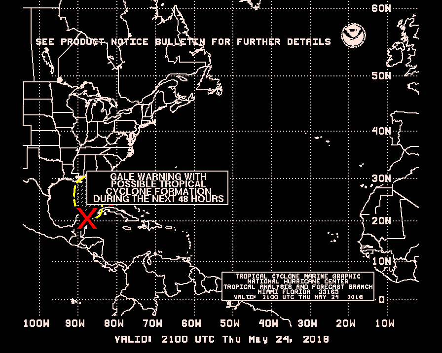
TROPICAL WEATHER OUTLOOK
NWS TPC/NATIONAL HURRICANE CENTER MIAMI FL
800 PM EDT TUE SEP 21 2010

FOR THE NORTH ATLANTIC...CARIBBEAN SEA AND THE GULF OF MEXICO...

THE NATIONAL HURRICANE CENTER IS ISSUING ADVISORIES ON TROPICAL
STORM LISA...LOCATED ABOUT 525 MILES WEST-NORTHWEST OF THE CAPE
VERDE ISLANDS...AND HAS ISSUED THE LAST ADVISORY ON HURRICANE
IGOR...THAT HAS LOST ITS TROPICAL CHARACTERISTICS ABOUT 125 MILES
NORTH-NORTHEAST OF ST. JOHNS NEWFOUNDLAND.

A TROPICAL WAVE OVER THE EASTERN CARIBBEAN SEA IS PRODUCING A LARGE
AREA OF DISORGANIZED SHOWERS AND THUNDERSTORMS. ENVIRONMENTAL
CONDITIONS ARE EXPECTED TO BECOME MORE FAVORABLE FOR A TROPICAL
DEPRESSION TO FORM DURING THE NEXT COUPLE OF DAYS AS THE SYSTEM
MOVES WESTWARD NEAR 15 MPH. THERE IS A MEDIUM CHANCE...50
PERCENT...OF THIS SYSTEM BECOMING A TROPICAL CYCLONE DURING THE
NEXT 48 HOURS. LOCALLY HEAVY RAINFALL AND GUSTY WINDS ARE LIKELY
OVER THE WINDWARD ISLANDS...THE NETHERLANDS ANTILLES...AND
THE NORTHERN COASTS OF VENEZUELA AND COLOMBIA DURING THE NEXT DAY OR
TWO. THESE RAINS COULD CAUSE LIFE-THREATENING FLASH FLOODS.

ELSEWHERE...TROPICAL CYCLONE FORMATION IS NOT EXPECTED DURING THE
NEXT 48 HOURS.

$$
FORECASTER CANGIALOSI/PASCH

Image
0 likes   
Visit the Caribbean-Central America Weather Thread where you can find at first post web cams,radars
and observations from Caribbean basin members Click Here

Vortmax1
Category 1
Category 1
Posts: 360
Joined: Wed Jul 07, 2010 11:35 pm
Location: Port Salerno, FL
Contact:

#123 Postby Vortmax1 » Tue Sep 21, 2010 6:40 pm

50% is still good.
It looks like a convective smear right now but it will continue developing slowly overnight I believe and we'll see how it looks at first visibles.
0 likes   

User avatar
cycloneye
Admin
Admin
Posts: 145286
Age: 68
Joined: Thu Oct 10, 2002 10:54 am
Location: San Juan, Puerto Rico

Re: ATL: INVEST 95L - Discussion

#124 Postby cycloneye » Tue Sep 21, 2010 7:11 pm

Image
0 likes   
Visit the Caribbean-Central America Weather Thread where you can find at first post web cams,radars
and observations from Caribbean basin members Click Here

User avatar
KWT
Category 5
Category 5
Posts: 31415
Joined: Tue Aug 17, 2004 11:02 am
Location: UK!!!

#125 Postby KWT » Tue Sep 21, 2010 7:16 pm

Once this system gets to say 75W the impact from SA begins to decrease and I feel the chances of this one developing into a decent storm really begin to increase quite markedly.
0 likes   
Personal Forecast Disclaimer:
The posts in this forum are NOT official forecast and should not be used as such. They are just the opinion of the poster and may or may not be backed by sound meteorological data. They are NOT endorsed by any professional institution or storm2k.org. For official information, please refer to the NHC and NWS products

hurricaneCW
Category 5
Category 5
Posts: 1794
Joined: Wed Mar 03, 2010 6:20 am
Location: Toms River, NJ

Re: ATL: INVEST 95L - Discussion

#126 Postby hurricaneCW » Tue Sep 21, 2010 7:30 pm

Hopefully it doesn't develop and once the disturbance makes landfall in CA that it just completely dissipates and we're all in the clear. I think there's a good chance of that happening, if a system stays inland for a while, it could get completely shredded and not develop at all, or it keeps heading west like the Ukmet states and it goes into mainland Mexico, never really having a chance to develop.

The U.S. has been very lucky and I believe there's a greater than normal chance of them continuing to get spared.
0 likes   

User avatar
alan1961
Category 2
Category 2
Posts: 771
Joined: Mon Mar 20, 2006 11:58 am
Location: Derby, Derbyshire, England
Contact:

Re: ATL: INVEST 95L - Discussion

#127 Postby alan1961 » Tue Sep 21, 2010 7:35 pm

Anyone else see a hint of turning in the area marked when
the loop is run.

Image

http://www.ssd.noaa.gov/goes/flt/t3/loop-avn.html
Last edited by alan1961 on Tue Sep 21, 2010 7:39 pm, edited 1 time in total.
0 likes   

User avatar
ConvergenceZone
Category 5
Category 5
Posts: 5194
Joined: Fri Jul 29, 2005 1:40 am
Location: Northern California

Re: ATL: INVEST 95L - Discussion

#128 Postby ConvergenceZone » Tue Sep 21, 2010 7:36 pm

The U.S. has been very lucky and I believe there's a greater than normal chance of them continuing to get spared.


I have to strongly disagree with you. as to why you think there's a very good chance of the US being spared from this system.....There's no evidence that
suggests that it will completely dissipate over CA. If you look at the models,
most of them shove this right back over the open warm waters.... I think there's a very good chance that the US WON'T be spared, is probably more like it.
0 likes   

User avatar
cycloneye
Admin
Admin
Posts: 145286
Age: 68
Joined: Thu Oct 10, 2002 10:54 am
Location: San Juan, Puerto Rico

Re: ATL: INVEST 95L - Discussion

#129 Postby cycloneye » Tue Sep 21, 2010 7:43 pm

Alan, around there as 00z Best Track has it. :)

AL, 95, 2010092200, , BEST, 0, 123N, 652W, 25, 1009, DB

ftp://ftp.tpc.ncep.noaa.gov/atcf/tcweb/ ... 010.invest
0 likes   
Visit the Caribbean-Central America Weather Thread where you can find at first post web cams,radars
and observations from Caribbean basin members Click Here

User avatar
SouthFLTropics
Category 5
Category 5
Posts: 4236
Age: 50
Joined: Thu Aug 14, 2003 8:04 am
Location: Port St. Lucie, Florida

#130 Postby SouthFLTropics » Tue Sep 21, 2010 7:53 pm

If 95L indeed turns out to be Matthew and if by chance he were a major and would affect South Florida there would be some serious irony for my family. I am the proud father of two little boys. My oldest son is named after South Florida's most famous hurricane from 1992. My other sons name...You guessed it...Matthew.

When I think about the irony I start hearing the Twilight Zone music in my head! LOL

SFT
0 likes   
Fourth Generation Florida Native

Personal Storm History: David 79, Andrew 92, Erin 95, Floyd 99, Irene 99, Frances 04, Jeanne 04, Wilma 05, Matthew 16, Irma 17, Ian 22, Nicole 22, Milton 24

User avatar
alan1961
Category 2
Category 2
Posts: 771
Joined: Mon Mar 20, 2006 11:58 am
Location: Derby, Derbyshire, England
Contact:

Re: ATL: INVEST 95L - Discussion

#131 Postby alan1961 » Tue Sep 21, 2010 7:55 pm

cycloneye wrote:Alan, around there as 00z Best Track has it. :)

AL, 95, 2010092200, , BEST, 0, 123N, 652W, 25, 1009, DB

ftp://ftp.tpc.ncep.noaa.gov/atcf/tcweb/ ... 010.invest


ok cyclone...i'll take the eyeglass off now :lol: :lol:
0 likes   

emeraldislencguy
S2K Supporter
S2K Supporter
Posts: 207
Joined: Sun Aug 27, 2006 4:35 pm
Location: emerald isle nc
Contact:

Re: ATL: INVEST 95L - Discussion

#132 Postby emeraldislencguy » Tue Sep 21, 2010 8:03 pm

going to key west oct 4-11
what do yall thk the weather will be like
giveme some ideas
0 likes   

Florida1118

Re: ATL: INVEST 95L - Discussion

#133 Postby Florida1118 » Tue Sep 21, 2010 8:05 pm

emeraldislencguy wrote:going to key west oct 4-11
what do yall thk the weather will be like
giveme some ideas

Well at the beach, pretty good odds there will be rough surf. Thats all we could know this far out.
0 likes   

User avatar
gtalum
S2K Supporter
S2K Supporter
Posts: 4749
Age: 49
Joined: Tue Sep 07, 2004 3:48 pm
Location: Bradenton, FL
Contact:

Re: ATL: INVEST 95L - Discussion

#134 Postby gtalum » Tue Sep 21, 2010 8:09 pm

emeraldislencguy wrote:going to key west oct 4-11
what do yall thk the weather will be like
giveme some ideas


Here, let me go get my crystal ball...
0 likes   

User avatar
alienstorm
Category 1
Category 1
Posts: 496
Joined: Tue Jul 31, 2007 1:29 pm
Location: Miami Fla western suburb

#135 Postby alienstorm » Tue Sep 21, 2010 8:11 pm

We have the first signs of banding on the western part of the developing system. We will see what tomorrow brings.
0 likes   
Personal Forecast Disclaimer:The posts in this forum are NOT official forecast and should not be used as such. They are just the opinion of the poster and may or may not be backed by sound meteorological data. They are NOT endorsed by any professional institution or storm2k.org. For official information, please refer to the NHC and NWS products.

jlauderdal
S2K Supporter
S2K Supporter
Posts: 7182
Joined: Wed May 19, 2004 5:46 am
Location: NE Fort Lauderdale
Contact:

Re: ATL: INVEST 95L - Discussion

#136 Postby jlauderdal » Tue Sep 21, 2010 8:23 pm

emeraldislencguy wrote:going to key west oct 4-11
what do yall thk the weather will be like
giveme some ideas

if anyone on this board or anywhere could predict that far out they would be worth billions, its a 15-21 day forecast you are asking for, i say temps will be in the 80's with passing clouds, chance of showers... :lol:
0 likes   

User avatar
MHurricanes
Tropical Storm
Tropical Storm
Posts: 102
Age: 73
Joined: Thu Aug 14, 2008 2:05 pm
Location: Altamonte Springs, FL
Contact:

Re:

#137 Postby MHurricanes » Tue Sep 21, 2010 8:42 pm

KWT wrote:It'll almost certainly be a code orange soon but conditions don't look amazing just yet, workable for sure, but the real fun probably begins at 80W as is normal for these sorts of systems at this time of year...


Perhaps, I'm worried too much. I went through Charley, Francis, and Jeane. I hope our family will not see another of these hurricanes.

One is enough.

There is no excitement after the first one.
0 likes   

User avatar
MGC
S2K Supporter
S2K Supporter
Posts: 5899
Joined: Sun Mar 23, 2003 9:05 pm
Location: Pass Christian MS, or what is left.

Re: ATL: INVEST 95L - Discussion

#138 Postby MGC » Tue Sep 21, 2010 8:45 pm

I dont see any evidence of cyclonic spin in the sat loop.....gonna have to wait a couple of days for this mess to get into the W Carb Sea......MGC
0 likes   

User avatar
SouthFLTropics
Category 5
Category 5
Posts: 4236
Age: 50
Joined: Thu Aug 14, 2003 8:04 am
Location: Port St. Lucie, Florida

Re: ATL: INVEST 95L - Discussion

#139 Postby SouthFLTropics » Tue Sep 21, 2010 8:52 pm

Is recon scheduled to fly within the next few days? We gotta have more recon baby!!!

Image

Uploaded with ImageShack.us

SFT
0 likes   
Fourth Generation Florida Native

Personal Storm History: David 79, Andrew 92, Erin 95, Floyd 99, Irene 99, Frances 04, Jeanne 04, Wilma 05, Matthew 16, Irma 17, Ian 22, Nicole 22, Milton 24

User avatar
HURAKAN
Professional-Met
Professional-Met
Posts: 46086
Age: 38
Joined: Thu May 20, 2004 4:34 pm
Location: Key West, FL
Contact:

Re: ATL: INVEST 95L - Discussion

#140 Postby HURAKAN » Tue Sep 21, 2010 8:53 pm

MGC wrote:I dont see any evidence of cyclonic spin in the sat loop.....gonna have to wait a couple of days for this mess to get into the W Carb Sea......MGC


Loop - http://rammb.cira.colostate.edu/ramsdis ... _floater_1

You don't see it or you don't want to see it? Speed up the loop!!
0 likes   


Return to “2010”

Who is online

Users browsing this forum: No registered users and 0 guests