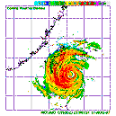
Simone Lussardi wrote:Infdidoll wrote:Any pro mets have any reasoning about the track? I know some in Taipei are wondering if they are going to be spared the worst of this after all. From radar, it appears the eye should be passing over Hualian (or is it Hualien? Two different spellings out there) at any time now. Does it look to anyone else that this is going to continue a little slightly more southwest?
It is going to track WSW to SW across Taiwan, Taipei will most likely be spared. This is a usual land effect induced on strong storms crossing Taiwan. Usually the low level center reforms SW of where it was landed for Typhoons that are moving west, while it reforms NW of the landfall location for WNW moving storms.
Moreover, JMA forecast a SW drift while in the strait, which may give enough time to re-organize a bit before smashing into the coast of SE China, at this point I am in danger as well, because it is forecast to pass over my head (JMA, HKO) at borderline TS/TY strength...
EDIT: sorry I am not a pro-met, just gave my 2 cents based on experience.

Thank you! Like Rob said, there is an area of high pressure just to the north that seems to be pushing it a little further to the south. Be careful over there. It seems to be moving rather quickly like you noted yesterday...which is a good thing for Taiwan as they struggle with water system overflow issues. It also doesn't look like there is as much rain behind this storms as have built up with other storms. Definitely good news for Taiwan.