ATL: IGOR - Ex Hurricane - Discussion
Moderator: S2k Moderators
-
cyclonic chronic
-
mf_dolphin

- Category 5

- Posts: 17758
- Age: 69
- Joined: Tue Oct 08, 2002 2:05 pm
- Location: St Petersburg, FL
- Contact:
Here's the link to the Bermuda radar and automated weather stations. Login = guest password = guest.
http://199.172.239.3/gemamet/index.jsp
http://199.172.239.3/gemamet/index.jsp
0 likes
-
tolakram
- Admin

- Posts: 20186
- Age: 62
- Joined: Sun Aug 27, 2006 8:23 pm
- Location: Florence, KY (name is Mark)
Re: ATL: IGOR - Hurricane - Discussion

0 likes
M a r k
- - - - -
Join us in chat: Storm2K Chatroom Invite. Android and IOS apps also available.
The posts in this forum are NOT official forecasts and should not be used as such. Posts are NOT endorsed by any professional institution or STORM2K.org. For official information and forecasts, please refer to NHC and NWS products.
-
weatherguy2
- Tropical Depression

- Posts: 72
- Joined: Sun Aug 01, 2010 2:45 am
Re: ATL: IGOR - Hurricane - Discussion
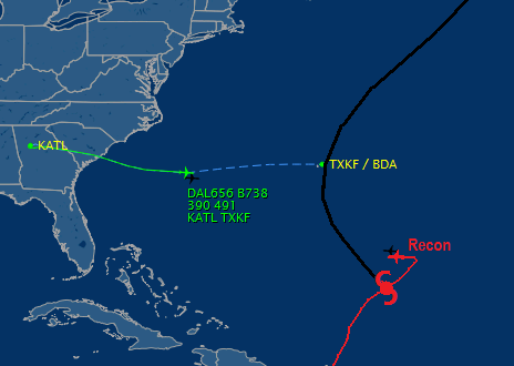
Jim Cantore is halfway to Bermuda along with lots of media people: Estimated arrival 12:30 PM CST 
0 likes

Re:
CrazyC83 wrote:Indeed it looks like the intensity is about 90 kt, despite a 946mb pressure. Such huge storms often result in pressure mismatches.
I suspect this is due to the pressure gradient being lower due to the pressure differences being spread out over a large area.
0 likes

-
HURAKAN

- Professional-Met

- Posts: 46084
- Age: 39
- Joined: Thu May 20, 2004 4:34 pm
- Location: Key West, FL
- Contact:
Re:
CrazyC83 wrote:Indeed it looks like the intensity is about 90 kt, despite a 946mb pressure. Such huge storms often result in pressure mismatches.
Looks exactly like Alex (pressure, wind-wise)
0 likes
-
cycloneye

- Admin
- Posts: 149725
- Age: 69
- Joined: Thu Oct 10, 2002 10:54 am
- Location: San Juan, Puerto Rico
Re: ATL: IGOR - Hurricane - Discussion
Hurricane Warning issued for Bermuda
SUMMARY OF 200 PM AST...1800 UTC...INFORMATION
----------------------------------------------
LOCATION...23.4N 60.7W
ABOUT 665 MI...1070 KM SSE OF BERMUDA
MAXIMUM SUSTAINED WINDS...115 MPH...185 KM/HR
PRESENT MOVEMENT...NW OR 305 DEGREES AT 9 MPH...15 KM/HR
MINIMUM CENTRAL PRESSURE...946 MB...27.93 INCHES
WATCHES AND WARNINGS
--------------------
CHANGES WITH THIS ADVISORY...
THE BERMUDA WEATHER SERVICE HAS ISSUED A HURRICANE WARNING FOR
BERMUDA AT 2 PM AST...1800 UTC.
SUMMARY OF WATCHES AND WARNINGS IN EFFECT...
A HURRICANE WARNING IS IN EFFECT FOR...
* BERMUDA
A HURRICANE WARNING MEANS THAT HURRICANE CONDITIONS ARE EXPECTED
SOMEWHERE WITHIN THE WARNING AREA. A WARNING IS TYPICALLY ISSUED 36
HOURS BEFORE THE ANTICIPATED FIRST OCCURRENCE OF TROPICAL-STORM-
FORCE WINDS...CONDITIONS THAT MAKE OUTSIDE PREPARATIONS DIFFICULT
OR DANGEROUS. PREPARATIONS TO PROTECT LIFE AND PROPERTY SHOULD BE
RUSHED TO COMPLETION.
FOR STORM INFORMATION SPECIFIC TO YOUR AREA OUTSIDE THE UNITED
STATES...PLEASE MONITOR PRODUCTS ISSUED BY YOUR NATIONAL
METEOROLOGICAL SERVICE.
0 likes
Visit the Caribbean-Central America Weather Thread where you can find at first post web cams,radars
and observations from Caribbean basin members Click Here
and observations from Caribbean basin members Click Here
-
wxman57

- Moderator-Pro Met

- Posts: 23175
- Age: 68
- Joined: Sat Jun 21, 2003 8:06 pm
- Location: Houston, TX (southwest)
Re:
HURAKAN wrote:According to Pythagoras, Igor and Julia are 841 nm apart or 969 miles.
If you want to be more exact
http://www2.wolframalpha.com/Calculate/ ... &w=68&h=22 nm
I measure 721nm (830 mi) on GARP. Pythagorian equation won't work on a curved surface. You need to use the Haversine equation. Here's an online Great Circle calculator:
http://www.movable-type.co.uk/scripts/latlong.html
And to convert Km to statute miles:
http://www.metric-conversions.org/lengt ... -miles.htm
Divide miles by 1.151 to get nautical miles.

0 likes


Re: ATL: IGOR - Hurricane - Discussion
Igor's got one last shot at intensifying based on the extent of TCHP map...IMO.....he could still get to cat 4....in the next 12 or so hours.
http://rammb.cira.colostate.edu/ramsdis ... _floater_1
http://rammb.cira.colostate.edu/ramsdis ... _floater_1
0 likes
-
lostinthetriangle
- Tropical Low

- Posts: 25
- Joined: Wed Sep 15, 2010 5:10 pm
- Location: Bermuda
Re: ATL: IGOR - Hurricane - Discussion
Igor is starting to look a bit more organized on the visible loop, and is that an eye starting to appear again!
0 likes
Who is online
Users browsing this forum: No registered users and 43 guests