
Is anyone else having this issue? (been happening to me for like three days now..)
When I run the AVN loop of igor here - http://www.ssd.noaa.gov/goes/flt/t1/flash-avn.html the last three or so images don't display. The box just goes white for those images. then it works like normal again for the first through what ever number of images till gets to the third to last and then those three again just go white.. Happening to anyone else? If not or if so whats the cause?
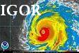
ATL: IGOR - Ex Hurricane - Discussion
Moderator: S2k Moderators
Re: ATL: IGOR - Hurricane - Discussion
0 likes
2010 Archive: HURRICANE ALEX, TD TWO, TS BONNIE, TS COLIN, TD FIVE, HURRICANE DANIELLE, HURRICANE EARL, TS FIONA, TS GASTON, TS HERMINE, HURRICANE IGOR, HURRICANE JULIA, HURRICANE KARL, HURRICANE LISA, TS MATTHEW, TS NICOLE, HURRICANE OTTO, HURRICANE PAULA (Active)
Re:
rsmith40 wrote:Julia and Igor seem to be getting closer together, looks like more potential for a Fujiwhara here. Not sure what the ultimate impact on Igor would be, but definitely would affect the track and models.
cyclonic chronic wrote:when was the last time we had a fujiwhara effect with two hurricanes in the atl.? i'd assume it would be rarer than in the west pac. because the atl. is soooo much smaller than the pac. have there been any studies about it in recent years(pre 85)?
I actually just started a thread about this in the talking tropics forum here - viewtopic.php?f=31&t=109430 Hopefully we can get a lot of info in that thread so we can all understand it fully
0 likes
2010 Archive: HURRICANE ALEX, TD TWO, TS BONNIE, TS COLIN, TD FIVE, HURRICANE DANIELLE, HURRICANE EARL, TS FIONA, TS GASTON, TS HERMINE, HURRICANE IGOR, HURRICANE JULIA, HURRICANE KARL, HURRICANE LISA, TS MATTHEW, TS NICOLE, HURRICANE OTTO, HURRICANE PAULA (Active)
-
hurricaneCW
- Category 5

- Posts: 1799
- Joined: Wed Mar 03, 2010 6:20 am
- Location: Toms River, NJ
Re: ATL: IGOR - Hurricane - Discussion
Just a beast of a storm. Can anyone imagine instead of a trough in the western Atlantic, there was a strong ridge building to the north of it. We'd have TS watches from Florida to the Carolinas.
0 likes
-
Riptide

- Category 2

- Posts: 753
- Age: 34
- Joined: Fri Jul 23, 2010 3:33 pm
- Location: Cape May, New Jersey
- Contact:
Re: ATL: IGOR - Hurricane - Discussion
hurricaneCW wrote:Just a beast of a storm. Can anyone imagine instead of a trough in the western Atlantic, there was a strong ridge building to the north of it. We'd have TS watches from Florida to the Carolinas.
Instead, Igor is simply following the trend of more wasted historical landfall potential. I wasn't around for 1995(As a weather hobbyist) but I now understand how awful it really was.
0 likes


-
lostinthetriangle
- Tropical Low

- Posts: 25
- Joined: Wed Sep 15, 2010 5:10 pm
- Location: Bermuda
Re: Re:
artist wrote:lostinthetriangle wrote:KWT wrote:Actually to be fair the NW quadrant looks better then it did about a few hours ago so thats a good sign at least!
"A GOOD SIGN"!!!!!!!! No hurricane heading towards a small (24 square mile) island is a good sign, especially one this large!
I have been through many storms, but this one bothers me more than Fabian. Look up Emily 1987 and read how the forecasters got it all so very wrong!
Oh and yes, the NW quadrant. Does look better....
The natives are getting a bit restless!.
Be sure to report in here viewtopic.php?f=59&t=109426 when you can to let us know the conditions there and if you lose communications, once you get them back, let us know you are ok in this same thread. Our thoughts and prayers go out to all being affected by Igor.
Will do! Thanks
0 likes
-
HurricaneQueen

- S2K Supporter

- Posts: 1011
- Age: 80
- Joined: Sat Oct 12, 2002 7:36 pm
- Location: No. Naples, Fl (Vanderbilt Beach area)
Re: ATL: IGOR - Hurricane - Discussion
Lost:
All the best to you and yours. We will all be praying that something pushes Igor far to your east. In the meantime, please be safe and keep us posted. I know what it is like to be on a small island when a Cat 4 comes directly over us-it's not fun and the aftermath is a horror. Some here can be insensitive in the wording of their posts. I am certain it was not meant as written. We are all family here and welcome aboard.
Good luck,
Lynn
0 likes
GO FLORIDA GATORS
-
lostinthetriangle
- Tropical Low
- Posts: 25
- Joined: Wed Sep 15, 2010 5:10 pm
- Location: Bermuda
Re: Re:
abajan wrote:lostinthetriangle wrote:KWT wrote:Actually to be fair the NW quadrant looks better then it did about a few hours ago so thats a good sign at least!
"A GOOD SIGN"!!!!!!!! No hurricane heading towards a small (24 square mile) island is a good sign, especially one this large!
I have been through many storms, but this one bothers me more than Fabian. Look up Emily 1987 and read how the forecasters got it all so very wrong!
Oh and yes, the NW quadrant. Does look better....
The natives are getting a bit restless!.
“Does look better”? Get my point? Is it possible that KWT simply meant that it was a good sign for the hurricane itself and didn’t mean it in the sense you thought? I’m just saying it could have been a misunderstanding. But then again, if I were in your situation, I would probably think what you did.
However, staying more on topic, Igor does seem to be becoming more organized for the umpteenth time but thankfully the winds are weaker than what was stated in the 11 a.m. update. However, hurricane force and tropical storm force winds extend outward up to 105 miles and 290 miles respectively! In short, it’s big. I certainly hope it passes to your east — far to your east but right now that seems pretty unlikely. Just keep closely monitoring the situation, be safe and let us know how things go as much as you can. BTW, my neighbor here in Barbados is a senator from Bermuda and although I haven’t spoken with her in a while, I know she must be quite worried too.
Getting close to hunting season...... Does and Bucks on the mind.
Yes I understood and was trying to phrase a proper response, big fingers on small blackberry keyboard.
Back to Igor, I see he is now down to a cat 3. I agree with you about the reorganization, maybe another upgrade to cat 4 before the cooler water and shear take thier toll?
0 likes

lostinthetriangle, yeah certainly not good for you guys, the only good thing is its a needle in a haystack, for a system to score a direct hit even from this far out needs nearly everything to slot into place...but its getting to the point now where you need to take it seriously, I think it'll be a little weaker then Fabian once up there but will probably still be a hefty hurricane either way...and its a large system so it'll be extended bad conditions.
Luckily still have some days to get ready....but I'm sure Bermuda can ride the storm better then most in this basin!
Luckily still have some days to get ready....but I'm sure Bermuda can ride the storm better then most in this basin!
0 likes
Personal Forecast Disclaimer:
The posts in this forum are NOT official forecast and should not be used as such. They are just the opinion of the poster and may or may not be backed by sound meteorological data. They are NOT endorsed by any professional institution or storm2k.org. For official information, please refer to the NHC and NWS products
The posts in this forum are NOT official forecast and should not be used as such. They are just the opinion of the poster and may or may not be backed by sound meteorological data. They are NOT endorsed by any professional institution or storm2k.org. For official information, please refer to the NHC and NWS products
-
cycloneye

- Admin

- Posts: 149727
- Age: 69
- Joined: Thu Oct 10, 2002 10:54 am
- Location: San Juan, Puerto Rico
Re: ATL: IGOR - Hurricane - Discussion
0 likes
Visit the Caribbean-Central America Weather Thread where you can find at first post web cams,radars
and observations from Caribbean basin members Click Here
and observations from Caribbean basin members Click Here
Yeah that one was right in the path of the hurricane...it'll do well to make it out of this storm to be honest Cycloneye!
0 likes
Personal Forecast Disclaimer:
The posts in this forum are NOT official forecast and should not be used as such. They are just the opinion of the poster and may or may not be backed by sound meteorological data. They are NOT endorsed by any professional institution or storm2k.org. For official information, please refer to the NHC and NWS products
The posts in this forum are NOT official forecast and should not be used as such. They are just the opinion of the poster and may or may not be backed by sound meteorological data. They are NOT endorsed by any professional institution or storm2k.org. For official information, please refer to the NHC and NWS products
-
alan1961

- Category 2
- Posts: 771
- Joined: Mon Mar 20, 2006 11:58 am
- Location: Derby, Derbyshire, England
- Contact:
Re: ATL: IGOR - Hurricane - Discussion
canes101 wrote:Is anyone else having this issue? (been happening to me for like three days now..)
When I run the AVN loop of igor here - http://www.ssd.noaa.gov/goes/flt/t1/flash-avn.html the last three or so images don't display. The box just goes white for those images. then it works like normal again for the first through what ever number of images till gets to the third to last and then those three again just go white.. Happening to anyone else? If not or if so whats the cause?
Canes..your not on your own with the loops, they have
been acting up for the last few days...they are not updating
on time, frames missing and also the eclipse issue..i find that
the wide view loop is a bit more reliable than the floaters at
the moment
0 likes
-
lonelymike
- S2K Supporter
- Posts: 634
- Joined: Sat Jul 26, 2008 10:12 am
- Location: walton county fla
-
cycloneye
- Admin
- Posts: 149727
- Age: 69
- Joined: Thu Oct 10, 2002 10:54 am
- Location: San Juan, Puerto Rico
Re: ATL: IGOR - Hurricane - Discussion
00z Best Track
AL, 11, 2010091700, , BEST, 0, 219N, 582W, 110, 940, HU
AL, 11, 2010091700, , BEST, 0, 219N, 582W, 110, 940, HU
0 likes
Visit the Caribbean-Central America Weather Thread where you can find at first post web cams,radars
and observations from Caribbean basin members Click Here
and observations from Caribbean basin members Click Here
-
Stephanie

- S2K Supporter
- Posts: 23843
- Age: 63
- Joined: Thu Feb 06, 2003 9:53 am
- Location: Glassboro, NJ
Re: ATL: IGOR - Hurricane - Discussion
Riptide wrote:hurricaneCW wrote:Just a beast of a storm. Can anyone imagine instead of a trough in the western Atlantic, there was a strong ridge building to the north of it. We'd have TS watches from Florida to the Carolinas.
Instead, Igor is simply following the trend of more wasted historical landfall potential. I wasn't around for 1995(As a weather hobbyist) but I now understand how awful it really was.
Care to explain? Are you unhappy that it won't strike a large landmass?
0 likes

-
CrazyC83
- Professional-Met

- Posts: 34316
- Joined: Tue Mar 07, 2006 11:57 pm
- Location: Deep South, for the first time!
http://www.ndbc.noaa.gov/station_page.php?station=41044
Buoy pressure 940 with 60 kt of winds. So probably 934mb pressure.
Buoy pressure 940 with 60 kt of winds. So probably 934mb pressure.
0 likes
-
Crostorm

- Category 5
- Posts: 2060
- Age: 51
- Joined: Mon Dec 25, 2006 3:51 pm
- Location: Croatia-Europe
- Contact:
Re: ATL: IGOR - Hurricane - Discussion
Wind Direction (WDIR): W ( 280 deg true )
Wind Speed (WSPD): 31.0 m/s
Wind Gust (GST): 41.0 m/s
Wave Height (WVHT): 8.4 m
Dominant Wave Period (DPD): 12 sec
Average Period (APD): 8.4 sec
Atmospheric Pressure (PRES): 941.9 mb
Pressure Tendency (PTDY): -18.9 mb ( Falling Rapidly )
Air Temperature (ATMP): 26.4 °C
Water Temperature (WTMP): 28.4 °C
Dew Point (DEWP): 26.4 °C
Heat Index (HEAT): 29.7 °C
http://www.ndbc.noaa.gov/station_page.p ... t=M&tz=STN
0 likes
Who is online
Users browsing this forum: Google Adsense [Bot] and 56 guests