

000
WHXX01 KWBC 071856
CHGHUR
TROPICAL CYCLONE GUIDANCE MESSAGE
NWS TPC/NATIONAL HURRICANE CENTER MIAMI FL
1856 UTC TUE SEP 7 2010
DISCLAIMER...NUMERICAL MODELS ARE SUBJECT TO LARGE ERRORS.
PLEASE REFER TO NHC OFFICIAL FORECASTS FOR TROPICAL CYCLONE
AND SUBTROPICAL CYCLONE INFORMATION.
ATLANTIC OBJECTIVE AIDS FOR
DISTURBANCE INVEST (AL912010) 20100907 1800 UTC
ATL: IGOR - Ex Hurricane - Discussion
Moderator: S2k Moderators
-
southerngale

- Retired Staff

- Posts: 27418
- Joined: Thu Oct 10, 2002 1:27 am
- Location: Southeast Texas (Beaumont area)
Link to the thread in Talkin' Tropics about this disturbance.
http://www.storm2k.org/phpbb2/viewtopic.php?f=31&t=109229&st=0&sk=t&sd=a
http://www.storm2k.org/phpbb2/viewtopic.php?f=31&t=109229&st=0&sk=t&sd=a
0 likes
Please support Storm2k by making a donation today. It is greatly appreciated! Click here: 
 my Cowboys my Rockets my Astros
my Cowboys my Rockets my Astros-
cycloneye

- Admin

- Posts: 149670
- Age: 69
- Joined: Thu Oct 10, 2002 10:54 am
- Location: San Juan, Puerto Rico
Re: ATL: INVEST 91L - Discussion
Is weird that the models came out first than Best Track.
0 likes
Visit the Caribbean-Central America Weather Thread where you can find at first post web cams,radars
and observations from Caribbean basin members Click Here
and observations from Caribbean basin members Click Here

Re: ATL: INVEST 91L - Discussion
It is also some weird model runs with the turn to the NW at the end. But, it was the BAM.
Anyone have a satellite picture of it right now?
Anyone have a satellite picture of it right now?
0 likes

-
Weatherfreak000
MIMIC imagery suggests this has quite an impressive circulation. I am liking this area even though it has lost convection, the structure is improving. I think it may re-fire convection again and maybe lose some size. TWs that look like this coming off Africa are nothing but a gamble it seems. I tend to gravitate towards the MIMIC, and i'd suggest everyone look at it regarding 91L as well
http://cimss.ssec.wisc.edu/tropic/real- ... /main.html
http://cimss.ssec.wisc.edu/tropic/real- ... /main.html
0 likes
-
ColinDelia

- S2K Supporter

- Posts: 918
- Joined: Mon Aug 29, 2005 5:52 am
- Location: The Beach, FL
Re: ATL: INVEST 91L - Discussion
From the TWD
A TROPICAL WAVE IS OVER THE FAR EASTERN TROPICAL ATLANTIC
BASIN...ANALYZED ALONG 21W S OF 18N MOVING WEST 10-15 KT.
SATELLITE DERIVED WINDS INDICATE BROAD CYCLONIC TURNING AROUND
THE WAVE AXIS CENTERED NEAR 14N. THIS WAVE IS EMBEDDED IN A
SURGE OF DEEP LEVEL MOISTURE AS INDICATED ON TOTAL PRECIPITABLE
WATER IMAGERY.
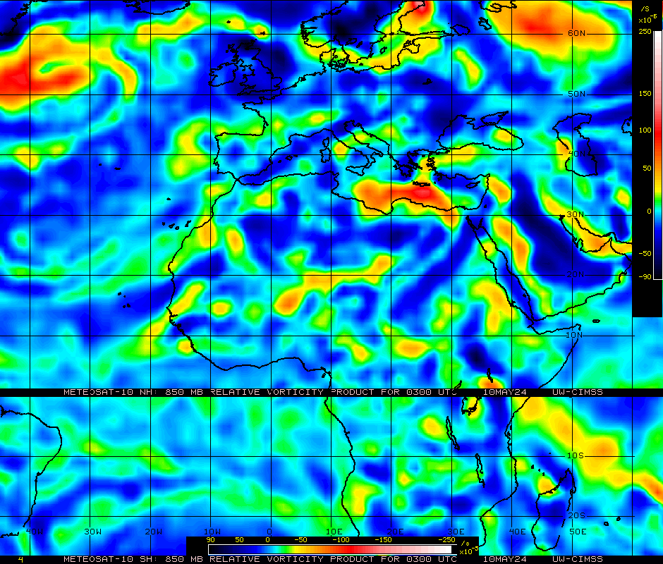
850 mb vorticity

A TROPICAL WAVE IS OVER THE FAR EASTERN TROPICAL ATLANTIC
BASIN...ANALYZED ALONG 21W S OF 18N MOVING WEST 10-15 KT.
SATELLITE DERIVED WINDS INDICATE BROAD CYCLONIC TURNING AROUND
THE WAVE AXIS CENTERED NEAR 14N. THIS WAVE IS EMBEDDED IN A
SURGE OF DEEP LEVEL MOISTURE AS INDICATED ON TOTAL PRECIPITABLE
WATER IMAGERY.
850 mb vorticity
0 likes
-
Cryomaniac
- Category 5

- Posts: 1289
- Joined: Tue Aug 15, 2006 2:26 pm
- Location: Newark, Nottinghamshire, UK
- Contact:
-
cycloneye
- Admin
- Posts: 149670
- Age: 69
- Joined: Thu Oct 10, 2002 10:54 am
- Location: San Juan, Puerto Rico
Re: ATL: INVEST 91L - Discussion

Will the dry air cause the same problems that Gaston had to this one?
0 likes
Visit the Caribbean-Central America Weather Thread where you can find at first post web cams,radars
and observations from Caribbean basin members Click Here
and observations from Caribbean basin members Click Here

-
cycloneye
- Admin
- Posts: 149670
- Age: 69
- Joined: Thu Oct 10, 2002 10:54 am
- Location: San Juan, Puerto Rico
Re: ATL: INVEST 91L - Discussion
8 PM TWO:
A TROPICAL WAVE NEAR THE SOUTHEASTERN CAPE VERDE ISLANDS IS
PRODUCING A LARGE AREA OF CLOUDINESS AND SHOWERS. DEVELOPMENT...IF
ANY...OF THIS SYSTEM IS EXPECTED TO BE SLOW TO OCCUR AS IT MOVES
WESTWARD AT 10 TO 15 MPH DURING THE NEXT COUPLE OF DAYS. THERE IS
A LOW CHANCE...20 PERCENT...OF THIS SYSTEM BECOMING A TROPICAL
CYCLONE DURING THE NEXT 48 HOURS.
0 likes
Visit the Caribbean-Central America Weather Thread where you can find at first post web cams,radars
and observations from Caribbean basin members Click Here
and observations from Caribbean basin members Click Here
-
bvigal

- S2K Supporter
- Posts: 2276
- Joined: Sun Jul 24, 2005 8:49 am
- Location: British Virgin Islands
- Contact:
Re: ATL: INVEST 91L - Discussion
This is never going to appear on the navy sites until someone at NCEP updates the /tcweb directory that the automated system uses.

0 likes
-
Chris_in_Tampa
- Category 5
- Posts: 5101
- Age: 42
- Joined: Thu Jun 21, 2007 11:06 pm
- Location: Tampa, Florida, USA
- Contact:
Re: ATL: INVEST 91L - Discussion
This is a serious error that they need to fix. The ATCF system this year has been prone to all sorts of errors. I'm trying to fix my site and it may take days or weeks to code around the NHC error as best that I can. I've had to shut down some areas of my site because of this.bvigal wrote:This is never going to appear on the navy sites until someone at NCEP updates the /tcweb directory that the automated system uses.
0 likes
-
cycloneye
- Admin
- Posts: 149670
- Age: 69
- Joined: Thu Oct 10, 2002 10:54 am
- Location: San Juan, Puerto Rico
Re: ATL: INVEST 91L - Discussion
No wonder Best Track has been absent from the start as the atcf site is not updating.
ftp://ftp.tpc.ncep.noaa.gov/atcf/tcweb/
ftp://ftp.tpc.ncep.noaa.gov/atcf/tcweb/
0 likes
Visit the Caribbean-Central America Weather Thread where you can find at first post web cams,radars
and observations from Caribbean basin members Click Here
and observations from Caribbean basin members Click Here
-
Chris_in_Tampa
- Category 5
- Posts: 5101
- Age: 42
- Joined: Thu Jun 21, 2007 11:06 pm
- Location: Tampa, Florida, USA
- Contact:
Re: ATL: INVEST 91L - Discussion
The "btk" directory is okay along with the "aidpublic" directory. For sites that use the "tcweb" directory though, like NRL (who created the system) and CIMSS for example, old storm data exists. Any new storms are not added. It's just causing all sorts of problems. And of course you have to use the "tcweb" directory to some extent to know when an invest gets renumbered into a depression or higher.cycloneye wrote:No wonder Best Track has been absent from the start as the atcf site is not updating.
ftp://ftp.tpc.ncep.noaa.gov/atcf/tcweb/
0 likes
-
bvigal
- S2K Supporter
- Posts: 2276
- Joined: Sun Jul 24, 2005 8:49 am
- Location: British Virgin Islands
- Contact:
Re: ATL: INVEST 91L - Discussion
Chris, you are right about this year being the worst. I've written letters and sent screen shots and had replies (from public relations people) and had to re-write and explain further, over and over. I don't think anybody who reads emails knows how this really works. Those who really do are insulated and difficult for everyone to communicate with. I'm not even sure it's in Miami, something one guy told me made me believe the big problem is in Maryland.Chris_in_Tampa wrote:This is a serious error that they need to fix. The ATCF system this year has been prone to all sorts of errors. I'm trying to fix my site and it may take days or weeks to code around the NHC error as best that I can. I've had to shut down some areas of my site because of this.bvigal wrote:This is never going to appear on the navy sites until someone at NCEP updates the /tcweb directory that the automated system uses.
0 likes

Re: ATL: INVEST 91L - Discussion
These tropical disturbances are like cockroaches. They keep coming at ya. Them cockroach tropical disturbances. 
0 likes
-
Chris_in_Tampa
- Category 5
- Posts: 5101
- Age: 42
- Joined: Thu Jun 21, 2007 11:06 pm
- Location: Tampa, Florida, USA
- Contact:
Re: ATL: INVEST 91L - Discussion
I receive this message when logging in with a FTP program about how contact them:bvigal wrote:Chris, you are right about this year being the worst. I've written letters and sent screen shots and had replies (from public relations people) and had to re-write and explain further, over and over. I don't think anybody who reads emails knows how this really works. Those who really do are insulated and difficult for everyone to communicate with. I'm not even sure it's in Miami, something one guy told me made me believe the big problem is in Maryland.
"This server is not considered operational. It is only supported Monday thru Friday between 0700 and 1600 EST. Report any problems to ncep.helpdesk@noaa.gov."
I don't even bother reporting the errors though. With as many sites that use the data I find it hard to believe they don't notice the errors. I have to believe they would double check each time they make updates and that when there is an actual error the time it takes to fix it is getting a tech person to work it out.
I think it is Washington where the servers are. I notice the NHC's seem to be there as well, or at least that is where my trace route ended up.
I know NRL developed the ATCF system so I don't know how it works to actually fix errors. When you design a program it helps fixing the errors when you were the one that designed the program. I'm not sure if the NHC, or a NOAA server rather, runs the software NRL developed and they need to work with NRL on errors or if NRL runs it and takes care of maintenance. So maybe getting a tech person to work out the problems can be a problem.
0 likes
-
Brent
- S2K Supporter
- Posts: 38769
- Age: 37
- Joined: Sun May 16, 2004 10:30 pm
- Location: Tulsa Oklahoma
- Contact:
Re: ATL: INVEST 91L - Discussion
SPECIAL TROPICAL WEATHER OUTLOOK
NWS TPC/NATIONAL HURRICANE CENTER MIAMI FL
1050 PM EDT TUE SEP 7 2010
FOR THE NORTH ATLANTIC...CARIBBEAN SEA AND THE GULF OF MEXICO...
THE NATIONAL HURRICANE CENTER HAS ISSUED THE LAST ADVISORY ON
TROPICAL DEPRESSION HERMINE...LOCATED INLAND OVER CENTRAL TEXAS
ABOUT 30 MILES SOUTH-SOUTHEAST OF BROWNWOOD.
A VIGOROUS TROPICAL WAVE...ACCOMPANIED BY A LOW PRESSURE SYSTEM...
IS LOCATED NEAR THE SOUTHEASTERN CAPE VERDE ISLANDS. SHOWERS AND
THUNDERSTORMS HAVE BECOME MORE CONCENTRATED NEAR THE CENTER OF THE
LOW DURING THE PAST FEW HOURS...AND ENVIRONMENTAL CONDITIONS APPEAR
CONDUCIVE FOR ADDITIONAL DEVELOPMENT DURING THE NEXT COUPLE OF DAYS
AS THE DISTURBANCE MOVES WESTWARD AT 10 TO 15 MPH. THERE IS A
MEDIUM CHANCE...40 PERCENT...OF THIS SYSTEM BECOMING A TROPICAL
CYCLONE DURING THE NEXT 48 HOURS.
SHOWERS AND THUNDERSTORMS REMAIN DISORGANIZED IN ASSOCIATION WITH
THE REMNANTS OF GASTON LOCATED ABOUT 60 MILES SOUTH OF PONCE PUERTO
RICO. DEVELOPMENT...IF ANY...OF THIS SYSTEM IS EXPECTED TO BE SLOW
TO OCCUR AS IT MOVES WESTWARD AT 15 TO 20 MPH. THERE IS A LOW
CHANCE...20 PERCENT...OF THIS SYSTEM BECOMING A TROPICAL CYCLONE
AGAIN DURING THE NEXT 48 HOURS.
SHOWER ACTIVITY ASSOCIATED WITH A WEAK AREA OF LOW PRESSURE LOCATED
ABOUT 450 MILES WEST-NORTHWEST OF THE NORTHERNMOST CAPE VERDE
ISLANDS REMAINS MINIMAL. ENVIRONMENTAL CONDITIONS ARE EXPECTED TO
BE UNFAVORABLE FOR DEVELOPMENT DURING THE NEXT COUPLE OF DAYS AS
THE LOW MOVES WESTWARD NEAR 10 MPH. THERE IS A LOW CHANCE...10
PERCENT...OF THIS SYSTEM BECOMING A TROPICAL CYCLONE DURING THE
NEXT 48 HOURS.
ELSEWHERE...TROPICAL CYCLONE FORMATION IS NOT EXPECTED DURING THE
NEXT 48 HOURS.
$$
FORECASTER STEWART
0 likes
#neversummer
Who is online
Users browsing this forum: No registered users and 77 guests