PTrackerLA wrote:I'd say Intracoastal City, La - Panama City, FL for possible watches/warnings. We'll see!
I would guess Pensacola to Florida Big Bend.
Moderator: S2k Moderators


PTrackerLA wrote:I'd say Intracoastal City, La - Panama City, FL for possible watches/warnings. We'll see!

MGC wrote:TV met in New Orleans kinda down played it today. Said there was not enough water for the system to cross before landfall for it to intensify much beyound a TS....What? If the ULL pulls away like it looks like it is then this can ramp up quickly.....MGC
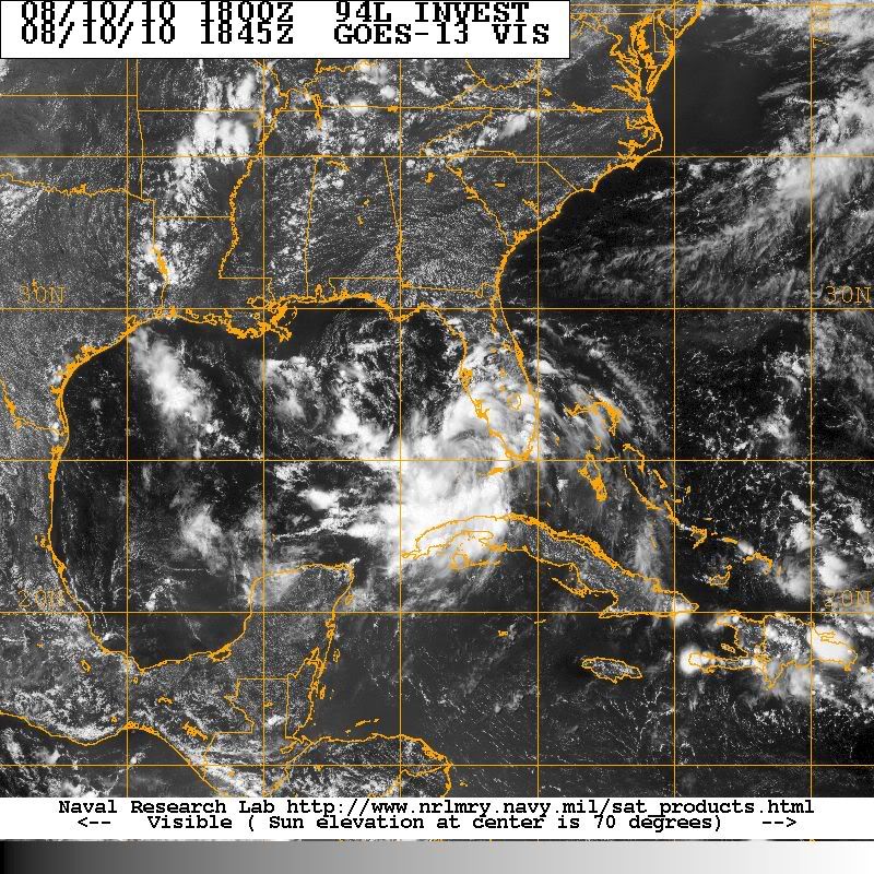
MGC wrote:TV met in New Orleans kinda down played it today. Said there was not enough water for the system to cross before landfall for it to intensify much beyound a TS....What? If the ULL pulls away like it looks like it is then this can ramp up quickly.....MGC

Dean4Storms wrote:If the center is where I think it is the convection is now firing right on top of it!
MGC wrote:TV met in New Orleans kinda down played it today. Said there was not enough water for the system to cross before landfall for it to intensify much beyound a TS....What? If the ULL pulls away like it looks like it is then this can ramp up quickly.....MGC

LAwxrgal wrote:IMO further east this thing goes, the less time it will have to strengthen.


brunota2003 wrote:Dean4Storms wrote:If the center is where I think it is the convection is now firing right on top of it!
I know...watching recon, it looks like it is SW of where we initially thought it was, though it is still most likely really elongated.
Aric Dunn wrote:Anyone look into the tornado threat over florida and the northern gulf coast with this. considering its partially still associated with a trough and there is a upper low near by.. some of the more severe weather experts may know..?


LAwxrgal wrote:MGC wrote:TV met in New Orleans kinda down played it today. Said there was not enough water for the system to cross before landfall for it to intensify much beyound a TS....What? If the ULL pulls away like it looks like it is then this can ramp up quickly.....MGC
Which met was that? Myers?
dixiebreeze wrote:LAwxrgal wrote:IMO further east this thing goes, the less time it will have to strengthen.
Not if it stalls, like Elena did in '85.
Bailey1777 wrote:question if 94 continues to basically sit how would it effect landfall im taking it that the models are going off of a moving system.
Users browsing this forum: No registered users and 63 guests
